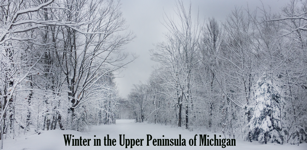
Winter in the Upper Peninsula

Upper Peninsula Snowfall Totals

Winter 2018/19

Snowfall in the Upper Peninsula of Michigan

A WINTER WONDERLAND

Hello all, welcome back to another winter season. This is the 7th year of snowfall reports on FunintheUP.com, thanks for following the snowfall page! FunintheUP has quickly become the #1 place for snowfall totals for those interested. Over 1.6 million people viewed our snowfall videos last year from LIVE snowfall reports, to our snowfall videos through our facebook page.
This year will be another fun year of snow, are you ready? Last year the highest snowfall was at the Calumet (Tamarack Loc.) with 331 inches of snowfall for the season. There was a total of 5 snow stations that hit 300 inches last season, they were Calumet (Tamarack Loc) with 331", Painesdale with 314.8", Houghton county with 311.9", Keweenaw County with 304", and Allouez township with 300". This season looks to be no different that last year cold and snow. The snowbelts usually always get their snowfall, but this season we should see an increase in non snowbelt areas with more snow than the last few years have brought to them. One thing is for sure and that is FunintheUP will have your snow updates all winter long, thanks for following.
If you enjoy the videos and the snowfall updates please consider making a donation or become a sponsor to help support this page so I can continue to promote the Upper Peninsula.

--Thank you so much for your support for over the years, Yooper Steve.

Nature is full of genius, full of the divinity; so that not a snowflake escapes its fashioning hand."
-- Henry David Thoreau

Top 10 Snowfall as of 11.26

Beautiful Snow Covered Trees

Upper Peninsula Tours

Upper Peninsula Snowfall Totals - by FunintheUP.com

Tune in Each Monday for Facebook LIVE at 5pm Top 10 Snowiest Locations in the Upper Peninsula.
Snowfall Reports Sponsored by Upper Peninsula Tours

Top 10 Snowiest places in the Upper Peninsula

Each week on Monday we update the Top 10, watch the LIVE report on facebook on Mondays at 5pm.

NEW SNOWFALL RECORD for Houghton County attained on April 30th, current snow as of May 8th, 2019 is 362.2 inches for season. Tamarack location surpassed the 1978/79 snowfall record in Houghton County of 354.1 inches that was recorded at the Houghton county airport. You can see the daily snowfall at the location below on the spreadsheet.


Top 5 snowfall amounts in the Upper Peninsula.
390.4" - 1978/79 - Keweenaw county (near Delaware)
384.0" - 1996/97 - Herman
367.4" - 1995/96 - Keweenaw county (near Delaware)
362.8" - 2018/19 - Tamarack location (near Calumet)(current as of 5.19.19)
354.1" - 1978/79 - Houghton county airport


Snowfall from Jan Mar 20th 10am to Mar 21st 10am. This page may be updated multiple times through the day.
Snowfall Reports by Steve Jurmu :: Mar 20th, 2019 :: Comments

Today's Notes: A trace of snowfall in some areas.

Today's High Snowfall: Multiple areas with a trace of snowfall"
Most snowfall, season to date: Calumet (Tamarack Loc.) with 333.5 inches

Upper Peninsula Tours - Guided Tours - kayaking, waterfalls, hiking, off-road, scenic views. Web - Facebook - Instagram
UP VIP Card - Discounts all year long at businesses in the Upper Peninsula. Web - Facebook
Add your link to this page. Contact steve @ funintheup .com for more details.
Mar 16 - Great Lakes Ice Coverage // Graphic of ice coverage
NOAA updates ice data later in evening
Lake Superior Ice Percentage Today - 57.84% - Yesterday 66.26% - High 94.91% on 3.6.19
Great Lakes Ice Percentage Today - 35.21% - Yesterday 38.25% - High 80.87% on 3.7.19

Top 10 Snowiest Places in the Upper Peninsula March 4th
KEY: T: trace - NR: No Report - ND: No Data
Western/Northern Upper Peninsula Snowfall totals Daily AmountSeason TotalOn ground Today in 2017YTD
2017/18 Season
Houghton County (Superior Loc.)
FunintheUP.com station - measured by Steve Jurmu
T266.2370268.2
Houghton County Snowfall Record: 354.1 inches - 1978/1979
2nd most Snowfall 338.7 inches - 2013/14
Keweenaw County (Delaware area)
Updates on weekdays only - view daily
measured by Keweenaw County Rd Commission
0290380263
Keweenaw County Snowfall Record: 390.4 inches - 1978/1979
Downtown Houghton
FunintheUP.com station - measured by Steve Jurmu
T170.5200165.9
Michigan Tech University xc ski trails
(FunintheUP.com station - measured by Steve Jurmu
T206.3320201.4
Dollar Bay (FunintheUP.com station - measured by Steve Jurmu)
T234.9410196
Agate Beach FunintheUP.com station - measured by John H.
0181.8300125.9
Calumet
(FunintheUP.com station - measured by Steve Jurmu)
T280.9410247.7
Calumet (Tamarack Loc.)
(FunintheUP.com station - measured by Steve Jurmu)

T333.5440285.7
Houghton County Airport
updates on weekdays only
measured by KRRC
T183.25250184.75
Painsedale
0269480271
Allouez twnship
(near Mohawk) measured by John Dee
0278.5381261.5
Twin Lakes no snow observer this year NRNA
Kearsarge
snowfall not updated regularly
0127.936
Hancock (Quincy Hill) 0186.334
RedRidge (started updating Dec 1st) 0.511928
Copper Harbor NR
Jacobsville T110.928
Pelkie (no update since 3.5) T92.810
Baraga (rarely updates) NR75
L'Anse (new station this year) 017028
Herman 0217.438
Covington (new station this yr) 0133.426
Alberta (FordCntr) (rarely updates) NR1414
Greenland 0201.431
Ontonagon NR118.232
Ironwood 0.2178.517
Ironwood #2 T176.918
Bergland T177.627
Watersmeet 1000 Isle 096.422
Paulding T122.820
Stambaugh (Iron River) T73.312
Watton 0132.422
Amasa 079.720
Central Upper Peninsula Snowfall totals Daily AmountSeason TotalOn Ground Today in 2017YTD
2017/18 Season
Marquette County (NWS Office)
measured by NOAA Marquette
T212.833T132.5
Marquette County NWS Record: 319.8 inches - 2001/2002
Three Lakes (Ruth Lake)(L'Anse 17.8SE) T212.446
Three Lakes (Beaufort Lake)(MICHIGAMME 3WNW) T129.622
Clarksburg T146.829
White City 0155.4ND
West Ishpeming 0136.423
Ishpeming (Deer Lake Dead River Basin area) 1.2209.132
Hoist Basin (no update since 10.22) NR5.7
Big Bay 1NW NR150.848
Marquette downtown T107.3ND
Marquette Lighthouse 01029
K.I. Sawyer (no update since 2.25) NR60.324
Harvey (Co.Rd.480)
(no update since 2.26)
NR118.121
Harvey south 059.419
Green Garden 0123.818
Chatham 0160.816
Munising 020033
Wetmore (barely ever updates) NR11.5
Eastern Upper Peninsula Snowfall totals Daily AmountSeason TotalOn Ground
Grand Marais (Green Haven Loc)
started measuring Dec 1st
T188.341
Newberry 0.5217.228
Paradise T166.829
Tahquamenon Falls St Park
updates end of each month, totals through Feb 28th
0158.830
Sault Ste Marie 0100.332
Sault Ste Marie Airport T150.931
Rudyard 089.724
Moran 099.624
St. Ignace (Mackinac Bridge)
measured by MDOT
010814
Engadine
measured by MDOT
028.812
Cedarville 085.2ND
Drummond Island 081.629
Detour 0113.123
Southern Upper Peninsula Snowfall totals Daily AmountSeason TotalOn Ground
Arnold 02011
Iron Mountain
077.119
Norway 075.415
Menominee 066.9ND
Rapid River
(no update since 2.8)
NR60ND
Escanaba
063.713
Gladstone 076.521
Garden Corners 083.820
Cooks (no reports this year)NR
Parent Bay(no reports this year) NR0
Manistique WWTP 096.520
Back to Top


Snowfall from Jan Mar 16th 10am to Mar 17th 10am. This page may be updated multiple times through the day.
Snowfall Reports by Steve Jurmu :: Mar 16th, 2019 :: Comments ::

Today's Notes:Not much snow to report today only a trace of snow in some locations with the NWS office getting the most with 0.8 inches overnight. This might be our beginning of spring it looks like as things will start getting warmer and we are starting to see more sunlight in the days now.

Today's High Snowfall: NWS office with 0.8"
Most snowfall, season to date: Calumet (Tamarack Loc.) with 333.5 inches

Upper Peninsula Tours - Guided Tours - kayaking, waterfalls, hiking, off-road, scenic views. Web - Facebook - Instagram
UP VIP Card - Discounts all year long at businesses in the Upper Peninsula. Web - Facebook
Add your link to this page. Contact steve @ funintheup .com for more details.
Mar 16 - Great Lakes Ice Coverage // Graphic of ice coverage
NOAA updates ice data later in evening
Lake Superior Ice Percentage Today - 60.38% - Yesterday 69.87% - High 94.91% on 3.6.19
Great Lakes Ice Percentage Today - 37.56% - Yesterday 40.99% - High 80.87% on 3.7.19

Top 10 Snowiest Places in the Upper Peninsula March 4th
KEY: T: trace - NR: No Report - ND: No Data
Western/Northern Upper Peninsula Snowfall totals Daily AmountSeason TotalOn ground Today in 2017YTD
2017/18 Season
Houghton County (Superior Loc.)
FunintheUP.com station - measured by Steve Jurmu
T266.2400268.2
Houghton County Snowfall Record: 354.1 inches - 1978/1979
2nd most Snowfall 338.7 inches - 2013/14
Keweenaw County (Delaware area)
Updates on weekdays only - view daily
measured by Keweenaw County Rd Commission
0290400263
Keweenaw County Snowfall Record: 390.4 inches - 1978/1979
Downtown Houghton
FunintheUP.com station - measured by Steve Jurmu
0170.5210165.9
Michigan Tech University xc ski trails
(FunintheUP.com station - measured by Steve Jurmu
T206.3380201.4
Dollar Bay (FunintheUP.com station - measured by Steve Jurmu)
T234.9490196
Agate Beach FunintheUP.com station - measured by John H.
0181.8300125.9
Calumet
(FunintheUP.com station - measured by Steve Jurmu)
T280.9500247.7
Calumet (Tamarack Loc.)
(FunintheUP.com station - measured by Steve Jurmu)

T333.5500285.7
Houghton County Airport
updates on weekdays only
measured by KRRC
0183.25300184.75
Painsedale
0.1269530271
Allouez twnship
(near Mohawk) measured by John Dee
T278.5441261.5
Twin Lakes no snow observer this year NRNA
Kearsarge
snowfall not updated regularly
0127.940
Hancock (Quincy Hill) T186.337
RedRidge (started updating Dec 1st) 0118.532
Copper Harbor NR
Jacobsville T110.928
Pelkie (no update since 3.5) NR9224
Baraga (rarely updates) NR75
L'Anse (new station this year) 017038
Herman 0.5217.438
Covington (new station this yr) 0133.430
Alberta (FordCntr) (rarely updates) NR41.84
Greenland 0201.431
Ontonagon NR118.232
Ironwood 0178.321
Ironwood #2 0176.925
Bergland 0177.642
Paulding 0122.823
Watersmeet 1000 Isle T96.427
Stambaugh (Iron River) 073.315
Watton 0132.422
Amasa 079.720
Central Upper Peninsula Snowfall totals Daily AmountSeason TotalOn Ground Today in 2017YTD
2017/18 Season
Marquette County (NWS Office)
measured by NOAA Marquette
0.8212.835T132.5
Marquette County NWS Record: 319.8 inches - 2001/2002
Three Lakes (Ruth Lake)(L'Anse 17.8SE) 0.3212.449
Three Lakes (Beaufort Lake)(MICHIGAMME 3WNW) T129.625
Clarksburg T146.834
White City 0155.4ND
West Ishpeming T136.423
Ishpeming (Deer Lake Dead River Basin area) 0207.937
Hoist Basin (no update since 10.22) NR5.7
Big Bay 1NW NR150.848
Marquette downtown 0107.3ND
Marquette Lighthouse 01029
K.I. Sawyer (no update since 2.25) NR60.336
Harvey (Co.Rd.480)
(no update since 2.26)
NR118.124
Harvey south NR59.435
Green Garden 0123.818
Chatham 0160.816
Munising 0.320035
Wetmore (barely ever updates) NR11.5
Eastern Upper Peninsula Snowfall totals Daily AmountSeason TotalOn Ground
Grand Marais (Green Haven Loc)
started measuring Dec 1st
0.5188.347
Newberry 0.7216.730
Paradise 0.4166.833
Tahquamenon Falls St Park
updates end of each month, totals through Feb 28th
0158.833
Sault Ste Marie 0.1100.332
Sault Ste Marie Airport 0.5150.434
Rudyard T89.724
Moran 099.626
St. Ignace (Mackinac Bridge)
measured by MDOT
T10817
Engadine
measured by MDOT
028.812
Cedarville 085.2ND
Drummond Island 081.629
Detour 011325
Southern Upper Peninsula Snowfall totals Daily AmountSeason TotalOn Ground
Arnold 02011
Iron Mountain
077.119
Norway T75.418
Menominee 066.9ND
Rapid River
(no update since 2.8)
NR6026
Escanaba
063.717
Gladstone 076.525
Garden Corners 083.823
Cooks (no reports this year)NR
Parent Bay(no reports this year) NR0
Manistique WWTP 096.528
Back to Top


Snowfall from Jan Mar 15th 10am to Mar 16th 10am. This page may be updated multiple times through the day.
Snowfall Reports by Steve Jurmu :: Mar 15th, 2019 :: Comments ::

Sault Ste. Marie, eastern side, joined the 100 Inch Club today with 100.2 inches of snow. The eastern side of the Soo is slighly less snowy, you can see the numbers in the data below.

Today's Notes: A bit of snow to report today after a few days nice weather. The days have gotten longer and the days are getting warmer which means the chances of snow are becoming less each passing day. What is different than the last few years is that ice coverage on Lake Superior is still just shy of 70% and the water temps are still cold. What this means is that with the cold waters in combination of cool air masses it may bring a little snowfall here and there through March and April.

Today's High Snowfall: Dollar Bay with 7.7"
Most snowfall, season to date: Calumet (Tamarack Loc.) with 333.5 inches

Upper Peninsula Tours - Guided Tours - kayaking, waterfalls, hiking, off-road, scenic views. Web - Facebook - Instagram
UP VIP Card - Discounts all year long at businesses in the Upper Peninsula. Web - Facebook
Add your link to this page. Contact steve @ funintheup .com for more details.
Mar 15 - Great Lakes Ice Coverage // Graphic of ice coverage
NOAA updates ice data later in evening
Lake Superior Ice Percentage Today - 69.87% - Yesterday 68.85% - High 94.91% on 3.6.19
Great Lakes Ice Percentage Today - 40.99% - Yesterday 47.24% - High 80.87% on 3.7.19

Top 10 Snowiest Places in the Upper Peninsula March 4th
KEY: T: trace - NR: No Report - ND: No Data
Western/Northern Upper Peninsula Snowfall totals Daily AmountSeason TotalOn ground Today in 2017YTD
2017/18 Season
Houghton County (Superior Loc.)
FunintheUP.com station - measured by Steve Jurmu
7266.243T268.2
Houghton County Snowfall Record: 354.1 inches - 1978/1979
2nd most Snowfall 338.7 inches - 2013/14
Keweenaw County (Delaware area)
Updates on weekdays only - view daily
measured by Keweenaw County Rd Commission
4290380263
Keweenaw County Snowfall Record: 390.4 inches - 1978/1979
Downtown Houghton
FunintheUP.com station - measured by Steve Jurmu
3.6170.522T165.9
Michigan Tech University xc ski trails
(FunintheUP.com station - measured by Steve Jurmu
5.5206.3400201.4
Dollar Bay (FunintheUP.com station - measured by Steve Jurmu)
7.7234.951T196
Agate Beach FunintheUP.com station - measured by John H.
4181.8300125.9
Calumet
(FunintheUP.com station - measured by Steve Jurmu)
4.5280.952T247.7
Calumet (Tamarack Loc.)
(FunintheUP.com station - measured by Steve Jurmu)

5.7333.554T285.7
Houghton County Airport
updates on weekdays only
measured by KRRC
NR179.5370184.75
Painsedale
7.3268.9570271
Allouez twnship
(near Mohawk) measured by John Dee
4278.5460260.5
Twin Lakes no snow observer this year NRNA
Kearsarge
snowfall not updated regularly
3.5127.942
Hancock (Quincy Hill) 3.5186.337
RedRidge (started updating Dec 1st) 4.5118.532
Copper Harbor NR
Jacobsville 2.2110.928
Pelkie (no update since 3.5) NR9224
Baraga (rarely updates) NR75
L'Anse (new station this year) 1.817038
Herman 4216.940
Covington (new station this yr) NR131.430
Alberta (FordCntr) (rarely updates) NR41.84
Greenland 3.5201.433
Ontonagon NR118.232
Ironwood 7.6178.323
Ironwood #2 3.5176.929
Bergland 5.4177.638
Paulding 3.1122.825
Watersmeet 1000 Isle 2.496.428
Stambaugh (Iron River) 173.315
Watton 1.7132.424
Amasa NR79.720
Central Upper Peninsula Snowfall totals Daily AmountSeason TotalOn Ground Today in 2017YTD
2017/18 Season
Marquette County (NWS Office)
measured by NOAA Marquette
T212350.3132.5
Marquette County NWS Record: 319.8 inches - 2001/2002
Three Lakes (Ruth Lake)(L'Anse 17.8SE) 5212.151
Three Lakes (Beaufort Lake)(MICHIGAMME 3WNW) 1.7129.626
Clarksburg 0.8146.835
White City NR155.343
West Ishpeming 0.9131.924
Ishpeming (Deer Lake Dead River Basin area) NR205.649
Hoist Basin (no update since 10.22) NR5.7
Big Bay 1NW NR150.848
Marquette downtown 0.2107.3ND
Marquette Lighthouse NR101.326
K.I. Sawyer (no update since 2.25) NR60.336
Harvey (Co.Rd.480)
(no update since 2.26)
NR118.124
Harvey south NR59.435
Green Garden 1.1123.819
Chatham NR159.217
Munising 2.9199.635
Wetmore (barely ever updates) NR11.5
Eastern Upper Peninsula Snowfall totals Daily AmountSeason TotalOn Ground
Grand Marais (Green Haven Loc)
started measuring Dec 1st
5.5187.848
Newberry 2.121631
Paradise 4.4166.436
Tahquamenon Falls St Park
updates end of each month, totals through Feb 28th
0147.742
Sault Ste Marie 0.8100.232
Sault Ste Marie Airport 0.9149.933
Rudyard NR85.741
Moran 0.499.627
St. Ignace (Mackinac Bridge)
measured by MDOT
0.510818
Engadine
measured by MDOT
NR28.812
Cedarville NR85.2ND
Drummond Island 081.629
Detour T11325
Southern Upper Peninsula Snowfall totals Daily AmountSeason TotalOn Ground
Arnold 02011
Iron Mountain
077.119
Norway T75.419
Menominee 0.566.9ND
Rapid River
(no update since 2.8)
NR6026
Escanaba
T61.317
Gladstone T76.526
Garden Corners 083.824
Cooks (no reports this year)NR
Parent Bay(no reports this year) NR0
Manistique WWTP 096.528
Back to Top


Snowfall from Jan Mar 14th 10am to Mar 15th 10am. This page may be updated multiple times through the day.
Snowfall Reports by Steve Jurmu :: Mar 14th, 2019 :: Comments ::

Today's Notes: Good day to you across the US and the World. Guess what...we have more snow falling, we got a few flurries last night after midnight briefly and now it has started back up. Areas to the far western UP saw the most snowfall in the early morning hours, those same clouds are making their way over Lake Superior and currently dropping some lake effect on the Copper Country and Keweenaw. A few flurries should be making their way into the Ishpeming and Negaunee areas as well as around Munising to Newberry. Down to the southern UP there are a few flakes in the skies, but overall most of the snowfall should be for the northern half of the UP today. Lake Superior ice coverage dropped from 84% down to 68% ice coverage overnight from the high winds moving from the N and NW. That should bring us more snowfall tonight and into the early morning hours as a result.

Today's High Snowfall: Ironwood with 1.5"
Most snowfall, season to date: Calumet (Tamarack Loc.) with 327.8 inches

FAQ's about Snowfall in the Upper Peninsula
Top 10 Snowiest Places in the U.P.
Current locations to hit 300 inches for the season.
Current locations to hit 200 inches for the season.
Current locations to hit 100 inches for the season.
Upper Peninsula Tours - Guided Tours - kayaking, waterfalls, hiking, off-road, scenic views. Web - Facebook - Instagram
UP VIP Card - Discounts all year long at businesses in the Upper Peninsula. Web - Facebook
Add your link to this page. Contact steve @ funintheup .com for more details.
Mar 14 - Great Lakes Ice Coverage // Graphic of ice coverage
NOAA updates ice data later in evening
Lake Superior Ice Percentage Today - 68.85% - Yesterday 84.36% - High 94.91% on 3.6.19
Great Lakes Ice Percentage Today - 47.24% - Yesterday 54.78% - High 80.87% on 3.7.19

Top 10 Snowiest Places in the Upper Peninsula March 4th
KEY: T: trace - NR: No Report - ND: No Data
Western/Northern Upper Peninsula Snowfall totals Daily AmountSeason TotalOn ground Today in 2017YTD
2017/18 Season
Houghton County (Superior Loc.)
FunintheUP.com station - measured by Steve Jurmu
0.2259.238T268.2
Houghton County Snowfall Record: 354.1 inches - 1978/1979
2nd most Snowfall 338.7 inches - 2013/14
Keweenaw County (Delaware area)
Updates on weekdays only - view daily
measured by Keweenaw County Rd Commission
NR286400263
Keweenaw County Snowfall Record: 390.4 inches - 1978/1979
Downtown Houghton
FunintheUP.com station - measured by Steve Jurmu
T166.919T165.9
Michigan Tech University xc ski trails
(FunintheUP.com station - measured by Steve Jurmu
T200.8360201.4
Dollar Bay (FunintheUP.com station - measured by Steve Jurmu)
T227.246T196
Agate Beach FunintheUP.com station - measured by John H.
0177.842T125.9
Calumet
(FunintheUP.com station - measured by Steve Jurmu)
0.2276.447T247.7
Calumet (Tamarack Loc.)
(FunintheUP.com station - measured by Steve Jurmu)

0.3327.550T285.7
Houghton County Airport
updates on weekdays only
measured by KRRC
0179.5370184.75
Painsedale
0.2261.6520.1271
Allouez twnship
(near Mohawk) measured by John Dee
T274.544T260.5
Twin Lakes no snow observer this year NRNA
Kearsarge
snowfall not updated regularly
0124.449
Hancock (Quincy Hill) T182.837
RedRidge (started updating Dec 1st) 011442
Copper Harbor NR
Jacobsville 0108.727
Pelkie (no update since 3.5) 09224
Baraga (rarely updates) NR75
L'Anse (new station this year) 0168.238
Herman T212.936
Covington (new station this yr) NR131.430
Alberta (FordCntr) (rarely updates) NR41.84
Greenland 0.4197.931
Ontonagon NR118.232
Ironwood 1.5170.720
Ironwood #2 0.5173.424
Bergland T172.242
Paulding 0.3119.723
Watersmeet 1000 Isle T9426
Stambaugh (Iron River) T72.317
Watton 0.1130.724
Amasa T79.720
Central Upper Peninsula Snowfall totals Daily AmountSeason TotalOn Ground Today in 2017YTD
2017/18 Season
Marquette County (NWS Office)
measured by NOAA Marquette
T21239T132.2
Marquette County NWS Record: 319.8 inches - 2001/2002
Three Lakes (Ruth Lake)(L'Anse 17.8SE) 0.1207.149
Three Lakes (Beaufort Lake)(MICHIGAMME 3WNW) 0.1127.926
Clarksburg T14634
White City 0155.343
West Ishpeming T13124
Ishpeming (Deer Lake Dead River Basin area) 0205.649
Hoist Basin (no update since 10.22) NR5.7
Big Bay 1NW NR150.848
Marquette downtown 0107.1ND
Marquette Lighthouse 0101.326
K.I. Sawyer (no update since 2.25) NR60.336
Harvey (Co.Rd.480)
(no update since 2.26)
0118.124
Harvey south 059.435
Green Garden 0122.718
Chatham 0159.217
Munising 0196.734
Wetmore (barely ever updates) NR11.5
Eastern Upper Peninsula Snowfall totals Daily AmountSeason TotalOn Ground
Grand Marais (Green Haven Loc)
started measuring Dec 1st
0182.344
Newberry 0213.939
Paradise 016231
Tahquamenon Falls St Park
updates end of each month, totals through Feb 28th
0147.742
Sault Ste Marie 095.432
Sault Ste Marie Airport 0.114933
Rudyard 085.741
Moran 099.227
St. Ignace (Mackinac Bridge)
measured by MDOT
0107.518
Engadine
measured by MDOT
028.812
Cedarville 085.2ND
Drummond Island 081.629
Detour 011325
Southern Upper Peninsula Snowfall totals Daily AmountSeason TotalOn Ground
Arnold 02011
Iron Mountain
0.177.119
Norway 0.175.419
Menominee NR66.4ND
Rapid River
(no update since 2.8)
06026
Escanaba
T61.317
Gladstone 076.526
Garden Corners 083.824
Cooks (no reports this year)NR
Parent Bay(no reports this year) NR0
Manistique WWTP 096.528
Back to Top


Snowfall from Jan Mar 13th 10am to Mar 14th 10am. This page may be updated multiple times through the day.
Snowfall Reports by Steve Jurmu :: Mar 13th, 2019 :: Comments ::

Today's Notes: Hello friends! There is no snowfall to report today as has been the last few days. Things have been mild and frankly it has been a nice change, whewwwww! Things might move back into winter for 3 or 4 days. I have only listed a few areas in the Copper Country and the NWS Marquette locations, so you can see the snowfall from last year and how it compares today's season totals. I have season totals and data from last season too, view last years snowfall here. Last year snowfall in the month of March was about 10-25 inches across the UP. The month of April last year April 15th and 16th was the largest 2 day total of the season for some snow locations. Look for rain to continue through much of today and into Friday, temps then should drop and winds will be increasing into the 20-30mph range with gusts as hith as 35mph possible. There most likely will be some lake effect snowfall taking place on Friday and perhaps carrying over into Saturday, 2-4 inches possible. Ice level on Lake Superior increased slightly again last night up to 84%. If the N and NW winds of 20-30 mph wind gusts next few days should break up the ice slightly. So ice coverage shouldn't move to far up or down with plenty of open water for lake effect snowfall to happen with some cool winds from the north.

Today's High Snowfall: NO Snow to Report
Most snowfall, season to date: Calumet (Tamarack Loc.) with 327.5 inches

FAQ's about Snowfall in the Upper Peninsula
Top 10 Snowiest Places in the U.P.
Current locations to hit 300 inches for the season.
Current locations to hit 200 inches for the season.
Current locations to hit 100 inches for the season.
Upper Peninsula Tours - Guided Tours - kayaking, waterfalls, hiking, off-road, scenic views. Web - Facebook - Instagram
UP VIP Card - Discounts all year long at businesses in the Upper Peninsula. Web - Facebook
Add your link to this page. Contact steve @ funintheup .com for more details.
Mar 13 - Great Lakes Ice Coverage // Graphic of ice coverage
NOAA updates ice data later in evening
Lake Superior Ice Percentage Today - 84.36% - Yesterday 83.02% - High 94.91% on 3.6.19
Great Lakes Ice Percentage Today - 54.78% - Yesterday 54.80% - High 80.87% on 3.7.19

Top 10 Snowiest Places in the Upper Peninsula March 4th
KEY: T: trace - NR: No Report - ND: No Data
Western/Northern Upper Peninsula Snowfall totals Daily AmountSeason TotalOn ground Today in 2017YTD
2017/18 Season
Houghton County (Superior Loc.)
FunintheUP.com station - measured by Steve Jurmu
0259400.2268.2
Houghton County Snowfall Record: 354.1 inches - 1978/1979
2nd most Snowfall 338.7 inches - 2013/14
Keweenaw County (Delaware area)
Updates on weekdays only - view daily
measured by Keweenaw County Rd Commission
0286401263
Keweenaw County Snowfall Record: 390.4 inches - 1978/1979
Downtown Houghton
FunintheUP.com station - measured by Steve Jurmu
0166.920T165.9
Michigan Tech University xc ski trails
(FunintheUP.com station - measured by Steve Jurmu
0200.837T201.4
Dollar Bay (FunintheUP.com station - measured by Steve Jurmu)
0227.2460196
Agate Beach FunintheUP.com station - measured by John H.
0177.8420125.9
Calumet
(FunintheUP.com station - measured by Steve Jurmu)
0276.2590.3247.7
Calumet (Tamarack Loc.)
(FunintheUP.com station - measured by Steve Jurmu)

0327.5520.5285.7
Houghton County Airport
updates on weekdays only
measured by KRRC
0179.5370184.75
Painsedale
0261.4550.3270.
Allouez twnship
(near Mohawk) measured by John Dee
0274.5461.5260.5
Twin Lakes no snow observer this year NRNA
Kearsarge
snowfall not updated regularly
0124.449
Hancock (Quincy Hill) 0182.845
RedRidge (started updating Dec 1st) 011442
Copper Harbor NR
Jacobsville 0108.738
Pelkie (no update since 3.5) 09224
Baraga (rarely updates) NR75
L'Anse (new station this year) 0168.250
Herman 0212.949
Covington (new station this yr) NR131.441
Alberta (FordCntr) (rarely updates) NR41.84
Greenland 0197.543
Ontonagon NR118.232
Ironwood 0169.230
Ironwood #2 0172.933
Bergland 0172.242
Paulding 0119.436
Watersmeet 1000 Isle 09439
Stambaugh (Iron River) 072.327
Watton 0130.636
Amasa 079.728
Central Upper Peninsula Snowfall totals Daily AmountSeason TotalOn Ground Today in 2017YTD
2017/18 Season
Marquette County (NWS Office)
measured by NOAA Marquette
0212461.9132.2
Marquette County NWS Record: 319.8 inches - 2001/2002
Three Lakes (Ruth Lake)(L'Anse 17.8SE) 020757
Three Lakes (Beaufort Lake)(MICHIGAMME 3WNW) 0127.835
Clarksburg 014642
White City 0155.343
West Ishpeming 013136
Ishpeming (Deer Lake Dead River Basin area) 0205.649
Hoist Basin (no update since 10.22) NR5.7
Big Bay 1NW NR150.848
Marquette downtown 0107.1ND
Marquette Lighthouse 0101.326
K.I. Sawyer (no update since 2.25) NR60.336
Harvey (Co.Rd.480)
(no update since 2.26)
0118.133
Harvey south 059.435
Green Garden 0122.727
Chatham 0159.228
Munising 0196.746
Wetmore (barely ever updates) NR11.5
Eastern Upper Peninsula Snowfall totals Daily AmountSeason TotalOn Ground
Grand Marais (Green Haven Loc)
started measuring Dec 1st
0182.351
Newberry 0213.939
Paradise 016240
Tahquamenon Falls St Park
updates end of each month, totals through Feb 28th
0147.742
Sault Ste Marie 095.432
Sault Ste Marie Airport 0148.741
Rudyard 085.741
Moran 099.236
St. Ignace (Mackinac Bridge)
measured by MDOT
0107.525
Engadine
measured by MDOT
028.819
Cedarville 085.2ND
Drummond Island 081.634.5
Detour 011332
Southern Upper Peninsula Snowfall totals Daily AmountSeason TotalOn Ground
Arnold 02011
Iron Mountain
07726
Norway 075.324
Menominee NR66.4ND
Rapid River
(no update since 2.8)
06026
Escanaba
061.322
Gladstone 076.533
Garden Corners 083.831
Cooks (no reports this year)NR
Parent Bay(no reports this year) NR0
Manistique WWTP 096.541
Back to Top


Snowfall from Jan Mar 12th 10am to Mar 13th 10am. This page may be updated multiple times through the day.
Snowfall Reports by Steve Jurmu :: Mar 12th, 2019 :: Comments ::

Today's Notes: More seasonally warm weather with a little bit of rain, things stayed mushy. You can actually see some snow banks actually get smaller but there will still be plenty of snow along the roadsides and woods probably into the end of the month of April even beginning of May. Ice on Lake Superior actually increased last night almost 3%, back up to 83%. This is the time of year that many people fall through the ice, be careful out there, treat all ice as unsafe ice. Look for rain to continue through much of Thursday and Friday temps should drop and winds will be increasing into the 20-30mph range with gusts as hith as 35mph possible. There most likely will be some lake effect snowfall taking place on Friday and perhaps carrying over into Saturday, 2-4 inches possible.

Today's High Snowfall: NO Snow to Report
Most snowfall, season to date: Calumet (Tamarack Loc.) with 327.5 inches

FAQ's about Snowfall in the Upper Peninsula
Top 10 Snowiest Places in the U.P.
Current locations to hit 300 inches for the season.
Current locations to hit 200 inches for the season.
Current locations to hit 100 inches for the season.
Upper Peninsula Tours - Guided Tours - kayaking, waterfalls, hiking, off-road, scenic views. Web - Facebook - Instagram
UP VIP Card - Discounts all year long at businesses in the Upper Peninsula. Web - Facebook
Add your link to this page. Contact steve @ funintheup .com for more details.
Mar 12 - Great Lakes Ice Coverage // Graphic of ice coverage
NOAA updates ice data later in evening
Lake Superior Ice Percentage Today - 83.02% - Yesterday 82.59% - High 94.91% on 3.6.19
Great Lakes Ice Percentage Today - 54.80% - Yesterday 65.13% - High 80.87% on 3.7.19

Top 10 Snowiest Places in the Upper Peninsula March 4th
KEY: T: trace - NR: No Report - ND: No Data
Western/Northern Upper Peninsula Snowfall totals Daily AmountSeason TotalOn ground Today in 2017YTD
2017/18 Season
Houghton County (Superior Loc.)
FunintheUP.com station - measured by Steve Jurmu
0259493.7268
Houghton County Snowfall Record: 354.1 inches - 1978/1979
2nd most Snowfall 338.7 inches - 2013/14
Keweenaw County (Delaware area)
Updates on weekdays only - view daily
measured by Keweenaw County Rd Commission
0286441262
Keweenaw County Snowfall Record: 390.4 inches - 1978/1979
Downtown Houghton
FunintheUP.com station - measured by Steve Jurmu
0166.9282.5165.9
Michigan Tech University xc ski trails
(FunintheUP.com station - measured by Steve Jurmu
0200.8442.2201.4
Dollar Bay (FunintheUP.com station - measured by Steve Jurmu)
0227.2572.7196
Agate Beach FunintheUP.com station - measured by John H.
0177.8421125.9
Calumet
(FunintheUP.com station - measured by Steve Jurmu)
0276.2561.8247.4
Calumet (Tamarack Loc.)
(FunintheUP.com station - measured by Steve Jurmu)

0327.5592.7285.2
Houghton County Airport
updates on weekdays only
measured by KRRC
0179.5372184.75
Painsedale
0261.4623.4270.6
Allouez twnship
(near Mohawk) measured by John Dee
0274.5501259
Twin Lakes no snow observer this year NRNA
Kearsarge
snowfall not updated regularly
0124.449
Hancock (Quincy Hill) 0182.845
RedRidge (started updating Dec 1st) 011442
Copper Harbor NR
Jacobsville 0108.738
Pelkie (no update since 3.5) 09224
Baraga (rarely updates) NR75
L'Anse (new station this year) 0168.250
Herman 0212.949
Covington (new station this yr) NR131.441
Alberta (FordCntr) (rarely updates) NR41.84
Greenland 0197.543
Ontonagon NR118.232
Ironwood 0169.230
Ironwood #2 0172.933
Bergland 0172.242
Paulding 0119.436
Watersmeet 1000 Isle 09439
Stambaugh (Iron River) 072.327
Watton 0130.636
Amasa 079.728
Central Upper Peninsula Snowfall totals Daily AmountSeason TotalOn Ground Today in 2017YTD
2017/18 Season
Marquette County (NWS Office)
measured by NOAA Marquette
0212461.5130.3
Marquette County NWS Record: 319.8 inches - 2001/2002
Three Lakes (Ruth Lake)(L'Anse 17.8SE) 020757
Three Lakes (Beaufort Lake)(MICHIGAMME 3WNW) 0127.835
Clarksburg 014642
White City 0155.343
West Ishpeming 013136
Ishpeming (Deer Lake Dead River Basin area) 0205.649
Hoist Basin (no update since 10.22) NR5.7
Big Bay 1NW NR150.848
Marquette downtown 0107.1ND
Marquette Lighthouse 0101.326
K.I. Sawyer (no update since 2.25) NR60.336
Harvey (Co.Rd.480)
(no update since 2.26)
0118.133
Harvey south 059.435
Green Garden 0122.727
Chatham 0159.228
Munising 0196.746
Wetmore (barely ever updates) NR11.5
Eastern Upper Peninsula Snowfall totals Daily AmountSeason TotalOn Ground
Grand Marais (Green Haven Loc)
started measuring Dec 1st
0182.351
Newberry 0213.939
Paradise 016240
Tahquamenon Falls St Park
updates end of each month, totals through Feb 28th
0147.742
Sault Ste Marie 095.432
Sault Ste Marie Airport 0148.741
Rudyard 085.741
Moran 099.236
St. Ignace (Mackinac Bridge)
measured by MDOT
0107.525
Engadine
measured by MDOT
028.819
Cedarville 085.2ND
Drummond Island 081.634.5
Detour 011332
Southern Upper Peninsula Snowfall totals Daily AmountSeason TotalOn Ground
Arnold 02011
Iron Mountain
07726
Norway 075.324
Menominee NR66.4ND
Rapid River
(no update since 2.8)
06026
Escanaba
061.322
Gladstone 076.533
Garden Corners 083.831
Cooks (no reports this year)NR
Parent Bay(no reports this year) NR0
Manistique WWTP 096.541
Back to Top


Snowfall from Jan Mar 11th 10am to Mar 12th 10am. This page may be updated multiple times through the day.
Snowfall Reports by Steve Jurmu :: Mar 11th, 2019 :: Comments ::

Today's Notes: A little snowfall to report today. After a couple days of cold and snow things were very mild, an accepting change for most people I am sure, including myself, as much as I love snow, measuring it and playing in it, it enjoyed the sun and the slushy roads and parking lots. Tomorrow looks to be the same type of weather. On Thursday there may be a little rain moving in across the UP which could add to minor flooding which could become major flooding with the amount of snowfall on the ground and ice build up on the rivers and Lake Superior, there could be some issues. Stay alert and report any flooding to your local township, city, and county official. Enjoy the next couple days of warmer weather and sunshine. Make sure to get your roof cleared off from the snow and ice build up, as the snow and ice starts melting the weight on your roof is exponentially increased. There is a chance of snowfall Friday and Saturday with a possible 2-4 inches, this could end up being just some rain and freezing rain as well. Stay tuned for developments.

Today's High Snowfall: Kearsarge with 3"
Most snowfall, season to date: Calumet (Tamarack Loc.) with 327.5 inches

FAQ's about Snowfall in the Upper Peninsula
Top 10 Snowiest Places in the U.P.
Current locations to hit 300 inches for the season.
Current locations to hit 200 inches for the season.
Current locations to hit 100 inches for the season.
Upper Peninsula Tours - Guided Tours - kayaking, waterfalls, hiking, off-road, scenic views. Web - Facebook - Instagram
UP VIP Card - Discounts all year long at businesses in the Upper Peninsula. Web - Facebook
Add your link to this page. Contact steve @ funintheup .com for more details.
Mar 11 - Great Lakes Ice Coverage // Graphic of ice coverage
NOAA updates ice data later in evening
Lake Superior Ice Percentage Today - 82.59% - Yesterday 87.53% - High 94.91% on 3.6.19
Great Lakes Ice Percentage Today - 65.13% - Yesterday 71.04% - High 80.87% on 3.7.19

Top 10 Snowiest Places in the Upper Peninsula March 4th
KEY: T: trace - NR: No Report - ND: No Data
Western/Northern Upper Peninsula Snowfall totals Daily AmountSeason TotalOn ground Today in 2017YTD
2017/18 Season
Houghton County (Superior Loc.)
FunintheUP.com station - measured by Steve Jurmu
0.5259491.8264.3
Houghton County Snowfall Record: 354.1 inches - 1978/1979
2nd most Snowfall 338.7 inches - 2013/14
Keweenaw County (Delaware area)
Updates on weekdays only - view daily
measured by Keweenaw County Rd Commission
2286443261
Keweenaw County Snowfall Record: 390.4 inches - 1978/1979
Downtown Houghton
FunintheUP.com station - measured by Steve Jurmu
0166.9281.2163.4
Michigan Tech University xc ski trails
(FunintheUP.com station - measured by Steve Jurmu
0.5200.8441.5199.2
Dollar Bay (FunintheUP.com station - measured by Steve Jurmu)
0227.2571.4193.3
Agate Beach FunintheUP.com station - measured by John H.
0177.8421.5124.9
Calumet
(FunintheUP.com station - measured by Steve Jurmu)
0.6276.2591.9245.6
Calumet (Tamarack Loc.)
(FunintheUP.com station - measured by Steve Jurmu)

1.2327.5622.5282.5
Houghton County Airport
updates on weekdays only
measured by KRRC
0179.5371182.75
Painsedale
1.7261.4651.2267.2
Allouez twnship
(near Mohawk) measured by John Dee
2.5274.5541258
Twin Lakes no snow observer this year NRNA
Kearsarge
snowfall not updated regularly
3124.449
Hancock (Quincy Hill) NR182.845
RedRidge (started updating Dec 1st) NR11442
Copper Harbor NR
Jacobsville T108.738
Pelkie (no update since 3.5) NR9224
Baraga (rarely updates) NR75
L'Anse (new station this year) 0168.250
Herman T212.949
Covington (new station this yr) NR131.441
Alberta (FordCntr) (rarely updates) NR41.84
Greenland T197.543
Ontonagon NR118.232
Ironwood 0169.230
Ironwood #2 0172.933
Bergland 0172.242
Paulding 0119.436
Watersmeet 1000 Isle 09439
Stambaugh (Iron River) 072.327
Watton 0130.636
Amasa 079.728
Central Upper Peninsula Snowfall totals Daily AmountSeason TotalOn Ground Today in 2017YTD
2017/18 Season
Marquette County (NWS Office)
measured by NOAA Marquette
0.3212461.1128.8
Marquette County NWS Record: 319.8 inches - 2001/2002
Three Lakes (Ruth Lake)(L'Anse 17.8SE) 120757
Three Lakes (Beaufort Lake)(MICHIGAMME 3WNW) 0.2127.835
Clarksburg 0.114642
White City 0155.343
West Ishpeming 013136
Ishpeming (Deer Lake Dead River Basin area) 0205.649
Hoist Basin (no update since 10.22) NR5.7
Big Bay 1NW NR150.848
Marquette downtown 0107.1ND
Marquette Lighthouse 0101.326
K.I. Sawyer (no update since 2.25) NR60.336
Harvey (Co.Rd.480)
(no update since 2.26)
NR118.133
Harvey south 059.435
Green Garden 0122.727
Chatham 0159.228
Munising 0196.746
Wetmore (barely ever updates) NR11.5
Eastern Upper Peninsula Snowfall totals Daily AmountSeason TotalOn Ground
Grand Marais (Green Haven Loc)
started measuring Dec 1st
T182.351
Newberry 1.1213.939
Paradise 016240
Tahquamenon Falls St Park
updates end of each month, totals through Feb 28th
NR147.742
Sault Ste Marie NR95.432
Sault Ste Marie Airport 0.2148.741
Rudyard NR85.741
Moran T99.236
St. Ignace (Mackinac Bridge)
measured by MDOT
0107.525
Engadine
measured by MDOT
NR28.819
Cedarville 0.285.2ND
Drummond Island 081.634.5
Detour 0.511332
Southern Upper Peninsula Snowfall totals Daily AmountSeason TotalOn Ground
Arnold NR2011
Iron Mountain
07726
Norway 075.324
Menominee NR66.4ND
Rapid River
(no update since 2.8)
NR6026
Escanaba
061.322
Gladstone 076.533
Garden Corners 083.831
Cooks (no reports this year)NR
Parent Bay(no reports this year) NR0
Manistique WWTP 096.541
Back to Top


Snowfall from Jan Mar 10th 10am to Mar 11th 10am. This page may be updated multiple times through the day.
Snowfall Reports by Steve Jurmu :: Mar 10th, 2019 :: Comments ::

Michigan Tech University xc ski trails snow station joined the 200 Inch Club with 200.3 inches of snow.

Today's Notes: Today unexpected snowfall amounts and high winds moved in over the Copper Country last night. A friend of mine who lives out at Agate Beach notified me yesterday of a storm system that was moving in over Lake Superior, it got dark, and it was still snowing over there when I talked with him around 3pm yesterday, Sunday. Meanwhile elsewhere in the UP skies were clearing and sun appeared briefly. The small storm system that hit earlier in the morning on Sunday left minimal snowfall amounts, just an average day in the UP in the winter. After talking with my friend I knew things weren't going to be calm for long through the Copper Country, it was about to change quickly, that it did. He said, there was a lot of open water over that way. With the NW winds that started to prevail moving quickly over this open water and the prime conditions in the atmosphere, it released a slightly smaller storm system than the one was saw hit the UP on the 23rd and 24th of February. The conditions were similiar, high winds, heavy snow, but wind gusts were slightly less with slightly less snowfall, but still lots of drifting. It was bad enough that schools had to be closed in the area that morning, not from the snow but as a result of the drifting snow. As a result of this last storm that hit the Copper Country and Keweenaw we now have a high probability of having 3 stations making it to 300+ inches of snow to finish the season. There is 1 station already at 300+, and that station has a slight possibility of surpassing 354.1 inches of snow, which happens to be the most snowfall to be recorded of any station in Houghton county ever. The year was 1978/79 measured at the Houghton County Airport. Tamarack Location is currently sitting at 326.3 inches for the season, last year it hit 331 inches. It is highly likely we will hit 335-340 inches by the middle of May, but like I said it is not unlikely it will surpass 355 inches. Last year today the Tamarack loc was sitting at 280 inches of snowfall, it wasn't until April 5th that we hit 300.6 inches. On April 15th the station hit 319.7 inches with the 15.4 inches that fell, and on April 16th the station received another 11.3 inches to bring the season total to 331 inches. On April 17th, there was a trace of snowfall,the last snowfall of the season for 2017/2018. Keweenaw county snow station hit 300 inches on April 15th with 8 inches recorded, and on April 16th it received 4 inches of snowfall to end the season at 304 inches. Mohawk location hit 288.5 inches of snowfall with 10 inches on April 15th, then on April 16th the station recorded 11.5 inches of snow to bring that station to 300 inches exactly for the season. Painesdale snow station recorded 12.8 inches of snowfall on April 15th to bring the station to 304.7 inches, then on April 16th 10.1 inches of snowfall was recorded to end the season with 314.8 inches. Houghton county (Superior loc) saw 11.8 inches on April 15th to bring the station to 303 inches, then on April 16th 8.9 inches of snowfall was recorded for a season total of 311.9 inches, and on April 17th a trace of snowfall was recorded the last of the season. As you can see with the snowfall in the Upper Peninsula, there is almost always some late snowfall in late March, sometime in April, and sometimes even a trace or an inch or two in May, Mother's Day snowfall anyone?

Today's High Snowfall: Mohawk with 11"
Most snowfall, season to date: Calumet (Tamarack Loc.) with 326.3 inches

FAQ's about Snowfall in the Upper Peninsula
Top 10 Snowiest Places in the U.P.
Current locations to hit 300 inches for the season.
Current locations to hit 200 inches for the season.
Current locations to hit 100 inches for the season.
Upper Peninsula Tours - Guided Tours - kayaking, waterfalls, hiking, off-road, scenic views. Web - Facebook - Instagram
UP VIP Card - Discounts all year long at businesses in the Upper Peninsula. Web - Facebook
Add your link to this page. Contact steve @ funintheup .com for more details.
Mar 10 - Great Lakes Ice Coverage // Graphic of ice coverage
NOAA updates ice data later in evening
Lake Superior Ice Percentage Today - 82.59% - Yesterday 87.53% - High 94.91% on 3.6.19
Great Lakes Ice Percentage Today - 65.13% - Yesterday 71.04% - High 80.87% on 3.7.19

Top 10 Snowiest Places in the Upper Peninsula March 4th
KEY: T: trace - NR: No Report - ND: No Data
Western/Northern Upper Peninsula Snowfall totals Daily AmountSeason TotalOn ground Today in 2017YTD
2017/18 Season
Houghton County (Superior Loc.)
FunintheUP.com station - measured by Steve Jurmu
8.5258.5500262.5
Houghton County Snowfall Record: 354.1 inches - 1978/1979
2nd most Snowfall 338.7 inches - 2013/14
Keweenaw County (Delaware area)
Updates on weekdays only - view daily
measured by Keweenaw County Rd Commission
10283480258
Keweenaw County Snowfall Record: 390.4 inches - 1978/1979
Downtown Houghton
FunintheUP.com station - measured by Steve Jurmu
5.2166.9290162.2
Michigan Tech University xc ski trails
(FunintheUP.com station - measured by Steve Jurmu
7.5200.3450197.7
Dollar Bay (FunintheUP.com station - measured by Steve Jurmu)
9.5227.2580191.9
Agate Beach FunintheUP.com station - measured by John H.
6177.8420123.4
Calumet
(FunintheUP.com station - measured by Steve Jurmu)
8.6275.6600243.7
Calumet (Tamarack Loc.)
(FunintheUP.com station - measured by Steve Jurmu)

10.4326.3630280
Houghton County Airport
updates on weekdays only
measured by KRRC
2.5179.5370181.75
Painsedale
7259.7650266
Allouez twnship
(near Mohawk) measured by John Dee
1127255T257
Twin Lakes no snow observer this year NRNA
Kearsarge
snowfall not updated regularly
8121.450
Hancock (Quincy Hill) NR182.845
RedRidge (started updating Dec 1st) 511444
Copper Harbor NR
Jacobsville 4108.738
Pelkie 09224
Baraga (rarely updates) NR75
L'Anse (new station this year) 0.8168.250
Herman 3212.950
Covington (new station this yr) NR131.441
Alberta (FordCntr) (rarely updates) NR41.84
Greenland 3.2197.543
Ontonagon NR118.232
Ironwood 2.4169.231
Ironwood #2 2172.935
Bergland 2.8172.242
Paulding 2119.436
Watersmeet 1000 Isle 1.69439
Stambaugh (Iron River) 0.272.327
Watton 1.8130.637
Amasa T79.728
Central Upper Peninsula Snowfall totals Daily AmountSeason TotalOn Ground Today in 2017YTD
2017/18 Season
Marquette County (NWS Office)
measured by NOAA Marquette
3.6211.747T127.7
Marquette County NWS Record: 319.8 inches - 2001/2002
Three Lakes (Ruth Lake)(L'Anse 17.8SE) 3.520659
Three Lakes (Beaufort Lake)(MICHIGAMME 3WNW) 1.4127.636
Clarksburg 4145.942
White City 1.3155.343
West Ishpeming 2.113136
Ishpeming (Deer Lake Dead River Basin area) 2.5205.649
Hoist Basin (no update since 10.22) NR5.7
Big Bay 1NW NR150.848
Marquette downtown 1.2107.1ND
Marquette Lighthouse 1101.326
K.I. Sawyer (no update since 2.25) NR60.336
Harvey (Co.Rd.480)
(no update since 2.26)
NR118.133
Harvey south 059.435
Green Garden 1.6122.727
Chatham 1.5159.228
Munising 3196.746
Wetmore (barely ever updates) NR11.5
Eastern Upper Peninsula Snowfall totals Daily AmountSeason TotalOn Ground
Grand Marais (Green Haven Loc)
started measuring Dec 1st
6182.352
Newberry 2.5212.839
Paradise 3.716240
Tahquamenon Falls St Park
updates end of each month, totals through Feb 28th
NR147.742
Sault Ste Marie NR95.432
Sault Ste Marie Airport 5148.541
Rudyard NR85.741
Moran 399.236
St. Ignace (Mackinac Bridge)
measured by MDOT
2107.525
Engadine
measured by MDOT
NR28.819
Cedarville 285ND
Drummond Island 1.581.634.5
Detour 3112.532
Southern Upper Peninsula Snowfall totals Daily AmountSeason TotalOn Ground
Arnold NR2011
Iron Mountain
0.47727
Norway 0.375.326
Menominee NR66.4ND
Rapid River
(no update since 2.8)
NR6026
Escanaba
061.322
Gladstone 0.676.533
Garden Corners 1.183.831
Cooks (no reports this year)NR
Parent Bay(no reports this year) NR0
Manistique WWTP 196.541
Back to Top


Snowfall from Jan Mar 9th 10am to Mar 10th 10am. This page may be updated multiple times through the day.
Snowfall Reports by Steve Jurmu :: Mar 9th, 2019 :: Comments ::

Downtown Marquette joined the 100 Inch Club today with 100.3 inches of snow for the season.

Today's Notes: A little snowfall today. The storm system that moved through came quickly and left quickly for the most part. Roads were a bit slippery and slushy early morning into the mid morning, but by noon the main roads were good. Most backroads have remained unplowed being as there was little snow to fall across the UP and it being Sunday. A winter storm advisory remains in effect for the Copper Country and Keweenaw through midnight. Winds switched to the NW bringing a colder air mass over the western side of Lake Superior shoreline from Ontonagon up to the tip of the Keweenaw. Earlier today things cleared up around noon, then around 2pm in the Copper Country we started seeing a little lake effect snowfall coming off of Lake Superior. There is a good portion of ice breakup now off the shoreline from Great Sand Bay all the way down to Agate Beach and Misery Bay. Lake Superior ice coverage is now at 87% dropping from a high of 94% yesterday. With winds today and warmer temps on their way we should see more ice breakup this week. If we get some cold air masses coming from the north and north west expect more heavy lake effect snowfall.

Today's High Snowfall: Menominee with 5.5"
Most snowfall, season to date: Calumet (Tamarack Loc.) with 315.9 inches

FAQ's about Snowfall in the Upper Peninsula
Top 10 Snowiest Places in the U.P.
Current locations to hit 300 inches for the season.
Current locations to hit 200 inches for the season.
Current locations to hit 100 inches for the season.
Upper Peninsula Tours - Guided Tours - kayaking, waterfalls, hiking, off-road, scenic views. Web - Facebook - Instagram
UP VIP Card - Discounts all year long at businesses in the Upper Peninsula. Web - Facebook
Add your link to this page. Contact steve @ funintheup .com for more details.
Mar 9 - Great Lakes Ice Coverage // Graphic of ice coverage
NOAA updates ice data later in evening
Lake Superior Ice Percentage Today - 87.53% - Yesterday 94.65% - High 94.91% on 3.6.19
Great Lakes Ice Percentage Today - 71.04% - Yesterday 80.87% - High 80.87% on 3.7.19

Top 10 Snowiest Places in the Upper Peninsula March 4th
KEY: T: trace - NR: No Report - ND: No Data
Western/Northern Upper Peninsula Snowfall totals Daily AmountSeason TotalOn ground Today in 2017YTD
2017/18 Season
Houghton County (Superior Loc.)
FunintheUP.com station - measured by Steve Jurmu
3.125046T262.5
Houghton County Snowfall Record: 354.1 inches - 1978/1979
2nd most Snowfall 338.7 inches - 2013/14
Keweenaw County (Delaware)
Updates on weekdays only - view daily
measured by Keweenaw County Rd Commission
0.5274462258
Keweenaw County Snowfall Record: 390.4 inches - 1978/1979
Downtown Houghton
FunintheUP.com station - measured by Steve Jurmu
2161.7270162.2
Michigan Tech University xc ski trails
(FunintheUP.com station - measured by Steve Jurmu
2.5192.8390197.7
Dollar Bay (FunintheUP.com station - measured by Steve Jurmu)
3217.7530.3191.9
Agate Beach FunintheUP.com station - measured by John H.
3171.8380123.4
Calumet
(FunintheUP.com station - measured by Steve Jurmu)
3.6267550.3243.7
Calumet (Tamarack Loc.)
(FunintheUP.com station - measured by Steve Jurmu)

2.9315.9570.4280
Houghton County Airport
updates on weekdays only
measured by KRRC
NR174.541T181.75
Painsedale
2.4252.7600266
Allouez twnship
(near Mohawk) measured by John Dee
NR257511.5257
Twin Lakes no snow observer this year NRNA
Kearsarge
snowfall not updated regularly
1.5113.449
Hancock (Quincy Hill) 2.1182.845
RedRidge (started updating Dec 1st) 610942
Copper Harbor NR
Jacobsville 0.7104.734
Pelkie 09224
Baraga (rarely updates) NR75
L'Anse (new station this year) 2.9164.556
Herman 3209.947
Covington (new station this yr) 1.5131.441
Alberta (FordCntr) (rarely updates) NR41.84
Greenland 3194.340
Ontonagon NR118.232
Ironwood 3166.828
Ironwood #2 2.5170.935
Bergland 3.5169.441
Paulding 2.2117.436
Watersmeet 1000 Isle 1.892.438
Stambaugh (Iron River) NR72.131
Watton 1.7128.836
Amasa 179.728
Central Upper Peninsula Snowfall totals Daily AmountSeason TotalOn Ground Today in 2017YTD
2017/18 Season
Marquette County (NWS Office)
measured by NOAA Marquette
T208.146T127.7
Marquette County NWS Record: 319.8 inches - 2001/2002
Three Lakes (Ruth Lake)(L'Anse 17.8SE) 2202.557
Three Lakes (Beaufort Lake)(MICHIGAMME 3WNW) 1.6126.236
Clarksburg 1.6141.940
White City NR15244
West Ishpeming 2.113136
Ishpeming (Deer Lake Dead River Basin area) 1.4203.147
Hoist Basin (no update since 10.22) NR5.7
Big Bay 1NW NR150.848
Marquette downtown 1.9105.9ND
Marquette Lighthouse 1.5100.326
K.I. Sawyer (no update since 2.25) NR60.336
Harvey (Co.Rd.480)
(no update since 2.26)
NR118.133
Harvey south 059.435
Green Garden 1.9121.126
Chatham NR153.230
Munising 2.5193.744
Wetmore (barely ever updates) NR11.5
Eastern Upper Peninsula Snowfall totals Daily AmountSeason TotalOn Ground
Grand Marais (Green Haven Loc)
started measuring Dec 1st
1.5176.350
Newberry 2.4210.338
Paradise 0.7158.337
Tahquamenon Falls St Park
updates end of each month, totals through Feb 28th
NR147.742
Sault Ste Marie NR95.432
Sault Ste Marie Airport 1.4143.539
Rudyard NR85.741
Moran 2.396.232
St. Ignace (Mackinac Bridge)
measured by MDOT
2105.523
Engadine
measured by MDOT
NR28.819
Cedarville 2.583ND
Drummond Island 1.880.133
Detour 2107.528
Southern Upper Peninsula Snowfall totals Daily AmountSeason TotalOn Ground
Arnold NR2011
Iron Mountain
1.776.627
Norway 2.47527
Menominee 5.566.4ND
Rapid River
(no update since 2.8)
NR6026
Escanaba
NR61.322
Gladstone 375.932
Garden Corners 2.682.730
Cooks (no reports this year)NR
Parent Bay(no reports this year) NR0
Manistique WWTP 395.540
Back to Top


Snowfall from Jan Mar 8th 10am to Mar 9th 10am. This page may be updated multiple times through the day.
Snowfall Reports by Steve Jurmu :: Mar 8th, 2019 :: Comments ::

NOTE: No snowfall to report. It was an a pleasant day overall, temps reached the mid 20s to low 30s across the UP which was a nice change, spring is coming. We are due for another storm system moving in tonight and should see snowfall and mixed precipitation across the southern and lower half of the Upper Peninsula before midnight. Most of the snowfall we should see will probably be later on in the early morning hours and even into the late morning if the system maintains strength, but it should be fizzling out by the afternoon on Sunday. This snow will be wet and the roads will be slippery, road crews should be able to keep them fairly driveable with salt and sanding. Use caution out there if you're on the roads tonight and into the morning hours that wet slushy stuff can pull your vehicle easily and spin you around into the ditch or into another vehicle. Lake Superior ice coverage is still at 94%. IT will be interesting to see if it breaks up much after this storm system moves through.

Today's High Snowfall: No snowfall
Most snowfall, season to date: Calumet (Tamarack Loc.) with 313 inches

FAQ's about Snowfall in the Upper Peninsula
Top 10 Snowiest Places in the U.P.
Current locations to hit 300 inches for the season.
Current locations to hit 200 inches for the season.
Current locations to hit 100 inches for the season.
Upper Peninsula Tours - Guided Tours - kayaking, waterfalls, hiking, off-road, scenic views. Web - Facebook - Instagram
UP VIP Card - Discounts all year long at businesses in the Upper Peninsula. Web - Facebook
Add your link to this page. Contact steve @ funintheup .com for more details.
Mar 8 - Great Lakes Ice Coverage // Graphic of ice coverage
NOAA updates ice data later in evening
Lake Superior Ice Percentage Today - 94.65% - Yesterday 94.91% - High 94.91% on 3.6.19
Great Lakes Ice Percentage Today - 80.87% - Yesterday 80.01% - High 80.87% on 3.7.19

Top 10 Snowiest Places in the Upper Peninsula March 4th
KEY: T: trace - NR: No Report - ND: No Data
Western/Northern Upper Peninsula Snowfall totals Daily AmountSeason TotalOn ground Today in 2017YTD
2017/18 Season
Houghton County (Superior Loc.)
FunintheUP.com station - measured by Steve Jurmu
0246.9480.5262.5
Houghton County Snowfall Record: 354.1 inches - 1978/1979
2nd most Snowfall 338.7 inches - 2013/14
Keweenaw County (Delaware)
Updates on weekdays only - view daily
measured by Keweenaw County Rd Commission
0273.5461256
Keweenaw County Snowfall Record: 390.4 inches - 1978/1979
Downtown Houghton
FunintheUP.com station - measured by Steve Jurmu
0159.7280.3162.2
Michigan Tech University xc ski trails
(FunintheUP.com station - measured by Steve Jurmu
0190.3420.3197.7
Dollar Bay (FunintheUP.com station - measured by Steve Jurmu)
0214.7530191.6
Agate Beach FunintheUP.com station - measured by John H.
NR168520123.4
Calumet
(FunintheUP.com station - measured by Steve Jurmu)
0263.4580243.4
Calumet (Tamarack Loc.)
(FunintheUP.com station - measured by Steve Jurmu)

0313600279.6
Houghton County Airport
updates on weekdays only
measured by KRRC
0174.5411181.75
Painsedale
0250.3611266
Allouez twnship
(near Mohawk) measured by John Dee
0257510255.5
Twin Lakes no snow observer this year NRNA
Kearsarge
snowfall not updated regularly
0111.949
Hancock (Quincy Hill) 0180.746
RedRidge (started updating Dec 1st) NR10140
Copper Harbor NR
Jacobsville 010436
Pelkie 09224
Baraga (rarely updates) NR75
L'Anse (new station this year) 0164.556
Herman 0206.948
Covington (new station this yr) NR129.942
Alberta (FordCntr) (rarely updates) NR41.84
Greenland 0191.343
Ontonagon 0118.232
Ironwood 0163.829
Ironwood #2 0168.434
Bergland NR164.941
Paulding 0115.236
Watersmeet 1000 Isle 090.639
Stambaugh (Iron River) 072.131
Watton 0127.136
Amasa 078.728
Central Upper Peninsula Snowfall totals Daily AmountSeason TotalOn Ground Today in 2017YTD
2017/18 Season
Marquette County (NWS Office)
measured by NOAA Marquette
0208.1470.8127.7
Marquette County NWS Record: 319.8 inches - 2001/2002
Three Lakes (Ruth Lake)(L'Anse 17.8SE) 0200.557
Three Lakes (Beaufort Lake)(MICHIGAMME 3WNW) 0124.638
Clarksburg 0140.345
White City 015244
West Ishpeming 0128.936
Ishpeming (Deer Lake Dead River Basin area) 0201.753
Hoist Basin (no update since 10.22) NR5.7
Big Bay 1NW NR150.848
Marquette downtown 0104ND
Marquette Lighthouse 098.826
K.I. Sawyer (no update since 2.25) NR60.336
Harvey (Co.Rd.480)
(no update since 2.26)
NR118.133
Harvey south 059.435
Green Garden 0119.226
Chatham NR153.230
Munising 0191.246
Wetmore (barely ever updates) NR11.5
Eastern Upper Peninsula Snowfall totals Daily AmountSeason TotalOn Ground
Grand Marais (Green Haven Loc)
started measuring Dec 1st
0174.852
Newberry 0207.938
Paradise 0157.640
Tahquamenon Falls St Park
updates end of each month, totals through Feb 28th
NR147.742
Sault Ste Marie 095.432
Sault Ste Marie Airport 0142.138
Rudyard 085.741
Moran 093.531
St. Ignace (Mackinac Bridge)
measured by MDOT
0103.523
Engadine
measured by MDOT
028.819
Cedarville 080.4ND
Drummond Island 078.334
Detour 0107.528
Southern Upper Peninsula Snowfall totals Daily AmountSeason TotalOn Ground
Arnold NR2011
Iron Mountain
074.935
Norway 072.625
Menominee 053.8ND
Rapid River
(no update since 2.8)
NR6026
Escanaba
061.322
Gladstone 072.932
Garden Corners 08032
Cooks (no reports this year)NR
Parent Bay(no reports this year) NR0
Manistique WWTP 092.539
Back to Top


Snowfall from Jan Mar 7th 10am to Mar 8th 10am. This page may be updated multiple times through the day.
Snowfall Reports by Steve Jurmu :: Mar 8th, 2019 :: Comments ::

NOTE: No snowfall to report. There is a chance that we will see some snowfall starting late Saturday night into the early morning hours of Sunday. Overall we should see anywhere from 2-6 inches. Possibly a little more depending the winds. Any snowfall we see will be system snowfall. Ice coverage on Lake Superior will probably decrease as the winds pick up tomorrow. Right now the ice has reached it's highest at 94.91%, probably the highest we will see the rest of the season. The USCG ice breakers will be out at the end of the month to start breaking ice so shipping season can start again.

Today's High Snowfall: No snowfall
Most snowfall, season to date: Calumet (Tamarack Loc.) with 313 inches

FAQ's about Snowfall in the Upper Peninsula
Top 10 Snowiest Places in the U.P.
Current locations to hit 300 inches for the season.
Current locations to hit 200 inches for the season.
Current locations to hit 100 inches for the season.
Upper Peninsula Tours - Guided Tours - kayaking, waterfalls, hiking, off-road, scenic views. Web - Facebook - Instagram
UP VIP Card - Discounts all year long at businesses in the Upper Peninsula. Web - Facebook
Add your link to this page. Contact steve @ funintheup .com for more details.
Mar 7 - Great Lakes Ice Coverage // Graphic of ice coverage
NOAA updates ice data later in evening
Lake Superior Ice Percentage Today - 94.91% - Yesterday 93.98% - High 94.91% on 3.6.19
Great Lakes Ice Percentage Today - 80.01% - Yesterday 74.59% - High 80.01% on 3.6.19

Top 10 Snowiest Places in the Upper Peninsula March 4th
KEY: T: trace - NR: No Report - ND: No Data
Western/Northern Upper Peninsula Snowfall totals Daily AmountSeason TotalOn ground Today in 2017YTD
2017/18 Season
Houghton County (Superior Loc.)
FunintheUP.com station - measured by Steve Jurmu
0246.9481.9262
Houghton County Snowfall Record: 354.1 inches - 1978/1979
2nd most Snowfall 338.7 inches - 2013/14
Keweenaw County (Delaware)
Updates on weekdays only - view daily
measured by Keweenaw County Rd Commission
0273.5462255
Keweenaw County Snowfall Record: 390.4 inches - 1978/1979
Downtown Houghton
FunintheUP.com station - measured by Steve Jurmu
0159.7281.5161.9
Michigan Tech University xc ski trails
(FunintheUP.com station - measured by Steve Jurmu
0190.3421.5197.4
Dollar Bay (FunintheUP.com station - measured by Steve Jurmu)
0214.7530.8191.6
Agate Beach FunintheUP.com station - measured by John H.
NR168521.5123.4
Calumet
(FunintheUP.com station - measured by Steve Jurmu)
0263.4581.4243.4
Calumet (Tamarack Loc.)
(FunintheUP.com station - measured by Steve Jurmu)

0313601.9279.6
Houghton County Airport
updates on weekdays only
measured by KRRC
0174.5411181.75
Painsedale
0250.3611.9265
Allouez twnship
(near Mohawk) measured by John Dee
0257514255.5
Twin Lakes no snow observer this year NRNA
Kearsarge
snowfall not updated regularly
0111.949
Hancock (Quincy Hill) 0180.746
RedRidge (started updating Dec 1st) NR10140
Copper Harbor NR
Jacobsville 010436
Pelkie 09224
Baraga (rarely updates) NR75
L'Anse (new station this year) 0164.556
Herman 0206.948
Covington (new station this yr) NR129.942
Alberta (FordCntr) (rarely updates) NR41.84
Greenland 0191.343
Ontonagon 0118.232
Ironwood 0163.829
Ironwood #2 0168.434
Bergland NR164.941
Paulding 0115.236
Watersmeet 1000 Isle 090.639
Stambaugh (Iron River) 072.131
Watton 0127.136
Amasa 078.728
Central Upper Peninsula Snowfall totals Daily AmountSeason TotalOn Ground Today in 2017YTD
2017/18 Season
Marquette County (NWS Office)
measured by NOAA Marquette
0208.1476.1126.9
Marquette County NWS Record: 319.8 inches - 2001/2002
Three Lakes (Ruth Lake)(L'Anse 17.8SE) 0200.557
Three Lakes (Beaufort Lake)(MICHIGAMME 3WNW) 0124.638
Clarksburg 0140.345
White City 015244
West Ishpeming 0128.936
Ishpeming (Deer Lake Dead River Basin area) 0201.753
Hoist Basin (no update since 10.22) NR5.7
Big Bay 1NW NR150.848
Marquette downtown 0104ND
Marquette Lighthouse 098.826
K.I. Sawyer (no update since 2.25) NR60.336
Harvey (Co.Rd.480)
(no update since 2.26)
NR118.133
Harvey south 059.435
Green Garden 0119.226
Chatham NR153.230
Munising 0191.246
Wetmore (barely ever updates) NR11.5
Eastern Upper Peninsula Snowfall totals Daily AmountSeason TotalOn Ground
Grand Marais (Green Haven Loc)
started measuring Dec 1st
0174.852
Newberry 0207.938
Paradise 0157.640
Tahquamenon Falls St Park
updates end of each month, totals through Feb 28th
NR147.742
Sault Ste Marie 095.432
Sault Ste Marie Airport 0142.138
Rudyard 085.741
Moran 093.531
St. Ignace (Mackinac Bridge)
measured by MDOT
0103.523
Engadine
measured by MDOT
028.819
Cedarville 080.4ND
Drummond Island 078.334
Detour 0107.528
Southern Upper Peninsula Snowfall totals Daily AmountSeason TotalOn Ground
Arnold NR2011
Iron Mountain
074.935
Norway 072.625
Menominee 053.8ND
Rapid River
(no update since 2.8)
NR6026
Escanaba
061.322
Gladstone 072.932
Garden Corners 08032
Cooks (no reports this year)NR
Parent Bay(no reports this year) NR0
Manistique WWTP 092.539
Back to Top


Snowfall from Jan Mar 6th 10am to Mar 7th 10am. This page may be updated multiple times through the day.
Snowfall Reports by Steve Jurmu :: Mar 6th, 2019 :: Comments ::

NOTE: Very little snow to report today. There was a little sunshine today and temps got into the 20s around the UP, things felt pretty nice after the bitter cold spell and winds.

Today's High Snowfall: Herman with 1"
Most snowfall, season to date: Calumet (Tamarack Loc.) with 313 inches

FAQ's about Snowfall in the Upper Peninsula
Top 10 Snowiest Places in the U.P.
Current locations to hit 300 inches for the season.
Current locations to hit 200 inches for the season.
Current locations to hit 100 inches for the season.
Upper Peninsula Tours - Guided Tours - kayaking, waterfalls, hiking, off-road, scenic views. Web - Facebook - Instagram
UP VIP Card - Discounts all year long at businesses in the Upper Peninsula. Web - Facebook
Add your link to this page. Contact steve @ funintheup .com for more details.
Mar 7 - Great Lakes Ice Coverage // Graphic of ice coverage
NOAA updates ice data later in evening
Lake Superior Ice Percentage Today - 93.98% - Yesterday 94.09% - High 94.09% on 3.6.19
Great Lakes Ice Percentage Today - 74.59% - Yesterday 75.07% - High 75.07% on 3.6.19

Top 10 Snowiest Places in the Upper Peninsula March 4th
KEY: T: trace - NR: No Report - ND: No Data
Western/Northern Upper Peninsula Snowfall totals Daily AmountSeason TotalOn ground Today in 2017YTD
2017/18 Season
Houghton County (Superior Loc.)
FunintheUP.com station - measured by Steve Jurmu
0.2246.9483.9260.1
Houghton County Snowfall Record: 354.1 inches - 1978/1979
2nd most Snowfall 338.7 inches - 2013/14
Keweenaw County (Delaware)
Updates on weekdays only - view daily
measured by Keweenaw County Rd Commission
0.5273.5468253
Keweenaw County Snowfall Record: 390.4 inches - 1978/1979
Downtown Houghton
FunintheUP.com station - measured by Steve Jurmu
0.1159.7282.4160.4
Michigan Tech University xc ski trails
(FunintheUP.com station - measured by Steve Jurmu
0.2190.3422.5195.9
Dollar Bay (FunintheUP.com station - measured by Steve Jurmu)
0.2214.7531.8190.8
Agate Beach FunintheUP.com station - measured by John H.
NR168522.5121.9
Calumet
(FunintheUP.com station - measured by Steve Jurmu)
0.4263.4584242
Calumet (Tamarack Loc.)
(FunintheUP.com station - measured by Steve Jurmu)

0.5312.4606.7277.7
Houghton County Airport
updates on weekdays only
measured by KRRC
0174.5414180.75
Painsedale
0.2250.3614.3263.1
Allouez twnship
(near Mohawk) measured by John Dee
0.5257516.5251
Twin Lakes no snow observer this year NRNA
Kearsarge
snowfall not updated regularly
0111.949
Hancock (Quincy Hill) T180.746
RedRidge (started updating Dec 1st) NR10140
Copper Harbor NR
Jacobsville 1.310436
Pelkie 09224
Baraga (rarely updates) NR75
L'Anse (new station this year) 0164.556
Herman 1206.948
Covington (new station this yr) NR129.942
Alberta (FordCntr) (rarely updates) NR41.84
Greenland 0191.343
Ontonagon T118.232
Ironwood 0163.829
Ironwood #2 T168.434
Bergland NR164.941
Paulding T115.236
Watersmeet 1000 Isle 090.639
Stambaugh (Iron River) T72.131
Watton 0.2127.136
Amasa T78.728
Central Upper Peninsula Snowfall totals Daily AmountSeason TotalOn Ground Today in 2017YTD
2017/18 Season
Marquette County (NWS Office)
measured by NOAA Marquette
0.5208.1474.8120.8
Marquette County NWS Record: 319.8 inches - 2001/2002
Three Lakes (Ruth Lake)(L'Anse 17.8SE) 0.3200.557
Three Lakes (Beaufort Lake)(MICHIGAMME 3WNW) 0124.638
Clarksburg T140.345
White City 015244
West Ishpeming T128.936
Ishpeming (Deer Lake Dead River Basin area) 0201.753
Hoist Basin (no update since 10.22) NR5.7
Big Bay 1NW NR150.848
Marquette downtown 0.4104ND
Marquette Lighthouse 098.826
K.I. Sawyer (no update since 2.25) NR60.336
Harvey (Co.Rd.480)
(no update since 2.26)
NR118.133
Harvey south 0.559.435
Green Garden 0.4119.226
Chatham NR153.230
Munising 0.4191.246
Wetmore (barely ever updates) NR11.5
Eastern Upper Peninsula Snowfall totals Daily AmountSeason TotalOn Ground
Grand Marais (Green Haven Loc)
started measuring Dec 1st
2174.852
Newberry 0.5207.938
Paradise 0.3157.640
Tahquamenon Falls St Park
updates end of each month, totals through Feb 28th
NR147.742
Sault Ste Marie 0.195.432
Sault Ste Marie Airport 0.1142.138
Rudyard 085.741
Moran 093.531
St. Ignace (Mackinac Bridge)
measured by MDOT
0103.523
Engadine
measured by MDOT
028.819
Cedarville 080.4ND
Drummond Island 078.334
Detour 0107.528
Southern Upper Peninsula Snowfall totals Daily AmountSeason TotalOn Ground
Arnold NR2011
Iron Mountain
074.935
Norway 072.625
Menominee 053.8ND
Rapid River
(no update since 2.8)
NR6026
Escanaba
061.322
Gladstone T72.932
Garden Corners 08032
Cooks (no reports this year)NR
Parent Bay(no reports this year) NR0
Manistique WWTP 092.539
Back to Top


Snowfall from Jan Mar 5th 10am to Mar 6th 10am. This page may be updated multiple times through the day.
Snowfall Reports by Steve Jurmu :: Mar 5th, 2019 :: Comments ::

Three Lakes (at Ruth lake) joined the 200 Inch Club today with 200.2 inches of snow.

NOTE: Today's update you will notice that Keweenaw Bay snowfall has disappeared. That is correct, there hasn't been a Kew Bay station. I wasn't aware that the person who had measured the Keweenaw Bay station actually moved to L'Anse and established a station this year, so his data was actually the L'Anse data. I have talked with him and have gotten all the correct information and data and the L'Anse station at 2SWS L'Anse is now correct, you'll notice it caught up to today. There is no Keweenaw Bay and there is no snowfall data for Keweenaw Bay area this year, sorry if there was confusion.

Little snowfall at all yesterday and early morning, but it sure was cold, very cold. Temps dipped down into the low -30s in Rapid River, Gwinn, Michigamme, and Clarksburg. The -20s were seen the rest of the central, western, and northern UP. Things should start to warm up slightly and be relatively nice on Thurs and Friday with sunshine most of the day with little to no snowfall expected through Saturday. Sunday however things look to get back into winter with a possible storm system moving across from the western states into the Midwest by Sunday. Not sure of the extent of the system, but it should bring us more snowfall and possible mixed precipitation. Stay tuned for developments. As the temps increase slightly into the month of March we will probably have some nice snowstorms as the ice level on lake superior decreases once again opening up those cool surface waters, it will be prime "lake effect" conditions. Ice on Lake Superior has reached 94% today and it should continue for the next few days. We may see 96% or even 97% ice but if so it won't be for long as things look to be warming up about midweek next week.

Today's High Snowfall: Grand Marais (Green Haven Loc.) with 3"
Most snowfall, season to date: Calumet (Tamarack Loc.) with 312.4 inches

FAQ's about Snowfall in the Upper Peninsula
Top 10 Snowiest Places in the U.P.
Current locations to hit 300 inches for the season.
Current locations to hit 200 inches for the season.
Current locations to hit 100 inches for the season.
Upper Peninsula Tours - Guided Tours - kayaking, waterfalls, hiking, off-road, scenic views. Web - Facebook - Instagram
UP VIP Card - Discounts all year long at businesses in the Upper Peninsula. Web - Facebook
Add your link to this page. Contact steve @ funintheup .com for more details.
Mar 6 - Great Lakes Ice Coverage // Graphic of ice coverage
NOAA updates ice data later in evening
Lake Superior Ice Percentage Today - 94.09% - Yesterday 92.71% - High 94.09% on 3.6.19
Great Lakes Ice Percentage Today - 75.07% - Yesterday 74.76% - High 75.07% on 3.6.19

Top 10 Snowiest Places in the Upper Peninsula March 4th
KEY: T: trace - NR: No Report - ND: No Data
Western/Northern Upper Peninsula Snowfall totals Daily AmountSeason TotalOn ground Today in 2017YTD
2017/18 Season
Houghton County (Superior Loc.)
FunintheUP.com station - measured by Steve Jurmu
1.1246.7480256.2
Houghton County Snowfall Record: 354.1 inches - 1978/1979
2nd most Snowfall 338.7 inches - 2013/14
Keweenaw County (Delaware)
Updates on weekdays only - view daily
measured by Keweenaw County Rd Commission
0.5272.5482245
Keweenaw County Snowfall Record: 390.4 inches - 1978/1979
Downtown Houghton
FunintheUP.com station - measured by Steve Jurmu
0.2159.6300158
Michigan Tech University xc ski trails
(FunintheUP.com station - measured by Steve Jurmu
0.2190.1430193.4
Dollar Bay (FunintheUP.com station - measured by Steve Jurmu)
0.4214.5530189
Agate Beach FunintheUP.com station - measured by John H.
NR168520119.4
Calumet
(FunintheUP.com station - measured by Steve Jurmu)
0.5263580238
Calumet (Tamarack Loc.)
(FunintheUP.com station - measured by Steve Jurmu)

0.5312.4600271
Houghton County Airport
updates on weekdays only
measured by KRRC
NR174.5400176.75
Painsedale
1.6250.1610258.8
Allouez twnship
(near Mohawk) measured by John Dee
0.5256.5531.5245
Twin Lakes no snow observer this year NRNA
Kearsarge
snowfall not updated regularly
0111.949
Hancock (Quincy Hill) 0.2180.746
RedRidge (started updating Dec 1st) NR10140
Copper Harbor NR
Jacobsville 1.310436
Pelkie T9224
Baraga (rarely updates) NR75
L'Anse (new station this year) NR164.556
Herman 2205.948
Covington (new station this yr) NR129.942
Alberta (FordCntr) (rarely updates) NR41.84
Greenland 0.2191.343
Ontonagon 0.2118.234
Ironwood 0.5163.830
Ironwood #2 0.5168.435
Bergland NR164.941
Paulding 0.4115.236
Watersmeet 1000 Isle 090.639
Stambaugh (Iron River) T72.131
Watton 0.5126.937
Amasa T78.728
Central Upper Peninsula Snowfall totals Daily AmountSeason TotalOn Ground Today in 2017YTD
2017/18 Season
Marquette County (NWS Office)
measured by NOAA Marquette
1.3207.6470116
Marquette County NWS Record: 319.8 inches - 2001/2002
Three Lakes (Ruth Lake)(L'Anse 17.8SE) 0.5200.257
Three Lakes (Beaufort Lake)(MICHIGAMME 3WNW) T124.638
Clarksburg 0.5140.345
White City 0.415244
West Ishpeming NR128.940
Ishpeming (Deer Lake Dead River Basin area) NR201.753
Hoist Basin (no update since 10.22) NR5.7
Big Bay 1NW NR150.848
Marquette downtown T103.6ND
Marquette Lighthouse 098.826
K.I. Sawyer (no update since 2.25) NR60.336
Harvey (Co.Rd.480)
(no update since 2.26)
NR118.133
Harvey south 058.936
Green Garden 0.1118.826
Chatham NR153.230
Munising 0.3190.847
Wetmore (barely ever updates) NR11.5
Eastern Upper Peninsula Snowfall totals Daily AmountSeason TotalOn Ground
Grand Marais (Green Haven Loc)
started measuring Dec 1st
3172.852
Newberry 2207.439
Paradise 1.4157.341
Tahquamenon Falls St Park
updates end of each month, totals through Feb 28th
NR147.742
Sault Ste Marie 0.195.332
Sault Ste Marie Airport NR141.939
Rudyard 185.741
Moran 0.293.531
St. Ignace (Mackinac Bridge)
measured by MDOT
T103.524
Engadine
measured by MDOT
028.819
Cedarville 080.4ND
Drummond Island 078.334
Detour 2107.526
Southern Upper Peninsula Snowfall totals Daily AmountSeason TotalOn Ground
Arnold NR2011
Iron Mountain
074.936
Norway T72.626
Menominee 053.8ND
Rapid River
(no update since 2.8)
NR6026
Escanaba
0.261.322
Gladstone 072.932
Garden Corners 0.68032
Cooks (no reports this year)NR
Parent Bay(no reports this year) NR0
Manistique WWTP T9239
Back to Top


Snowfall from Jan Mar 4th 10am to Mar 5th 10am. This page may be updated multiple times through the day.
Snowfall Reports by Steve Jurmu :: Mar 4th, 2019 :: Comments ::

Good day to you friends! Snowfall was light again. Winds are pretty brisk and it remains very cold. There is no such thing as to cold to snow, we saw that during the end of January and are seeing that now with the very cold temps. Snowfall becomes more rare when the temp hits -10F. Snowfall thrives on moisture in the air, typically less moisture means less snow. The air at 0 degrees F holds about one-seventh of the moisture as air at 30 degrees F. If there is a lack of moisture in the air itself, moisture is pulled into the atmosphere as a warmer air system may move over the colder air mass as it moves over earth producing fine crystals with less air and moisture content, resulting in what is called a dry snow. This snow will crunch when you step on it, it won't hold shape well if you try to make a snowball, and it is more compact in structure. Anyway, there is a bit of sunshine once again today, even if for just a little bit, it is nice. It is that time of the year when people start to get antsy-in-their-pantsy for spring and summer. Here in the Upper Peninsula of Michigan spring usually comes later for us. Last year we had snow on the ground into the first week of May. Lake Superior last year reached a max ice coverage of about 77% but that didn't last long, there was a brief cold spell but with the warm ups we had it kept any ice from being very thick. This year today ice coverage is about 90% on Lake Superior. As things warm up through the month and Lake Superior starts to open up again those cold artic winds that move across Lake Superior will produce lake effect snowfall again. We might see some large snowfalls in March and April this year. Last year if you recall April 15th and 16th we saw our biggest 2 day snow total across the UP and snow was still on the ground into the first week of May.

Today's High Snowfall: Keweenaw County (Delaware area) with 3"
Most snowfall, season to date: Calumet (Tamarack Loc.) with 311.9 inches

FAQ's about Snowfall in the Upper Peninsula
Top 10 Snowiest Places in the U.P.
Current locations to hit 300 inches for the season.
Current locations to hit 200 inches for the season.
Current locations to hit 100 inches for the season.
Upper Peninsula Tours - Guided Tours - kayaking, waterfalls, hiking, off-road, scenic views. Web - Facebook - Instagram
UP VIP Card - Discounts all year long at businesses in the Upper Peninsula. Web - Facebook
Add your link to this page. Contact steve @ funintheup .com for more details.
Mar 5 - Great Lakes Ice Coverage // Graphic of ice coverage
NOAA updates ice data later in evening
Lake Superior Ice Percentage Today - 92.71% - Yesterday 90.76% - High 92.71% on 3.5.19
Great Lakes Ice Percentage Today - 74.76% - Yesterday 74.20% - High 74.76% on 3.5.19

Top 10 Snowiest Places in the Upper Peninsula March 4th
KEY: T: trace - NR: No Report - ND: No Data
Western/Northern Upper Peninsula Snowfall totals Daily AmountSeason TotalOn ground Today in 2017YTD
2017/18 Season
Houghton County (Superior Loc.)
FunintheUP.com station - measured by Steve Jurmu
2.3245.6500256.2
Houghton County Snowfall Record: 354.1 inches - 1978/1979
2nd most Snowfall 338.7 inches - 2013/14
Keweenaw County (Delaware)
Updates on weekdays only - view daily
measured by Keweenaw County Rd Commission
3272.5482245
Keweenaw County Snowfall Record: 390.4 inches - 1978/1979
Downtown Houghton
FunintheUP.com station - measured by Steve Jurmu
1.2159.4300158
Michigan Tech University xc ski trails
(FunintheUP.com station - measured by Steve Jurmu
2189.9440193.4
Dollar Bay (FunintheUP.com station - measured by Steve Jurmu)
2.5214.1540189
Agate Beach FunintheUP.com station - measured by John H.
1.5168520119.4
Calumet
(FunintheUP.com station - measured by Steve Jurmu)
2.2262.5600238
Calumet (Tamarack Loc.)
(FunintheUP.com station - measured by Steve Jurmu)

1.9311.9610271
Houghton County Airport
updates on weekdays only
measured by KRRC
2.25174.5400176.75
Painsedale
1.2248.5610258.8
Allouez twnship
(near Mohawk) measured by John Dee
2256541.5245
Twin Lakes no snow observer this year NRNA
Kearsarge
snowfall not updated regularly
2111.950
Hancock (Quincy Hill) 1.4180.547
RedRidge (started updating Dec 1st) NR10140
Copper Harbor NR
Jacobsville 1.1102.736
Pelkie 0.39224
Keweenaw Bay NR165.956
Baraga (rarely updates) NR75
L'Anse (new station this year) NR126.1ND
Herman 0.5203.949
Covington (new station this yr) NR129.942
Alberta (FordCntr) (rarely updates) NR41.84
Greenland 2.8191.143
Ontonagon 1.611835
Ironwood 0.3163.330
Ironwood #2 0.2167.935
Bergland NR164.941
Paulding T114.836
Watersmeet 1000 Isle T90.639
Stambaugh (Iron River) T72.131
Watton 0.2126.437
Amasa T78.728
Central Upper Peninsula Snowfall totals Daily AmountSeason TotalOn Ground Today in 2017YTD
2017/18 Season
Marquette County (NWS Office)
measured by NOAA Marquette
T206.3470116
Marquette County NWS Record: 319.8 inches - 2001/2002
Three Lakes (Ruth Lake)(L'Anse 17.8SE) 0.3199.757
Three Lakes (Beaufort Lake)(MICHIGAMME 3WNW) 0.1124.638
Clarksburg T139.845
White City T151.645
West Ishpeming NR128.940
Ishpeming (Deer Lake Dead River Basin area) NR201.753
Hoist Basin (no update since 10.22) NR5.7
Big Bay 1NW NR150.848
Marquette downtown 0103.6ND
Marquette Lighthouse 098.826
K.I. Sawyer (no update since 2.25) NR60.336
Harvey (Co.Rd.480)
(no update since 2.26)
NR118.133
Harvey south 058.936
Green Garden 0118.728
Chatham NR153.230
Munising 0190.547
Wetmore (barely ever updates) NR11.5
Eastern Upper Peninsula Snowfall totals Daily AmountSeason TotalOn Ground
Grand Marais (Green Haven Loc)
started measuring Dec 1st
0169.852
Newberry T205.437
Paradise 0.1155.940
Tahquamenon Falls St Park
updates end of each month, totals through Feb 28th
NR147.742
Sault Ste Marie 0.595.232
Sault Ste Marie Airport 0.4142.139
Rudyard NR61.427
Moran 0.293.531
St. Ignace (Mackinac Bridge)
measured by MDOT
T103.524
Engadine
measured by MDOT
NR28.818
Cedarville 080.4ND
Drummond Island 0.578.334
Detour 2105.526
Southern Upper Peninsula Snowfall totals Daily AmountSeason TotalOn Ground
Arnold NR2011
Iron Mountain
074.936
Norway 072.626
Menominee 0.153.8ND
Rapid River
(no update since 2.8)
NR6026
Escanaba
061.124
Gladstone 072.933
Garden Corners 079.432
Cooks (no reports this year)NR
Parent Bay(no reports this year) NR0
Manistique WWTP 09239
Back to Top


Snowfall from Jan Mar 3rd 10am to Mar 4th 10am. This page may be updated multiple times through the day.
Snowfall Reports by Steve Jurmu :: Mar 3rd, 2019 :: Comments ::

Snowfall minimal, make sure to tune in for LIVE at 5pm for this weeks Top 10 Snowiest Places in the Upper Peninsula. If you want SHOUT OUT during today's LIVE Broadcast, donate $5 or more. Leave a note if you want me to read it. Thanks for your support.

Back to cold weather again. Temps hovering around 0 degrees with wind chills reached -20s across the Upper Peninsula. Snowfall has been light the last few days because of it along with Lake Superior really starting to freeze over now, reaching 90% ice coverage yesterday. Look for that to increase this week, possibly reaching 95% or more by Wednesday or Thursday. Any snowfall we see now will be from system snowfall or light snowfall from moisture being drawn into the atmosphere from the earth and snowfall holding moisture this actually produces very fine particles of snowfall but nothing of significance. As things warm up through the month and Lake Superior starts to open up again those cold artic winds that move across Lake Superior will produce lake effect snowfall again. We might see some large snowfalls in March and April this year. Last year if you recall April 15th and 16th we saw our biggest 2 day snow total across the UP and snow was still on the ground into the first week of May.

Today's High Snowfall: Keweenaw County (Delaware area) with 1"
Most snowfall, season to date: Calumet (Tamarack Loc.) with 310 inches

FAQ's about Snowfall in the Upper Peninsula
Top 10 Snowiest Places in the U.P.
Current locations to hit 300 inches for the season.
Current locations to hit 200 inches for the season.
Current locations to hit 100 inches for the season.
Upper Peninsula Tours - Guided Tours - kayaking, waterfalls, hiking, off-road, scenic views. Web - Facebook - Instagram
UP VIP Card - Discounts all year long at businesses in the Upper Peninsula. Web - Facebook
Add your link to this page. Contact steve @ funintheup .com for more details.
Mar 4 - Great Lakes Ice Coverage // Graphic of ice coverage
NOAA updates ice data later in evening
Lake Superior Ice Percentage Today (not updated for today) - 90.76% - Yesterday 85.96% - High 90.76% on 3.3.19
Great Lakes Ice Percentage Today (not updated for today) - 74.20% - Yesterday 71.39% - High 74.20% on 3.3.19

Top 10 Snowiest Places in the Upper Peninsula March 4th


KEY: T: trace - NR: No Report - ND: No Data
Western/Northern Upper Peninsula Snowfall totals Daily AmountSeason TotalOn ground Today in 2017YTD
2017/18 Season
Houghton County (Superior Loc.)
FunintheUP.com station - measured by Steve Jurmu
0.3243.3500256.2
Houghton County Snowfall Record: 354.1 inches - 1978/1979
2nd most Snowfall 338.7 inches - 2013/14
Keweenaw County (Delaware)
Updates on weekdays only - view daily
measured by Keweenaw County Rd Commission
1269.5472245
Keweenaw County Snowfall Record: 390.4 inches - 1978/1979
Downtown Houghton
FunintheUP.com station - measured by Steve Jurmu
0.2158.2300158
Michigan Tech University xc ski trails
(FunintheUP.com station - measured by Steve Jurmu
0.3187.9430193.4
Dollar Bay (FunintheUP.com station - measured by Steve Jurmu)
0.5211.6530189
Agate Beach FunintheUP.com station - measured by John H.
NR165550119.4
Calumet
(FunintheUP.com station - measured by Steve Jurmu)
0.6260.3600238
Calumet (Tamarack Loc.)
(FunintheUP.com station - measured by Steve Jurmu)

0.6310600271
Houghton County Airport
updates on weekdays only
measured by KRRC
0.25172.25410176.75
Painsedale
0.6247.3620258.8
Allouez twnship
(near Mohawk) measured by John Dee
T254521.5245
Twin Lakes no snow observer this year NRNA
Kearsarge
snowfall not updated regularly
0109.950
Hancock (Quincy Hill) 0179.140
RedRidge (started updating Dec 1st) 0.510140
Copper Harbor NR
Jacobsville 0.1101.637
Pelkie 091.734
Keweenaw Bay 0.8165.956
Baraga (rarely updates) 075
L'Anse (new station this year) 0126.1ND
Herman 0203.450
Covington (new station this yr) 0129.942
Alberta (FordCntr) (rarely updates) NR41.84
Greenland T188.342
Ontonagon 0.6116.434
Ironwood 016331
Ironwood #2 0167.737
Bergland T164.941
Paulding NR114.836
Watersmeet 1000 Isle 090.639
Stambaugh (Iron River) 072.131
Watton 0126.237
Amasa 078.728
Central Upper Peninsula Snowfall totals Daily AmountSeason TotalOn Ground Today in 2017YTD
2017/18 Season
Marquette County (NWS Office)
measured by NOAA Marquette
0206.3480116
Marquette County NWS Record: 319.8 inches - 2001/2002
Three Lakes (Ruth Lake)(L'Anse 17.8SE) 0199.458
Three Lakes (Beaufort Lake)(MICHIGAMME 3WNW) 0124.538
Clarksburg 0139.845
West Ishpeming NR128.940
Ishpeming (Deer Lake Dead River Basin area) NR201.753
Hoist Basin (no update since 10.22) NR5.7
Big Bay 1NW 0150.848
Marquette downtown 0103.6ND
Marquette Lighthouse 098.826
K.I. Sawyer NR60.336
Harvey (Co.Rd.480) NR118.133
Harvey south NR58.938
Green Garden 0118.728
Chatham 0153.230
Munising 0190.547
Wetmore (barely ever updates) NR11.5
Eastern Upper Peninsula Snowfall totals Daily AmountSeason TotalOn Ground
Grand Marais (Green Haven Loc)
started measuring Dec 1st
T169.852
Newberry 0205.437
Paradise 0155.841
Tahquamenon Falls St Park
updates end of each month, totals through Feb 28th
NR147.742
Sault Ste Marie 0.494.732
Sault Ste Marie Airport 0.5141.739
Rudyard NR61.427
Moran 093.331
St. Ignace (Mackinac Bridge)
measured by MDOT
0103.524
Engadine
measured by MDOT
NR28.818
Cedarville 080.4ND
Drummond Island T77.833.5
Detour 0103.526
Southern Upper Peninsula Snowfall totals Daily AmountSeason TotalOn Ground
Arnold NR2011
Iron Mountain
074.927
Norway 072.627
Menominee 053.8ND
Rapid River NR6026
Escanaba
061.124
Gladstone 072.933
Garden Corners T79.432
Cooks (no reports this year)NR
Parent Bay(no reports this year) NR0
Manistique WWTP T9239
Back to Top


Snowfall from Jan Mar 2nd 10am to Mar 3rd 10am. This page may be updated multiple times through the day.
Snowfall Reports by Steve Jurmu :: Mar 2nd, 2019 :: Comments ::

Light snowfall again across the UP, most areas had no snowfall to an inch or two. Temps have dropped and winds picked up bringing wind chills into the -20 range. The temps look to remain on the colder side through the week and warming up into the 20s in the weekend. Lake Superior ice coverage should increase into the low 90s by the weekend.

Today's High Snowfall: Three Lakes (Ruth Lake) with 1.6"
Most snowfall, season to date: Calumet (Tamarack Loc.) with 309.4 inches

FAQ's about Snowfall in the Upper Peninsula
Top 10 Snowiest Places in the U.P.
Current locations to hit 300 inches for the season.
Current locations to hit 200 inches for the season.
Current locations to hit 100 inches for the season.
Upper Peninsula Tours - Guided Tours - kayaking, waterfalls, hiking, off-road, scenic views. Web - Facebook - Instagram
UP VIP Card - Discounts all year long at businesses in the Upper Peninsula. Web - Facebook
Add your link to this page. Contact steve @ funintheup .com for more details.
Mar 3 - Great Lakes Ice Coverage // Graphic of ice coverage
NOAA updates ice data later in evening
Lake Superior Ice Percentage Today - 90.76% - Yesterday 85.96% - High 90.76% on 3.3.19
Great Lakes Ice Percentage Today - 74.20% - Yesterday 71.39% - High 74.20% on 3.3.19

Top 10 Snowiest Places in the Upper Peninsula Feb 25th


KEY: T: trace - NR: No Report - ND: No Data
Western/Northern Upper Peninsula Snowfall totals Daily AmountSeason TotalOn ground Today in 2017YTD
2017/18 Season
Houghton County (Superior Loc.)
FunintheUP.com station - measured by Steve Jurmu
0.3243510256.2
Houghton County Snowfall Record: 354.1 inches - 1978/1979
2nd most Snowfall 338.7 inches - 2013/14
Keweenaw County (Delaware)
Updates on weekdays only - view daily
measured by Keweenaw County Rd Commission
0.5268.5472245
Keweenaw County Snowfall Record: 390.4 inches - 1978/1979
Downtown Houghton
FunintheUP.com station - measured by Steve Jurmu
T158300158
Michigan Tech University xc ski trails
(FunintheUP.com station - measured by Steve Jurmu
0.2187.6440193.4
Dollar Bay (FunintheUP.com station - measured by Steve Jurmu)
0.2211.1550189
Agate Beach FunintheUP.com station - measured by John H.
NR165550119.4
Calumet
(FunintheUP.com station - measured by Steve Jurmu)
0.3259.7550238
Calumet (Tamarack Loc.)
(FunintheUP.com station - measured by Steve Jurmu)

0.3309.4610271
Houghton County Airport
updates on weekdays only
measured by KRRC
NR159.25420176.75
Painsedale
0.4246.7620258.8
Allouez twnship
(near Mohawk) measured by John Dee
T254531.5245
Twin Lakes no snow observer this year NRNA
Kearsarge
snowfall not updated regularly
0109.952
Hancock (Quincy Hill) 0179.140
RedRidge (started updating Dec 1st) 0100.541
Copper Harbor NR
Jacobsville T101.538
Pelkie 091.734
Keweenaw Bay 0165.157
Baraga (rarely updates) 075
L'Anse (new station this year) 0126.1ND
Herman 1203.452
Covington (new station this yr) 0129.942
Alberta (FordCntr) (rarely updates) NR41.84
Greenland T188.345
Ontonagon 0.2115.834
Ironwood 016331
Ironwood #2 0167.730
Bergland T164.943
Paulding NR114.837
Watersmeet 1000 Isle 090.640
Stambaugh (Iron River) T72.134
Watton 0.1126.238
Amasa 078.728
Central Upper Peninsula Snowfall totals Daily AmountSeason TotalOn Ground Today in 2017YTD
2017/18 Season
Marquette County (NWS Office)
measured by NOAA Marquette
0.4206.3490116
Marquette County NWS Record: 319.8 inches - 2001/2002
Three Lakes (Ruth Lake)(L'Anse 17.8SE) 1.6199.459
Three Lakes (Beaufort Lake)(MICHIGAMME 3WNW) 0.4124.538
Clarksburg T139.845
West Ishpeming NR128.940
Ishpeming (Deer Lake Dead River Basin area) NR201.753
Hoist Basin (no update since 10.22) NR5.7
Big Bay 1NW 0.1150.848
Marquette downtown 0103.6ND
Marquette Lighthouse 098.826
K.I. Sawyer NR60.336
Harvey (Co.Rd.480) NR118.133
Harvey south NR58.938
Green Garden 0.1118.727
Chatham 0153.230
Munising 0190.548
Wetmore (barely ever updates) NR11.5
Eastern Upper Peninsula Snowfall totals Daily AmountSeason TotalOn Ground
Grand Marais (Green Haven Loc)
started measuring Dec 1st
T169.852
Newberry 0.7205.438
Paradise 0.9155.841
Tahquamenon Falls St Park
updates end of each month, totals through Feb 28th
NR147.742
Sault Ste Marie 0.694.332
Sault Ste Marie Airport 1.1141.239
Rudyard NR61.427
Moran 0.493.331
St. Ignace (Mackinac Bridge)
measured by MDOT
0.5103.525
Engadine
measured by MDOT
NR28.818
Cedarville 080.4ND
Drummond Island 0.277.834
Detour T103.526
Southern Upper Peninsula Snowfall totals Daily AmountSeason TotalOn Ground
Arnold NR2011
Iron Mountain
074.927
Norway T72.627
Menominee T53.8ND
Rapid River NR6026
Escanaba
0.861.124
Gladstone 072.933
Garden Corners 079.432
Cooks (no reports this year)NR
Parent Bay(no reports this year) NR0
Manistique WWTP T9239
Back to Top


Snowfall from Jan Mar 1st 10am to Mar 2nd 10am. This page may be updated multiple times through the day.
Check out the 11th Annual Glide-N-Gorge Fundraiser - Join friends for xc skiing, delicious eats, and social time at the Maasto Hiihto XC Ski Trails in Hancock, MI. Get your tickets today and save $5, all proceeds go towards maintaining the cross country ski trails.

Snowfall Reports by Steve Jurmu :: Mar 1st, 2019 :: Comments ::

Light snowfall today for the first day of March. Overall a nice day with a little sunshine and little wind. Things should be colder this week with a few inches here and there.

Today's High Snowfall: Menominee with 3.2"
Most snowfall, season to date: Calumet (Tamarack Loc.) with 309.1 inches

FAQ's about Snowfall in the Upper Peninsula
Top 10 Snowiest Places in the U.P.
Current locations to hit 300 inches for the season.
Current locations to hit 200 inches for the season.
Current locations to hit 100 inches for the season.
Upper Peninsula Tours - Guided Tours - kayaking, waterfalls, hiking, off-road, scenic views. Web - Facebook - Instagram
UP VIP Card - Discounts all year long at businesses in the Upper Peninsula. Web - Facebook
Add your link to this page. Contact steve @ funintheup .com for more details.
Mar 2 - Great Lakes Ice Coverage // Graphic of ice coverage
NOAA updates ice data later in evening
Lake Superior Ice Percentage Today - 85.96% - Yesterday 84.00% - High 86.05% on 2.28.19
Great Lakes Ice Percentage Today - 71.39% - Yesterday 74.19% - High 74.19% on 3.2.19

Top 10 Snowiest Places in the Upper Peninsula Feb 25th


KEY: T: trace - NR: No Report - ND: No Data
Western/Northern Upper Peninsula Snowfall totals Daily AmountSeason TotalOn ground Today in 2017YTD
2017/18 Season
Houghton County (Superior Loc.)
FunintheUP.com station - measured by Steve Jurmu
1.8242.7520256.2
Houghton County Snowfall Record: 354.1 inches - 1978/1979
2nd most Snowfall 338.7 inches - 2013/14
Keweenaw County (Delaware)
Updates on weekdays only - view daily
measured by Keweenaw County Rd Commission
2268482245
Keweenaw County Snowfall Record: 390.4 inches - 1978/1979
Downtown Houghton
FunintheUP.com station - measured by Steve Jurmu
0.9158300158
Michigan Tech University xc ski trails
(FunintheUP.com station - measured by Steve Jurmu
1.2187.4440193.4
Dollar Bay (FunintheUP.com station - measured by Steve Jurmu)
1.5210.9560189
Agate Beach FunintheUP.com station - measured by John H.
NR165550119.4
Calumet
(FunintheUP.com station - measured by Steve Jurmu)
1.5259.4560238
Calumet (Tamarack Loc.)
(FunintheUP.com station - measured by Steve Jurmu)

1.7309.1620271
Houghton County Airport
updates on weekdays only view daily
measured by KRRC
NR159.25420176.75
Painsedale
1.4246.3630258.8
Allouez twnship
(near Mohawk) measured by John Dee
2254531.5245
Twin Lakes no snow observer this year NRNA
Kearsarge
snowfall not updated regularly
2109.952
Hancock (Quincy Hill) 1.7179.140
RedRidge (started updating Dec 1st) 2100.541
Copper Harbor NR
Jacobsville 0.9101.538
Pelkie 1.691.724
Keweenaw Bay 1.8165.157
Baraga (rarely updates) 075
L'Anse (new station this year) 1.8126.1ND
Herman 2202.452
Covington (new station this yr) 1.7129.943
Alberta (FordCntr) (rarely updates) NR41.84
Greenland 2.5188.345
Ontonagon 2.5115.635
Ironwood 316332
Ironwood #2 2.8167.730
Bergland 2.2164.943
Paulding 1.8114.837
Watersmeet 1000 Isle 2.290.640
Stambaugh (Iron River) 1.372.134
Watton 1.6126.138
Amasa 1.578.729
Central Upper Peninsula Snowfall totals Daily AmountSeason TotalOn Ground Today in 2017YTD
2017/18 Season
Marquette County (NWS Office)
measured by NOAA Marquette
1205.9490116
Marquette County NWS Record: 319.8 inches - 2001/2002
Three Lakes (Beaufort Lake)(MICHIGAMME 3WNW) 1.3124.139
Clarksburg 1139.845
West Ishpeming 1128.940
Ishpeming (Deer Lake Dead River Basin area) 1201.753
Hoist Basin (no update since 10.22) NR5.7
Big Bay 1NW 2.3150.748
Marquette downtown 1.1103.6ND
Marquette Lighthouse 1.298.826
K.I. Sawyer NR60.336
Harvey (Co.Rd.480) NR118.133
Harvey south NR58.938
Green Garden 1.8118.627
Chatham 0153.230
Munising 1190.548
Wetmore (barely ever updates) NR11.5
Eastern Upper Peninsula Snowfall totals Daily AmountSeason TotalOn Ground
Grand Marais (Green Haven Loc)
started measuring Dec 1st
1169.852
Newberry 1204.738
Paradise 0.7154.941
Tahquamenon Falls St Park
updates end of each month, totals through Feb 28th
NR147.742
Sault Ste Marie 0.793.732
Sault Ste Marie Airport 1140.139
Rudyard NR61.427
Moran 0.792.931
St. Ignace (Mackinac Bridge)
measured by MDOT
110325
Engadine
measured by MDOT
NR28.818
Cedarville 0.680.4ND
Drummond Island 0.877.634
Detour 1103.526
Southern Upper Peninsula Snowfall totals Daily AmountSeason TotalOn Ground
Arnold NR2011
Iron Mountain
274.927
Norway 1.972.627
Menominee 3.253.8ND
Rapid River NR6026
Escanaba
160.325
Gladstone 1.772.934
Garden Corners 1.772.932
Cooks (no reports this year)NR
Parent Bay(no reports this year) NR0
Manistique WWTP 29239
Back to Top


Top 10 Snowfall as of 11.26


Beautiful Snow Covered Trees

Past Seasons Snowfall

Top 5 Snowfall totals 2017-18
331.0" - Calumet (Tamarack Loc)
314.8" - Painesdale
311.9" - Houghton county
304.0" - Keweenaw county
300.0" - Allouez township

Snowfall totals 2016-17
Houghton county - 286.6 inches
Keweenaw county - 276.0 inches
Marquette county - 154.0 inches

Snowfall totals 2015-16
Houghton county - 290.1 inches
Keweenaw county - 222.0 inches
Marquette county - 160.9 inches

Snowfall totals 2014-15
Houghton county - 246.4 inches
Keweenaw county - 271.5 inches
Marquette county - 172.9 inches

Snowfall totals 2013-14
Houghton county - 338.7 inches
Keweenaw county - 340.5 inches
Marquette county - 198.9 inches

Snowfall totals 2012-13
Houghton county - 288 inches
Keweenaw county - 314 inches
Marquette county - 214.6 inches

Snowfall totals 2011-12
Houghton county - 178.5 inches
Keweenaw county - 195 inches
Marquette county - 152.8 inches


People often search for:

snowfall in michigan 2018
snowfall in michigan 2017
current snow totals michigan
michigan snowfall totals by year
michigan average snowfall map
latest snowfall in michigan
michigan snowfall records
upper peninsula snowfall
snow in michigan yesterday
upper peninsula snow report
michigan snowfall totals by year
houghton snowfall total 2018
first snowfall in michigan 2018