Upper Peninsula Snowfall Totals - 2017-2018
These are the snowfall totals in the Upper Peninsula of Michigan for the winter season of 2017/2018. You will scroll down starting from the last snowfall down to the first snowfall of the year.
View 2018/2019 Upper Peninsula snowfall totals
You're viewing 2017/2018 Upper Peninsula snowfall totals
View 2016/2017 Upper Peninsula snowfall totals
Winter Scenes from the U.P. Jan 2018
FAQ's about Snowfall in the Upper Peninsula
NOTE: Be sure to LIKE the Facebook page you'll find lots of fun videos, pictures, and updates on the UP.
1.1 Million Video Views last year! Thank you for watching our videos!
1.1 Million Video Views last year! Thank you for watching our videos!
Our Sponsors
Add your sponsorship link here. Email - steve (AT) funintheup.comNorth Winds Adventures - Premiere lodging for individuals & groups in the Keweenaw.
Geo Camo Clothing - Michigan T-shirts, Hoodies, & window decals. $0.01 Shipping Enter Code: funintheUP.
Michigan in METAL - Unique MI Metal Art for your home.
GoodCollegeGear.com - Stormy Kromer NMU and MSU hats.
Upper Peninsula Tours - Guided Tours - kayaking, waterfalls, hiking, off-road, scenic views.
|
April 17th, 2018 - Upper Peninsula Snowfall totals
Report for April 18th, 2018 - Snowfall from April 17th 10am to April 18th 10am. This page may be updated multiple times through the day. Notes: What is that? Sunshine? A little bit of snowfall to report today, nothing to much through. Today a little sunshine is warming us up, warming our bodies and easing our minds this morning. After a fun adventurous 3 or 4 days of snowfall, wind, and cold, it is nice to have a little break, hopefully a long break from the snowfall, but I know it won't be the last flakes we see for the season. We can hope it warms up nicely through the next week. One thing is for certain and that is there will be flooding this year, it will happen with all the snow that we have on the ground through the U.P. so if you have a low lying area around a flood prone river here in the UP, I would suggest taking precautions right now to prevent damage to your property. The worst thing that can happen is a heavy prolonged rainfall right now, some say that would be great to melt the snow, it will melt for sure but it will just run off into the rivers and not seep into the ground as it is still frozen. A slow warmup is fine, you would be surprised how much the snowfall on the ground drops with sunshine and 45 degree days. Ice data for 4.17.18 Lake Superior Ice Percentage today - 7.13% - Yesterday - 8.13% - High 77.11% on 2.11.18 Great Lakes Ice Percentage today - 5.8% - Yesterday - 6.00% - High 69.09% on 2.11.18 The Soo Locks are now open for the season and shipping is underway. |
|||||
|---|---|---|---|---|---|
|
Today's High Snowfall in the UP - Green Garden with 1.2 inches Most snow in the U.P.(season total) Calumet (Tamarack Location) with 331 inches | |||||
| KEY: T: trace - NR: No Report - ND: No Data | |||||
| Western/Northern Upper Peninsula Snowfall totals | Daily Amount | Season Total | On ground | Today in 2016 | YTD 2016/17 Season |
|
Houghton County FunintheUP.com station |
T | 311.9 | 40 | 0.4 | 275.6 |
| Houghton County Snowfall Record: 354.1 inches - 1978/1979 | |||||
| 2nd most Snowfall 338.7 inches - 2013/14 | |||||
|
Marquette County (NWS Office)
measured by NOAA Marquette |
3.1 | 175.3 | 36 | 0.3 | 150.3 |
|
Keweenaw County - Updates on weekdays only - view daily measured by Keweenaw County Rd Commission |
0 | 300 | 36 | 0 | 267 |
| Keweenaw County Snowfall Record: 390.4 inches - 1978/1979 | |||||
|
Downtown Houghton FunintheUP.com station |
0 | 193.8 | 27 | 0.2 | 187 |
|
Houghton County Airport - updates on weekdays only view daily measured by KRRC This number reported in Daily Mining Gazette |
0 | 210.5 | 23 | 0 | 174.5 |
|
Michigan Tech University xc ski trails (FunintheUP.com station) |
T | 236.5 | 30 | 0.2 | 215.1 |
|
Dollar Bay (FunintheUP.com station) |
0 | 227.4 | 32 | 0.3 | 202.8 |
|
Agate Beach (FunintheUP.com station) |
0 | 136 | 13 | 0.3 | 130.9 |
|
Allouez twnship (near Mohawk) measured by John Dee |
T | 298.5 | 44 | T | 254 |
|
Twin Lakes measured by Cindy Hoover |
0 | 268.9 | NA | 0 | 217.9 |
|
Calumet(North) (FunintheUP.com station) |
T | 284.6 | 35 | 0 | 230.9 |
|
Calumet(Tamarack Location) (FunintheUP.com station) |
T | 331 | 52 | NR | NR |
|
Painsedale |
0 | 314.7 | 53 | 0 | 258.8 |
|
Hancock (Quincy Hill) |
0.2 | 240.1 | 32 | ||
|
Kearsarge |
T | 203.2 | 42 | ||
| RedRidge | 0 | 268 | 35 | ||
| Copper Harbor | NR | 116.9 | 22 | ||
| Jacobsville | 0 | 124.5 | 17 | ||
|
Pelkie snowfall more than what shown, doesn't update regularly |
0 | 39.8 | 7 | ||
| Keweenaw Bay | 0 | 143.45 | 28 | ||
|
Baraga - not updated since Dec 5th | NR | 57.2 | 16 | ||
| Herman | 0.5 | 192.9 | 34 | ||
|
Alberta(FordCntr) No report since Jan 18th |
NR | 96.3 | NR | ||
| Greenland | T | 211.9 | 28 | ||
| Ontonagon | T | 138.1 | 9 | ||
| Ironwood | 0 | 172.3 | 17 | ||
| Bergland | 0.2 | 175.9 | 32 | ||
| Paulding | T | 139.1 | 30 | ||
| Watersmeet 1000 Isle | T | 106.3 | 26 | ||
| Stambaugh(IronRiver) | 0 | 75.7 | 23 | ||
| Amasa | 0 | 61.1 | 16 | ||
| Central Upper Peninsula Snowfall totals | Daily Amount | Season Total | On Ground | ||
| Three Lakes | 0.3 | 106.4 | 20 | ||
| Clarksburg | 0.5 | 104.3 | 24 | ||
| Ishpeming (Deer Lake) | 1 | 181.1 | 40 | ||
| Hoist Basin | 0 | 202.6 | 48 | ||
| Big Bay 1NW | 0 | 138.1 | 26 | ||
| Marquette downtown | T | 132.4 | NR | ||
| Marquette Lighthouse | 0 | 99.9 | 18 | ||
| K.I. Sawyer | 0 | 79.6 | 23 | ||
| Harvey CoRd480 | T | 114.4 | 26 | ||
| Harvey south | 0.8 | 69.5 | 32 | ||
| Green Garden | 1.2 | 96 | 16 | ||
| Munising | 0 | 199.7 | 39 | ||
| Chatham | 0 | 136.2 | 16 | ||
| Wetmore | 0 | 102.7 | 15 | ||
| Eastern Upper Peninsula Snowfall totals | Daily Amount | Season Total | On Ground | ||
| Grand Marais (Green Haven Loc) | 0 | 217.3 | 44 | ||
| Newberry City | 0 | 230.1 | 28 | ||
| Paradise | 0 | 151.5 | 19 | ||
|
Tahquamenon Falls St Park updates monthly data at end of each month Snow totals through March 31st |
NR | 137.5 | 27 | ||
| Sault Ste Marie | NR | 117.5 | 14 | ||
|
Sault Ste Marie Airport updates multiple times per day |
T | 138.9 | 18 | ||
| Moran | 0 | 90.9 | 8 | ||
|
St. Ignace (Mackinac Bridge) measured by MDOT |
T | 91.5 | 12 | ||
|
Engadine measured by MDOT |
T | 24.1 | 8 | ||
| Cedarville | 0 | 65.3 | NR | ||
| Detour | T | 65.7 | 13 | ||
| Southern Upper Peninsula Snowfall totals | Daily Amount | Season Total | On Ground | ||
| Arnold | 0 | 69.3 | 13 | ||
|
Iron Mountain | 0 | 70.1 | 17 | ||
| Norway | 0 | 61.4 | 8 | ||
| Menominee | 0 | 60.5 | |||
|
Bark River not updated since Dec 14 | NR | 5.8 | 0 | ||
| Rapid River | 0 | 91.3 | 17 | ||
|
Escanaba station has more than shown | T | 52.9 | 7 | ||
| Gladstone | 0 | 78.3 | 17 | ||
| Garden Corners | T | 89.9 | 16 | ||
| Cooks | 0 | 82.5 | 19 | ||
| Parent Bay | 0 | 62.1 | 14 | ||
| Manistique WWTP | 0 | 75.6 | 21 | ||
|
April 16th, 2018 - Upper Peninsula Snowfall totals
Report for April 17th, 2018 - Snowfall from April 16th 10am to April 17th 10am. This page may be updated multiple times through the day. Notes: Well the snowfall is done, last few flakes ended around 9am this morning across most of the Upper Peninsula. The highest 2 day snow snowfall total for April 15th and 16th was the Hoist Basin with 31.5 inchess. Who would have thought this far into April we would see some of the largest 1 and two day totals for the entire 2017/18 winter season. Warm weather is coming soon I think, it is spring afterall right? Keweenaw county hit 300 inches today. Hoist Basing hit 200 inches today. Kearsarge hit 200 inches today. Clarksburg hit 100 inches today. Ice data for 4.16.18 Lake Superior Ice Percentage today - 8.13% - Yesterday - 12.34% - High 77.11% on 2.11.18 Great Lakes Ice Percentage today - 6.00% - Yesterday - 7.8% - High 69.09% on 2.11.18 The Soo Locks are now open for the season and shipping is underway. 
Keweenaw County snowfall - 300 inches today. |
|||||
|---|---|---|---|---|---|
|
Today's High Snowfall in the UP - De Tour Village with 12 inches Most snow in the U.P.(season total) Calumet (Tamarack Location) with 331 inches | |||||
| KEY: T: trace - NR: No Report - ND: No Data | |||||
| Western/Northern Upper Peninsula Snowfall totals | Daily Amount | Season Total | On ground | Today in 2016 | YTD 2016/17 Season |
|
Houghton County FunintheUP.com station |
8.9 | 311.9 | 43 | 0.4 | 275.6 |
| Houghton County Snowfall Record: 354.1 inches - 1978/1979 | |||||
| 2nd most Snowfall 338.7 inches - 2013/14 | |||||
|
Marquette County (NWS Office)
measured by NOAA Marquette |
7.8 | 172.2 | 30 | 0.3 | 150.3 |
|
Keweenaw County - Updates on weekdays only - view daily measured by Keweenaw County Rd Commission |
8 | 300 | 38 | 0 | 267 |
| Keweenaw County Snowfall Record: 390.4 inches - 1978/1979 | |||||
|
Downtown Houghton FunintheUP.com station |
6.4 | 193.8 | 29 | 0.2 | 187 |
|
Houghton County Airport - updates on weekdays only view daily measured by KRRC This number reported in Daily Mining Gazette |
4 | 210.5 | 25 | 0 | 174.5 |
|
Michigan Tech University xc ski trails (FunintheUP.com station) |
8 | 236.5 | 32 | 0.2 | 215.1 |
|
Dollar Bay (FunintheUP.com station) |
5.5 | 227.4 | 34 | 0.3 | 202.8 |
|
Agate Beach (FunintheUP.com station) |
2 | 136 | 15 | 0.3 | 130.9 |
|
Allouez twnship (near Mohawk) measured by John Dee |
11.5 | 298.5 | 45 | T | 254 |
|
Twin Lakes measured by Cindy Hoover |
9 | 268.9 | NA | 0 | 217.9 |
|
Calumet(North) (FunintheUP.com station) |
10.1 | 284.6 | 37 | 0 | 230.9 |
|
Calumet(Tamarack Location) (FunintheUP.com station) |
11.3 | 331 | 55 | NR | NR |
|
Painsedale |
10.1 | 314.7 | 55 | 0 | 258.8 |
|
Hancock (Quincy Hill) |
6 | 239.9 | 36 | ||
|
Kearsarge |
8 | 203.2 | 38 | ||
| RedRidge | 5 | 268 | 37 | ||
| Copper Harbor | NR | 116.9 | 27 | ||
| Jacobsville | 1.8 | 124.5 | 21 | ||
|
Pelkie snowfall more than what shown, doesn't update regularly |
0 | 39.8 | 7 | ||
| Keweenaw Bay | 2 | 143.45 | 28 | ||
|
Baraga - not updated since Dec 5th | NR | 57.2 | 16 | ||
| Herman | 9 | 192.4 | 35 | ||
|
Alberta(FordCntr) No report since Jan 18th |
NR | 96.3 | NR | ||
| Greenland | 4.2 | 211.9 | 29 | ||
| Ontonagon | 3.4 | 138.1 | 11 | ||
| Ironwood | 7 | 172.3 | 22 | ||
| Bergland | NR | 175.7 | 31 | ||
| Paulding | 5.2 | 139.1 | 30 | ||
| Watersmeet 1000 Isle | 3.4 | 106.3 | 26 | ||
| Stambaugh(IronRiver) | 1 | 75.7 | 23 | ||
| Amasa | 1.5 | 61.1 | 17 | ||
| Central Upper Peninsula Snowfall totals | Daily Amount | Season Total | On Ground | ||
| Three Lakes | 9 | 106.4 | 18 | ||
| Clarksburg | 4.3 | 103.8 | 24 | ||
| Ishpeming (Deer Lake) | 18.5 | 172.1 | 36 | ||
| Hoist Basin | 7.1 | 202.6 | 51 | ||
| Big Bay 1NW | 5.2 | 138.1 | 26 | ||
| Marquette downtown | 5.7 | 132.4 | NR | ||
| Marquette Lighthouse | 6.7 | 99.9 | 18 | ||
| K.I. Sawyer | 4.8 | 79.6 | 23 | ||
| Harvey CoRd480 | 6.5 | 114.4 | 26 | ||
| Harvey south | 8.7 | 68.7 | 33 | ||
| Green Garden | NR | 94.8 | 6 | ||
| Munising | 7 | 199.7 | 35 | ||
| Chatham | 5 | 136.2 | 17 | ||
| Wetmore | 6.6 | 102.7 | 15 | ||
| Eastern Upper Peninsula Snowfall totals | Daily Amount | Season Total | On Ground | ||
| Grand Marais (Green Haven Loc) | 8 | 217.3 | 46 | ||
| Newberry City | 9.1 | 230.1 | 30 | ||
| Paradise | 7.4 | 151.5 | 21 | ||
|
Tahquamenon Falls St Park updates monthly data at end of each month Snow totals through March 31st |
NR | 137.5 | 27 | ||
| Sault Ste Marie | NR | 117.5 | 14 | ||
|
Sault Ste Marie Airport updates multiple times per day |
7.1 | 138.9 | 22 | ||
| Moran | 6.2 | 90.9 | 12 | ||
|
St. Ignace (Mackinac Bridge) measured by MDOT |
9 | 91.5 | 12 | ||
|
Engadine measured by MDOT |
3 | 24.1 | 8 | ||
| Cedarville | 8.5 | 65.3 | NR | ||
| Detour | 12 | 65.7 | 13 | ||
| Southern Upper Peninsula Snowfall totals | Daily Amount | Season Total | On Ground | ||
| Arnold | 1 | 69.3 | 13 | ||
|
Iron Mountain | 0 | 70.1 | 17 | ||
| Norway | T | 61.4 | 9 | ||
| Menominee | 0 | 60.5 | |||
|
Bark River not updated since Dec 14 | NR | 5.8 | 0 | ||
| Rapid River | 1.2 | 91.3 | 17 | ||
|
Escanaba station has more than shown | 0.5 | 52.9 | 7 | ||
| Gladstone | 0 | 77.8 | 17 | ||
| Garden Corners | 3.9 | 89.9 | 16 | ||
| Cooks | 4 | 82.5 | 20 | ||
| Parent Bay | 4 | 62.1 | 14 | ||
| Manistique WWTP | 6 | 75.6 | 22 | ||
|
April 15th, 2018 - Upper Peninsula Snowfall totals
Report for April 16th, 2018 - Snowfall from April 15th 10am to April 16th 10am. This page may be updated multiple times through the day. Notes: Storm moved in and dumped a little snowfall, not as much as some areas of Minnesota, Wisconsin, and Lower Michigan. Snowfall for the Upper Peninsula isn't anything new in April but for those areas it is a bit more unusual for this time of the year. To think that last year we had green grass here in the U.P. and this year we have places like Calumet with 52" on the ground and Painesdale with 48" on the ground. There will be more snowfall through the day and into the night. It is looking like totals may be about what they were for today, winter still sticking around for sure at least for a few days. Ice data for 4.15.18 Lake Superior Ice Percentage today - 12.34% - Yesterday - 10.28% - High 77.11% on 2.11.18 Great Lakes Ice Percentage today - 7.8% - Yesterday - 6.73% - High 69.09% on 2.11.18 The Soo Locks are now open for the season and shipping is underway. |
|||||
|---|---|---|---|---|---|
|
Today's High Snowfall in the UP - Hoist Basin with 24.4 inches Most snow in the U.P.(season total) Calumet (Tamarack Location) with 319.7 inches | |||||
| KEY: T: trace - NR: No Report - ND: No Data | |||||
| Western/Northern Upper Peninsula Snowfall totals | Daily Amount | Season Total | On ground | Today in 2016 | YTD 2016/17 Season |
|
Houghton County FunintheUP.com station |
2.5 | 291.2 | 34 | 0 | 275.2 |
| Houghton County Snowfall Record: 354.1 inches - 1978/1979 | |||||
| 2nd most Snowfall 338.7 inches - 2013/14 | |||||
|
Marquette County (NWS Office)
measured by NOAA Marquette |
15.8 | 164.4 | 19 | 0 | 150 |
|
Keweenaw County - Updates on weekdays only - view daily measured by Keweenaw County Rd Commission |
6 | 292 | 38 | 0 | 267 |
| Keweenaw County Snowfall Record: 390.4 inches - 1978/1979 | |||||
|
Downtown Houghton FunintheUP.com station |
6.8 | 187.4 | 227 | 0 | 186.8 |
|
Houghton County Airport - updates on weekdays only view daily measured by KRRC This number reported in Daily Mining Gazette |
8.5 | 206.5 | 23 | 0 | 174.5 |
|
Michigan Tech University xc ski trails (FunintheUP.com station) |
9.8 | 228.5 | 28 | 0 | 214.9 |
|
Dollar Bay (FunintheUP.com station) |
8.2 | 221.9 | 32 | 0 | 202.5 |
|
Agate Beach (FunintheUP.com station) |
4.3 | 134 | 13 | 0 | 130.6 |
|
Allouez twnship (near Mohawk) measured by John Dee |
10 | 2287 | 40 | 0 | 254 |
|
Twin Lakes measured by Cindy Hoover |
13 | 259 | NA | 0 | 217.9 |
|
Calumet(North) (FunintheUP.com station) |
11.7 | 274.58 | 35 | 0 | 230.9 |
|
Calumet(Tamarack Location) (FunintheUP.com station) |
15.4 | 319.7 | 52 | NR | NR |
|
Painsedale |
12.8 | 304.6 | 48 | 0 | 258.8 |
|
Hancock (Quincy Hill) |
8 | 233.9 | 31 | ||
|
Kearsarge |
10 | 195.2 | 38 | ||
| RedRidge | 15 | 263 | 37 | ||
| Copper Harbor | NR | 116.9 | 27 | ||
| Jacobsville | 1 | 116.7 | 16 | ||
|
Pelkie snowfall more than what shown, doesn't update regularly |
0 | 39.8 | 7 | ||
| Keweenaw Bay | 16 | 141.45 | 28 | ||
|
Baraga - not updated since Dec 5th | NR | 57.2 | 16 | ||
| Herman | 10 | 182.4 | 30 | ||
|
Alberta(FordCntr) No report since Jan 18th |
NR | 96.3 | NR | ||
| Greenland | 8 | 207.7 | 27 | ||
| Ontonagon | 4.6 | 134.7 | 9 | ||
| Ironwood | 10 | 165.3 | 18 | ||
| Bergland | 14.6 | 175.7 | 31 | ||
| Paulding | 10.2 | 133.9 | 27 | ||
| Watersmeet 1000 Isle | 9.8 | 102.9 | 23 | ||
| Stambaugh(IronRiver) | 10 | 74.7 | 22 | ||
| Amasa | 4.5 | 59.6 | 11 | ||
| Central Upper Peninsula Snowfall totals | Daily Amount | Season Total | On Ground | ||
| Three Lakes | 9 | 106.4 | 18 | ||
| Clarksburg | 12 | 99.8 | 20 | ||
| Ishpeming (Deer Lake) | 18.5 | 172.1 | 36 | ||
| Hoist Basin | 24.4 | 195.5 | 45 | ||
| Big Bay 1NW | 10.7 | 132.9 | 23 | ||
| Marquette downtown | 12 | 126.7 | NR | ||
| Marquette Lighthouse | 11.9 | 93.2 | 14 | ||
| K.I. Sawyer | 11 | 74.8 | 17 | ||
| Harvey CoRd480 | 10.5 | 107.9 | 24 | ||
| Harvey south | NR | 60 | 15 | ||
| Green Garden | NR | 94.8 | 6 | ||
| Munising | 7 | 199.7 | 35 | ||
| Chatham | 8 | 131.2 | 14 | ||
| Wetmore | 5.4 | 96.1 | 10 | ||
| Eastern Upper Peninsula Snowfall totals | Daily Amount | Season Total | On Ground | ||
| Grand Marais (Green Haven Loc) | 8 | 209.3 | 38 | ||
| Newberry City | 4.5 | 221 | 26 | ||
| Paradise | 5 | 144.1 | 20 | ||
|
Tahquamenon Falls St Park updates monthly data at end of each month Snow totals through March 31st |
NR | 137.5 | 27 | ||
| Sault Ste Marie | NR | 117.5 | 14 | ||
|
Sault Ste Marie Airport updates multiple times per day |
2.3 | 131.8 | 15 | ||
| Moran | 3.3 | 84.7 | 5 | ||
|
St. Ignace (Mackinac Bridge) measured by MDOT |
3.5 | 82.5 | 4 | ||
|
Engadine measured by MDOT |
5 | 21.1 | 5 | ||
| Cedarville | 1.3 | 56.8 | NR | ||
| Detour | 3.5 | 53.7 | 3 | ||
| Southern Upper Peninsula Snowfall totals | Daily Amount | Season Total | On Ground | ||
| Arnold | 8.5 | 68.3 | 13 | ||
|
Iron Mountain | 7 | 70.1 | 17 | ||
| Norway | 3.4 | 61.4 | 9 | ||
| Menominee | 7.5 | 60.5 | |||
|
Bark River not updated since Dec 14 | NR | 5.8 | 0 | ||
| Rapid River | 9.6 | 90.1 | 18 | ||
|
Escanaba station has more than shown | 4 | 52.4 | 6 | ||
| Gladstone | 6.3 | 76.6 | 17 | ||
| Garden Corners | 7.7 | 86 | 14 | ||
| Cooks | 5.4 | 78.5 | 16 | ||
| Parent Bay | 6 | 58.1 | 0 | ||
| Manistique WWTP | 11 | 69.6 | 16 | ||
|
April 14th, 2018 - Upper Peninsula Snowfall totals
Report for April 15th, 2018 - Snowfall from April 14th 10am to April 15th 10am. This page may be updated multiple times through the day. Notes: Well so far the next storm system hasn't impacted the U.P. to much as of right now. Look for it to start impacting the U.P. into mid morning into late tonight and early Monday morning. There is a large cool air mass moving up from the Gulf of Mexico up through Indiana and lower Michigan. Along with a cool North East wind from Canada it will spin moisture over the entire U.P. today. The higher snowfall amounts are to be likely through the central U.P. and Western U.P. with areas to the far northern tip of the Keweenaw getting a little less as well. There are a lot of people out there both on our comments and people from the U.P. commenting on the late snowfall we are getting here in April and late March. Let me tell you this isn't anything new, snow till the end of April isn't a new thing to happen, it has happened many times through history, some people are new to the U.P. and some live in other areas of the Midwest or the USA that haven't lived here their whole lives, this isn't a big deal to us Yoopers, but it does get sickening after awhile when you just want to enjoy the 3 months of summer we do get here in the U.P. of Michigan. We do have cycles of warmth and cool temperatures it happens the earth cools and heats up, it is what the earth does, it controls itself, humans do not. As far as snowfall we are on a cooling trend and have been for the last 6-8 years, it seems we will have 10 years or warmer temps and less snowfall with a cooler years mixed in, and just the opposite, right now we're in that cooling trend with more snowy and cold winters, with a few warmer years mixed in. One thing is for certain, those of us who live here in the U.P. truly do embrace our summers and make the most of them, because we know winter is right around the corner. Ice data for 4.14.18 Lake Superior Ice Percentage today - 10.28% - Yesterday - 10.06% - High 77.11% on 2.11.18 Great Lakes Ice Percentage today - 6.73% - Yesterday - 6.67% - High 69.09% on 2.11.18 The Soo Locks are now open for the season and shipping is underway. |
|||||
|---|---|---|---|---|---|
|
Today's High Snowfall in the UP - Keweenaw County with 8 inches Most snow in the U.P.(season total) Calumet (Tamarack Location) with 304.3 inches | |||||
| KEY: T: trace - NR: No Report - ND: No Data | |||||
| Western/Northern Upper Peninsula Snowfall totals | Daily Amount | Season Total | On ground | Today in 2016 | YTD 2016/17 Season |
|
Houghton County FunintheUP.com station |
2.5 | 291.2 | 34 | 0 | 275.2 |
| Houghton County Snowfall Record: 354.1 inches - 1978/1979 | |||||
| 2nd most Snowfall 338.7 inches - 2013/14 | |||||
|
Marquette County (NWS Office)
measured by NOAA Marquette |
0 | 148.6 | 19 | 0 | 150 |
|
Keweenaw County - Updates on weekdays only - view daily measured by Keweenaw County Rd Commission |
8 | 286 | 34 | 0 | 267 |
| Keweenaw County Snowfall Record: 390.4 inches - 1978/1979 | |||||
|
Downtown Houghton FunintheUP.com station |
1 | 180.6 | 23 | 0 | 186.8 |
|
Houghton County Airport - updates on weekdays only view daily measured by KRRC This number reported in Daily Mining Gazette |
2 | 198 | 18 | 0 | 174.5 |
|
Michigan Tech University xc ski trails (FunintheUP.com station) |
2 | 218.7 | 24 | 0 | 214.9 |
|
Dollar Bay (FunintheUP.com station) |
1.2 | 213.7 | 25 | 0 | 202.5 |
|
Agate Beach (FunintheUP.com station) |
3 | 129.7 | 13 | 0 | 130.6 |
|
Allouez twnship (near Mohawk) measured by John Dee |
1 | 277 | 31 | 0 | 254 |
|
Twin Lakes measured by Cindy Hoover |
0 | 242.1 | NA | 0 | 217.9 |
|
Calumet(North) (FunintheUP.com station) |
T | 262.8 | 27 | 0 | 230.9 |
|
Calumet(Tamarack Location) (FunintheUP.com station) |
0.2 | 304.3 | 43 | NR | NR |
|
Painsedale |
2.7 | 291.8 | 36 | 0 | 258.8 |
|
Hancock (Quincy Hill) |
1.7 | 225.9 | 28 | ||
|
Kearsarge |
T | 185.2 | 28 | ||
| RedRidge | 0 | 248 | 30 | ||
| Copper Harbor | 0 | 116.9 | 27 | ||
| Jacobsville | 1 | 116.7 | 16 | ||
|
Pelkie snowfall more than what shown, doesn't update regularly |
0 | 39.8 | 7 | ||
| Keweenaw Bay | 0 | 125.45 | 12 | ||
|
Baraga - not updated since Dec 5th | NR | 57.2 | 16 | ||
| Herman | 1 | 172.4 | 23 | ||
|
Alberta(FordCntr) No report since Jan 18th |
NR | 96.3 | NR | ||
| Greenland | 2 | 199.7 | 21 | ||
| Ontonagon | 0 | 127.2 | 6 | ||
| Ironwood | 1.5 | 155.3 | 13 | ||
| Bergland | 1.8 | 161.1 | 22 | ||
| Paulding | 2.1 | 123.7 | 19 | ||
| Watersmeet 1000 Isle | 1.6 | 93.1 | 16 | ||
| Stambaugh(IronRiver) | 2 | 64.7 | 10 | ||
| Amasa | 0 | 55.1 | 11 | ||
| Central Upper Peninsula Snowfall totals | Daily Amount | Season Total | On Ground | ||
| Three Lakes | 0.6 | 97.4 | 13 | ||
| Clarksburg | T | 86.6 | 10 | ||
| Ishpeming (Deer Lake) | 0 | 153.6 | 20 | ||
| Hoist Basin | 0.4 | 171.1 | 23 | ||
| Big Bay 1NW | 0 | 122.2 | 17 | ||
| Marquette downtown | T | 114.7 | NR | ||
| Marquette Lighthouse | 0 | 81.3 | 2 | ||
| K.I. Sawyer | 0 | 62.9 | 12 | ||
| Harvey CoRd480 | 0.3 | 97.1 | 13 | ||
| Harvey south | 0 | 60 | 15 | ||
| Green Garden | 0 | 94.8 | 6 | ||
| Munising | 0 | 192.7 | 28 | ||
| Chatham | 0 | 123.2 | 11 | ||
| Wetmore | 0 | 90.7 | 6 | ||
| Eastern Upper Peninsula Snowfall totals | Daily Amount | Season Total | On Ground | ||
| Grand Marais (Green Haven Loc) | 0 | 201.3 | 34 | ||
| Newberry City | 0 | 216.5 | 23 | ||
| Paradise | 0 | 139.1 | 11 | ||
|
Tahquamenon Falls St Park updates monthly data at end of each month Snow totals through March 31st |
NR | 137.5 | 27 | ||
| Sault Ste Marie | 0 | 117.5 | 14 | ||
|
Sault Ste Marie Airport updates multiple times per day |
0 | 129.5 | 13 | ||
| Moran | 0.3 | 81.4 | 2 | ||
|
St. Ignace (Mackinac Bridge) measured by MDOT |
1 | 79 | 1 | ||
|
Engadine measured by MDOT |
0 | 16.1 | 0 | ||
| Cedarville | 0 | 55.5 | NR | ||
| Detour | 0 | 50.2 | 1 | ||
| Southern Upper Peninsula Snowfall totals | Daily Amount | Season Total | On Ground | ||
| Arnold | 0 | 59.3 | 13 | ||
|
Iron Mountain | 1.2 | 63.1 | 11 | ||
| Norway | 1.4 | 58 | 5 | ||
| Menominee | 6.5 | 53 | |||
|
Bark River not updated since Dec 14 | NR | 5.8 | 0 | ||
| Rapid River | 0 | 80.5 | 12 | ||
|
Escanaba station has more than shown | 0 | 48.4 | 7 | ||
| Gladstone | 0 | 70.3 | 14 | ||
| Garden Corners | 1 | 77.3 | 7 | ||
| Cooks | 1.3 | 73.1 | 11 | ||
| Parent Bay | 0 | 47.1 | 0 | ||
| Manistique WWTP | 1 | 58.6 | 4 | ||
|
April 13th, 2018 - Upper Peninsula Snowfall totals
Report for April 14th, 2018 - Snowfall from April 13th 10am to April 14th 10am. This page may be updated multiple times through the day. Notes: Storm system didn't make it's way into the U.P. like forecasted, goes to show you anything can happen with the weather as most know. The only area to record any snowfall were Menominee at 10.5 from the system that hit Minnesota, North Wisconsin, and Northern Lower Peninsula. Moran also recorded snowfall but I think that was a late report based on the prior day because there wasn't any other station east or west of Moran to report snowfal not even a trace. There however is another system supposed to be making its way across the Midwest tonight and into tomorrow, maybe even late Sunday night into Monday morning. This one looks like it will actually hit the U.P. and bring some significant snowfall. Ice data for 4.13.18 Lake Superior Ice Percentage today - 10.06% - Yesterday - 10.48% - High 77.11% on 2.11.18 Great Lakes Ice Percentage today - 6.67% - Yesterday - 6.81% - High 69.09% on 2.11.18 The Soo Locks are now open for the season and shipping is underway. |
|||||
|---|---|---|---|---|---|
|
Today's High Snowfall in the UP - Menominee with 10.5 inches Most snow in the U.P.(season total) Calumet (Tamarack Location) with 304.1 inches | |||||
| KEY: T: trace - NR: No Report - ND: No Data | |||||
| Western/Northern Upper Peninsula Snowfall totals | Daily Amount | Season Total | On ground | Today in 2016 | YTD 2016/17 Season |
|
Houghton County FunintheUP.com station |
0 | 288.7 | 34 | 0 | 275.2 |
| Houghton County Snowfall Record: 354.1 inches - 1978/1979 | |||||
| 2nd most Snowfall 338.7 inches - 2013/14 | |||||
|
Marquette County (NWS Office)
measured by NOAA Marquette |
0 | 143.8 | 19 | 0 | 150 |
|
Keweenaw County - Updates on weekdays only - view daily measured by Keweenaw County Rd Commission |
0 | 276 | 30 | 0 | 267 |
| Keweenaw County Snowfall Record: 390.4 inches - 1978/1979 | |||||
|
Downtown Houghton FunintheUP.com station |
0 | 179.6 | 25 | 0 | 186.8 |
|
Houghton County Airport - updates on weekdays only view daily measured by KRRC This number reported in Daily Mining Gazette |
0 | 193.5 | 21 | 0 | 174.5 |
|
Michigan Tech University xc ski trails (FunintheUP.com station) |
0 | 216.7 | 26 | 0 | 214.9 |
|
Dollar Bay (FunintheUP.com station) |
0 | 212.5 | 27 | 0 | 202.5 |
|
Agate Beach (FunintheUP.com station) |
0 | 126.7 | 12 | 0 | 130.6 |
|
Allouez twnship (near Mohawk) measured by John Dee |
0 | 276 | 31 | 0 | 254 |
|
Twin Lakes measured by Cindy Hoover |
0 | 242.1 | NA | 0 | 217.9 |
|
Calumet(North) (FunintheUP.com station) |
0 | 262.8 | 27 | 0 | 230.9 |
|
Calumet(Tamarack Location) (FunintheUP.com station) |
0 | 304.1 | 43 | NR | NR |
|
Painsedale |
0 | 289.1 | 34 | 0 | 258.8 |
|
Hancock (Quincy Hill) |
0 | 224.2 | 28 | ||
|
Kearsarge |
0 | 185.2 | 28 | ||
| RedRidge | 0 | 248 | 30 | ||
| Copper Harbor | 0 | 116.9 | 27 | ||
| Jacobsville | 0 | 115.7 | 16 | ||
|
Pelkie snowfall more than what shown, doesn't update regularly |
0 | 39.8 | 7 | ||
| Keweenaw Bay | 0 | 125.45 | 12 | ||
|
Baraga - not updated since Dec 5th | NR | 57.2 | 16 | ||
| Herman | 0 | 172.4 | 23 | ||
|
Alberta(FordCntr) No report since Jan 18th |
NR | 96.3 | NR | ||
| Greenland | 0 | 197.7 | 20 | ||
| Ontonagon | 0 | 127.2 | 6 | ||
| Ironwood | 0 | 151.8 | 13 | ||
| Bergland | 0 | 159.3 | 20 | ||
| Paulding | 0 | 121.6 | 18 | ||
| Watersmeet 1000 Isle | 0 | 91.5 | 16 | ||
| Stambaugh(IronRiver) | 0 | 62.7 | 10 | ||
| Amasa | 0 | 55.1 | 11 | ||
| Central Upper Peninsula Snowfall totals | Daily Amount | Season Total | On Ground | ||
| Three Lakes | T | 96.8 | 13 | ||
| Clarksburg | 0 | 86.6 | 11 | ||
| Ishpeming (Deer Lake) | 0 | 153.6 | 20 | ||
| Hoist Basin | 0 | 170.7 | 23 | ||
| Big Bay 1NW | 0 | 1122.2 | 17 | ||
| Marquette downtown | 0 | 114.7 | NR | ||
| Marquette Lighthouse | 0 | 81.3 | 2 | ||
| K.I. Sawyer | 0 | 62.9 | 12 | ||
| Harvey CoRd480 | 0 | 97.1 | 13 | ||
| Harvey south | 0 | 60 | 15 | ||
| Green Garden | 0 | 94.8 | 6 | ||
| Munising | 2.5 | 192.7 | 29 | ||
|
Chatham no update since March 8th | NR | 112 | 16 | ||
| Wetmore | 0 | 90.7 | 6 | ||
| Eastern Upper Peninsula Snowfall totals | Daily Amount | Season Total | On Ground | ||
| Grand Marais (Green Haven Loc) | 0 | 201.3 | 34 | ||
| Newberry City | 0 | 216.5 | 23 | ||
| Paradise | 0 | 139.1 | 11 | ||
|
Tahquamenon Falls St Park updates monthly data at end of each month Snow totals through March 31st |
NR | 137.5 | 27 | ||
| Sault Ste Marie | 0 | 117.5 | 15 | ||
|
Sault Ste Marie Airport updates multiple times per day |
0 | 129.5 | 15 | ||
| Moran | 6 | 81.1 | 6 | ||
|
St. Ignace (Mackinac Bridge) measured by MDOT |
0 | 78 | T | ||
|
Engadine measured by MDOT |
0 | 16.1 | 0 | ||
| Cedarville | 0 | 55.5 | NR | ||
| Detour | 0 | 50.2 | 1 | ||
| Southern Upper Peninsula Snowfall totals | Daily Amount | Season Total | On Ground | ||
| Arnold | 0 | 59.3 | 13 | ||
|
Iron Mountain | 0 | 61.1 | 12 | ||
| Norway | 0 | 56.5 | 7 | ||
| Menominee | 10.5 | 46.5 | |||
|
Bark River not updated since Dec 14 | NR | 5.8 | 0 | ||
| Rapid River | 0 | 80.5 | 12 | ||
|
Escanaba station has more than shown | 0 | 48.4 | 7 | ||
| Gladstone | 0 | 70.3 | 14 | ||
| Garden Corners | 0 | 76.3 | 7 | ||
| Cooks | 0 | 70.5 | 11 | ||
| Parent Bay | 0 | 47.1 | 0 | ||
| Manistique WWTP | 1 | 57.6 | 5 | ||
|
April 12th, 2018 - Upper Peninsula Snowfall totals
Report for April 13th, 2018 - Snowfall from April 12th 10am to April 13th 10am. This page may be updated multiple times through the day. Notes: Light snowfall across sections of the U.P. last night again. Today's talk is the storm system moving from the west into the Midwest Saturday. Current data shows that it will most likely stay to the souther half of the Upper Peninsula along M28 and south. Northern areas of the Copper Country and Keweenaw don't appear to in the crosshairs of this system, but anything can happen. Travel can be slippery in this wet snow, so slow down when traveling and keep your emergency kit handy. The cold looks to continue for a little bit with a slight warmup starting next week, but evenings will remain cool enough to produce snowfall, especially with Lake Superior so cold yet, it is prime "lake effect" temperature. If you have lived in the U.P. for anytime you know snowfall can happen well through April and around Mothers Day we see our last few flakes until Sept and early October. Grand Marais hit 201.3 inches for the season with 6" that was measured today. Ice data for 4.12.18 Lake Superior Ice Percentage today - 10.48% - Yesterday - 39.1% - High 77.11% on 2.11.18 Great Lakes Ice Percentage today - 6.81% - Yesterday - 17.48% - High 69.09% on 2.11.18 The Soo Locks are now open for the season and shipping is underway. |
|||||
|---|---|---|---|---|---|
|
Today's High Snowfall in the UP - Grand Marais with 6 inches Most snow in the U.P.(season total) Calumet (Tamarack Location) with 304.1 inches | |||||
| KEY: T: trace - NR: No Report - ND: No Data | |||||
| Western/Northern Upper Peninsula Snowfall totals | Daily Amount | Season Total | On ground | Today in 2016 | YTD 2016/17 Season |
|
Houghton County FunintheUP.com station |
0 | 288.7 | 34 | 0 | 275.2 |
| Houghton County Snowfall Record: 354.1 inches - 1978/1979 | |||||
| 2nd most Snowfall 338.7 inches - 2013/14 | |||||
|
Marquette County (NWS Office)
measured by NOAA Marquette |
0 | 143.8 | 19 | 0 | 150 |
|
Keweenaw County - Updates on weekdays only - view daily measured by Keweenaw County Rd Commission |
0 | 276 | 30 | 0 | 267 |
| Keweenaw County Snowfall Record: 390.4 inches - 1978/1979 | |||||
|
Downtown Houghton FunintheUP.com station |
0 | 179.6 | 25 | 0 | 186.8 |
|
Houghton County Airport - updates on weekdays only view daily measured by KRRC This number reported in Daily Mining Gazette |
0 | 193.5 | 21 | 0 | 174.5 |
|
Michigan Tech University xc ski trails (FunintheUP.com station) |
0 | 216.7 | 26 | 0 | 214.9 |
|
Dollar Bay (FunintheUP.com station) |
0 | 212.5 | 27 | 0 | 202.5 |
|
Agate Beach (FunintheUP.com station) |
0 | 126.7 | 12 | 0 | 130.6 |
|
Allouez twnship (near Mohawk) measured by John Dee |
3 | 276 | 31 | 0 | 254 |
|
Twin Lakes measured by Cindy Hoover |
0 | 242.1 | NA | 0 | 217.9 |
|
Calumet(North) (FunintheUP.com station) |
0 | 262.8 | 27 | 0 | 230.9 |
|
Calumet(Tamarack Location) (FunintheUP.com station) |
0 | 304.1 | 43 | NR | NR |
|
Painsedale |
1.5 | 289.1 | 34 | 0 | 258.8 |
|
Hancock (Quincy Hill) |
0.2 | 224.2 | 28 | ||
|
Kearsarge |
1 | 185.2 | 28 | ||
| RedRidge | 0 | 248 | 30 | ||
| Copper Harbor | 0 | 116.9 | 27 | ||
| Jacobsville | 3.5 | 115.7 | 16 | ||
|
Pelkie snowfall more than what shown, doesn't update regularly |
2.1 | 39.8 | 7 | ||
| Keweenaw Bay | 0 | 125.45 | 12 | ||
|
Baraga - not updated since Dec 5th | NR | 57.2 | 16 | ||
| Herman | T | 172.4 | 23 | ||
|
Alberta(FordCntr) No report since Jan 18th |
NR | 96.3 | NR | ||
| Greenland | 1.1 | 197.7 | 20 | ||
| Ontonagon | 1.6 | 127.2 | 6 | ||
| Ironwood | 0 | 151.8 | 13 | ||
| Bergland | 0.5 | 159.3 | 21 | ||
| Paulding | 0 | 121.6 | 18 | ||
| Watersmeet 1000 Isle | 0 | 91.5 | 16 | ||
| Stambaugh(IronRiver) | 0 | 62.7 | 10 | ||
| Amasa | 0 | 55.1 | 11 | ||
| Central Upper Peninsula Snowfall totals | Daily Amount | Season Total | On Ground | ||
| Three Lakes | 1.8 | 96.8 | 13 | ||
| Clarksburg | 3 | 86.6 | 11 | ||
| Ishpeming (Deer Lake) | 3.8 | 153.6 | 20 | ||
| Hoist Basin | 3 | 170.7 | 25 | ||
| Big Bay 1NW | 2 | 122,2 | 14 | ||
| Marquette downtown | 3.7 | 114.7 | NR | ||
| Marquette Lighthouse | 0.2 | 81.3 | 2 | ||
| K.I. Sawyer | 0 | 62.9 | 12 | ||
| Harvey CoRd480 | 3.5 | 97.1 | 13 | ||
| Harvey south | 0 | 60 | 15 | ||
| Green Garden | 4 | 94.8 | 6 | ||
| Munising | 2.5 | 192.7 | 29 | ||
|
Chatham no update since March 8th | NR | 112 | 16 | ||
| Wetmore | 0 | 90.7 | 6 | ||
| Eastern Upper Peninsula Snowfall totals | Daily Amount | Season Total | On Ground | ||
| Grand Marais (Green Haven Loc) | 6 | 201.3 | 34 | ||
| Newberry City | 4.2 | 216.5 | 25 | ||
| Paradise | 3.8 | 139.1 | 12 | ||
|
Tahquamenon Falls St Park updates monthly data at end of each month Snow totals through March 31st |
NR | 137.5 | 27 | ||
| Sault Ste Marie | 4 | 117.5 | 15 | ||
|
Sault Ste Marie Airport updates multiple times per day |
4 | 129.5 | 15 | ||
| Moran | 2 | 75.1 | 2 | ||
|
St. Ignace (Mackinac Bridge) measured by MDOT |
T | 78 | T | ||
|
Engadine measured by MDOT |
T | 16.1 | 0 | ||
| Cedarville | 0 | 55.5 | NR | ||
| Detour | 1.5 | 50.2 | 1 | ||
| Southern Upper Peninsula Snowfall totals | Daily Amount | Season Total | On Ground | ||
| Arnold | 1 | 59.3 | 13 | ||
|
Iron Mountain | 0 | 61.1 | 12 | ||
| Norway | T | 56.5 | 7 | ||
| Menominee | 0 | 36 | |||
|
Bark River not updated since Dec 14 | NR | 5.8 | 0 | ||
| Rapid River | 0 | 80.5 | 12 | ||
|
Escanaba station has more than shown | 0 | 48.4 | 7 | ||
| Gladstone | 1.2 | 71.5 | 11 | ||
| Garden Corners | 0.2 | 76.3 | 7 | ||
| Cooks | 0 | 70.5 | 11 | ||
| Parent Bay | 0.3 | 47.1 | 0 | ||
| Manistique WWTP | T | 56.6 | 4 | ||
|
April 11th, 2018 - Upper Peninsula Snowfall totals
Report for April 12th, 2018 - Snowfall from April 11th 10am to April 12th 10am. This page may be updated multiple times through the day. Notes: Well it has certainly been an interesting spring, if there has been a spring yet here in the U.P. of Michigan, a few days it warmed up and gave us a tease. Many including myself are itching to get the shorts and tshirts out and put away the winter jackets and winter boots. The thing however is at the Houghton county snow station we are still below our 6 year average of 24 inches in April for snowfall, with todays snowfall we are around 13 inches shy of hitting the April average for snowfall. Most areas of the U.P. saw snowfall with a trace of snow up to 4.8" the high in Twin Lakes. The snowfall we typically get during the spring wet and heavy and often causes many to loose control on the roads and end up in the ditch because they drive to fast not realizing it is slippery. Tow companies make a good living just towing vehicles out of the ditch here in the U.P. of Michigan. Ice data for 4.11.18 Lake Superior Ice Percentage today - 39.1% - Yesterday - 52.95% - High 77.11% on 2.11.18 4 days ago ice percentage dropped to 12.74% Great Lakes Ice Percentage today - 17.48% - Yesterday - 22.63% - High 69.09% on 2.11.18 4 days ago GL ice percentage was 7.37% The Soo Locks are now open for the season and shipping is underway. |
|||||
|---|---|---|---|---|---|
|
Today's High Snowfall in the UP - Twin Lakes with 4.8 inches Most snow in the U.P.(season total) Calumet (Tamarack Location) with 304.1 inches | |||||
| KEY: T: trace - NR: No Report - ND: No Data | |||||
| Western/Northern Upper Peninsula Snowfall totals | Daily Amount | Season Total | On ground | Today in 2016 | YTD 2016/17 Season |
|
Houghton County FunintheUP.com station |
3.7 | 288.7 | 34 | 0 | 275.2 |
| Houghton County Snowfall Record: 354.1 inches - 1978/1979 | |||||
| 2nd most Snowfall 338.7 inches - 2013/14 | |||||
|
Marquette County (NWS Office)
measured by NOAA Marquette |
0.2 | 143.8 | 19 | 0 | 150 |
|
Keweenaw County - Updates on weekdays only - view daily measured by Keweenaw County Rd Commission |
NR | 276 | 30 | 0 | 267 |
| Keweenaw County Snowfall Record: 390.4 inches - 1978/1979 | |||||
|
Downtown Houghton FunintheUP.com station |
2.8 | 179.6 | 25 | 0 | 186.8 |
|
Houghton County Airport - updates on weekdays only view daily measured by KRRC This number reported in Daily Mining Gazette |
NR | 193.5 | 21 | 0 | 174.5 |
|
Michigan Tech University xc ski trails (FunintheUP.com station) |
3.2 | 216.7 | 26 | 0 | 214.9 |
|
Dollar Bay (FunintheUP.com station) |
3.2 | 212.5 | 27 | 0 | 202.5 |
|
Agate Beach (FunintheUP.com station) |
2 | 126.7 | 12 | 0 | 130.6 |
|
Allouez twnship (near Mohawk) measured by John Dee |
T | 273 | 35 | 0 | 254 |
|
Twin Lakes measured by Cindy Hoover |
4.8 | 242.1 | NA | 0 | 217.9 |
|
Calumet(North) (FunintheUP.com station) |
2.3 | 262.8 | 27 | 0 | 230.9 |
|
Calumet(Tamarack Location) (FunintheUP.com station) |
2.7 | 304.1 | 43 | NR | NR |
|
Painsedale |
1.9 | 287.6 | 35 | 0.3 | 258.8 |
|
Hancock (Quincy Hill) |
0.7 | 224 | 29 | ||
|
Kearsarge |
1.2 | 184.2 | 29 | ||
| RedRidge | 4 | 248 | 28 | ||
| Copper Harbor | 0 | 116.9 | 27 | ||
| Jacobsville | 0.4 | 112.2 | 16 | ||
|
Pelkie snowfall more than what shown, doesn't update regularly |
0 | 30.7 | 15 | ||
| Keweenaw Bay | 4.8 | 125.45 | 12 | ||
|
Baraga - not updated since Dec 5th | NR | 57.2 | 16 | ||
| Herman | 3 | 172.4 | 25 | ||
|
Alberta(FordCntr) No report since Jan 18th |
NR | 96.3 | NR | ||
| Greenland | 1.9 | 196.6 | 20 | ||
| Ontonagon | 1.6 | 127.2 | 6 | ||
| Ironwood | 0.5 | 153.8 | 15 | ||
| Bergland | 1.8 | 158.8 | 22 | ||
| Paulding | 1.6 | 121.6 | 19 | ||
| Watersmeet 1000 Isle | 2 | 91.5 | 16 | ||
| Stambaugh(IronRiver) | 2.4 | 62.7 | 11 | ||
| Amasa | 1.8 | 55.1 | 11 | ||
| Central Upper Peninsula Snowfall totals | Daily Amount | Season Total | On Ground | ||
| Three Lakes | 1.7 | 95 | 13 | ||
| Clarksburg | 1.1 | 83.6 | 10 | ||
| Ishpeming (Deer Lake) | 0.5 | 149.8 | 20 | ||
| Hoist Basin | 1.8 | 167.7 | 24 | ||
| Big Bay 1NW | 0.3 | 120.2 | 14 | ||
| Marquette downtown | 1 | 111 | NR | ||
| Marquette Lighthouse | 1.5 | 81.1 | 4 | ||
| K.I. Sawyer | 0 | 62.9 | 12 | ||
| Harvey CoRd480 | 1.5 | 93.6 | 16 | ||
| Harvey south | 0.9 | 60 | 15 | ||
| Green Garden | T | 90.8 | 6 | ||
| Munising | 0 | 190.2 | 29 | ||
| Chatham | .1 | 128.8 | 11 | ||
| Wetmore | 0.7 | 90.7 | 6 | ||
| Eastern Upper Peninsula Snowfall totals | Daily Amount | Season Total | On Ground | ||
| Grand Marais (Green Haven Loc) | 0 | 195.3 | 33 | ||
| Newberry City | 0 | 212.3 | 25 | ||
| Paradise | 0 | 135 | 12 | ||
|
Tahquamenon Falls St Park updates monthly data at end of each month Snow totals through March 31st |
NR | 137.5 | 27 | ||
| Sault Ste Marie | 0.2 | 113.5 | 13 | ||
|
Sault Ste Marie Airport updates multiple times per day |
0.2 | 125.5 | 14 | ||
| Moran | 0.8 | 73.1 | 2 | ||
|
St. Ignace (Mackinac Bridge) measured by MDOT |
T | 78 | T | ||
|
Engadine measured by MDOT |
0 | 16.1 | 0 | ||
| Cedarville | 0 | 55.5 | NR | ||
| Detour | T | 48.2 | 1 | ||
| Southern Upper Peninsula Snowfall totals | Daily Amount | Season Total | On Ground | ||
| Arnold | 1.5 | 58.3 | 13 | ||
|
Iron Mountain | 2.8 | 61.1 | 12 | ||
| Norway | 2.2 | 56.5 | 7 | ||
| Menominee | 0 | 36 | |||
|
Bark River not updated since Dec 14 | NR | 5.8 | 0 | ||
| Rapid River | 1.6 | 80.5 | 12 | ||
|
Escanaba station has more than shown | 1 | 48.4 | 7 | ||
| Gladstone | 1.7 | 70.3 | 14 | ||
| Garden Corners | 1.2 | 76.1 | 9 | ||
| Cooks | 1.1 | 70.5 | 11 | ||
| Parent Bay | 0.3 | 47.1 | 0 | ||
| Manistique WWTP | T | 56.6 | 4 | ||
|
April 10th, 2018 - Upper Peninsula Snowfall totals
Report for April 11th, 2018 - Snowfall from April 10th 10am to April 11th 10am. This page may be updated multiple times through the day. Notes: With the cold weather still lingering around our evenings have been pretty cold for this time of the year. Some areas of the U.P. hit record or close to record lows for the month of April. A couple days ago it was pretty windy and ice on Lake Superior really broke up it went to 12% ice coverage, but with the cold evenings and calm winds ice percentage rose to 50% ice again, thin ice, but still ice. It just goes to show you how cold Lake Superior waters are right now. Last year most snow stations had no snow on the ground on the 9th, it was then on the 10th that many stations from Ironwood across to the east through Harvey saw some snowfall, and a trace to half and inch near Gladstone area of the UP. Below are some snow numbers from last year on the 10th. Ironwood - 2" Begland - 2.1" Watersmeet - 7.4" Paulding - 3.8" Iron River - 7.8" Amasa - 10" NWS office Mqt - 9" Michigamme - 4.6" Clarksburg - 4" Ishpeming - 10" Big Bay 4.1" Gwinn - 5.7" Harvey - 8" Gladstone - 0.6" Cooks - 0.4" Manistique - Trace Comparing numbers from 2013/14 winter for Houghton county snow station, today in 2014 we had 29 inches on the ground and May 3rd we had 9 inches on the ground still. Today in Houghton county we have 34 inches on the ground, will snow melt by the beginning of May? Right now it appears we are hoving around the same numbers as 2013/14 but with less snowfall. We are running 30 inches behind 2013/14 winter, and 68.5 inches behind the record year of 1978/79. It is safe to say we won't come close to that year in total snowfall. Calumet (Tamarack Loc) is at 301.4 inches which is 52.1 inches behind today in 1978/79, so highly unlikely it won't come close. Ice data for 4.10.18 Lake Superior Ice Percentage today - 52.95% - Yesterday - 53.15% - High 77.11% on 2.11.18 3 days ago ice percentage dropped to 12.74% Great Lakes Ice Percentage today - 22.63% - Yesterday - 22.76% - High 69.09% on 2.11.18 3 days ago GL ice percentage was 7.37% The Soo Locks are now open for the season and shipping is underway. 
Quincy Mine - Hancock, MI |
|||||
|---|---|---|---|---|---|
|
Today's High Snowfall in the UP - Calumet(Tamarack Loc.) with 0.8 inches Most snow in the U.P.(season total) Calumet (Tamarack Location) with 301.4 inches | |||||
| KEY: T: trace - NR: No Report - ND: No Data | |||||
| Western/Northern Upper Peninsula Snowfall totals | Daily Amount | Season Total | On ground | Today in 2016 | YTD 2016/17 Season |
|
Houghton County FunintheUP.com station |
0.5 | 285 | 34 | 0.2 | 275.2 |
| Houghton County Snowfall Record: 354.1 inches - 1978/1979 | |||||
| 2nd most Snowfall 338.7 inches - 2013/14 | |||||
|
Marquette County (NWS Office)
measured by NOAA Marquette |
T | 143.6 | 20 | 9 | 150 |
|
Keweenaw County - Updates on weekdays only - view daily measured by Keweenaw County Rd Commission |
0.5 | 276 | 30 | 0 | 267 |
| Keweenaw County Snowfall Record: 390.4 inches - 1978/1979 | |||||
|
Downtown Houghton FunintheUP.com station |
0.3 | 176.8 | 24 | 0 | 186.8 |
|
Houghton County Airport - updates on weekdays only view daily measured by KRRC This number reported in Daily Mining Gazette |
NR | 193.5 | 21 | T | 174.5 |
|
Michigan Tech University xc ski trails (FunintheUP.com station) |
0.4 | 213.5 | 24 | 0 | 214.9 |
|
Dollar Bay (FunintheUP.com station) |
0.4 | 209.3 | 26 | 0 | 202.5 |
|
Agate Beach (FunintheUP.com station) |
NR | 124.7 | 15 | 0 | 130.6 |
|
Allouez twnship (near Mohawk) measured by John Dee |
0.5 | 273 | 35 | T | 254 |
|
Twin Lakes measured by Cindy Hoover |
0.4 | 242.1 | NA | 0.5 | 217.9 |
|
Calumet(North) (FunintheUP.com station) |
0.5 | 260.5 | 29 | 0 | 230.9 |
|
Calumet(Tamarack Location) (FunintheUP.com station) |
0.8 | 301.4 | 43 | NR | NR |
|
Painsedale |
0.6 | 285.7 | 35 | 0 | 258.5 |
|
Hancock (Quincy Hill) |
0.4 | 223.3 | 30 | ||
|
Kearsarge |
T | 183 | 30 | ||
| RedRidge | 0.5 | 244 | 28 | ||
| Copper Harbor | 0.5 | 116.6 | 30 | ||
| Jacobsville | 0.2 | 111.8 | 16 | ||
|
Pelkie snowfall more than what shown, doesn't update regularly |
0 | 30.7 | 15 | ||
| Keweenaw Bay | 0 | 120.45 | 8 | ||
|
Baraga - not updated since Dec 5th | NR | 57.2 | 16 | ||
| Herman | T | 169.4 | 23 | ||
|
Alberta(FordCntr) No report since Jan 18th |
NR | 96.3 | NR | ||
| Greenland | T | 194.7 | 19 | ||
| Ontonagon | T | 125.6 | 5 | ||
| Ironwood | 0 | 151.3 | 15 | ||
| Bergland | 0.5 | 157 | 20 | ||
| Paulding | 0.1 | 120 | 19 | ||
| Watersmeet 1000 Isle | T | 89.5 | 20 | ||
| Stambaugh(IronRiver) | 0.2 | 60.3 | 9 | ||
| Amasa | T | 53.3 | 9 | ||
| Central Upper Peninsula Snowfall totals | Daily Amount | Season Total | On Ground | ||
| Three Lakes | 0.2 | 93.3 | 13 | ||
| Clarksburg | 0.1 | 82.5 | 10 | ||
| Ishpeming (Deer Lake) | 0.3 | 149.3 | 20 | ||
| Hoist Basin | 0 | 161.7 | 29 | ||
| Big Bay 1NW | 0.3 | 119.9 | 14 | ||
| Marquette downtown | 0 | 110 | NR | ||
| Marquette Lighthouse | 0 | 79.6 | 3 | ||
| K.I. Sawyer | 0 | 62.9 | 12 | ||
| Harvey CoRd480 | 0 | 92.1 | 16 | ||
| Harvey south | 0 | 59.1 | 16 | ||
| Green Garden | T | 90.8 | 7 | ||
| Munising | 0.1 | 190.2 | 31 | ||
|
Chatham no update since March 8th | NR | 112 | 16 | ||
| Wetmore | 0 | 90 | 6 | ||
| Eastern Upper Peninsula Snowfall totals | Daily Amount | Season Total | On Ground | ||
| Grand Marais (Green Haven Loc) | T | 195.3 | 34 | ||
| Newberry City | 0 | 212.3 | 25 | ||
| Paradise | 0 | 135 | 12 | ||
|
Tahquamenon Falls St Park updates monthly data at end of each month Snow totals through March 31st |
NR | 137.5 | 27 | ||
| Sault Ste Marie | T | 113.3 | 15 | ||
|
Sault Ste Marie Airport updates multiple times per day |
T | 125.3 | 14 | ||
| Moran | T | 72.3 | 3 | ||
|
St. Ignace (Mackinac Bridge) measured by MDOT |
0 | 78 | T | ||
|
Engadine measured by MDOT |
0 | 16.1 | 0 | ||
| Cedarville | 0.1 | 55.5 | NR | ||
| Detour | 0.2 | 48.2 | 1 | ||
| Southern Upper Peninsula Snowfall totals | Daily Amount | Season Total | On Ground | ||
| Arnold | 0 | 56.8 | 12 | ||
|
Iron Mountain | 0 | 58.3 | 11 | ||
| Norway | 0 | 54.3 | 4 | ||
| Menominee | 0 | 36 | |||
|
Bark River not updated since Dec 14 | NR | 5.8 | 0 | ||
| Rapid River | T | 78.9 | 13 | ||
|
Escanaba station has more than shown | T | 47.4 | 7 | ||
| Gladstone | 0 | 66.9 | 7 | ||
| Garden Corners | T | 74.9 | 9 | ||
| Cooks | T | 69.4 | 11 | ||
| Parent Bay | 0 | 46.8 | 2 | ||
| Manistique WWTP | 0 | 56.6 | 6 | ||
|
April 5th, 2018 - Upper Peninsula Snowfall totals
Report for April 6th, 2018 - Snowfall from April 5th 10am to April 6th 10am. This page may be updated multiple times through the day. Notes: Today, Calumet (Tamarack Loc) hit 300 inches of snowfall. It is the first station to 300 inches this year and may be the only station to hit 300 this season. If snow continues through this week and into next week we might see 4 stations hit 300. Snow has been measureable 5 out of last 6 days across most of the U.P. which is unusual for this time of the year, seeing snow anywhere in the U.P. this time of the year isn't unusual, it is just unusual for the entire U.P. to see snow the first 6 days of April. Also the amount of snow still left on the ground is amazing as well. Look for the cold to continue with a slight warm up around Tuesday and Wednesday. Ice data for 4.5.18 Lake Superior Ice Percentage today - 12.72% - Yesterday - 22.06% - High 77.11% on 2.11.18 Great Lakes Ice Percentage today - 7.95% - Yesterday - 12.61% - High 69.09% on 2.11.18 The Soo Locks are now open for the season and shipping is underway.
Quincy Mine - Hancock, MI |
|||||
|---|---|---|---|---|---|
|
Today's High Snowfall in the UP - Soo with 5.7 inches Most snow in the U.P.(season total) Calumet (Tamarack Location) with 300.6 inches | |||||
| KEY: T: trace - NR: No Report - ND: No Data | |||||
| Western/Northern Upper Peninsula Snowfall totals | Daily Amount | Season Total | On ground | Today in 2016 | YTD 2016/17 Season |
|
Houghton County FunintheUP.com station |
2.8 | 284.1 | 38 | 0 | 274.7 |
| Houghton County Snowfall Record: 354.1 inches - 1978/1979 | |||||
| 2nd most Snowfall 338.7 inches - 2013/14 | |||||
|
Marquette County (NWS Office)
measured by NOAA Marquette |
0.8 | 143 | 20 | 0 | 141 |
|
Keweenaw County - Updates on weekdays only - view daily measured by Keweenaw County Rd Commission |
2 | 275 | 30 | 0 | 267 |
| Keweenaw County Snowfall Record: 390.4 inches - 1978/1979 | |||||
|
Downtown Houghton FunintheUP.com station |
2.2 | 176.3 | 27 | 0 | 186.8 |
|
Houghton County Airport - updates on weekdays only view daily measured by KRRC This number reported in Daily Mining Gazette |
2 | 193.5 | 21 | 0 | 174.5 |
|
Michigan Tech University xc ski trails (FunintheUP.com station) |
2.2 | 212.9 | 28 | 0 | 214.9 |
|
Dollar Bay (FunintheUP.com station) |
2.2 | 208.5 | 29 | 0 | 202.5 |
|
Agate Beach (FunintheUP.com station) |
0.3 | 124.7 | 15 | 0 | 130.6 |
|
Allouez twnship (near Mohawk) measured by John Dee |
2 | 272.5 | 35 | 0 | 254 |
|
Twin Lakes measured by Cindy Hoover |
NR | 238.5 | NA | 0 | 217.4 |
|
Calumet(North) (FunintheUP.com station) |
1.5 | 260 | 29 | 0 | 230.9 |
|
Calumet(Tamarack Location) (FunintheUP.com station) |
1.5 | 300.6 | 46 | NR | NR |
|
Painsedale |
3.1 | 284.8 | 38 | 0 | 258.5 |
|
Hancock (Quincy Hill) |
1.5 | 222.5 | 32 | ||
|
Kearsarge |
2 | 183 | 32 | ||
| RedRidge | 2.5 | 242.5 | 31 | ||
| Copper Harbor | 2.3 | 116.1 | 30 | ||
| Jacobsville | 1.6 | 111.6 | 18 | ||
|
Pelkie snowfall more than what shown, doesn't update regularly |
0 | 30.7 | 15 | ||
| Keweenaw Bay | 1.3 | 120.45 | 10 | ||
|
Baraga - not updated since Dec 5th | NR | 57.2 | 16 | ||
| Herman | 1 | 167.4 | 24 | ||
|
Alberta(FordCntr) No report since Jan 18th |
NR | 96.3 | NR | ||
| Greenland | 0.3 | 194.3 | 20 | ||
| Ontonagon | 0 | 125 | 9 | ||
| Ironwood | 4 | 151.3 | 20 | ||
| Bergland | NR | 140 | 27 | ||
| Paulding | 2.8 | 118.8 | 22 | ||
| Watersmeet 1000 Isle | 3.2 | 89.5 | 22 | ||
| Stambaugh(IronRiver) | 1.4 | 59.9 | 12 | ||
| Amasa | 0 | 53.3 | 10 | ||
| Central Upper Peninsula Snowfall totals | Daily Amount | Season Total | On Ground | ||
| Three Lakes | 0.9 | 93 | 15 | ||
| Clarksburg | 0.4 | 82.4 | 12 | ||
| Ishpeming (Deer Lake) | 0.5 | 147.8 | 22 | ||
| Hoist Basin | 0 | 161.7 | 32 | ||
| Big Bay 1NW | 1.8 | 119.4 | 17 | ||
| Marquette downtown | 1.8 | 110 | NR | ||
| Marquette Lighthouse | 1.2 | 78.6 | 6 | ||
| K.I. Sawyer | 0 | 60.7 | 21 | ||
| Harvey CoRd480 | 1.5 | 92.1 | 16 | ||
| Harvey south | 1.3 | 59.1 | 26 | ||
| Green Garden | 2.6 | 90.8 | 10 | ||
| Munising | 1.6 | 187.8 | 33 | ||
| Chatham | NR | 112 | 16 | ||
| Wetmore | 0.5 | 88.5 | 8 | ||
| Eastern Upper Peninsula Snowfall totals | Daily Amount | Season Total | On Ground | ||
| Grand Marais (Green Haven Loc) | 2 | 191.8 | 35 | ||
| Newberry City | 0 | 204.9 | 25 | ||
| Paradise | 0.8 | 130.3 | 13 | ||
|
Tahquamenon Falls St Park updates monthly data at end of each month |
NR | 127.2 | 27 | ||
| Sault Ste Marie | 5.7 | 110.4 | 19 | ||
|
Sault Ste Marie Airport updates multiple times per day |
5.7 | 121.7 | 18 | ||
| Moran | 0.6 | 72 | 6 | ||
|
St. Ignace (Mackinac Bridge) measured by MDOT |
0.5 | 78 | 7 | ||
|
Engadine measured by MDOT |
T | 16.1 | 3 | ||
| Cedarville | 1.1 | 54.7 | NR | ||
| Detour | 0.2 | 48.2 | 1 | ||
| Southern Upper Peninsula Snowfall totals | Daily Amount | Season Total | On Ground | ||
| Arnold | 1.3 | 56.8 | 12 | ||
|
Iron Mountain | 1.5 | 56.8 | 12 | ||
| Norway | 0.7 | 54. | 9 | ||
| Menominee | 0 | 35.5 | |||
|
Bark River not updated since Dec 14 | NR | 5.8 | 0 | ||
| Rapid River | 2 | 78.9 | 16 | ||
|
Escanaba station has more than shown | 0.1 | 47.4 | 9 | ||
| Gladstone | 1.7 | 66.9 | 12 | ||
| Garden Corners | 1.2 | 74.9 | 13 | ||
| Cooks | 0.3 | 69.4 | 15 | ||
| Parent Bay | 0.7 | 46.8 | 2 | ||
| Manistique WWTP | T | 56.6 | 10 | ||
|
April 4th, 2018 - Upper Peninsula Snowfall totals
Report for April 5th, 2018 - Snowfall from April 4th 10am to April 5th 10am. This page may be updated multiple times through the day. April has started out colder than normal and snowier than normal. Much of the U.P. has seen snowfall 5 out of 5 days to start the month. Looking back on some of the numbers just from around the Copper Country from our data, our last comparable year to this of most recent is winter season of 2013-2014, when it was cold, Lake Superior rose to 98% ice, and on 4.5.14 we had 60 inches of snow on the ground, and it was May 2nd we still had 9 inches on the ground at the Houghton county snow station. May 5th during the day it warmed up and then May 6th it was gone. Snow wasn't finished, it was May 16th we had our final snowfall for the season. The Month of Aril 2014 we saw 42.25 inches, and ended the season with 338.9 inches (354.1" is record for most snowfall at Houghton county station, 1978/79). The most snowfall for the month has been making its way into the southern UP from Watersmeet across to Gladstone, with a few spring storm systems moving across from the west. Look for cold, wind, and snowfall to continue into next week, with a slight warmup coming around Tues-Thursday into lower 40s. Until then it will hover around 20 degrees, while Lake Superior will still have ice on it for weeks to come, even though it has broken up a lot from 2 weeks ago when it was 70.33% on Lake Superior. Ice data for 4.4.18 Lake Superior Ice Percentage today - 22.06% - Yesterday - 18.88% - High 77.11% on 2.11.18 Great Lakes Ice Percentage today - 12.61% - Yesterday - 11.18% - High 69.09% on 2.11.18 Top 5 snowiest places in the U.P. (Season Totals) 300 inches is still possible at all locations listed below. Calumet (Tamarack loc.) - 299.1" (will hit 300) Painesdale - 281.6" (highly possible) Houghton County - 281.3" (highly possible) Keweenaw County - 273"(slightly possible) Allouez Twnshp - 270.5" (slightly possible) |
|---|
MARCH 20TH-Snowfall amounts are the same at March 12th when snow pretty much stopped. A few flurries here and there through the U.P. but nothing worth noting and updating the page for, so numbers are the same. There is still a lot of snow on the ground from the western U.P. up into the Keweenaw, and east of Munising, and a decent amount north west of Newberry. Elsewhere south of M28 across the U.P. snowfall is minimal to bare ground. Lake Superior and Great Lakes ice coverage is below. We have started to see some open water looking from the shorelines to the west now, ice coverage has been going up and down 45-65% the last two weeks.
Ice data for 3.20.18 - Usually peak ice coverage is around March 13th. March 25th, the Soo Locks open for the season.
Lake Superior Ice Percentage today - 57.47% - Yesterday - 54.47% - High 77.11% on 2.11.18
Great Lakes Ice Percentage today - 30.12% - Yesterday - 28.40% - High 69.09% on 2.11.18
|
March 12th, 2018 - Upper Peninsula Snowfall totals
Report for March 13th, 2018 - Snowfall from March 12th 10am to March 13th 10am. This page may be updated multiple times through the day. Notes: More winds from the N & NE brought a few more inches. On the ground snowfall levels vary greatly, anywhere in the snowbelts has 25"-50" on the ground, and areas southeast of Newberry have 0"-10" on the ground. Ice data for 3.12.18 - Usually peak ice coverage is around March 13th. Lake Superior Ice Percentage today - 67.34% - Yesterday - 53.91% - High 77.11% on 2.11.18 Great Lakes Ice Percentage today - 32.33% - Yesterday - 27.16% - High 69.09% on 2.11.18 March 25th, the Soo Locks open for the season. 
Agate Beach, MI on Lake Superior |
|||||
|---|---|---|---|---|---|
|
Today's High Snowfall in the UP - Cooks with 5 inches Most snow in the U.P.(season total) Calumet (Tamarack Location) with 285.2 inches | |||||
| KEY: T: trace - NR: No Report - ND: No Data | |||||
| Western/Northern Upper Peninsula Snowfall totals | Daily Amount | Season Total | On ground | Today in 2016 | YTD 2016/17 Season |
|
Houghton County FunintheUP.com station |
3.7 | 268 | 40 | 1.3 | 270.4 |
| Houghton County Snowfall Record: 354.1 inches - 1978/1979 | |||||
| 2nd most Snowfall 338.7 inches - 2013/14 | |||||
|
Marquette County (NWS Office)
measured by NOAA Marquette |
1.5 | 128.8 | 27 | T | 130.4 |
|
Keweenaw County - Updates on weekdays only - view daily measured by Keweenaw County Rd Commission |
1 | 262 | 32 | 1 | 259 |
| Keweenaw County Snowfall Record: 390.4 inches - 1978/1979 | |||||
|
Downtown Houghton FunintheUP.com station |
2.5 | 165.9 | 31 | 0 | 186.6 |
|
Houghton County Airport - updates on weekdays only view daily measured by KRRC This number reported in Daily Mining Gazette |
NR | 181.75 | 20 | T | 173.25 |
|
Michigan Tech University xc ski trails (FunintheUP.com station) |
2.2 | 201.4 | 32 | 0.5 | 214.4 |
|
Dollar Bay (FunintheUP.com station) |
2.7 | 196 | 37 | 0.5 | 200.9 |
|
Agate Beach (FunintheUP.com station) |
1 | 120.6 | 20 | 1 | 130.6 |
|
Allouez twnship (near Mohawk) measured by John Dee |
1 | 257.5 | 38 | 1 | 249 |
|
Twin Lakes measured by Cindy Hoover |
3 | 228.5 | NA | 0.5 | 215.3 |
|
Calumet(North) (FunintheUP.com station) |
1.8 | 247.4 | 34 | 0 | 230.9 |
|
Calumet(Tamarack Location) (FunintheUP.com station) |
2.7 | 285.2 | 49 | NR | NR |
|
Painsedale |
3.4 | 267.2 | 42 | 1.1 | 255.3 |
|
Hancock (Quincy Hill) |
2.3 | 213 | 35 | ||
|
Kearsarge |
1 | 173 | 36 | ||
| RedRidge | NR | 230.5 | 36 | ||
| Copper Harbor | 1.3 | 108.4 | 34 | ||
| Jacobsville | 1.6 | 103.8 | 24 | ||
|
Pelkie snowfall more than what shown, doesn't update regularly |
0 | 30.7 | 15 | ||
| Keweenaw Bay | 0 | 109 | 20 | ||
|
Baraga - not updated since Dec 5th | NR | 57.2 | 16 | ||
| Herman | 1.5 | 158.4 | 30 | ||
|
Alberta(FordCntr) No report since Jan 18th |
NR | 96.3 | NR | ||
| Greenland | NR | 185 | 27 | ||
|
Ontonagon no update since Feb 28th | 0 | 118 | 20 | ||
| Ironwood | 0.5 | 135.1 | 18 | ||
| Bergland | NR | 140 | 27 | ||
| Paulding | 2.3 | 108.7 | 22 | ||
| Watersmeet 1000 Isle | 2.4 | 78.8 | 20 | ||
| Stambaugh(IronRiver) | 0.8 | 50.6 | 9 | ||
| Amasa | 0.5 | 53.3 | 16 | ||
| Central Upper Peninsula Snowfall totals | Daily Amount | Season Total | On Ground | ||
| Three Lakes | 2.6 | 83.1 | 21 | ||
| Clarksburg | 3 | 77.4 | 18 | ||
| Ishpeming (Deer Lake) | 3.1 | 131.3 | 29 | ||
| Hoist Basin | NR | 140.8 | 36 | ||
|
Big Bay 1NW no update since Feb 28th | NR | 103.5 | 20 | ||
| Marquette downtown | 0.8 | 99.6 | NR | ||
| Marquette Lighthouse | 0.7 | 73.2 | 14 | ||
| K.I. Sawyer | 1.5 | 54.9 | 21 | ||
| Harvey CoRd480 | NR | 82.1 | 22 | ||
| Harvey south | 0.9 | 57.1 | 26 | ||
| Green Garden | 1 | 78 | 11 | ||
| Munising | 4 | 175 | 35 | ||
| Chatham | NR | 112 | 16 | ||
| Wetmore | 4.5 | 71.8 | 12 | ||
| Eastern Upper Peninsula Snowfall totals | Daily Amount | Season Total | On Ground | ||
| Grand Marais (Green Haven Loc) | 1.5 | 179.3 | 37 | ||
| Newberry City | 1.3 | 189 | 25 | ||
| Paradise | 0.6 | 120.2 | 20 | ||
|
Tahquamenon Falls St Park updates monthly data at end of each month |
NR | 127.2 | 27 | ||
| Sault Ste Marie | 0.3 | 95.1 | 20 | ||
|
Sault Ste Marie Airport updates multiple times per day |
0.3 | 106.4 | 20 | ||
| Moran | 0 | 57 | 5 | ||
|
St. Ignace (Mackinac Bridge) measured by MDOT |
T | 66.5 | 1 | ||
|
Engadine measured by MDOT |
T | 15.1 | 9 | ||
| Cedarville | 0.2 | 49.9 | NR | ||
| Detour | NR | 36 | 1 | ||
| Southern Upper Peninsula Snowfall totals | Daily Amount | Season Total | On Ground | ||
| Arnold | 0.5 | 44.5 | 10 | ||
|
Iron Mountain | NR | 44.9 | 12 | ||
| Norway | T | 41.4 | 7 | ||
| Menominee | 0 | 35.5 | |||
|
Bark River not updated since Dec 14 | NR | 5.8 | 0 | ||
| Rapid River | T | 62 | 14 | ||
|
Escanaba station has more than shown | T | 37.5 | 3 | ||
| Gladstone | T | 50.8 | 14 | ||
| Garden Corners | 2.2 | 62 | 14 | ||
| Cooks | 5 | 64.8 | 18 | ||
| Parent Bay | NR | 31.5 | 2 | ||
| Manistique WWTP | 1 | 49 | 6 | ||
|
March 11th, 2018 - Upper Peninsula Snowfall totals
Report for March 12th, 2018 - Snowfall from March 11th 10am to March 12th 10am. This page may be updated multiple times through the day. Notes: Light and fluffy snow started across the U.P. around 7pm last night. Most areas of the U.P. at least saw a trace of snow up to 3 inches in the Keweenaw. Ice coverage on Lake Superior continues to hover around 50% and will probably continue to stay around there for a few more days. Ice data for 3.11.18 - Usually peak ice coverage is around March 13th. Lake Superior Ice Percentage today - 53.91% - Yesterday - 51.67% - High 77.11% on 2.11.18 Great Lakes Ice Percentage today - 27.16% - Yesterday - 26.40% - High 69.09% on 2.11.18 March 25th, the Soo Locks open for the season. 
McLain State Park - Saturday March, 10th. |
|||||
|---|---|---|---|---|---|
|
Today's High Snowfall in the UP - Keweenaw County with 3 inches Most snow in the U.P.(season total) Calumet (Tamarack Location) with 282.5 inches | |||||
| KEY: T: trace - NR: No Report - ND: No Data | |||||
| Western/Northern Upper Peninsula Snowfall totals | Daily Amount | Season Total | On ground | Today in 2016 | YTD 2016/17 Season |
|
Houghton County FunintheUP.com station |
1.8 | 264.3 | 38 | 1.3 | 270.4 |
| Houghton County Snowfall Record: 354.1 inches - 1978/1979 | |||||
| 2nd most Snowfall 338.7 inches - 2013/14 | |||||
|
Marquette County (NWS Office)
measured by NOAA Marquette |
1.1 | 128.8 | 26 | T | 130.4 |
|
Keweenaw County - Updates on weekdays only - view daily measured by Keweenaw County Rd Commission |
3 | 261 | 34 | 1 | 259 |
| Keweenaw County Snowfall Record: 390.4 inches - 1978/1979 | |||||
|
Downtown Houghton FunintheUP.com station |
1.2 | 163.4 | 29 | 0 | 186.6 |
|
Houghton County Airport - updates on weekdays only view daily measured by KRRC This number reported in Daily Mining Gazette |
NR | 181.75 | 20 | T | 173.25 |
|
Michigan Tech University xc ski trails (FunintheUP.com station) |
1.5 | 199.2 | 31 | 0.5 | 214.4 |
|
Dollar Bay (FunintheUP.com station) |
1.4 | 193.3 | 34 | 0.5 | 200.9 |
|
Agate Beach (FunintheUP.com station) |
NR | 118.1 | 18 | 1 | 130.6 |
|
Allouez twnship (near Mohawk) measured by John Dee |
1 | 256.5 | 38 | 1 | 249 |
|
Twin Lakes measured by Cindy Hoover |
1 | 225.5 | NA | 0.5 | 215.3 |
|
Calumet(North) (FunintheUP.com station) |
1.9 | 245.6 | 34 | 0 | 230.9 |
|
Calumet(Tamarack Location) (FunintheUP.com station) |
2.5 | 282.5 | 49 | NR | NR |
|
Painsedale |
1.2 | 267.2 | 42 | 1.1 | 255.3 |
|
Hancock (Quincy Hill) |
0.9 | 210.7 | 34 | ||
|
Kearsarge |
2 | 172 | 37 | ||
| RedRidge | NR | 230.5 | 36 | ||
| Copper Harbor | 1 | 107.1 | 33 | ||
| Jacobsville | 0.2 | 102.2 | 23 | ||
|
Pelkie snowfall more than what shown, doesn't update regularly |
0 | 30.7 | 15 | ||
| Keweenaw Bay | 0 | 109 | 20 | ||
|
Baraga - not updated since Dec 5th | NR | 57.2 | 16 | ||
| Herman | 2 | 156.9 | 29 | ||
|
Alberta(FordCntr) No report since Jan 18th |
NR | 96.3 | NR | ||
| Greenland | 0.5 | 185 | 27 | ||
|
Ontonagon no update since Feb 28th | 0 | 118 | 20 | ||
| Ironwood | 0 | 134.6 | 18 | ||
| Bergland | 0 | 140 | 27 | ||
| Paulding | 0.7 | 106.4 | 20 | ||
| Watersmeet 1000 Isle | T | 76.4 | 18 | ||
| Stambaugh(IronRiver) | 0.2 | 49.8 | 8 | ||
| Amasa | 0.4 | 52.8 | 16 | ||
| Central Upper Peninsula Snowfall totals | Daily Amount | Season Total | On Ground | ||
| Three Lakes | 1.6 | 80.5 | 19 | ||
| Clarksburg | 1.3 | 74.4 | 15 | ||
| Ishpeming (Deer Lake) | 1 | 128.2 | 27 | ||
| Hoist Basin | 0 | 140.8 | 36 | ||
|
Big Bay 1NW no update since Feb 28th | 0 | 103.5 | 20 | ||
| Marquette downtown | 0 | 98.1 | NR | ||
| Marquette Lighthouse | 0.9 | 72.5 | 14 | ||
| K.I. Sawyer | 1.2 | 53.4 | 20 | ||
| Harvey CoRd480 | 1.3 | 82.1 | 22 | ||
| Harvey south | 0.8 | 56.2 | 25 | ||
| Green Garden | 1.1 | 77 | 11 | ||
| Munising | 1 | 171 | 32 | ||
| Chatham | NR | 112 | 16 | ||
| Wetmore | 1 | 67.3 | 9 | ||
| Eastern Upper Peninsula Snowfall totals | Daily Amount | Season Total | On Ground | ||
| Grand Marais (Green Haven Loc) | 1 | 177.8 | 37 | ||
| Newberry City | 2.4 | 187.7 | 24 | ||
| Paradise | 0.6 | 119.6 | 19 | ||
|
Tahquamenon Falls St Park updates monthly data at end of each month |
0 | 127.2 | 27 | ||
| Sault Ste Marie | 0.7 | 94.8 | 20 | ||
|
Sault Ste Marie Airport updates multiple times per day |
0.7 | 106.1 | 20 | ||
| Moran | 1.2 | 57 | 5 | ||
|
St. Ignace (Mackinac Bridge) measured by MDOT |
1 | 66.5 | 1 | ||
|
Engadine measured by MDOT |
1 | 15.1 | 9 | ||
| Cedarville | 1 | 49.7 | NR | ||
| Detour | 0.1 | 36 | 1 | ||
| Southern Upper Peninsula Snowfall totals | Daily Amount | Season Total | On Ground | ||
| Arnold | 0.5 | 44 | 10 | ||
|
Iron Mountain | 0.1 | 44.9 | 12 | ||
| Norway | 0.1 | 41.4 | 9 | ||
| Menominee | T | 35.5 | |||
|
Bark River not updated since Dec 14 | 0 | 5.8 | 0 | ||
| Rapid River | 0.5 | 62 | 14 | ||
|
Escanaba station has more than shown | 0.2 | 37.5 | 3 | ||
| Gladstone | 0.2 | 50.8 | 14 | ||
| Garden Corners | 0.5 | 59.8 | 14 | ||
| Cooks | 1 | 59.8 | 14 | ||
| Parent Bay | 0 | 31.5 | 2 | ||
| Manistique WWTP | 0.5 | 48 | 5 | ||
|
March 10th, 2018 - Upper Peninsula Snowfall totals
Report for March 11th, 2018 - Snowfall from March 10th 10am to March 11th 10am. This page may be updated multiple times through the day. Notes: Snowfall is starting to slow down a bit. Areas in the Copper Country and Keweenaw saw 5-12 inches of snow fall from March 6th-9th. Elsewhere through the U.P. saw a trace of snowfall up to 8 inches of snow for the same period. Ice on Lake Superior started to break up again after going back up to 70% for a couple days, it never got very thick through most of the lake which allowed the winds to break it up easily, it did get higher than expected this year, a few cold snaps helped get that lake temperature down. With the lake being this cold it will probably give us a few more lake effect dumps in the next couple weeks. Snowmobiles are still out enjoying the trails through much of the U.P. and if temps still stay cooler they will still groom for the next week possibly two. With daylight savings time we now get to see more sunshine and have more daylight. Join a Guided UP Tour with Upper Peninsula Tours, you'll enjoy off the beaten path adventures, not found anywhere else. Ice data for 3.10.18 - Usually peak ice coverage is around March 13th. Lake Superior Ice Percentage today - 51.67% - Yesterday - 50.38% - High 77.11% on 2.11.18 Great Lakes Ice Percentage today - 26.40% - Yesterday - 27.40% - High 69.09% on 2.11.18 March 25th, the Soo Locks open for the season. 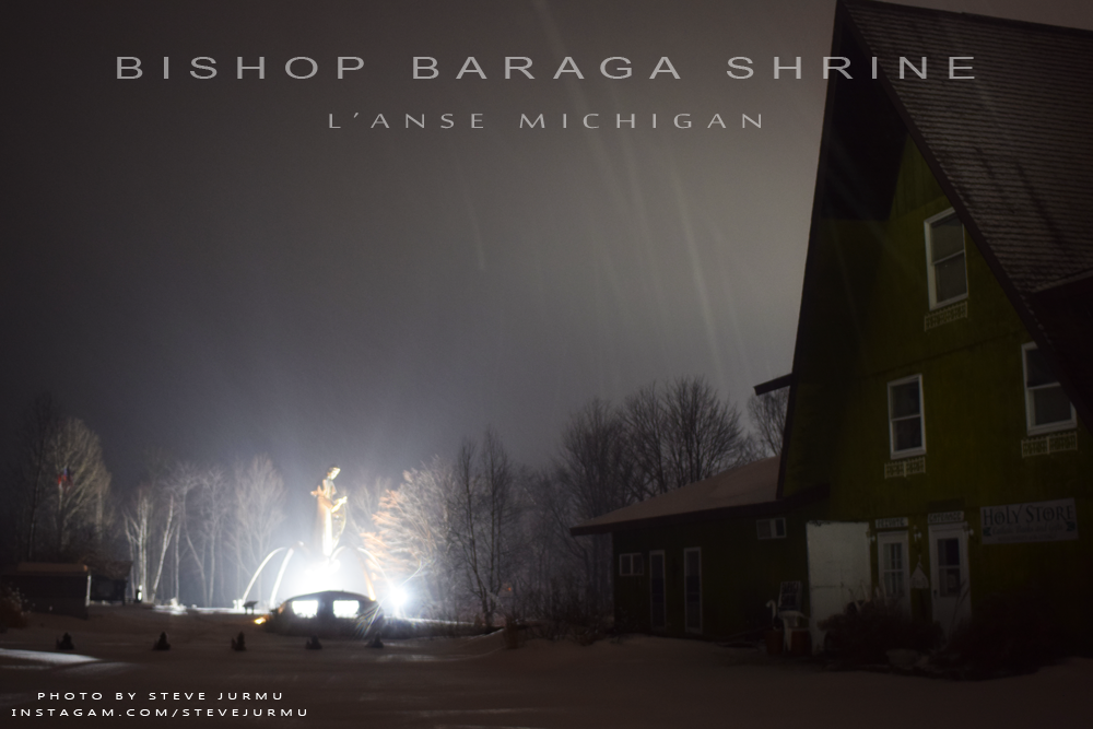
|
|||||
|---|---|---|---|---|---|
|
Today's High Snowfall in the UP - Parent Bay with 0.5 inches Most snow in the U.P.(season total) Calumet (Tamarack Location) with 280 inches | |||||
| KEY: T: trace - NR: No Report - ND: No Data | |||||
| Western/Northern Upper Peninsula Snowfall totals | Daily Amount | Season Total | On ground | Today in 2016 | YTD 2016/17 Season |
|
Houghton County FunintheUP.com station |
0 | 262.5 | 38 | 0.3 | 269 |
| Houghton County Snowfall Record: 354.1 inches - 1978/1979 | |||||
| 2nd most Snowfall 338.7 inches - 2013/14 | |||||
|
Marquette County (NWS Office)
measured by NOAA Marquette |
0 | 127.7 | 28 | 0.3 | 130.4 |
|
Keweenaw County - Updates on weekdays only - view daily measured by Keweenaw County Rd Commission |
0 | 258 | 36 | 0 | 258 |
| Keweenaw County Snowfall Record: 390.4 inches - 1978/1979 | |||||
|
Downtown Houghton FunintheUP.com station |
0 | 162.2 | 30 | 0 | 186.6 |
|
Houghton County Airport - updates on weekdays only view daily measured by KRRC This number reported in Daily Mining Gazette |
0 | 181.75 | 20 | T | 173.25 |
|
Michigan Tech University xc ski trails (FunintheUP.com station) |
0 | 197.7 | 30 | 0.2 | 213.9 |
|
Dollar Bay (FunintheUP.com station) |
0 | 191.9 | 35 | T | 200.4 |
|
Agate Beach (FunintheUP.com station) |
0 | 118.1 | 18 | 0 | 129.6 |
|
Allouez twnship (near Mohawk) measured by John Dee |
T | 256.5 | 38 | 0.5 | 248 |
|
Twin Lakes measured by Cindy Hoover |
0 | 224.5 | NA | 0.6 | 214.8 |
|
Calumet(North) (FunintheUP.com station) |
0 | 243.7 | 33 | 0 | 230.9 |
|
Calumet(Tamarack Location) (FunintheUP.com station) |
0 | 280 | 48 | NR | NR |
|
Painsedale |
0 | 266 | 41 | 0.5 | 254.2 |
|
Hancock (Quincy Hill) |
0 | 209.8 | 35 | ||
|
Kearsarge |
0 | 170 | 36 | ||
| RedRidge | 0 | 230.5 | 36 | ||
| Copper Harbor | 0 | 106.1 | 33 | ||
| Jacobsville | 0 | 102 | 24 | ||
|
Pelkie snowfall more than what shown, doesn't update regularly |
0 | 30.7 | 15 | ||
| Keweenaw Bay | 0 | 109 | 20 | ||
|
Baraga - not updated since Dec 5th | NR | 57.2 | 16 | ||
| Herman | 0 | 154.9 | 29 | ||
|
Alberta(FordCntr) No report since Jan 18th |
NR | 96.3 | NR | ||
| Greenland | 0 | 184.5 | 28 | ||
|
Ontonagon no update since Feb 28th | 0 | 118 | 20 | ||
| Ironwood | 0 | 134.6 | 19 | ||
| Bergland | 0 | 140 | 27 | ||
| Paulding | 0 | 105.7 | 20 | ||
| Watersmeet 1000 Isle | 0 | 76.4 | 18 | ||
| Stambaugh(IronRiver) | 0 | 49.6 | 9 | ||
| Amasa | 0 | 52.4 | 16 | ||
| Central Upper Peninsula Snowfall totals | Daily Amount | Season Total | On Ground | ||
| Three Lakes | T | 78.9 | 18 | ||
| Clarksburg | T | 73.1 | 15 | ||
| Ishpeming (Deer Lake) | 0 | 127.2 | 30 | ||
| Hoist Basin | 0 | 140.8 | 36 | ||
|
Big Bay 1NW no update since Feb 28th | 0 | 103.5 | 20 | ||
| Marquette downtown | 0 | 98.1 | NR | ||
| Marquette Lighthouse | 0 | 71.6 | 14 | ||
| K.I. Sawyer | 0 | 52.2 | 19 | ||
| Harvey CoRd480 | 0 | 80.8 | 22 | ||
| Harvey south | 0 | 55.4 | 24 | ||
| Green Garden | 0 | 75.9 | 10 | ||
| Munising | 0 | 170 | 32 | ||
| Chatham | 0 | 112 | 16 | ||
| Wetmore | 0 | 66.3 | 12 | ||
| Eastern Upper Peninsula Snowfall totals | Daily Amount | Season Total | On Ground | ||
| Grand Marais (Green Haven Loc) | 0 | 176.8 | 36 | ||
| Newberry City | 0 | 185.3 | 23 | ||
| Paradise | 0 | 119 | 19 | ||
|
Tahquamenon Falls St Park updates monthly data at end of each month |
0 | 127.2 | 27 | ||
| Sault Ste Marie | T | 94.1 | 19 | ||
|
Sault Ste Marie Airport updates multiple times per day |
0 | 105.4 | 19 | ||
| Moran | 0 | 55.8 | 5 | ||
|
St. Ignace (Mackinac Bridge) measured by MDOT |
0 | 65.5 | T | ||
|
Engadine measured by MDOT |
0 | 14.1 | 7 | ||
| Cedarville | 0 | 48.7 | NR | ||
| Detour | 0 | 35.9 | 2 | ||
| Southern Upper Peninsula Snowfall totals | Daily Amount | Season Total | On Ground | ||
| Arnold | 0 | 43.5 | 10 | ||
|
Iron Mountain | 0 | 44.9 | 12 | ||
| Norway | 0 | 41.3 | 7 | ||
| Menominee | 0 | 35.5 | |||
|
Bark River not updated since Dec 14 | 0 | 5.8 | 0 | ||
| Rapid River | T | 61.5 | 13 | ||
|
Escanaba station has more than shown | 0 | 37.3 | 4 | ||
| Gladstone | 0 | 50.6 | 14 | ||
| Garden Corners | T | 59.3 | 13 | ||
| Cooks | 0 | 58.3 | 13 | ||
| Parent Bay | 0 | 31.5 | 2 | ||
| Manistique WWTP | 0 | 47.5 | 4 | ||
|
March 1st, 2018 - Upper Peninsula Snowfall totals
Report for March 2nd, 2018 - Snowfall from March 1st 10am to March 2nd 10am. This page may be updated multiple times through the day. Notes: Ice data for 3.2.18 - Usually peak ice coverage is around March 13th. Lake Superior Ice Percentage today - 57.12% - Yesterday - 56.53% - High 77.11% on 2.11.18 Great Lakes Ice Percentage today - 34.26% - Yesterday - 32.53% - High 69.09% on 2.11.18 March 25th, the Soo Locks open for the season. |
|||||
|---|---|---|---|---|---|
|
Today's High Snowfall in the UP - Paulding with 1.5 inches Most snow in the U.P.(season total) Calumet (Tamarack Location) with 271 inches | |||||
| KEY: T: trace - NR: No Report - ND: No Data | |||||
| Western/Northern Upper Peninsula Snowfall totals | Daily Amount | Season Total | On ground | Today in 2016 | YTD 2016/17 Season |
|
Houghton County FunintheUP.com station |
0 | 256.2 | 39 | 0 | 262 |
| Houghton County Snowfall Record: 354.1 inches - 1978/1979 | |||||
| 2nd most Snowfall 338.7 inches - 2013/14 | |||||
|
Marquette County (NWS Office)
measured by NOAA Marquette |
0 | 116 | 24 | T | 127.3 |
|
Keweenaw County - Updates on weekdays only - view daily measured by Keweenaw County Rd Commission |
0 | 245 | 30 | 0 | 248 |
| Keweenaw County Snowfall Record: 390.4 inches - 1978/1979 | |||||
|
Downtown Houghton FunintheUP.com station |
0 | 158 | 25 | 0 | 183.5 |
|
Houghton County Airport - updates on weekdays only view daily measured by KRRC This number reported in Daily Mining Gazette |
0 | 176.5 | 20 | 0 | 172.75 |
|
Michigan Tech University xc ski trails (FunintheUP.com station) |
0 | 193.4 | 29 | 0 | 208.8 |
|
Dollar Bay (FunintheUP.com station) |
0 | 189 | 36 | 0 | 195.3 |
|
Agate Beach (FunintheUP.com station) |
0 | 114.1 | 18 | 0 | 128.8 |
|
Allouez twnship (near Mohawk) measured by John Dee |
0 | 243.5 | 37 | 0 | 238.5 |
|
Twin Lakes measured by Cindy Hoover |
0 | 218.2 | NA | 0 | 204.7 |
|
Calumet(North) (FunintheUP.com station) |
0 | 238 | 35 | 0 | 230.9 |
|
Calumet(Tamarack Location) (FunintheUP.com station) |
0 | 271 | 48 | NR | NR |
|
Painsedale |
0 | 258.8 | 42 | 0 | 246.9 |
|
Hancock (Quincy Hill) |
0 | 204.5 | 35 | ||
|
Kearsarge |
0 | 169 | 36 | ||
| RedRidge | 0 | 226.5 | 36 | ||
| Copper Harbor | 0 | 101.9 | 36 | ||
| Jacobsville | 0 | 100 | 25 | ||
| Pelkie | 0 | 30.7 | 15 | ||
| Keweenaw Bay | 0 | 105.5 | 20 | ||
|
Baraga - not updated since Dec 5th | NR | 57.2 | 16 | ||
| Herman | 0 | 143.9 | 28 | ||
|
Alberta(FordCntr) No report since Jan 18th |
NR | 96.3 | NR | ||
| Greenland | 0 | 177.2 | 29 | ||
| Ontonagon | 0 | 118 | 20 | ||
| Ironwood | 0 | 132.4 | 20 | ||
| Bergland | 0 | 135.8 | 27 | ||
| Paulding | 1.5 | 101.8 | 21 | ||
| Watersmeet 1000 Isle | T | 75.9 | 26 | ||
| Stambaugh(IronRiver) | 0.3 | 48.8 | 13 | ||
| Amasa | 0 | 51.8 | 17 | ||
| Central Upper Peninsula Snowfall totals | Daily Amount | Season Total | On Ground | ||
| Three Lakes | 0 | 75.9 | 19 | ||
| Clarksburg | 0 | 71.3 | 15 | ||
| Ishpeming (Deer Lake) | 0 | 115.8 | 25 | ||
| Hoist Basin | 0 | 131.1 | 32 | ||
| Big Bay 1NW | 0 | 103.5 | 20 | ||
| Marquette downtown | 0 | 92 | NR | ||
| Marquette Lighthouse | 0 | 67.4 | 11 | ||
| K.I. Sawyer | 0 | 50.3 | 19 | ||
| Harvey CoRd480 | 0 | 76.6 | 19 | ||
| Harvey south | 0 | 50.9 | 24 | ||
| Green Garden | 0 | 70.5 | 10 | ||
| Munising | 0 | 162 | 30 | ||
| Chatham | 0 | 107.3 | 14 | ||
| Wetmore | 0 | 65.3 | 12 | ||
| Eastern Upper Peninsula Snowfall totals | Daily Amount | Season Total | On Ground | ||
| Grand Marais (Green Haven Loc) | 0 | 170.3 | 37 | ||
| Newberry City | 2.5 | 182.7 | 25 | ||
| Paradise | 0 | 116.5 | 20 | ||
|
Tahquamenon Falls St Park updates monthly data at end of each month |
0 | 127.2 | 27 | ||
| Sault Ste Marie | T | 92.3 | 20 | ||
|
Sault Ste Marie Airport updates multiple times per day |
T | 103.6 | 20 | ||
| Moran | 0 | 54 | 5 | ||
|
St. Ignace (Mackinac Bridge) measured by MDOT |
0 | 64 | 2 | ||
|
Engadine measured by MDOT |
0 | 14.1 | 9 | ||
| Cedarville | 0 | 48.7 | NR | ||
| Detour | 0 | 32.9 | 2 | ||
| Southern Upper Peninsula Snowfall totals | Daily Amount | Season Total | On Ground | ||
| Arnold | 0 | 42.5 | 13 | ||
|
Iron Mountain | 0 | 44.9 | 15 | ||
| Norway | 0 | 40.9 | 10 | ||
| Menominee | 0 | 35.5 | |||
|
Bark River not updated since Dec 14 | 0 | 5.8 | 0 | ||
| Rapid River | 0 | 60.3 | 15 | ||
|
Escanaba station has more than shown | 0 | 36.8 | 6 | ||
| Gladstone | 0 | 50.3 | 17 | ||
| Garden Corners | 0 | 58.3 | 13 | ||
| Cooks | 0 | 57.5 | 14 | ||
| Parent Bay | 0 | 30 | 7 | ||
| Manistique WWTP | 0 | 47 | 5 | ||
|
Feb 28th, 2018 - Upper Peninsula Snowfall totals
Report for March 1st, 2018 - Snowfall from Feb 28th 10am to March 1st 10am. This page may be updated multiple times through the day. Notes: Another nice sunny day yesterday March 28th, the last day of the month. A good bit of melting has been occuring the last couple days which has dropped on the ground snow levels down 2-4 inches in some places. Through this weekend it should remain in the low 30s, with possible snowfall when it cools down in the evenings. Copper Dog starts tomorrow Friday March 2nd through Sunday March 4th, so if you are up in the Copper Country get there to see a premier dog sledding race here in the U.P. of Michigan. Ice data for 3.1.18 - Usually peak ice coverage is around March 13th. Lake Superior Ice Percentage today - 57.12% - Yesterday - 56.53% - High 77.11% on 2.11.18 Great Lakes Ice Percentage today - 34.26% - Yesterday - 32.53% - High 69.09% on 2.11.18 March 25th, the Soo Locks open for the season. |
|||||
|---|---|---|---|---|---|
|
Today's High Snowfall in the UP - NWS Marquette with 2 inches Most snow in the U.P.(season total) Calumet (Tamarack Location) with 271 inches | |||||
| KEY: T: trace - NR: No Report - ND: No Data | |||||
| Western/Northern Upper Peninsula Snowfall totals | Daily Amount | Season Total | On ground | Today in 2016 | YTD 2016/17 Season |
|
Houghton County FunintheUP.com station |
0 | 256.2 | 40 | 3.6 | 262 |
| Houghton County Snowfall Record: 354.1 inches - 1978/1979 | |||||
| 2nd most Snowfall 338.7 inches - 2013/14 | |||||
|
Marquette County (NWS Office)
measured by NOAA Marquette |
2 | 116 | 24 | 0.3 | 121.1 |
|
Keweenaw County - Updates on weekdays only - view daily measured by Keweenaw County Rd Commission |
0 | 245 | 35 | 5 | 248 |
| Keweenaw County Snowfall Record: 390.4 inches - 1978/1979 | |||||
|
Downtown Houghton FunintheUP.com station |
0 | 158 | 28 | 1.9 | 183.5 |
|
Houghton County Airport - updates on weekdays only view daily measured by KRRC This number reported in Daily Mining Gazette |
0 | 176.5 | 23 | 1 | 172.75 |
|
Michigan Tech University xc ski trails (FunintheUP.com station) |
0 | 193.4 | 32 | 2.1 | 208.8 |
|
Dollar Bay (FunintheUP.com station) |
0 | 189 | 36 | 0 | 195.3 |
|
Agate Beach (FunintheUP.com station) |
0 | 114.1 | 20 | 2 | 128.8 |
|
Allouez twnship (near Mohawk) measured by John Dee |
0 | 243.5 | 39 | 3.5 | 238.5 |
|
Twin Lakes measured by Cindy Hoover |
0 | 218.2 | NA | 3 | 203.7 |
|
Calumet(North) (FunintheUP.com station) |
0 | 238 | 37 | 3.3 | 230.9 |
|
Calumet(Tamarack Location) (FunintheUP.com station) |
0 | 271 | 50 | NR | NR |
|
Painsedale |
0 | 258.8 | 43 | 2.9 | 246.9 |
|
Hancock (Quincy Hill) |
0 | 204.5 | 36 | ||
|
Kearsarge |
0 | 169 | 36 | ||
| RedRidge | 0 | 226.5 | 36 | ||
| Copper Harbor | 0 | 101.9 | 36 | ||
| Jacobsville | 0 | 100 | 25 | ||
| Pelkie | 0 | 30.7 | 15 | ||
| Keweenaw Bay | 0 | 105.5 | 20 | ||
|
Baraga - not updated since Dec 5th | NR | 57.2 | 16 | ||
| Herman | 0 | 143.9 | 28 | ||
|
Alberta(FordCntr) No report since Jan 18th |
NR | 96.3 | NR | ||
| Greenland | 0 | 177.2 | 29 | ||
| Ontonagon | 0 | 118 | 20 | ||
| Ironwood | 0 | 132.4 | 20 | ||
| Bergland | 0 | 135.8 | 27 | ||
| Paulding | 0 | 100.3 | 21 | ||
| Watersmeet 1000 Isle | 0 | 75.9 | 26 | ||
| Stambaugh(IronRiver) | 0 | 48.8 | 13 | ||
| Amasa | 0 | 51.8 | 17 | ||
| Central Upper Peninsula Snowfall totals | Daily Amount | Season Total | On Ground | ||
| Three Lakes | 0 | 75.9 | 19 | ||
| Clarksburg | 0 | 71.3 | 15 | ||
| Ishpeming (Deer Lake) | 0 | 115.8 | 25 | ||
| Hoist Basin | 0 | 131.1 | 32 | ||
| Big Bay 1NW | 0 | 103.5 | 20 | ||
| Marquette downtown | 0 | 92 | NR | ||
| Marquette Lighthouse | 0 | 67.4 | 11 | ||
| K.I. Sawyer | 0 | 50.3 | 19 | ||
| Harvey CoRd480 | 0 | 76.6 | 19 | ||
| Harvey south | 0 | 50.9 | 24 | ||
| Green Garden | 0 | 70.5 | 10 | ||
| Munising | 0 | 162 | 30 | ||
| Chatham | 0 | 107.3 | 14 | ||
| Wetmore | 0 | 65.3 | 12 | ||
| Eastern Upper Peninsula Snowfall totals | Daily Amount | Season Total | On Ground | ||
| Grand Marais (Green Haven Loc) | 0 | 170.3 | 37 | ||
| Newberry City | 2.5 | 182.7 | 25 | ||
| Paradise | 0 | 116.5 | 20 | ||
|
Tahquamenon Falls St Park updates monthly data at end of each month |
0 | 127.2 | 27 | ||
| Sault Ste Marie | 0 | 92.3 | 20 | ||
|
Sault Ste Marie Airport updates multiple times per day |
T | 103.6 | 20 | ||
| Moran | 0 | 54 | 5 | ||
|
St. Ignace (Mackinac Bridge) measured by MDOT |
0 | 64 | 2 | ||
|
Engadine measured by MDOT |
0 | 14.1 | 9 | ||
| Cedarville | 0 | 48.7 | NR | ||
| Detour | 0 | 32.9 | 2 | ||
| Southern Upper Peninsula Snowfall totals | Daily Amount | Season Total | On Ground | ||
| Arnold | 0 | 42.5 | 13 | ||
|
Iron Mountain | 0 | 44.9 | 15 | ||
| Norway | 0 | 40.9 | 10 | ||
| Menominee | 0 | 35.5 | |||
|
Bark River not updated since Dec 14 | 0 | 5.8 | 0 | ||
| Rapid River | 0 | 60.3 | 15 | ||
|
Escanaba station has more than shown | 0 | 36.8 | 6 | ||
| Gladstone | 0 | 50.3 | 17 | ||
| Garden Corners | 0 | 58.3 | 13 | ||
| Cooks | 0 | 57.5 | 14 | ||
| Parent Bay | 0 | 30 | 7 | ||
| Manistique WWTP | 0 | 47 | 5 | ||
|
Feb 27th, 2018 - Upper Peninsula Snowfall totals
Report for Feb 28th, 2018 - Snowfall from Feb 27th 10am to Feb 28th 10am. This page may be updated multiple times through the day. Notes: Warm again through the day in the mid 40s. As it cooled off during the early morning hours, places in the central and northern east saw a little snowfall. Ice data for 2.28.18 - Usually peak ice coverage is around March 13th. Lake Superior Ice Percentage today - 56.53% - Yesterday - 57.48% - High 77.11% on 2.11.18 Great Lakes Ice Percentage today - 32.53% - Yesterday - 33.35% - High 69.09% on 2.11.18 March 25th, the Soo Locks open for the season. |
|||||
|---|---|---|---|---|---|
|
Today's High Snowfall in the UP - Newberry with 3 inches. Most snow in the U.P.(season total) Calumet (Tamarack Location) with 271 inches | |||||
| KEY: T: trace - NR: No Report - ND: No Data | |||||
| Western/Northern Upper Peninsula Snowfall totals | Daily Amount | Season Total | On ground | Today in 2016 | YTD 2016/17 Season |
|
Houghton County FunintheUP.com station |
0 | 256.2 | 40 | 0 | 239 |
| Houghton County Snowfall Record: 354.1 inches - 1978/1979 | |||||
| 2nd most Snowfall 338.7 inches - 2013/14 | |||||
|
Marquette County (NWS Office)
measured by NOAA Marquette |
T | 114 | 23 | T | 106.4 |
|
Keweenaw County - Updates on weekdays only - view daily measured by Keweenaw County Rd Commission |
0 | 245 | 35 | 0 | 222 |
| Keweenaw County Snowfall Record: 390.4 inches - 1978/1979 | |||||
|
Downtown Houghton FunintheUP.com station |
0 | 158 | 28 | 0 | 169.8 |
|
Houghton County Airport - updates on weekdays only view daily measured by KRRC This number reported in Daily Mining Gazette |
0 | 176.5 | 23 | 0 | 161 |
|
Michigan Tech University xc ski trails (FunintheUP.com station) |
0 | 193.4 | 32 | 0 | 191.6 |
|
Dollar Bay (FunintheUP.com station) |
0 | 189 | 36 | 0 | 181.8 |
|
Agate Beach (FunintheUP.com station) |
0 | 114.1 | 20 | 0 | 114.8 |
|
Allouez twnship (near Mohawk) measured by John Dee |
0 | 243.5 | 39 | 0 | 215 |
|
Twin Lakes measured by Cindy Hoover |
0 | 218.2 | NA | 0 | 182.7 |
|
Calumet(North) (FunintheUP.com station) |
0 | 238 | 37 | 0 | 211 |
|
Calumet(Tamarack Location) (FunintheUP.com station) |
0 | 271 | 50 | NR | NR |
|
Painsedale |
0 | 258.8 | 43 | 0 | 226.9 |
|
Hancock (Quincy Hill) |
0 | 204.5 | 36 | ||
|
Kearsarge |
0 | 169 | 36 | ||
| RedRidge | 0.5 | 226.5 | 36 | ||
| Copper Harbor | 0 | 101.9 | 36 | ||
| Jacobsville | 0.2 | 100 | 25 | ||
| Pelkie | 0 | 30.7 | 15 | ||
| Keweenaw Bay | 0 | 105.5 | 20 | ||
|
Baraga - not updated since Dec 5th | NR | 57.2 | 16 | ||
| Herman | T | 143.9 | 28 | ||
|
Alberta(FordCntr) No report since Jan 18th |
NR | 96.3 | NR | ||
| Greenland | 0 | 177.2 | 29 | ||
| Ontonagon | 0 | 118 | 20 | ||
| Ironwood | 0 | 132.4 | 20 | ||
| Bergland | 0 | 135.8 | 27 | ||
| Paulding | 0 | 100.3 | 21 | ||
| Watersmeet 1000 Isle | 0 | 75.9 | 26 | ||
| Stambaugh(IronRiver) | 0.2 | 48.8 | 13 | ||
| Amasa | 0 | 51.8 | 17 | ||
| Central Upper Peninsula Snowfall totals | Daily Amount | Season Total | On Ground | ||
| Three Lakes | 0 | 75.9 | 19 | ||
| Clarksburg | 1 | 71.3 | 15 | ||
| Ishpeming (Deer Lake) | 1 | 115.8 | 25 | ||
| Hoist Basin | 0.9 | 131.1 | 32 | ||
| Big Bay 1NW | 0 | 103.5 | 20 | ||
| Marquette downtown | 0 | 92 | NR | ||
| Marquette Lighthouse | 1 | 67.4 | 11 | ||
| K.I. Sawyer | 0 | 50.3 | 19 | ||
| Harvey CoRd480 | 0 | 76.6 | 19 | ||
| Harvey south | 0.6 | 50.9 | 24 | ||
| Green Garden | 0.5 | 70.5 | 10 | ||
| Munising | 0.2 | 162 | 30 | ||
| Chatham | 0 | 107.3 | 14 | ||
| Wetmore | 0 | 65.3 | 12 | ||
| Eastern Upper Peninsula Snowfall totals | Daily Amount | Season Total | On Ground | ||
| Grand Marais (Green Haven Loc) | 0.5 | 170.3 | 37 | ||
| Newberry City | 2.5 | 182.7 | 25 | ||
| Paradise | 0 | 116.5 | 20 | ||
|
Tahquamenon Falls St Park updates monthly data at end of each month |
1 | 127.2 | 27 | ||
| Sault Ste Marie | 1.4 | 92.3 | 20 | ||
|
Sault Ste Marie Airport updates multiple times per day |
1.4 | 103.6 | 20 | ||
| Moran | T | 54 | 5 | ||
|
St. Ignace (Mackinac Bridge) measured by MDOT |
0 | 64 | 2 | ||
|
Engadine measured by MDOT |
0.1 | 14.1 | 9 | ||
| Cedarville | 0.2 | 48.7 | NR | ||
| Detour | 0 | 32.9 | 2 | ||
| Southern Upper Peninsula Snowfall totals | Daily Amount | Season Total | On Ground | ||
| Arnold | 0 | 42.5 | 13 | ||
|
Iron Mountain | 0 | 44.9 | 15 | ||
| Norway | 0 | 40.9 | 10 | ||
| Menominee | 0 | 35.5 | |||
|
Bark River not updated since Dec 14 | 0 | 5.8 | 0 | ||
| Rapid River | 0.2 | 60.3 | 15 | ||
|
Escanaba station has more than shown | 0 | 36.8 | 6 | ||
| Gladstone | 0 | 50.3 | 17 | ||
| Garden Corners | 0 | 58.3 | 13 | ||
| Cooks | 0 | 57.5 | 14 | ||
| Parent Bay | 0 | 30 | 7 | ||
| Manistique WWTP | 0 | 47 | 5 | ||
|
Feb 26th, 2018 - Upper Peninsula Snowfall totals
Report for Feb 27th, 2018 - Snowfall from Feb 26th 10am to Feb 27th 10am. This page may be updated multiple times through the day. Notes: Ice data for 2.27.18 Lake Superior Ice Percentage today - 57.48% - Yesterday - 61.24% - High 77.11% on 2.11.18 Great Lakes Ice Percentage today - 33.35% - Yesterday - 37.73% - High 69.09% on 2.11.18 |
|||||
|---|---|---|---|---|---|
|
Today's High Snowfall in the UP - NWS Marquette with a Trace of snowfall Most snow in the U.P.(season total) Calumet (Tamarack Location) with 271 inches | |||||
| KEY: T: trace - NR: No Report - ND: No Data | |||||
| Western/Northern Upper Peninsula Snowfall totals | Daily Amount | Season Total | On ground | Today in 2016 | YTD 2016/17 Season |
|
Houghton County FunintheUP.com station |
0 | 256.2 | 41 | 0 | 239 |
| Houghton County Snowfall Record: 354.1 inches - 1978/1979 | |||||
| 2nd most Snowfall 338.7 inches - 2013/14 | |||||
|
Marquette County (NWS Office)
measured by NOAA Marquette |
T | 114 | 24 | T | 106.4 |
|
Keweenaw County - Updates on weekdays only - view daily measured by Keweenaw County Rd Commission |
0 | 245 | 38 | 0 | 222 |
| Keweenaw County Snowfall Record: 390.4 inches - 1978/1979 | |||||
|
Downtown Houghton FunintheUP.com station |
0 | 158 | 31 | 0 | 169.8 |
|
Houghton County Airport - updates on weekdays only view daily measured by KRRC This number reported in Daily Mining Gazette |
0 | 176.5 | 25 | 0 | 161 |
|
Michigan Tech University xc ski trails (FunintheUP.com station) |
0 | 193.4 | 34 | 0 | 191.6 |
|
Dollar Bay (FunintheUP.com station) |
0 | 189 | 38 | 0 | 181.8 |
|
Agate Beach (FunintheUP.com station) |
0 | 114.1 | 20 | 0 | 114.8 |
|
Allouez twnship (near Mohawk) measured by John Dee |
0 | 243.5 | 40 | 0 | 215 |
|
Twin Lakes measured by Cindy Hoover |
0 | 218.2 | NA | 0 | 182.7 |
|
Calumet(North) (FunintheUP.com station) |
0 | 238 | 39 | 0 | 211 |
|
Calumet(Tamarack Location) (FunintheUP.com station) |
0 | 271 | 53 | NR | NR |
|
Painsedale |
0 | 258.8 | 44 | 0 | 226.9 |
|
Hancock (Quincy Hill) |
0 | 204.5 | 37 | ||
|
Kearsarge |
0 | 169 | 37 | ||
| RedRidge | 0.5 | 226.5 | 40 | ||
|
Copper Harbor No update since Jan 20th |
0 | 101.9 | 37 | ||
| Jacobsville | 0.2 | 100 | 26 | ||
| Pelkie | 0 | 30.7 | 16 | ||
| Keweenaw Bay | 0 | 105.5 | 22 | ||
|
Baraga - not updated since Dec 5th | NR | 57.2 | 16 | ||
| Herman | T | 143.9 | 29 | ||
|
Alberta(FordCntr) No report since Jan 18th |
NR | 96.3 | NR | ||
| Greenland | 0 | 177.2 | 30 | ||
| Ontonagon | 0 | 118 | 22 | ||
| Ironwood | 0 | 132.4 | 21 | ||
| Bergland | 0 | 135.8 | 29 | ||
| Paulding | 0 | 100.3 | 23 | ||
| Watersmeet 1000 Isle | 0 | 75.9 | 28 | ||
| Stambaugh(IronRiver) | 0 | 48.6 | 14 | ||
| Amasa | 0 | 51.8 | 18 | ||
| Central Upper Peninsula Snowfall totals | Daily Amount | Season Total | On Ground | ||
| Three Lakes | 0.8 | 75.9 | 20 | ||
| Clarksburg | T | 70.3 | 17 | ||
| Ishpeming (Deer Lake) | 0 | 114.8 | 26 | ||
|
Hoist Basin no update since Feb 15th |
0.1 | 130.2 | 35 | ||
| Big Bay 1NW | 0 | 103.5 | 22 | ||
| Marquette downtown | 0 | 92 | NR | ||
| Marquette Lighthouse | 0 | 66.4 | 11 | ||
| K.I. Sawyer | 0 | 50.3 | 21 | ||
| Harvey CoRd480 | 0 | 76.6 | 20 | ||
| Harvey south | 0 | 50.3 | 24 | ||
| Green Garden | 0 | 70 | 10 | ||
| Munising | 0 | 161.8 | 30 | ||
| Chatham | 0 | 107.3 | 14 | ||
| Wetmore | 0 | 65.3 | 15 | ||
| Eastern Upper Peninsula Snowfall totals | Daily Amount | Season Total | On Ground | ||
| Grand Marais (Green Haven Loc) | 0.5 | 170.3 | 36 | ||
| Newberry City | 0.4 | 180.2 | 24 | ||
| Paradise | 0 | 116.5 | 20 | ||
|
Tahquamenon Falls St Park no report since Jan 30th |
0.5 | 126.2 | 26 | ||
| Sault Ste Marie | 0.3 | 90.9 | 20 | ||
|
Sault Ste Marie Airport updates multiple times per day |
0.4 | 102.2 | 20 | ||
| Moran | 0 | 54 | 5 | ||
|
St. Ignace (Mackinac Bridge) measured by MDOT |
0 | 64 | 2 | ||
|
Engadine measured by MDOT |
T | 14 | 9 | ||
| Cedarville | 0 | 48.5 | NR | ||
| Detour | 0 | 32.9 | 2 | ||
| Southern Upper Peninsula Snowfall totals | Daily Amount | Season Total | On Ground | ||
| Arnold | 0 | 42.5 | 13 | ||
|
Iron Mountain | 0 | 44.9 | 15 | ||
| Norway | 0 | 40.9 | 10 | ||
| Menominee | 0 | 35.5 | |||
|
Bark River not updated since Dec 14 | 0 | 5.8 | 0 | ||
| Rapid River | 0 | 60.1 | 16 | ||
|
Escanaba station has more than shown | 0 | 36.8 | 6 | ||
| Gladstone | 0 | 50.3 | 17 | ||
| Garden Corners | 0 | 58.3 | 13 | ||
| Cooks | 0 | 57.5 | 14 | ||
| Parent Bay | 0 | 30 | 7 | ||
| Manistique WWTP | 0 | 47 | 5 | ||
|
Feb 25th, 2018 - Upper Peninsula Snowfall totals
Report for Feb 26th, 2018 - Snowfall from Feb 25th 10am to Feb 26th 10am. This page may be updated multiple times through the day. Notes: Two stations joined the 100 inch club today. Copper Harbor now has 101.9" and Jacobsville now has 100". Ice data for 2.26.18 Great Lakes Ice Percentage today - 37.73% - Yesterday - 44.27% - High 69.09% on 2.11.18 Lake Superior Ice Percentage today - 61.24% - Yesterday - 74.88% - High 77.11% on 2.11.18 |
|||||
|---|---|---|---|---|---|
|
Today's High Snowfall in the UP - Copper Harbor with 4.5 inches Most snow in the U.P.(season total) Calumet (Tamarack Location) with 271 inches | |||||
| KEY: T: trace - NR: No Report - ND: No Data | |||||
| Western/Northern Upper Peninsula Snowfall totals | Daily Amount | Season Total | On ground | Today in 2016 | YTD 2016/17 Season |
|
Houghton County FunintheUP.com station |
0 | 256.2 | 42 | 0 | 239 |
| Houghton County Snowfall Record: 354.1 inches - 1978/1979 | |||||
| 2nd most Snowfall 338.7 inches - 2013/14 | |||||
|
Marquette County (NWS Office)
measured by NOAA Marquette |
3.9 | 114 | 27 | T | 106.4 |
|
Keweenaw County - Updates on weekdays only - view daily measured by Keweenaw County Rd Commission |
2 | 245 | 38 | 0 | 222 |
| Keweenaw County Snowfall Record: 390.4 inches - 1978/1979 | |||||
|
Downtown Houghton FunintheUP.com station |
0 | 158 | 33 | 0 | 169.8 |
|
Houghton County Airport - updates on weekdays only view daily measured by KRRC This number reported in Daily Mining Gazette |
0 | 176.5 | 32 | 0 | 161 |
|
Michigan Tech University xc ski trails (FunintheUP.com station) |
0 | 193.4 | 36 | 0 | 191.6 |
|
Dollar Bay (FunintheUP.com station) |
0 | 189 | 41 | 0 | 181.8 |
|
Agate Beach (FunintheUP.com station) |
0 | 114.1 | 21 | 0 | 114.8 |
|
Allouez twnship (near Mohawk) measured by John Dee |
1.5 | 243.5 | 42 | 0 | 215 |
|
Twin Lakes measured by Cindy Hoover |
0 | 218.2 | NA | 0 | 182.7 |
|
Calumet(North) (FunintheUP.com station) |
0.9 | 238 | 40 | 0 | 211 |
|
Calumet(Tamarack Location) (FunintheUP.com station) |
1.9 | 271 | 53 | NR | NR |
|
Painsedale |
0 | 258.8 | 45 | 0 | 226.9 |
|
Hancock (Quincy Hill) |
0.8 | 204.5 | 7 | ||
|
Kearsarge |
1.5 | 169 | 38 | ||
| RedRidge | 0.5 | 226.5 | 40 | ||
|
Copper Harbor No update since Jan 20th |
4.5 | 101.9 | 39 | ||
| Jacobsville | 0.2 | 100 | 26 | ||
| Pelkie | 0 | 30.7 | 17 | ||
| Keweenaw Bay | 0 | 105.5 | 25 | ||
|
Baraga - not updated since Dec 5th | NR | 57.2 | 15 | ||
| Herman | T | 143.9 | 32 | ||
|
Alberta(FordCntr) No report since Jan 18th |
NR | 96.3 | NR | ||
| Greenland | T | 177.2 | 35 | ||
| Ontonagon | T | 118 | 24 | ||
| Ironwood | 0 | 132.4 | 24 | ||
|
Bergland no update since Jan 31st | 0 | 135.8 | 32 | ||
| Paulding | 0 | 100.3 | 27 | ||
| Watersmeet 1000 Isle | T | 75.9 | 31 | ||
| Stambaugh(IronRiver) | 0 | 48.6 | 16 | ||
| Amasa | 0 | 51.8 | 19 | ||
| Central Upper Peninsula Snowfall totals | Daily Amount | Season Total | On Ground | ||
| Three Lakes | 0.8 | 75.9 | 20 | ||
| Clarksburg | T | 70.3 | 19 | ||
| Ishpeming (Deer Lake) | 0 | 114.8 | 28 | ||
|
Hoist Basin no update since Feb 15th |
0.1 | 130.2 | 35 | ||
|
Big Bay 1NW no update since Jan 31st | 0 | 103.5 | 24 | ||
| Marquette downtown | 0 | 92 | NR | ||
| Marquette Lighthouse | 0 | 66.4 | 12 | ||
| K.I. Sawyer | 0 | 50.3 | 21 | ||
| Harvey CoRd480 | 0 | 76.6 | 22 | ||
| Harvey south | 0 | 50.3 | 25 | ||
| Green Garden | 0 | 70 | 12 | ||
| Munising | 0 | 161.8 | 32 | ||
| Chatham | 0 | 107.3 | 15 | ||
| Wetmore | 0 | 65.3 | 15 | ||
| Eastern Upper Peninsula Snowfall totals | Daily Amount | Season Total | On Ground | ||
| Grand Marais (Green Haven Loc) | 0.5 | 170.3 | 38 | ||
| Newberry City no report since Feb 3rd |
0.4 | 180.2 | 25 | ||
| Paradise | 0 | 116.5 | 22 | ||
|
Tahquamenon Falls St Park no report since Jan 30th |
0.5 | 126.2 | 27 | ||
| Sault Ste Marie | 0.3 | 90.9 | 20 | ||
|
Sault Ste Marie Airport updates multiple times per day |
0.4 | 102.2 | 20 | ||
| Moran | 0 | 54 | 5 | ||
|
St. Ignace (Mackinac Bridge) measured by MDOT |
0 | 64 | 2 | ||
|
Engadine measured by MDOT |
T | 14 | 8 | ||
| Cedarville | 0 | 48.5 | NR | ||
| Detour | 0 | 32.9 | 2 | ||
| Southern Upper Peninsula Snowfall totals | Daily Amount | Season Total | On Ground | ||
| Arnold | 0 | 42.5 | 14 | ||
|
Iron Mountain | 0 | 44.9 | 17 | ||
| Norway | 0 | 40.9 | 12 | ||
| Menominee | 0 | 35.5 | |||
|
Bark River not updated since Dec 14 | 0 | 5.8 | 0 | ||
| Rapid River | 0 | 60.1 | 17 | ||
|
Escanaba station has more than shown | 0 | 36.8 | 7 | ||
| Gladstone | 0 | 50.3 | 18 | ||
| Garden Corners | 0 | 58.3 | 16 | ||
| Cooks | 1.5 | 57.5 | 13 | ||
| Parent Bay | 0 | 30 | 7 | ||
| Manistique WWTP | 0 | 47 | 6 | ||
|
Feb 24th, 2018 - Upper Peninsula Snowfall totals
Report for Feb 25th, 2018 - Snowfall from Feb 24th 10am to Feb 25th 10am. This page may be updated multiple times through the day. Notes: Paulding joined the 100 inch club today. Ice data for 2.25.18 Great Lakes Ice Percentage today - 44.27% - Yesterday - 48.84% - High 69.09% on 2.11.18 Lake Superior Ice Percentage today - 74.88% - Yesterday - 74.56% - High 77.11% on 2.11.18 |
|||||
|---|---|---|---|---|---|
|
Today's High Snowfall in the UP - Twin Lakes with 7.6 inches Most snow in the U.P.(season total) Calumet (Tamarack Location) with 269.1 inches | |||||
| KEY: T: trace - NR: No Report - ND: No Data | |||||
| Western/Northern Upper Peninsula Snowfall totals | Daily Amount | Season Total | On ground | Today in 2016 | YTD 2016/17 Season |
|
Houghton County FunintheUP.com station |
5.3 | 256.2 | 44 | 0 | 239 |
| Houghton County Snowfall Record: 354.1 inches - 1978/1979 | |||||
| 2nd most Snowfall 338.7 inches - 2013/14 | |||||
|
Marquette County (NWS Office)
measured by NOAA Marquette |
T | 110.1 | 23 | T | 106.4 |
|
Keweenaw County - Updates on weekdays only - view daily measured by Keweenaw County Rd Commission |
7 | 243 | 38 | 0 | 222 |
| Keweenaw County Snowfall Record: 390.4 inches - 1978/1979 | |||||
|
Downtown Houghton FunintheUP.com station |
3.5 | 158 | 33 | 0 | 169.8 |
|
Houghton County Airport - updates on weekdays only view daily measured by KRRC This number reported in Daily Mining Gazette |
5 | 176.5 | 32 | 0 | 161 |
|
Michigan Tech University xc ski trails (FunintheUP.com station) |
4.5 | 193.4 | 36 | 0 | 191.6 |
|
Dollar Bay (FunintheUP.com station) |
5 | 189 | 41 | 0 | 181.8 |
|
Agate Beach (FunintheUP.com station) |
0 | 114.1 | 21 | 0 | 114.8 |
|
Allouez twnship (near Mohawk) measured by John Dee |
5.5 | 242 | 44 | 0 | 215 |
|
Twin Lakes measured by Cindy Hoover |
7.6 | 218.2 | NA | 0 | 182.7 |
|
Calumet(North) (FunintheUP.com station) |
4.3 | 237.1 | 38 | 0 | 211 |
|
Calumet(Tamarack Location) (FunintheUP.com station) |
5.5 | 269.1 | 53 | NR | NR |
|
Painsedale |
4.4 | 258.8 | 49 | 0 | 226.9 |
|
Hancock (Quincy Hill) |
3.1 | 203.7 | 39 | ||
|
Kearsarge |
4 | 167.5 | 41 | ||
| RedRidge | 6 | 226 | 42 | ||
|
Copper Harbor No update since Jan 20th |
7 | 97.4 | 38 | ||
| Jacobsville | 3.9 | 99.8 | 28 | ||
| Pelkie | 4.6 | 30.7 | 17 | ||
| Keweenaw Bay | 0 | 105.5 | 25 | ||
|
Baraga - not updated since Dec 5th | NR | 57.2 | 15 | ||
| Herman | 4 | 143.9 | 32 | ||
|
Alberta(FordCntr) No report since Jan 18th |
NR | 96.3 | NR | ||
| Greenland | 4.8 | 177.2 | 35 | ||
| Ontonagon | 3.9 | 118 | 24 | ||
| Ironwood | 4.5 | 132.4 | 24 | ||
|
Bergland no update since Jan 31st | 4.1 | 135.8 | 32 | ||
| Paulding | 4.2 | 100.3 | 27 | ||
| Watersmeet 1000 Isle | 6 | 75.9 | 31 | ||
| Stambaugh(IronRiver) | 3.7 | 48.6 | 16 | ||
| Amasa | 5 | 51.8 | 19 | ||
| Central Upper Peninsula Snowfall totals | Daily Amount | Season Total | On Ground | ||
| Three Lakes | 3.5 | 75.1 | 20 | ||
| Clarksburg | 4 | 70.3 | 19 | ||
| Ishpeming (Deer Lake) | 3.1 | 114.8 | 28 | ||
|
Hoist Basin no update since Feb 15th |
3.4 | 130.1 | 36 | ||
|
Big Bay 1NW no update since Jan 31st | 2.8 | 103.5 | 26 | ||
| Marquette downtown | 3.7 | 92 | NR | ||
| Marquette Lighthouse | 3 | 66.4 | 14 | ||
| K.I. Sawyer | 3 | 50.3 | 21 | ||
| Harvey CoRd480 | 3.4 | 76.6 | 22 | ||
| Harvey south | 0 | 50.3 | 25 | ||
| Green Garden | 3.4 | 70 | 12 | ||
| Munising | 3 | 161.8 | 32 | ||
| Chatham | 2.2 | 107.3 | 15 | ||
| Wetmore | 2.1 | 65.3 | 15 | ||
| Eastern Upper Peninsula Snowfall totals | Daily Amount | Season Total | On Ground | ||
| Grand Marais (Green Haven Loc) | 3 | 169.8 | 38 | ||
| Newberry City no report since Feb 3rd |
2.4 | 179.8 | 26 | ||
| Paradise | 1.7 | 116.5 | 22 | ||
|
Tahquamenon Falls St Park no report since Jan 30th |
1.4 | 125.7 | 27 | ||
| Sault Ste Marie | 3.2 | 90.6 | 20 | ||
|
Sault Ste Marie Airport updates multiple times per day |
3.5 | 101.8 | 20 | ||
| Moran | 1.4 | 54 | 5 | ||
|
St. Ignace (Mackinac Bridge) measured by MDOT |
0.5 | 64 | 2 | ||
|
Engadine measured by MDOT |
0 | 14 | 8 | ||
| Cedarville | 0.9 | 48.5 | NR | ||
| Detour | 0 | 32.9 | 2 | ||
| Southern Upper Peninsula Snowfall totals | Daily Amount | Season Total | On Ground | ||
| Arnold | 2.5 | 42.5 | 14 | ||
|
Iron Mountain | 4 | 44.9 | 17 | ||
| Norway | 3.5 | 40.9 | 12 | ||
| Menominee | 0 | 35.5 | |||
|
Bark River not updated since Dec 14 | 0 | 5.8 | 0 | ||
| Rapid River | 2.8 | 60.1 | 17 | ||
|
Escanaba station has more than shown | 2 | 36.8 | 7 | ||
| Gladstone | 3.2 | 50.3 | 18 | ||
| Garden Corners | 1.6 | 58.3 | 16 | ||
| Cooks | 0 | 56 | 13 | ||
| Parent Bay | 1 | 30 | 7 | ||
| Manistique WWTP | 1 | 47 | 6 | ||
|
Feb 23rd, 2018 - Upper Peninsula Snowfall totals
Report for Feb 24th, 2018 - Snowfall from Feb 23rd 10am to Feb 24th 10am. This page may be updated multiple times through the day. Notes: Light snow across the U.P. today, data still being updated, so check back later today for update. Another winter system looks to be moving in later tonight, and it looks to be a wintery mix of snow, sleet, and rain possible, things might get nasty quickly, stay tuned for updates on the NWS Marquette page. The high snowfall for the last 5 days was Calumet (Tamarack Location) with 24.6" of snowfall recorded bringing it above Painesdale once again for the most snow in the U.P. for season to date. Since Nov 8th Painesdale has held the lead for snowfall except for a brief 10 day period from Dec 13th through Dec 23rd. Hancock( Quincy Hill) joined 200" Club today with 2.3" of snow, season total of 200.6" Ice data for 2.24.18 Great Lakes Ice Percentage today - 48.84% - Yesterday - 50.55% - High 69.09% on 2.11.18 Lake Superior Ice Percentage today - 74.56% - Yesterday - 67.97% - High 77.11% on 2.11.18 |
|||||
|---|---|---|---|---|---|
|
Today's High Snowfall in the UP - NWS Marquette with 3.5 inches Most snow in the U.P.(season total) Calumet (Tamarack Location) with 263.6 inches | |||||
| KEY: T: trace - NR: No Report - ND: No Data | |||||
| Western/Northern Upper Peninsula Snowfall totals | Daily Amount | Season Total | On ground | Today in 2016 | YTD 2016/17 Season |
|
Houghton County FunintheUP.com station |
0 | 250.9 | 42 | 0 | 239 |
| Houghton County Snowfall Record: 354.1 inches - 1978/1979 | |||||
| 2nd most Snowfall 338.7 inches - 2013/14 | |||||
|
Marquette County (NWS Office)
measured by NOAA Marquette |
3.5 | 110.1 | 21 | T | 106.4 |
|
Keweenaw County - Updates on weekdays only - view daily measured by Keweenaw County Rd Commission |
2 | 236 | 38 | 0 | 222 |
| Keweenaw County Snowfall Record: 390.4 inches - 1978/1979 | |||||
|
Downtown Houghton FunintheUP.com station |
0 | 154.5 | 33 | 0 | 169.8 |
|
Houghton County Airport - updates on weekdays only view daily measured by KRRC This number reported in Daily Mining Gazette |
0 | 171.75 | 28 | 0 | 161 |
|
Michigan Tech University xc ski trails (FunintheUP.com station) |
0 | 188.9 | 35 | 0 | 191.6 |
|
Dollar Bay (FunintheUP.com station) |
0 | 184 | 40 | 0 | 181.8 |
|
Agate Beach (FunintheUP.com station) |
0 | 114.1 | 21 | 0 | 114.8 |
|
Allouez twnship (near Mohawk) measured by John Dee |
2 | 236.5 | 40 | 0 | 215 |
|
Twin Lakes measured by Cindy Hoover |
0 | 210.6 | NA | 0 | 182.7 |
|
Calumet(North) (FunintheUP.com station) |
0.5 | 232.8 | 39 | 0 | 211 |
|
Calumet(Tamarack Location) (FunintheUP.com station) |
1 | 263.6 | 51 | NR | NR |
|
Painsedale |
1 | 254.4 | 47 | 0 | 226.9 |
|
Hancock (Quincy Hill) |
2.3 | 200.6 | 36 | ||
|
Kearsarge |
2 | 163.5 | 40 | ||
| RedRidge | T | 220 | 36 | ||
|
Copper Harbor No update since Jan 20th |
1.4 | 90.4 | 33 | ||
| Jacobsville | 1.5 | 95.9 | 25 | ||
| Pelkie | 0.4 | 26.1 | 14 | ||
| Keweenaw Bay | 4.5 | 105.5 | 21 | ||
|
Baraga - not updated since Dec 5th | NR | 57.2 | 15 | ||
| Herman | 0 | 139.9 | 30 | ||
|
Alberta(FordCntr) No report since Jan 18th |
NR | 96.3 | NR | ||
| Greenland | T | 172.4 | 32 | ||
| Ontonagon | 0 | 114.1 | 22 | ||
| Ironwood | 0 | 127.9 | 24 | ||
| Bergland | T | 131.7 | 28 | ||
| Paulding | T | 96.1 | 24 | ||
| Watersmeet 1000 Isle | T | 69.9 | 26 | ||
| Stambaugh(IronRiver) | 0 | 44.9 | 13 | ||
| Amasa | 0 | 46.8 | 18 | ||
| Central Upper Peninsula Snowfall totals | Daily Amount | Season Total | On Ground | ||
| Three Lakes | 0.8 | 71.6 | 18 | ||
| Clarksburg | 2.5 | 66.3 | 16 | ||
| Ishpeming (Deer Lake) | 2.9 | 111.7 | 26 | ||
| Hoist Basin | 0.6 | 126.7 | 33 | ||
|
Big Bay 1NW no update since Jan 31st | 0 | 100.7 | 24 | ||
| Marquette downtown | 2.4 | 88.3 | NR | ||
| Marquette Lighthouse | 0 | 63.4 | 12 | ||
| K.I. Sawyer | 0 | 47.3 | 17 | ||
| Harvey CoRd480 | 0 | 73.2 | 21 | ||
| Harvey south | 0 | 50.3 | 25 | ||
| Green Garden | 3 | 66.6 | 9 | ||
| Munising | 1 | 158.8 | 30 | ||
| Chatham | 0 | 105.1 | 13 | ||
| Wetmore | 0 | 63.2 | 12 | ||
| Eastern Upper Peninsula Snowfall totals | Daily Amount | Season Total | On Ground | ||
| Grand Marais (Green Haven Loc) | 2 | 166.8 | 35 | ||
| Newberry City no report since Feb 3rd |
2.5 | 177.4 | 24 | ||
| Paradise | 1.7 | 114.8 | 22 | ||
|
Tahquamenon Falls St Park no report since Jan 30th |
3 | 124.3 | 27 | ||
| Sault Ste Marie | 1.9 | 87.4 | 18 | ||
|
Sault Ste Marie Airport updates multiple times per day |
2 | 98.3 | 18 | ||
| Moran | T | 52.6 | 3 | ||
|
St. Ignace (Mackinac Bridge) measured by MDOT |
1 | 63.5 | 2 | ||
|
Engadine measured by MDOT |
0 | 14 | 8 | ||
| Cedarville | 0 | 47.6 | NR | ||
| Detour | T | 32.9 | 2 | ||
| Southern Upper Peninsula Snowfall totals | Daily Amount | Season Total | On Ground | ||
| Arnold | 2.5 | 40 | 12 | ||
|
Iron Mountain | 0 | 40.9 | 14 | ||
| Norway | T | 37.4 | 10 | ||
| Menominee | 0 | 35.4 | |||
|
Bark River not updated since Dec 14 | 0 | 5.8 | 0 | ||
| Rapid River | 1.7 | 57.3 | 15 | ||
|
Escanaba station has more than shown | 0 | 34.8 | 5 | ||
| Gladstone | 0 | 47.1 | 16 | ||
| Garden Corners | 0.2 | 56.7 | 15 | ||
| Cooks | 0.2 | 56 | 13 | ||
| Parent Bay | 0 | 29 | 8 | ||
| Manistique WWTP | T | 46 | 5 | ||
|
Feb 22nd, 2018 - Upper Peninsula Snowfall totals
Report for Feb 23rd, 2018 - Snowfall from Feb 22nd 10am to Feb 23rd 10am. This page may be updated multiple times through the day. Notes: The storm that hit was exactly as expected. The system moved through fast. It started around 12 midnight and was still dropping snowfall into the morning hours around 9am. Most of the snowfall was in the western U.P., northern U.P., central U.P., and southern areas. The Mackinac Bridge was has been closed for falling ice. Lake Superior ice coverage is starting to climb again after a week of breaking up from the warmer temps and winds from last week. Today Keweenaw Bay hit 100 inches with the 5 inches of snowfall for 101 inches for season. Ice data for 2.23.18 Great Lakes Ice Percentage today - 50.55% - Yesterday - 50.05% - High 69.09% on 2.11.18 Lake Superior Ice Percentage today - 67.97% - Yesterday - 67.06% - High 77.11% on 2.11.18 |
|||||
|---|---|---|---|---|---|
|
Today's High Snowfall in the UP - Dollar Bay with 9.2 inches Most snow in the U.P.(season total) Calumet (Tamarack Location) with 262.6 inches | |||||
| KEY: T: trace - NR: No Report - ND: No Data | |||||
| Western/Northern Upper Peninsula Snowfall totals | Daily Amount | Season Total | On ground | Today in 2016 | YTD 2016/17 Season |
|
Houghton County FunintheUP.com station |
8.3 | 250.9 | 43 | 0 | 239 |
| Houghton County Snowfall Record: 354.1 inches - 1978/1979 | |||||
| 2nd most Snowfall 338.7 inches - 2013/14 | |||||
|
Marquette County (NWS Office)
measured by NOAA Marquette |
0 | 106.6 | 20 | T | 106.4 |
|
Keweenaw County - Updates on weekdays only - view daily measured by Keweenaw County Rd Commission |
6 | 234 | 36 | 0 | 222 |
| Keweenaw County Snowfall Record: 390.4 inches - 1978/1979 | |||||
|
Downtown Houghton FunintheUP.com station |
6.8 | 154.5 | 34 | 0 | 169.8 |
|
Houghton County Airport - updates on weekdays only view daily measured by KRRC This number reported in Daily Mining Gazette |
7 | 1171.75 | 29 | 0 | 161 |
|
Michigan Tech University xc ski trails (FunintheUP.com station) |
7.2 | 188.9 | 37 | 0 | 191.6 |
|
Dollar Bay (FunintheUP.com station) |
9.2 | 184 | 35 | 0 | 181.8 |
|
Agate Beach (FunintheUP.com station) |
NR | 114.1 | 21 | 0 | 114.8 |
|
Allouez twnship (near Mohawk) measured by John Dee |
8 | 234.5 | 40 | 0 | 215 |
|
Twin Lakes measured by Cindy Hoover |
8 | 210.6 | NA | 0 | 182.7 |
|
Calumet(North) (FunintheUP.com station) |
8.5 | 232.3 | 40 | 0 | 211 |
|
Calumet(Tamarack Location) (FunintheUP.com station) |
9 | 262.6 | 51 | NR | NR |
|
Painsedale |
7.4 | 253.4 | 47 | 0 | 226.9 |
|
Hancock (Quincy Hill) |
4.8 | 198.3 | 36 | ||
|
Kearsarge |
6 | 161.5 | 40 | ||
| RedRidge | 8 | 220 | 40 | ||
|
Copper Harbor No update since Jan 20th |
5.6 | 89 | 33 | ||
| Jacobsville | 3.5 | 94.4 | 25 | ||
|
Pelkie - not updated since Dec 7th |
NR | 16.5 | NR | ||
| Keweenaw Bay | 2.8 | 98.85 | 19 | ||
|
Baraga - not updated since Dec 5th | NR | 57.2 | 15 | ||
| Herman | 5 | 139.9 | 30 | ||
|
Alberta(FordCntr) No report since Jan 18th |
NR | 96.3 | NR | ||
| Greenland | 5.7 | 172.4 | 33 | ||
| Ontonagon | 4.6 | 114.1 | 19 | ||
| Ironwood | 0 | 122.7 | 24 | ||
|
Bergland no update since Jan 31st | NR | 123.6 | 24 | ||
| Paulding | 5.1 | 96.1 | 25 | ||
| Watersmeet 1000 Isle | 5.5 | 69.9 | 26 | ||
| Stambaugh(IronRiver) | 4 | 44.9 | 14 | ||
| Amasa | 4 | 46.8 | 18 | ||
| Central Upper Peninsula Snowfall totals | Daily Amount | Season Total | On Ground | ||
| Three Lakes | 3.6 | 70.8 | 18 | ||
| Clarksburg | 1.3 | 63.8 | 15 | ||
| Ishpeming (Deer Lake) | 1.4 | 108.8 | 24 | ||
|
Hoist Basin no update since Feb 15th |
NR | 117.5 | 25 | ||
|
Big Bay 1NW no update since Jan 31st | NR | 94.9 | 20 | ||
| Harvey south | 2.6 | 50.3 | 25 | ||
| Harvey CoRd480 | 0 | 69.4 | 15 | ||
| Green Garden | 0 | 63.2 | 6 | ||
| Marquette Lighthouse | 3.9 | 63.4 | 12 | ||
| Marquette downtown | 1.7 | 85.9 | NR | ||
| K.I. Sawyer | 2.8 | 47.3 | 17 | ||
| Munising | 1.5 | 157.8 | 30 | ||
| Chatham | NR | 102.9 | 12 | ||
| Wetmore | 1.4 | 63.2 | 12 | ||
| Eastern Upper Peninsula Snowfall totals | Daily Amount | Season Total | On Ground | ||
| Grand Marais (Green Haven Loc) | 0.5 | 164.8 | 35 | ||
| Newberry City no report since Feb 3rd |
0 | 174.6 | 22 | ||
| Paradise | 0 | 113.1 | 21 | ||
|
Tahquamenon Falls St Park no report since Jan 30th |
NR | 98.1 | 20 | ||
| Sault Ste Marie | 0.1 | 85.5 | 17 | ||
|
Sault Ste Marie Airport updates multiple times per day |
0 | 96.3 | 19 | ||
| Moran | T | 52.6 | 4 | ||
|
St. Ignace (Mackinac Bridge) measured by MDOT |
T | 62.5 | 2 | ||
|
Engadine measured by MDOT |
0.1 | 14 | 8 | ||
| Cedarville | 0 | 47.6 | NR | ||
| Detour | 0 | 32.9 | 3 | ||
| Southern Upper Peninsula Snowfall totals | Daily Amount | Season Total | On Ground | ||
| Arnold | 0 | 37.5 | 12 | ||
|
Iron Mountain | 3.3 | 40.9 | 14 | ||
| Norway | 2.1 | 37.4 | 10 | ||
| Menominee | 0 | 35.4 | |||
|
Bark River not updated since Dec 14 | 0 | 5.8 | 0 | ||
| Rapid River | 1.7 | 57.3 | 15 | ||
|
Escanaba station has more than shown | 0.6 | 34.8 | 5 | ||
| Gladstone | 1.8 | 47.1 | 17 | ||
| Garden Corners | 1.7 | 56.5 | 15 | ||
| Cooks | 1.8 | 55.7 | 15 | ||
| Parent Bay | 1 | 29 | 8 | ||
| Manistique WWTP | 2.5 | 46 | 6 | ||
|
Feb 21st, 2018 - Upper Peninsula Snowfall totals
Report for Feb 22nd, 2018 - Snowfall from Feb 21st 10am to Feb 22nd 10am. This page may be updated multiple times through the day. Notes: The last few days we have been seeing snowfall up in the Copper Country and Keweenaw. Elsewhere across the U.P. it has been minimal. It appears that we will be seeing another winter storm. View storm warning. Snowall numbers are hovering around the same seasonal totals as last season at this time. At the start of the month we were up 15-30 inches above last seasons totals as of today at many stations in the Upper Peninsula. If patterns equal last years end of the winter totals there won't be any station in the U.P. with 300 inches. As many of you know anything can happen in the month of March and early April. Great Lakes Ice Percentage today - 50.05% - Yesterday - 45.35% - High 69.09% on 2.11.18 Lake Superior Ice Percentage today - 67.06% - Yesterday - 65.58% - High 77.11% on 2.11.18 |
|||||
|---|---|---|---|---|---|
|
Today's High Snowfall in the UP - Keweenaw County with 3 inches Most snow in the U.P.(season total) Calumet (Tamarack Location) with 253.6 inches | |||||
| KEY: T: trace - NR: No Report - ND: No Data | |||||
| Western/Northern Upper Peninsula Snowfall totals | Daily Amount | Season Total | On ground | Today in 2016 | YTD 2016/17 Season |
|
Houghton County FunintheUP.com station |
0 | 242.6 | 36 | 0 | 239 |
| Houghton County Snowfall Record: 354.1 inches - 1978/1979 | |||||
| 2nd most Snowfall 338.7 inches - 2013/14 | |||||
|
Marquette County (NWS Office)
measured by NOAA Marquette |
0.2 | 106.6 | 20 | T | 106.4 |
|
Keweenaw County - Updates on weekdays only - view daily measured by Keweenaw County Rd Commission |
3 | 228 | 33 | 0 | 222 |
| Keweenaw County Snowfall Record: 390.4 inches - 1978/1979 | |||||
|
Downtown Houghton FunintheUP.com station |
0 | 147.7 | 29 | 0 | 169.8 |
|
Houghton County Airport - updates on weekdays only view daily measured by KRRC This number reported in Daily Mining Gazette |
0 | 164.75 | 22 | 0 | 161 |
|
Michigan Tech University xc ski trails (FunintheUP.com station) |
0 | 181.7 | 31 | 0 | 191.6 |
|
Dollar Bay (FunintheUP.com station) |
0 | 174.8 | 35 | 0 | 181.8 |
|
Agate Beach (FunintheUP.com station) |
0 | 114.1 | 21 | 0 | 114.8 |
|
Allouez twnship (near Mohawk) measured by John Dee |
1.5 | 226.5 | 35 | 0 | 215 |
|
Twin Lakes measured by Cindy Hoover |
0 | 202.6 | NA | 0 | 182.7 |
|
Calumet(North) (FunintheUP.com station) |
0.5 | 223.8 | 32 | 0 | 211 |
|
Calumet(Tamarack Location) (FunintheUP.com station) |
0.8 | 253.6 | 45 | NR | NR |
|
Painsedale |
0 | 246 | 42 | 0 | 226.9 |
|
Hancock (Quincy Hill) |
0.2 | 193.5 | 33 | ||
|
Kearsarge |
2.5 | 155.5 | 35 | ||
| RedRidge | 0 | 212 | 36 | ||
|
Copper Harbor No update since Jan 20th |
0.1 | 83.4 | 29 | ||
| Jacobsville | 0 | 90.9 | 21 | ||
|
Pelkie - not updated since Dec 7th |
NR | 16.5 | NR | ||
| Keweenaw Bay | 0 | 96.05 | 17 | ||
|
Baraga - not updated since Dec 5th | NR | 57.2 | 15 | ||
| Herman | 1 | 134.9 | 25 | ||
|
Alberta(FordCntr) No report since Jan 18th |
NR | 96.3 | NR | ||
| Greenland | 0 | 166.7 | 28 | ||
| Ontonagon | 0 | 109.5 | 19 | ||
| Ironwood | 0 | 122.7 | 19 | ||
|
Bergland no update since Jan 31st | NR | 123.6 | 24 | ||
| Paulding | 0 | 91 | 19 | ||
| Watersmeet 1000 Isle | 0 | 64.4 | 21 | ||
| Stambaugh(IronRiver) | 0 | 40.9 | 10 | ||
| Amasa | 0 | 42.8 | 14 | ||
| Central Upper Peninsula Snowfall totals | Daily Amount | Season Total | On Ground | ||
| Three Lakes | T | 67.2 | 15 | ||
| Clarksburg | 0 | 62.5 | 14 | ||
| Ishpeming (Deer Lake) | 0 | 107.4 | 22 | ||
|
Hoist Basin no update since Feb 15th |
NR | 117.5 | 25 | ||
|
Big Bay 1NW no update since Jan 31st | NR | 94.9 | 20 | ||
| Harvey south | 0 | 47.7 | 21 | ||
| Harvey CoRd480 | 0 | 69.4 | 15 | ||
| Green Garden | 0 | 63.2 | 6 | ||
| Marquette Lighthouse | 0 | 59.5 | 9 | ||
| Marquette downtown | 0 | 84.2 | NR | ||
| K.I. Sawyer | 0 | 42.9 | 15 | ||
| Munising | 0 | 156.3 | 29 | ||
| Chatham | 0 | 102.9 | 12 | ||
| Wetmore | 0 | 61.8 | 9 | ||
| Eastern Upper Peninsula Snowfall totals | Daily Amount | Season Total | On Ground | ||
| Grand Marais (Green Haven Loc) | T | 164.3 | 35 | ||
| Newberry City no report since Feb 3rd |
0 | 174.6 | 22 | ||
| Paradise | 0 | 113.1 | 21 | ||
|
Tahquamenon Falls St Park no report since Jan 30th |
NR | 98.1 | 20 | ||
| Sault Ste Marie | T | 85.4 | 17 | ||
|
Sault Ste Marie Airport updates multiple times per day |
T | 96.3 | 17 | ||
| Moran | T | 52.6 | 4 | ||
|
St. Ignace (Mackinac Bridge) measured by MDOT |
0 | 62.5 | 2 | ||
|
Engadine measured by MDOT |
0 | 13.9 | 8 | ||
| Cedarville | 0 | 47.6 | NR | ||
| Detour | 0 | 32.9 | 3 | ||
| Southern Upper Peninsula Snowfall totals | Daily Amount | Season Total | On Ground | ||
| Arnold | 0 | 37.5 | 12 | ||
|
Iron Mountain | 0 | 37.6 | 11 | ||
| Norway | 0 | 35.3 | 9 | ||
| Menominee | 0 | 35.4 | |||
|
Bark River not updated since Dec 14 | 0 | 5.8 | 0 | ||
| Rapid River | T | 55.6 | 14 | ||
|
Escanaba station has more than shown | 0 | 34.2 | 6 | ||
| Gladstone | 0 | 45.3 | 15 | ||
| Garden Corners | 0 | 54.8 | 13 | ||
| Cooks | 0 | 53.9 | 13 | ||
| Parent Bay | 0 | 28 | 7 | ||
| Manistique WWTP | 0 | 43.5 | 4 | ||
|
Feb 20th, 2018 - Upper Peninsula Snowfall totals
Report for Feb 21st, 2018 - Snowfall from Feb 20th 10am to Feb 21st 10am. This page may be updated multiple times through the day. Notes: There hasn't been a lot of snowfall to report the since Feb 4th, a few inches here and there. The last 3 days with a slight warmup and ice on Lake Superior breaking up from a brief warm spell caused a little bit of lake effect to make its way into the Northern U.P. in the Copper Country and Keweenaw County. Other than those places snowfall has been minimal elsewhere across the U.P. the last couple weeks. We saw the highest ice coverage on Lake Superior on Feb 11th with 77.11%, and it might not get much higher than that this year, as our days are getting longer and we are starting to see a bit more sunshine the last week. It has stayed cold for the most part through the last few weeks. There are people ice fishing on Munising Bay and Keweenaw Bay now. Ice on Keweenaw Bay is anywhere from 12-18", there has been full size trucks out on the ice this year. Look for another winter system moving into the U.P. late Thursday and into Friday, possibly even during Saturday. Won't be anything we haven't seen before. Great Lakes Ice Percentage today - 45.35% - Yesterday - 35.68% - High 69.09% on 2.11.18 Lake Superior Ice Percentage today - 65.58% - Yesterday - 60.5% - High 77.11% on 2.11.18 |
|||||
|---|---|---|---|---|---|
|
Today's High Snowfall in the UP - Hancock (Quincy Hill) & Houghton Cnty Airport with 2.5 inches Most snow in the U.P.(season total) Calumet (Tamarack Location) with 252.8 inches | |||||
| KEY: T: trace - NR: No Report - ND: No Data | |||||
| Western/Northern Upper Peninsula Snowfall totals | Daily Amount | Season Total | On ground | Today in 2016 | YTD 2016/17 Season |
|
Houghton County FunintheUP.com station |
1.8 | 242.6 | 37 | 0.2 | 204.2 |
| Houghton County Snowfall Record: 354.1 inches - 1978/1979 | |||||
| 2nd most Snowfall 338.7 inches - 2013/14 | |||||
|
Marquette County (NWS Office)
measured by NOAA Marquette |
0.1 | 106.4 | 20 | 0.2 | 88.9 |
|
Keweenaw County - Updates on weekdays only - view daily measured by Keweenaw County Rd Commission |
2 | 225 | 33 | 0 | 176 |
| Keweenaw County Snowfall Record: 390.4 inches - 1978/1979 | |||||
|
Downtown Houghton FunintheUP.com station |
1.5 | 147.7 | 30 | T | 143.7 |
|
Houghton County Airport - updates on weekdays only view daily measured by KRRC This number reported in Daily Mining Gazette |
2.5 | 164.75 | 22 | T | 139.25 |
|
Michigan Tech University xc ski trails (FunintheUP.com station) |
1.5 | 181.7 | 32 | 0.2 | 164.2 |
|
Dollar Bay (FunintheUP.com station) |
1.5 | 174.8 | 36 | 0.2 | 155.2 |
|
Agate Beach (FunintheUP.com station) |
NR | 113.8 | 21 | 0.3 | 93.1 |
|
Allouez twnship (near Mohawk) measured by John Dee |
1 | 225 | 36 | 0.5 | 183.5 |
|
Twin Lakes measured by Cindy Hoover |
1.3 | 202.6 | NA | 1.9 | 157.8 |
|
Calumet(North) (FunintheUP.com station) |
1.5 | 223.3 | 33 | T | 186.4 |
|
Calumet(Tamarack Location) (FunintheUP.com station) |
1.8 | 252.8 | 46 | NR | NR |
|
Painsedale |
1.6 | 246 | 43 | 0.4 | 192.1 |
|
Hancock (Quincy Hill) |
2.5 | 193.3 | 33 | ||
|
Kearsarge |
1 | 153 | 36 | ||
| RedRidge | 1.5 | 212 | 36 | ||
|
Copper Harbor No update since Jan 20th |
1.5 | 83.3 | 29 | ||
| Jacobsville | 0.5 | 90.9 | 22 | ||
|
Pelkie - not updated since Dec 7th |
NR | 16.5 | NR | ||
| Keweenaw Bay | 0.5 | 96.05 | 17 | ||
|
Baraga - not updated since Dec 5th | NR | 57.2 | 15 | ||
| Herman | 1 | 133.9 | 25 | ||
|
Alberta(FordCntr) No report since Jan 18th |
NR | 96.3 | NR | ||
| Greenland | 1.8 | 166.7 | 29 | ||
| Ontonagon | 0.2 | 109.5 | 19 | ||
| Ironwood | 0.5 | 122.7 | 19 | ||
|
Bergland no update since Jan 31st | NR | 123.6 | 24 | ||
| Paulding | 0.4 | 91 | 20 | ||
| Watersmeet 1000 Isle | T | 64.4 | 21 | ||
| Stambaugh(IronRiver) | T | 40.9 | 10 | ||
| Amasa | T | 42.8 | 14 | ||
| Central Upper Peninsula Snowfall totals | Daily Amount | Season Total | On Ground | ||
| Three Lakes | 0.4 | 67.2 | 15 | ||
| Clarksburg | 0.2 | 62.5 | 14 | ||
| Ishpeming (Deer Lake) | 0 | 107.4 | 22 | ||
|
Hoist Basin no update since Feb 15th |
NR | 117.5 | 25 | ||
|
Big Bay 1NW no update since Jan 31st | NR | 94.9 | 20 | ||
| Harvey south | 0 | 47.7 | 21 | ||
| Harvey CoRd480 | T | 69.4 | 15 | ||
| Green Garden | T | 63.2 | 6 | ||
| Marquette Lighthouse | T | 59.5 | 9 | ||
| Marquette downtown | 0 | 84.2 | NR | ||
| K.I. Sawyer | 0 | 42.9 | 15 | ||
| Munising | 0.2 | 156.3 | 29 | ||
| Chatham | 0.4 | 102.9 | 12 | ||
| Wetmore | 0 | 61.8 | 9 | ||
| Eastern Upper Peninsula Snowfall totals | Daily Amount | Season Total | On Ground | ||
| Grand Marais (Green Haven Loc) | T | 164.3 | 35 | ||
| Newberry City no report since Feb 3rd |
0.5 | 174.6 | 22 | ||
| Paradise | 0.3 | 113.1 | 21 | ||
|
Tahquamenon Falls St Park no report since Jan 30th |
NR | 98.1 | 20 | ||
| Sault Ste Marie | 0.1 | 85.4 | 17 | ||
|
Sault Ste Marie Airport updates multiple times per day |
0.1 | 96.3 | 17 | ||
| Moran | T | 52.6 | 4 | ||
|
St. Ignace (Mackinac Bridge) measured by MDOT |
T | 62.5 | 2 | ||
|
Engadine measured by MDOT |
T | 13.9 | 8 | ||
| Cedarville | 0 | 47.6 | NR | ||
| Detour | T | 32.9 | 3 | ||
| Southern Upper Peninsula Snowfall totals | Daily Amount | Season Total | On Ground | ||
| Arnold | 0 | 37.5 | 12 | ||
|
Iron Mountain | 0 | 37.6 | 11 | ||
| Norway | 0 | 35.3 | 9 | ||
| Menominee | 0 | 35.4 | |||
|
Bark River not updated since Dec 14 | 0 | 5.8 | 0 | ||
| Rapid River | 0 | 55.6 | 14 | ||
|
Escanaba station has more than shown | T | 34.2 | 6 | ||
| Gladstone | 0 | 45.3 | 15 | ||
| Garden Corners | 0.1 | 54.8 | 13 | ||
| Cooks | 0.2 | 53.9 | 13 | ||
| Parent Bay | 0 | 28 | 7 | ||
| Manistique WWTP | 0 | 43.5 | 4 | ||
|
Feb 4th, 2018 - Upper Peninsula Snowfall totals
Report for Feb 5th, 2018 - Snowfall from Feb 4th 10am to Feb 5th 10am. This page may be updated multiple times through the day. Notes: Great Lakes Ice Percentage today - 50.28% - Yesterday - 35.68% - High 50.28% on 2.4.18 Lake Superior Ice Percentage today - 48.39% - Yesterday - 38.03% - High 48.39% on 2.4.18 |
|||||
|---|---|---|---|---|---|
|
Today's High Snowfall in the UP - Menominee with 5 inches Most snow in the U.P.(season total) Painesdale with 229.8 inches | |||||
| KEY: T: trace - NR: No Report - ND: No Data | |||||
| Western/Northern Upper Peninsula Snowfall totals | Daily Amount | Season Total | On ground | Today in 2016 | YTD 2016/17 Season |
|
Houghton County FunintheUP.com station |
1.3 | 225.5 | 32 | 0.2 | 204.2 |
| Houghton County Snowfall Record: 354.1 inches - 1978/1979 | |||||
| 2nd most Snowfall 338.7 inches - 2013/14 | |||||
|
Marquette County (NWS Office)
measured by NOAA Marquette |
T | 103.2 | 20 | 0.2 | 88.9 |
|
Keweenaw County - Updates on weekdays only - view daily measured by Keweenaw County Rd Commission |
2 | 193.5 | 28 | 0 | 176 |
| Keweenaw County Snowfall Record: 390.4 inches - 1978/1979 | |||||
|
Downtown Houghton FunintheUP.com station |
1.4 | 135.8 | 28 | T | 143.7 |
|
Houghton County Airport - updates on weekdays only view daily measured by KRRC This number reported in Daily Mining Gazette |
2.5 | 152.25 | 24 | T | 139.25 |
|
Michigan Tech University xc ski trails (FunintheUP.com station) |
1.2 | 168.6 | 30 | 0.2 | 164.2 |
|
Dollar Bay (FunintheUP.com station) |
1.3 | 161.4 | 32 | 0.2 | 155.2 |
|
Agate Beach (FunintheUP.com station) |
0.8 | 104.7 | 21 | 0.3 | 93.1 |
|
Allouez twnship (near Mohawk) measured by John Dee |
2 | 202.5 | 33 | 0.5 | 183.5 |
|
Twin Lakes measured by Cindy Hoover |
0.4 | 191.8 | NA | 1.9 | 157.8 |
|
Calumet(North) (FunintheUP.com station) |
1.8 | 205.6 | 34 | T | 186.4 |
|
Calumet(Tamarack Location) (FunintheUP.com station) |
2.5 | 229.1 | 42 | NR | NR |
|
Painsedale |
1.5 | 231.3 | 40 | 0.4 | 192.1 |
|
Hancock (Quincy Hill) |
2.1 | 178.6 | 31 | ||
|
Kearsarge |
2 | 140 | 29 | ||
| RedRidge | 2 | 196.5 | 37 | ||
|
Copper Harbor No update since Jan 20th |
2 | 73.7 | 26 | ||
| Jacobsville | T | 85.5 | 18 | ||
|
Pelkie - not updated since Dec 7th |
NR | 16.5 | NR | ||
| Keweenaw Bay | 0 | 91.8 | 18 | ||
|
Baraga - not updated since Dec 5th | NR | 57.2 | 15 | ||
| Herman | 0 | 130 | 24 | ||
|
Alberta(FordCntr) No report since Jan 18th |
NR | 96.3 | NR | ||
| Greenland | 2.1 | 156.4 | 27 | ||
| Ontonagon | 0 | 102.7 | 17 | ||
| Ironwood | 0 | 118 | 20 | ||
|
Bergland no update since Jan 31st | NR | 119.3 | 26 | ||
| Paulding | 1.6 | 87.7 | 19 | ||
| Watersmeet 1000 Isle | T | 61.4 | 23 | ||
| Stambaugh(IronRiver) | 0 | 39.9 | 11 | ||
|
Amasa no update since Jan 31st | NR | 39.2 | 13 | ||
| Central Upper Peninsula Snowfall totals | Daily Amount | Season Total | On Ground | ||
| Three Lakes | T | 64.4 | 16 | ||
| Clarksburg | 0 | 59.9 | 13 | ||
| Ishpeming (Deer Lake) | 0 | 104.2 | 22 | ||
|
Hoist Basin no update since Feb 1st |
NR | 113.9 | 29 | ||
|
Big Bay 1NW no update since Jan 31st | NR | 91 | 20 | ||
| Harvey south | 0 | 46.3 | 19 | ||
| Harvey CoRd480 | 0 | 68.4 | 15 | ||
| Green Garden | 0 | 61.5 | 6 | ||
| Marquette Lighthouse | 3 | 56.9 | 9 | ||
| Marquette downtown | 0 | 81.2 | NR | ||
| K.I. Sawyer | 0 | 42.9 | 15 | ||
| Munising | 0.5 | 146 | 31 | ||
| Chatham | 0 | 95 | 14 | ||
| Wetmore | T | 60.6 | 9 | ||
| Eastern Upper Peninsula Snowfall totals | Daily Amount | Season Total | On Ground | ||
| Grand Marais (Green Haven Loc) | 0.5 | 156.3 | 37 | ||
| Newberry City no report since Feb 3rd |
NR | 167.3 | 24 | ||
| Paradise | 0.4 | 105.8 | 22 | ||
|
Tahquamenon Falls St Park no report since Jan 30th |
NR | 98.1 | 20 | ||
| Sault Ste Marie | 0.1 | 81.3 | 18 | ||
|
Sault Ste Marie Airport updates multiple times per day |
0.1 | 91.7 | 18 | ||
| Moran | T | 50.8 | 7 | ||
|
St. Ignace (Mackinac Bridge) measured by MDOT |
0 | 59.5 | 9 | ||
|
Engadine measured by MDOT |
T | 13.9 | 9 | ||
| Cedarville | 0 | 45.7 | NR | ||
| Detour | 0 | 31.8 | 6 | ||
| Southern Upper Peninsula Snowfall totals | Daily Amount | Season Total | On Ground | ||
| Arnold | 0 | 36 | 5 | ||
|
Iron Mountain | 0 | 36.6 | 13 | ||
| Norway | 0 | 34.7 | 11 | ||
| Menominee | 0 | 35.2 | 6 | ||
|
Bark River not updated since Dec 14 | 0 | 5.8 | 0 | ||
| Rapid River | 0 | 53.8 | 15 | ||
|
Escanaba station has more than shown | T | 33.7 | 10 | ||
| Gladstone | 0 | 44 | 18 | ||
| Garden Corners | 0.1 | 54.3 | 15 | ||
| Cooks | 0.3 | 52.3 | 14 | ||
| Parent Bay | 0 | 27.7 | 13 | ||
| Manistique WWTP | 0 | 42.5 | 11 | ||
|
Feb 3rd, 2018 - Upper Peninsula Snowfall totals
Report for Feb 4th, 2018 - Snowfall from Feb 3rd 10am to Feb 4th 10am. This page may be updated multiple times through the day. Notes: I want to start out today by saying "DRIVE WITH CAUTION and SLOW DOWN" on our U.P. roads. Yesterday January 3rd, a woman died in an accident resulting from another woman trying to pass a semi fuel tanker outside Chassell, MI. A woman was trying to pass a fuel tanker on around a bend in the road outside Chassell when she lost control on the slippery ice and the other vehicle collided with her and spun into the on coming fuel semi truck striking the drivers side. There is absolutely NO REASON, NO REASON, to speed and zip around in your vehicles during the winter, and even in the summer. ROADS can be slippery even when they don't appear to be. DRIVE SAFE! DON'T BE STUPID. Also please clean off your vehicles, hard to see oncoming traffic when your windows are full of snow, plus it is the law. Now on with todays report...Finally the wind was a little more calm today across the U.P. it was pretty harsh for a few days with the winds making the wind chills 0 to -20. We have seen snowfall almost everywhere in the U.P. the last 8 days after having a couple brief warm ups. Look for things to remain cold and for snow to continue, with accumulations through most of the U.P. on a daily basis through mid week. Allouez Township - hit 200 inches with 2" of snowfall today. Great Lakes Ice Percentage today - 35.68% - Yesterday - 29.09% - High 35.68% on 2.3.18 Lake Superior Ice Percentage today - 38.03% - Yesterday - 21.8% - High 38.03% on 2.3.18 |
|||||
|---|---|---|---|---|---|
|
Today's High Snowfall in the UP - Menominee with 5 inches Most snow in the U.P.(season total) Painesdale with 229.8 inches | |||||
| KEY: T: trace - NR: No Report - ND: No Data | |||||
| Western/Northern Upper Peninsula Snowfall totals | Daily Amount | Season Total | On ground | Today in 2016 | YTD 2016/17 Season |
|
Houghton County FunintheUP.com station |
1.6 | 224.2 | 34 | 0.2 | 204.2 |
| Houghton County Snowfall Record: 354.1 inches - 1978/1979 | |||||
| 2nd most Snowfall 338.7 inches - 2013/14 | |||||
|
Marquette County (NWS Office)
measured by NOAA Marquette |
1.9 | 103.2 | 18 | 0.2 | 88.9 |
|
Keweenaw County - Updates on weekdays only - view daily measured by Keweenaw County Rd Commission |
4 | 191.5 | 24 | 0 | 176 |
| Keweenaw County Snowfall Record: 390.4 inches - 1978/1979 | |||||
|
Downtown Houghton FunintheUP.com station |
1.4 | 134.4 | 27 | T | 143.7 |
|
Houghton County Airport - updates on weekdays only view daily measured by KRRC This number reported in Daily Mining Gazette |
1 | 149.75 | 23 | T | 139.25 |
|
Michigan Tech University xc ski trails (FunintheUP.com station) |
1 | 167.4 | 29 | 0.2 | 164.2 |
|
Dollar Bay (FunintheUP.com station) |
0.9 | 160.1 | 32 | 0.2 | 155.2 |
|
Agate Beach (FunintheUP.com station) |
1 | 103.9 | 21 | 0.3 | 93.1 |
|
Allouez twnship (near Mohawk) measured by John Dee |
2 | 200.5 | 33 | 0.5 | 183.5 |
|
Twin Lakes measured by Cindy Hoover |
1 | 191.4 | NA | 1.9 | 157.8 |
|
Calumet(North) (FunintheUP.com station) |
2.1 | 203.8 | 32 | T | 186.4 |
|
Calumet(Tamarack Location) (FunintheUP.com station) |
3 | 226.6 | 39 | NR | NR |
|
Painsedale |
1.3 | 229.8 | 39 | 0.4 | 192.1 |
|
Hancock (Quincy Hill) |
1.8 | 176.5 | 31 | ||
|
Kearsarge |
3 | 138 | 29 | ||
| RedRidge | 2.5 | 194.5 | 36 | ||
|
Copper Harbor No update since Jan 20th |
1.5 | 71.7 | 25 | ||
| Jacobsville | 0.8 | 85.5 | 19 | ||
|
Pelkie - not updated since Dec 7th |
NR | 16.5 | NR | ||
| Keweenaw Bay | 2.3 | 91.8 | 18 | ||
|
Baraga - not updated since Dec 5th | NR | 57.2 | 15 | ||
| Herman | 3 | 130 | 25 | ||
|
Alberta(FordCntr) No report since Jan 18th |
NR | 96.3 | NR | ||
| Greenland | 2.1 | 156.4 | 27 | ||
| Ontonagon | 1.3 | 102.7 | 17 | ||
| Ironwood | 3 | 118 | 20 | ||
| Bergland | NR | 119.3 | 26 | ||
| Paulding | 1.6 | 87.7 | 19 | ||
| Watersmeet 1000 Isle | 2.5 | 61.4 | 23 | ||
| Stambaugh(IronRiver) | 1.5 | 39.9 | 11 | ||
| Amasa | NR | 39.2 | 13 | ||
| Central Upper Peninsula Snowfall totals | Daily Amount | Season Total | On Ground | ||
| Three Lakes | 1.2 | 64.4 | 16 | ||
| Clarksburg | 1 | 59.9 | 14 | ||
| Ishpeming (Deer Lake) | 1.7 | 104.2 | 23 | ||
| Hoist Basin | NR | 113.9 | 29 | ||
| Big Bay 1NW | NR | 91 | 20 | ||
| Harvey south | 0 | 46.3 | 19 | ||
| Harvey CoRd480 | 0 | 68.4 | 15 | ||
| Green Garden | 2.9 | 61.5 | 6 | ||
| Marquette Lighthouse | 3 | 56.9 | 9 | ||
| Marquette downtown | 3.9 | 81.2 | NR | ||
| K.I. Sawyer | 1.9 | 42.9 | 15 | ||
| Munising | 3 | 145.5 | 32 | ||
| Chatham | 0 | 95 | 14 | ||
| Wetmore | 2.2 | 60.6 | 9 | ||
| Eastern Upper Peninsula Snowfall totals | Daily Amount | Season Total | On Ground | ||
| Grand Marais (Green Haven Loc) | 4.5 | 155.8 | 38 | ||
| Newberry City | 2.4 | 167.3 | 24 | ||
| Paradise | 1.2 | 105.4 | 23 | ||
| Tahquamenon Falls St Park | NR | 98.1 | 20 | ||
| Sault Ste Marie | 1.8 | 81.2 | 18 | ||
|
Sault Ste Marie Airport updates multiple times per day |
0.3 | 91.6 | 18 | ||
| Moran | 2.2 | 50.8 | 8 | ||
|
St. Ignace (Mackinac Bridge) measured by MDOT |
3.5 | 59.5 | 9 | ||
|
Engadine measured by MDOT |
0 | 13.9 | 9 | ||
| Cedarville | 0 | 45.7 | NR | ||
| Detour | 1 | 31.8 | 6 | ||
| Southern Upper Peninsula Snowfall totals | Daily Amount | Season Total | On Ground | ||
| Arnold | 1.5 | 36 | 5 | ||
|
Iron Mountain | 3.7 | 36.6 | 13 | ||
| Norway | 3.2 | 34.7 | 11 | ||
| Menominee | 5 | 35.2 | 6 | ||
|
Bark River not updated since Dec 14 | 0 | 5.8 | 0 | ||
| Rapid River | 3.2 | 53.8 | 15 | ||
|
Escanaba station has more than shown | 4.5 | 33.7 | 10 | ||
| Gladstone | 2.5 | 44 | 18 | ||
| Garden Corners | 2.4 | 54.2 | 15 | ||
| Cooks | 2.3 | 52.3 | 14 | ||
| Parent Bay | 3 | 27.7 | 13 | ||
| Manistique WWTP | 2 | 42.5 | 11 | ||
|
Feb 2nd, 2018 - Upper Peninsula Snowfall totals
Report for Feb 3rd, 2018 - Snowfall from Feb 2nd 10am to Feb 3rd 10am. This page may be updated multiple times through the day. Notes: Winds continued through most of the morning and into the afternoon. Light snowfall for most of the day with a few periods of heavy snowfall. The snow that is falling is fine flakes and dry snow due to the colder temps. Light snow looks to continue to fall through most of the U.P. through the weekend and into next week. Temps do look to increase slightly into the middle of the week into the lower teens across much of the U.P. for the most part. Calumet - hit 200 inches with 4.5" of snowfall today. Agate Beach - hit 100 inches with 5.5" of snowfall today. Great Lakes Ice Percentage today - 29.09% - Yesterday - 22.61% - High 35.44% on 1.16.18 Lake Superior Ice Percentage today - 21.8% - Yesterday - 15.74% - High 23.77% on 1.16.18 |
|||||
|---|---|---|---|---|---|
|
Today's High Snowfall in the UP - Red Ridge with 14 inches Most snow in the U.P.(season total) Painesdale with 228.5 inches | |||||
| KEY: T: trace - NR: No Report - ND: No Data | |||||
| Western/Northern Upper Peninsula Snowfall totals | Daily Amount | Season Total | On ground | Today in 2016 | YTD 2016/17 Season |
|
Houghton County FunintheUP.com station |
6.2 | 222.6 | 34 | 2.4 | 204 |
| Houghton County Snowfall Record: 354.1 inches - 1978/1979 | |||||
| 2nd most Snowfall 338.7 inches - 2013/14 | |||||
|
Marquette County (NWS Office)
measured by NOAA Marquette |
0.1 | 101.3 | 18 | T | 88.7 |
|
Keweenaw County - Updates on weekdays only - view daily measured by Keweenaw County Rd Commission |
NR | 180.5 | 24 | 3 | 176 |
| Keweenaw County Snowfall Record: 390.4 inches - 1978/1979 | |||||
|
Downtown Houghton FunintheUP.com station |
5.7 | 133 | 28 | 1.5 | 143.7 |
|
Houghton County Airport - updates on weekdays only view daily measured by KRRC This number reported in Daily Mining Gazette |
NR | 142.25 | 18 | 0 | 139.25 |
|
Michigan Tech University xc ski trails (FunintheUP.com station) |
5.3 | 166.4 | 30 | 1.9 | 164 |
|
Dollar Bay (FunintheUP.com station) |
4.7 | 159.2 | 32 | 1.1 | 155 |
|
Agate Beach (FunintheUP.com station) |
5.5 | 102.9 | 23 | 0.5 | 92.8 |
|
Allouez twnship (near Mohawk) measured by John Dee |
NR | 194.5 | 30 | 1 | 183 |
|
Twin Lakes measured by Cindy Hoover |
1 | 190.4 | NA | 1.8 | 155.9 |
|
Calumet(North) (FunintheUP.com station) |
4.5 | 201.7 | 32 | T | 186.4 |
|
Calumet(Tamarack Location) (FunintheUP.com station) |
4 | 223.6 | 38 | NR | NR |
|
Painsedale |
6.6 | 228.5 | 38 | 2.6 | 191.7 |
|
Hancock (Quincy Hill) |
7 | 174.7 | 31 | ||
|
Kearsarge |
4 | 135 | 28 | ||
| RedRidge | 14 | 192 | 36 | ||
|
Copper Harbor No update since Jan 20th |
1.5 | 70.2 | 23 | ||
| Jacobsville | 1.8 | 84.7 | 19 | ||
|
Pelkie - not updated since Dec 7th |
NR | 16.5 | NR | ||
| Keweenaw Bay | 0.5 | 89 | 16 | ||
|
Baraga - not updated since Dec 5th | NR | 57.2 | 15 | ||
| Herman | 1 | 127 | 24 | ||
|
Alberta(FordCntr) No report since Jan 18th |
NR | 96.3 | NR | ||
| Greenland | 1.1 | 154.3 | 27 | ||
| Ontonagon | 1.3 | 101.4 | 16 | ||
| Ironwood | 0.5 | 115 | 19 | ||
| Bergland | NR | 119.3 | 26 | ||
| Paulding | 0.5 | 86.1 | 18 | ||
| Watersmeet 1000 Isle | 0.9 | 58.9 | 21 | ||
| Stambaugh(IronRiver) | 0.4 | 38.4 | 9 | ||
| Amasa | 0 | 39.2 | 13 | ||
| Central Upper Peninsula Snowfall totals | Daily Amount | Season Total | On Ground | ||
| Three Lakes | 0.4 | 63.2 | 15 | ||
| Clarksburg | 0.2 | 58.9 | 13 | ||
| Ishpeming (Deer Lake) | 0.3 | 102.5 | 21 | ||
| Hoist Basin | 0 | 113.9 | 29 | ||
| Big Bay 1NW | NR | 91 | 20 | ||
| Harvey south | 0 | 46.3 | 19 | ||
| Harvey CoRd480 | 0 | 68.4 | 15 | ||
| Green Garden | T | 58.6 | 4 | ||
| Marquette Lighthouse | 0.3 | 53.9 | 7 | ||
| Marquette downtown | 0 | 77.3 | NR | ||
| K.I. Sawyer | 0.2 | 41 | 13 | ||
| Munising | 0.2 | 142.5 | 30 | ||
| Chatham | 0 | 95 | 14 | ||
| Wetmore | NR | 58.4 | 5 | ||
| Eastern Upper Peninsula Snowfall totals | Daily Amount | Season Total | On Ground | ||
| Grand Marais (Green Haven Loc) | 2 | 151.3 | 36 | ||
| Newberry City | NR | 160.9 | 22 | ||
| Paradise | 2.2 | 104.2 | 23 | ||
| Tahquamenon Falls St Park | NR | 98.1 | 20 | ||
| Sault Ste Marie | 0.3 | 79.4 | 18 | ||
|
Sault Ste Marie Airport updates multiple times per day |
1.8 | 91.3 | 18 | ||
| Moran | 0.2 | 48.6 | 6 | ||
|
St. Ignace (Mackinac Bridge) measured by MDOT |
T | 56 | 6 | ||
|
Engadine measured by MDOT |
0 | 13.9 | 9 | ||
| Cedarville | 0 | 45.7 | NR | ||
| Detour | 0 | 30.8 | 5 | ||
| Southern Upper Peninsula Snowfall totals | Daily Amount | Season Total | On Ground | ||
| Arnold | 0.5 | 34.5 | 5 | ||
|
Iron Mountain | 0 | 32.9 | 6 | ||
| Norway | 0 | 31.1 | 9 | ||
| Menominee | 0 | 29.7 | T | ||
|
Bark River not updated since Dec 14 | 0 | 5.8 | 0 | ||
| Rapid River | T | 50.6 | 14 | ||
|
Escanaba station has more than shown | T | 29.2 | 8 | ||
| Gladstone | T | 41.5 | 17 | ||
| Garden Corners | 0 | 51.8 | 13 | ||
| Cooks | T | 50 | 12 | ||
| Parent Bay | T | 24.7 | 10 | ||
| Manistique WWTP | 0 | 40.5 | 10 | ||
|
Feb 1st, 2018 - Upper Peninsula Snowfall totals
Report for Feb 2nd, 2018 - Snowfall from Feb 1st 10am to Feb 2nd 10am. This page may be updated multiple times through the day. Notes: It was very windy again. Most of the U.P. saw higher than normal wind speeds anywhere from 15mph up to 30mph for most of the day. Wind gusts as high as 39mph were recorded at the Houghton County airport and 45mph in Copper Harbor. Not much snowfall fell, most that was recorded was 4 inches in Munising and areas south of Grand Marais. Other areas in the Copper Country and Keweenaw saw 1-3 inches of snowfall. Temps didn't get any higher than the single digits through most of the U.P. and wind chills up to -20. Don't expect warmer temps until early next week, it doesn't look like it will get above 15 degrees. Snowfall will continue on an almost daily basis through this weekend and into next week. NWS Marquette - hit 100 inches today with 1.4" of snowfall today Paradise - hit 100 inches of snowfall with 2.1" of snowfall today. Ontonagon - hit 100 inches of snowfall with 2.8" of snowfall today. Great Lakes Ice Percentage today - 22.61% - Yesterday - 26.35% - High 35.44% on 1.16.18 Lake Superior Ice Percentage today - 15.74% - Yesterday - 22.16% - High 23.77% on 1.16.18 |
|||||
|---|---|---|---|---|---|
|
Today's High Snowfall in the UP - Munising/Grand Marais/Halfway Lake all with 4 inches Most snow in the U.P.(season total) Painesdale with 221.9 inches | |||||
| KEY: T: trace - NR: No Report - ND: No Data | |||||
| Western/Northern Upper Peninsula Snowfall totals | Daily Amount | Season Total | On ground | Today in 2016 | YTD 2016/17 Season |
|
Houghton County FunintheUP.com station |
3.2 | 216.4 | 30 | 1.6 | 201.6 |
| Houghton County Snowfall Record: 354.1 inches - 1978/1979 | |||||
| 2nd most Snowfall 338.7 inches - 2013/14 | |||||
|
Marquette County (NWS Office)
hit 100 inches today measured by NOAA Marquette |
1.4 | 101.2 | 19 | 2.3 | 88.7 |
|
Keweenaw County - Updates on weekdays only - view daily measured by Keweenaw County Rd Commission |
NR | 180.5 | 24 | 2 | 173 |
| Keweenaw County Snowfall Record: 390.4 inches - 1978/1979 | |||||
|
Downtown Houghton FunintheUP.com station |
1.4 | 127.3 | 23 | 1.3 | 142.2 |
|
Houghton County Airport - updates on weekdays only view daily measured by KRRC This number reported in Daily Mining Gazette |
2.5 | 142.25 | 18 | 0.75 | 139.25 |
|
Michigan Tech University xc ski trails (FunintheUP.com station) |
2.5 | 161.1 | 27 | 1.5 | 162.1 |
|
Dollar Bay (FunintheUP.com station) |
1.5 | 154.5 | 27 | 1 | 153.9 |
|
Agate Beach (FunintheUP.com station) |
0.3 | 97.4 | 21 | 0.5 | 92.3 |
|
Allouez twnship (near Mohawk) measured by John Dee |
1 | 194.5 | 30 | 0.5 | 182 |
|
Twin Lakes measured by Cindy Hoover |
2.4 | 189.4 | NA | 2.7 | 154.1 |
|
Calumet(North) (FunintheUP.com station) |
2.1 | 197.2 | 30 | 1 | 186.4 |
|
Calumet(Tamarack Location) (FunintheUP.com station) |
2.4 | 219.6 | 38 | NR | NR |
|
Painsedale |
1.7 | 221.9 | 35 | 3.2 | 189.1 |
|
Hancock (Quincy Hill) |
1.1 | 167.7 | 25 | ||
|
Kearsarge |
1.5 | 131 | 25 | ||
| RedRidge | 2 | 178 | 27 | ||
|
Copper Harbor No update since Jan 20th |
1 | 68.7 | 23 | ||
| Jacobsville | 1.5 | 82.9 | 18 | ||
|
Pelkie - not updated since Dec 7th |
NR | 16.5 | NR | ||
| Keweenaw Bay | 0.3 | 89 | 16 | ||
|
Baraga - not updated since Dec 5th | NR | 57.2 | 15 | ||
| Herman | 3 | 126 | 24 | ||
|
Alberta(FordCntr) No report since Jan 18th |
NR | 96.3 | NR | ||
| Greenland | 3.1 | 153.2 | 27 | ||
|
Ontonagon hit 100 inches today | 2.8 | 100.1 | 14 | ||
| Ironwood | 0.5 | 113.6 | 19 | ||
| Bergland | NR | 119.3 | 26 | ||
| Paulding | 1.2 | 85.6 | 18 | ||
| Watersmeet 1000 Isle | T | 58 | 20 | ||
| Stambaugh(IronRiver) | T | 38 | 9 | ||
| Amasa | 0 | 39.2 | 13 | ||
| Central Upper Peninsula Snowfall totals | Daily Amount | Season Total | On Ground | ||
| Three Lakes | 0.6 | 62.8 | 15 | ||
| Clarksburg | 0.5 | 58.7 | 13 | ||
| Ishpeming (Deer Lake) | 0.5 | 102.2 | 21.5 | ||
| Hoist Basin | 0.6 | 113.9 | 29 | ||
| Big Bay 1NW | NR | 91 | 20 | ||
| Harvey south | T | 46.3 | 19 | ||
| Harvey CoRd480 | 0.3 | 68.4 | 15 | ||
| Green Garden | 0.2 | 58.6 | 4 | ||
| Marquette Lighthouse | 0.3 | 53.9 | 7 | ||
| Marquette downtown | 0.1 | 77.3 | NR | ||
| K.I. Sawyer | 0.1 | 40.8 | 13 | ||
| Munising | 4 | 142.3 | 31 | ||
| Chatham | 3 | 95 | 14 | ||
| Wetmore | NR | 58.4 | 5 | ||
| Eastern Upper Peninsula Snowfall totals | Daily Amount | Season Total | On Ground | ||
| Grand Marais (Green Haven Loc) | 4 | 149.3 | 36 | ||
| Newberry City | NR | 160.9 | 22 | ||
|
Paradise hit 100 inches today |
2.1 | 102 | 21 | ||
| Tahquamenon Falls St Park | NR | 98.1 | 20 | ||
| Sault Ste Marie | 2.2 | 79.1 | 19 | ||
|
Sault Ste Marie Airport updates multiple times per day |
0.1 | 89.5 | 18 | ||
| Moran | 0.4 | 48.4 | 7 | ||
|
St. Ignace (Mackinac Bridge) measured by MDOT |
0.5 | 56 | 6 | ||
|
Engadine measured by MDOT |
1 | 13.9 | 9 | ||
| Cedarville | 0 | 45.7 | NR | ||
| Detour | 0.1 | 30.8 | 5 | ||
| Southern Upper Peninsula Snowfall totals | Daily Amount | Season Total | On Ground | ||
| Arnold | 0 | 34 | 5 | ||
|
Iron Mountain | 0 | 32.9 | 6 | ||
| Norway | T | 31.1 | 9 | ||
| Menominee | 0 | 29.7 | T | ||
|
Bark River not updated since Dec 14 | 0 | 5.8 | 0 | ||
| Rapid River | T | 50.6 | 14 | ||
|
Escanaba station has more than shown | 0 | 29.2 | 8 | ||
| Gladstone | 0 | 41.5 | 17 | ||
| Garden Corners | 0 | 51.8 | 13 | ||
| Cooks | 0.3 | 50 | 13 | ||
| Parent Bay | T | 24.7 | 10 | ||
| Manistique WWTP | 1 | 40.5 | 10 | ||
|
Jan 31st, 2018 - Upper Peninsula Snowfall totals
Daily snow amount is measured snowfall from Jan 31st 10am to Feb 1st 10am. This page may be updated multiple times through the day. Notes for today: It was windy, winds up to 35mph and gusts up to 45mph. More light snowfall across most of the UP, no serious storms coming, some people are really freaking out about some bigger snowfall numbers being talked about, but from the data I am looking at the snowfall amounts seem to be spread out more than all at once. The temps will remain cold through the weekendw with a slight warm up into the low to mid teens this coming week, which will probably yield to more snowfall. Ishpeming at Deer Lake - hit 100" with 1.9" of snowfall today. Great Lakes Ice Percentage today - 26.35% - Yesterday - 23.48% - High 35.44% on 1.16.18 Lake Superior Ice Percentage today - 22.16% - Yesterday - 15.3% - High 23.77% on 1.16.18 |
|||||
|---|---|---|---|---|---|
|
Today's High Snowfall in the UP - Munising with 6 inches Most snow in the U.P.(season total) Painesdale with 220.2 inches | |||||
| KEY: T: trace - NR: No Report - ND: No Data | |||||
| Western/Northern Upper Peninsula Snowfall totals | Daily Amount | Season Total | On ground | Today in 2016 | YTD 2016/17 Season |
|
Houghton County FunintheUP.com station |
2.3 | 213.2 | 30 | 4 | 200 |
| Houghton County Snowfall Record: 354.1 inches - 1978/1979 | |||||
| 2nd most Snowfall 338.7 inches - 2013/14 | |||||
|
Marquette County (NWS Office)
measured by NOAA Marquette |
0.8 | 99.8 | 19 | 1.4 | 86.4 |
|
Keweenaw County - Updates on weekdays only - view daily measured by Keweenaw County Rd Commission |
2 | 180.5 | 24 | 6 | 171 |
| Keweenaw County Snowfall Record: 390.4 inches - 1978/1979 | |||||
|
Downtown Houghton FunintheUP.com station |
0.5 | 125.9 | 23 | 3.2 | 140.9 |
|
Houghton County Airport - updates on weekdays only view daily measured by KRRC This number reported in Daily Mining Gazette |
2.75 | 139.75 | 16 | 2.75 | 138.5 |
|
Michigan Tech University xc ski trails (FunintheUP.com station) |
1.5 | 158.6 | 25 | 3.8 | 160.6 |
|
Dollar Bay (FunintheUP.com station) |
2 | 153 | 27 | 3.5 | 152.9 |
|
Agate Beach (FunintheUP.com station) |
1.5 | 97.1 | 21 | 0.3 | 91.8 |
|
Allouez twnship (near Mohawk) measured by John Dee |
1.5 | 193.5 | 30 | 5 | 181.5 |
|
Twin Lakes measured by Cindy Hoover |
3.1 | 187 | NA | 2.5 | 151.4 |
|
Calumet (North) (FunintheUP.com station) |
1.7 | 195.1 | 27 | 4.5 | 185.4 |
|
Tamarack Location (Calumet) (FunintheUP.com station) |
2.4 | 217.2 | 37 | NR | NR |
|
Painsedale |
0.6 | 218.3 | 34 | 4.3 | 185.9 |
|
Hancock (Quincy Hill) |
1.1 | 167.7 | 25 | ||
|
Kearsarge |
2.5 | 129.5 | 24 | ||
| RedRidge | 0 | 176 | 27 | ||
|
Copper Harbor No update since Jan 20th |
1 | 67.7 | 23 | ||
| Jacobsville | 0.9 | 81.4 | 17 | ||
|
Pelkie - not updated since Dec 7th |
NR | 16.5 | NR | ||
| Keweenaw Bay | 1.5 | 88.75 | 15 | ||
|
Baraga - not updated since Dec 5th | NR | 57.2 | 15 | ||
| Herman | 2 | 123 | 24 | ||
|
Alberta(FordCntr) No report since Jan 18th |
NR | 96.3 | NR | ||
| Greenland | 3 | 150.1 | 25 | ||
| Ontonagon | 0 | 97.3 | 14 | ||
| Ironwood | 0.5 | 113.1 | 19 | ||
| Bergland | 2.3 | 119.3 | 26 | ||
| Paulding | 0.8 | 84.4 | 18 | ||
| Watersmeet 1000 Isle | T | 58 | 20 | ||
| Stambaugh(IronRiver) | 0 | 38 | 10 | ||
| Amasa | T | 39.2 | 13 | ||
| Central Upper Peninsula Snowfall totals | Daily Amount | Season Total | On Ground | ||
| Three Lakes | 0.3 | 62.2 | 15 | ||
| Clarksburg | 1 | 58.2 | 13 | ||
| Ishpeming (Deer Lake) | 1.9 | 101.7 | 21.5 | ||
| Hoist Basin | 0.4 | 113.3 | 28 | ||
| Big Bay 1NW | 0.9 | 91 | 20 | ||
| Harvey south | 0.3 | 46.3 | 19 | ||
| Harvey CoRd480 | T | 68.1 | 16 | ||
| Green Garden | 1 | 58.4 | 6 | ||
| Marquette Lighthouse | T | 53.6 | 8 | ||
| Marquette downtown | 0.2 | 77.2 | NR | ||
| K.I. Sawyer | 0.1 | 40.8 | 13 | ||
| Munising | 6 | 138.3 | 29 | ||
| Chatham | 0.3 | 92 | 12 | ||
| Wetmore | 5 | 58.4 | 5 | ||
| Eastern Upper Peninsula Snowfall totals | Daily Amount | Season Total | On Ground | ||
| Grand Marais (Green Haven Loc) | 5 | 145.3 | 35 | ||
| Newberry City | 3.3 | 160.9 | 22 | ||
| Paradise | NR | 98.9 | 19 | ||
| Tahquamenon Falls St Park | NR | 98.1 | 20 | ||
| Sault Ste Marie | 3.6 | 76.9 | 18 | ||
| Sault Ste Marie Airport | 4.4 | 89.4 | 19 | ||
| Moran | 2 | 48 | 6 | ||
|
St. Ignace (Mackinac Bridge) measured by MDOT |
5.5 | 55.5 | 7 | ||
|
Engadine measured by MDOT |
0.5 | 12.9 | 8 | ||
| Cedarville | 3 | 45.7 | NR | ||
| Detour | 3 | 30.7 | 5 | ||
| Southern Upper Peninsula Snowfall totals | Daily Amount | Season Total | On Ground | ||
| Arnold | 2 | 34 | 5 | ||
|
Iron Mountain | 0 | 32.9 | 6 | ||
| Norway | 0.6 | 31.1 | 9 | ||
| Menominee | 1.2 | 29.7 | T | ||
|
Bark River not updated since Dec 14 | 0 | 5.8 | 0 | ||
| Rapid River | 1.4 | 50.6 | 14 | ||
|
Escanaba station has more than shown | 4 | 29.2 | 8 | ||
| Gladstone | 3.2 | 41.5 | 17 | ||
| Garden Corners | 2.6 | 51.8 | 13 | ||
| Cooks | 1.9 | 49.7 | 13 | ||
| Parent Bay | 1 | 24.7 | 10 | ||
| Manistique WWTP | 3 | 39.5 | 9 | ||
|
Jan 30th, 2018 - Upper Peninsula Snowfall totals
Daily snow amount is measured snowfall from Jan 30th 10am to Jan 31st 10am. This page may be updated multiple times through the day. Notes for today: Very light snowfall across areas of the UP today. Your higher snowfall amounts were around Escanaba and Rapid River. Calumet (Tamarack Location) has been slowly catching up to Painesdale in season snowfall amount the last week. We should see snowfall almost daily for the next week and temps look to drop into the single digits starting Thursday, so bundle up everyone. Great Lakes Ice Percentage today - 23.48% - Yesterday - 19.67% - High 35.44% on 1.16.18 Lake Superior Ice Percentage today - 15.3% - Yesterday - 11.06% - High 23.77% on 1.16.18 |
|||||
|---|---|---|---|---|---|
|
Today's High Snowfall in the UP - Rapid River with 4.6 inches Most snow in the U.P.(season total) Painesdale with 218.3 inches | |||||
| KEY: T: trace - NR: No Report - ND: No Data | |||||
| Western/Northern Upper Peninsula Snowfall totals | Daily Amount | Season Total | On ground | Today in 2016 | YTD 2016/17 Season |
|
Houghton County FunintheUP.com station |
1.3 | 210.9 | 29 | 1.9 | 196 |
| Houghton County Snowfall Record: 354.1 inches - 1978/1979 | |||||
| 2nd most Snowfall 338.7 inches - 2013/14 | |||||
|
Marquette County (NWS Office)
measured by NOAA Marquette |
1 | 99 | 18 | 0.2 | 85 |
|
Keweenaw County - Updates on weekdays only - view daily measured by Keweenaw County Rd Commission |
3 | 178.5 | 23 | 1 | 165 |
| Keweenaw County Snowfall Record: 390.4 inches - 1978/1979 | |||||
|
Downtown Houghton FunintheUP.com station |
0.9 | 125.4 | 22 | 1.3 | 137.7 |
|
Houghton County Airport - updates on weekdays only view daily measured by KRRC This number reported in Daily Mining Gazette |
NR | 136 | 16 | 2.25 | 135.75 |
|
Michigan Tech University xc ski trails (FunintheUP.com station) |
1 | 157.1 | 23 | 1.1 | 156.8 |
|
Dollar Bay (FunintheUP.com station) |
0.8 | 151 | 24 | 1 | 149.4 |
|
Agate Beach (FunintheUP.com station) |
NR | 95.3 | 21 | 0.5 | 91.5 |
|
Allouez twnship (near Mohawk) measured by John Dee |
1.5 | 192.5 | 30 | 0.5 | 176.5 |
|
Twin Lakes measured by Cindy Hoover |
1.1 | 183.9 | NA | 2.1 | 148.9 |
|
Calumet (North) (FunintheUP.com station) |
1.1 | 193.4 | 25 | 1 | 180.9 |
|
Tamarack Location (Calumet) (FunintheUP.com station) |
1.4 | 214.8 | 36 | NR | NR |
|
Painsedale |
0.6 | 218.3 | 34 | 0.6 | 181.6 |
|
Hancock (Quincy Hill) |
0.7 | 166.1 | 25 | ||
|
Kearsarge |
1 | 127 | 28 | ||
| RedRidge | NR | 176 | 26 | ||
|
Copper Harbor No update since Jan 20th |
0.8 | 66.7 | 22 | ||
| Jacobsville | 1 | 80.5 | 17 | ||
|
Pelkie - not updated since Dec 7th |
NR | 16.5 | NR | ||
| Keweenaw Bay | 0.5 | 87.25 | 14.5 | ||
|
Baraga - not updated since Dec 5th | NR | 57.2 | 15 | ||
| Herman | 3 | 121 | 22 | ||
|
Alberta(FordCntr) No report since Jan 18th |
NR | 96.3 | NR | ||
| Greenland | 0.4 | 147.1 | 24 | ||
| Ontonagon | 0.5 | 97.3 | 14 | ||
| Ironwood | 0 | 112.6 | 20 | ||
| Bergland | 0.2 | 117 | 24 | ||
| Paulding | 0.8 | 83.6 | 17 | ||
| Watersmeet 1000 Isle | 2 | 58 | 20 | ||
| Stambaugh(IronRiver) | 1.3 | 38 | 10 | ||
| Amasa | 4 | 39.2 | 13 | ||
| Central Upper Peninsula Snowfall totals | Daily Amount | Season Total | On Ground | ||
| Three Lakes | 0.8 | 61.9 | 15 | ||
| Clarksburg | 1 | 57.2 | 13 | ||
| Ishpeming (Deer Lake) | 1 | 99.8 | 20 | ||
| Hoist Basin | 3.2 | 112.9 | 28 | ||
| Big Bay 1NW | 0 | 88.7 | 21 | ||
| Harvey south | 0 | 45.1 | 18 | ||
| Harvey CoRd480 | 1.7 | 68.1 | 16 | ||
| Green Garden | 0.7 | 57.4 | 5 | ||
| Marquette Lighthouse | 0.6 | 53.6 | 7 | ||
| Marquette downtown | 0.7 | 77 | NR | ||
| K.I. Sawyer | 0.1 | 40.7 | 12 | ||
| Munising | 2 | 132.3 | 25 | ||
| Chatham | 4 | 91.7 | 14 | ||
| Wetmore | 0 | 53.4 | 5 | ||
| Eastern Upper Peninsula Snowfall totals | Daily Amount | Season Total | On Ground | ||
| Grand Marais (Green Haven Loc) | 2 | 140.3 | 32 | ||
| Newberry City | 2.5 | 157.6 | 20 | ||
| Paradise | NR | 96.8 | 17 | ||
| Tahquamenon Falls St Park | 0.8 | 98.9 | 20 | ||
| Sault Ste Marie | 1 | 73.2 | 15 | ||
| Sault Ste Marie Airport | 2.4 | 85 | 16 | ||
| Moran | 1 | 46 | 4 | ||
|
St. Ignace (Mackinac Bridge) measured by MDOT |
T | 50 | 2 | ||
|
Engadine measured by MDOT |
0.5 | 12.4 | 6 | ||
| Cedarville | 0 | 42.7 | NR | ||
| Detour | 0.5 | 27.7 | 7 | ||
| Southern Upper Peninsula Snowfall totals | Daily Amount | Season Total | On Ground | ||
| Arnold | 2 | 32 | 5 | ||
|
Iron Mountain | 3.1 | 32.9 | 6 | ||
| Norway | 2.6 | 30.5 | 8 | ||
| Menominee | 0 | 26.9 | T | ||
|
Bark River not updated since Dec 14 | 0 | 5.8 | 0 | ||
| Rapid River | 4.6 | 49.2 | 14 | ||
|
Escanaba station has more than shown | 0.5 | 25.2 | 7 | ||
| Gladstone | 3.8 | 38.3 | 14 | ||
| Garden Corners | 1 | 49.2 | 11 | ||
| Cooks | 1.4 | 47.8 | 10 | ||
| Parent Bay | 1 | 23.7 | 10 | ||
| Manistique WWTP | T | 36.5 | 6 | ||
|
Jan 29th, 2018 - Upper Peninsula Snowfall totals
Daily snow amount is measured snowfall from Jan 29th 10am to Jan 30th 10am. This page may be updated multiple times through the day. Notes for today: Very light snowfall across areas of the UP today. Great Lakes Ice Percentage today - 19.67% - Yesterday - 15.11% - High 35.44% on 1.16.18 Lake Superior Ice Percentage today - 11.06% - Yesterday -6.49% - High 23.77% on 1.16.18 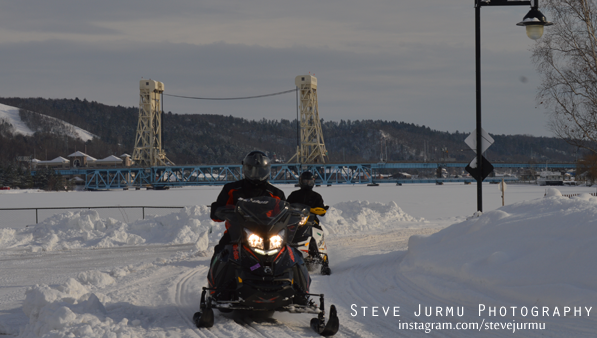 Photo: Houghton, MI - Photo by Steve Jurmu - Instagram: SteveJurmu |
|||||
|---|---|---|---|---|---|
|
Today's High Snowfall in the UP - Grand Marais (Green Haven Location) with 5.5 inches Most snow in the U.P.(season total) Painesdale with 217.7 inches | |||||
| KEY: T: trace - NR: No Report - ND: No Data | |||||
| Western/Northern Upper Peninsula Snowfall totals | Daily Amount | Season Total | On ground | Today in 2016 | YTD 2016/17 Season |
|
Houghton County FunintheUP.com station |
1 | 209.6 | 29 | 3.9 | 194.1 |
| Houghton County Snowfall Record: 354.1 inches - 1978/1979 | |||||
| 2nd most Snowfall 338.7 inches - 2013/14 | |||||
|
Marquette County (NWS Office)
measured by NOAA Marquette |
T | 98 | 19 | 2 | 84.8 |
|
Keweenaw County - Updates on weekdays only - view daily measured by Keweenaw County Rd Commission |
1 | 175.5 | 21 | 2 | 164 |
| Keweenaw County Snowfall Record: 390.4 inches - 1978/1979 | |||||
|
Downtown Houghton FunintheUP.com station |
0.2 | 124.5 | 23 | 1.4 | 136.4 |
|
Houghton County Airport - updates on weekdays only view daily measured by KRRC This number reported in Daily Mining Gazette |
NR | 136 | 16 | 2 | 133.5 |
|
Michigan Tech University xc ski trails (FunintheUP.com station) |
0.3 | 156.1 | 22 | 2.5 | 155.7 |
|
Dollar Bay (FunintheUP.com station) |
0.3 | 150.2 | 26 | 1.5 | 148.4 |
|
Agate Beach (FunintheUP.com station) |
0.3 | 95.3 | 21 | 1.5 | 91 |
|
Allouez twnship (near Mohawk) measured by John Dee |
1 | 191 | 29 | 0.5 | 176 |
|
Twin Lakes measured by Cindy Hoover |
2.9 | 182.8 | NA | 1.3 | 146.8 |
|
Calumet (North) (FunintheUP.com station) |
0.6 | 192.3 | 26 | 0.8 | 179.9 |
|
Tamarack Location (Calumet) (FunintheUP.com station) |
1.4 | 213.4 | 36 | NR | NR |
|
Painsedale |
0.9 | 217.7 | 35 | 5 | 181 |
|
Hancock (Quincy Hill) |
0.7 | 165.4 | 26 | ||
|
Kearsarge |
0 | 126 | 27 | ||
| RedRidge | 1 | 176 | 26 | ||
|
Copper Harbor No update since Jan 20th |
0.7 | 65.9 | 21 | ||
| Jacobsville | T | 79.5 | 17 | ||
|
Pelkie - not updated since Dec 7th |
NR | 16.5 | NR | ||
| Keweenaw Bay | 0 | 86.75 | 14 | ||
|
Baraga - not updated since Dec 5th | NR | 57.2 | 15 | ||
| Herman | T | 118 | 24 | ||
|
Alberta(FordCntr) No report since Jan 18th |
NR | 96.3 | NR | ||
| Greenland | 1.2 | 146.7 | 24 | ||
| Ontonagon | 0.7 | 96.8 | 14 | ||
| Ironwood | 0 | 112.6 | 20 | ||
| Bergland | 0.2 | 116.8 | 24 | ||
| Paulding | 0.1 | 82.8 | 17 | ||
| Watersmeet 1000 Isle | 0 | 56 | 19 | ||
| Stambaugh(IronRiver) | 0 | 36.7 | 8 | ||
| Amasa | T | 35.2 | 11 | ||
| Central Upper Peninsula Snowfall totals | Daily Amount | Season Total | On Ground | ||
| Three Lakes | 0.1 | 61.1 | 15 | ||
| Clarksburg | T | 56.2 | 12 | ||
| Ishpeming (Deer Lake) | 0 | 98.8 | 21 | ||
| Hoist Basin | 0 | 109.7 | 26 | ||
| Big Bay 1NW | 0 | 88.7 | 21 | ||
| Harvey south | 0 | 45.1 | 18 | ||
| Harvey CoRd480 | 0 | 66.4 | 15 | ||
| Green Garden | T | 56.7 | 5 | ||
| Marquette Lighthouse | 0 | 53 | 8 | ||
| Marquette downtown | 0 | 76.3 | NR | ||
| K.I. Sawyer | 0.1 | 40.6 | 14 | ||
| Munising | 2 | 130.3 | 24 | ||
| Chatham | 0.5 | 87.7 | 12 | ||
| Wetmore | 0 | 53.4 | 5 | ||
| Eastern Upper Peninsula Snowfall totals | Daily Amount | Season Total | On Ground | ||
| Grand Marais (Green Haven Loc) | 5.5 | 138.3 | 33 | ||
| Newberry City | 2.5 | 155.1 | 20 | ||
| Paradise | 0 | 96.8 | 17 | ||
| Tahquamenon Falls St Park | 0.5 | 98.1 | 20 | ||
| Sault Ste Marie | T | 72.2 | 14 | ||
| Sault Ste Marie Airport | T | 82.6 | 14 | ||
| Moran | T | 45 | 4 | ||
|
St. Ignace (Mackinac Bridge) measured by MDOT |
0 | 50 | 2 | ||
|
Engadine measured by MDOT |
0 | 11.9 | 6 | ||
| Cedarville | 0 | 42.7 | NR | ||
| Detour | 0 | 27.2 | 3 | ||
| Southern Upper Peninsula Snowfall totals | Daily Amount | Season Total | On Ground | ||
| Arnold | 0 | 30 | 5 | ||
|
Iron Mountain | 0 | 29.8 | 6 | ||
| Norway | T | 27.9 | 9 | ||
| Menominee | 0 | 26.9 | T | ||
|
Bark River not updated since Dec 14 | 0 | 5.8 | 0 | ||
| Rapid River | T | 44.6 | 10 | ||
|
Escanaba station has more than shown | 0 | 19.7 | 8 | ||
| Gladstone | 0 | 35.7 | 10 | ||
| Garden Corners | 0 | 48.2 | 10 | ||
| Cooks | T | 46.4 | 9 | ||
| Parent Bay | 0 | 22.7 | 9 | ||
| Manistique WWTP | T | 36.5 | 6 | ||
|
Jan 28th, 2018 - Upper Peninsula Snowfall totals
Daily snow amount is measured snowfall from Jan 28th 10am to Jan 29th 10am. This page may be updated multiple times through the day. Notes for today: Snowfall is about on the same level at this time as it was last year. There was a long warm up through the middle of January and again this year although this year it was spread out with a slight cool down between the warm up. Ice on Lake Superior and the Great Lakes hasn't been able to account to much more than 20% as a whole on the Great Lakes and more than 27% on Lake Superior, winds keep whipping up breaking up what any ice increases that seems to gain every few days. Temps look to dip starting Thursday into the single digits through the weekend and slightly rising into the low teens into next week. As we all know things can change quickly here in the Upper Peninsula. Snowmobiling is a little rough out to the east and far western areas of the UP, and virtually non-existent to the southern UP with the best snow although not excellent but fair to good conditions through Southern Houghton county into Keweenaw county. We need this cool down and about 12-18 inches to make conditions prime again. Great Lakes Ice Percentage today - 19.67% - Yesterday - 15.11% - High 35.44% on 1.16.18 Lake Superior Ice Percentage today - 11.06% - Yesterday -6.49% - High 23.77% on 1.16.18 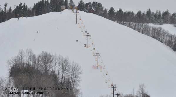 Photo: Mont Ripley Ski Hill - Photo by Steve Jurmu - Instagram: SteveJurmu |
|||||
|---|---|---|---|---|---|
|
Today's High Snowfall in the UP - Allouez Township with 4 inches Most snow in the U.P.(season total) Painesdale with 215.9 inches | |||||
| KEY: T: trace - NR: No Report - ND: No Data | |||||
| Western/Northern Upper Peninsula Snowfall totals | Daily Amount | Season Total | On ground | Today in 2016 | YTD 2016/17 Season |
|
Houghton County FunintheUP.com station |
0.8 | 208.6 | 30 | 3.4 | 190.2 |
| Houghton County Snowfall Record: 354.1 inches - 1978/1979 | |||||
| 2nd most Snowfall 338.7 inches - 2013/14 | |||||
|
Marquette County (NWS Office)
measured by NOAA Marquette |
1.7 | 98 | 18 | 5 | 82.8 |
|
Keweenaw County - Updates on weekdays only - view daily measured by Keweenaw County Rd Commission |
2 | 174.5 | 21 | 1.5 | 162 |
| Keweenaw County Snowfall Record: 390.4 inches - 1978/1979 | |||||
|
Downtown Houghton FunintheUP.com station |
0.2 | 124.3 | 24 | 2.3 | 135 |
|
Houghton County Airport - updates on weekdays only view daily measured by KRRC This number reported in Daily Mining Gazette |
1 | 136 | 16 | 3 | 131.5 |
|
Michigan Tech University xc ski trails (FunintheUP.com station) |
0.3 | 155.8 | 24 | 3 | 153.2 |
|
Dollar Bay (FunintheUP.com station) |
0.3 | 149.9 | 26 | 2.4 | 146.9 |
|
Agate Beach (FunintheUP.com station) |
T | 95 | 23 | 0.5 | 89.5 |
|
Allouez twnship (near Mohawk) measured by John Dee |
4 | 190 | 30 | 3 | 175.5 |
|
Twin Lakes measured by Cindy Hoover |
1.3 | 179.9 | NA | 2.5 | 145.5 |
|
Calumet (North) (FunintheUP.com station) |
1.1 | 191.7 | 28 | 1.5 | 179.1 |
|
Tamarack Location (Calumet) (FunintheUP.com station) |
1.5 | 212 | 38 | NR | NR |
|
Painsedale |
0.9 | 216.8 | 36 | 2.1 | 176 |
|
Hancock (Quincy Hill) |
0.8 | 164.7 | 26 | ||
|
Kearsarge |
0 | 126 | 27 | ||
| RedRidge | 0 | 175 | 27 | ||
|
Copper Harbor No update since Jan 20th |
NR | 65.2 | 22 | ||
| Jacobsville | 0.3 | 79.5 | 17 | ||
|
Pelkie - not updated since Dec 7th |
NR | 16.5 | NR | ||
| Keweenaw Bay | 0 | 86.75 | 14 | ||
|
Baraga - not updated since Dec 5th | NR | 57.2 | 15 | ||
| Herman | 1.5 | 118 | 24 | ||
|
Alberta(FordCntr) No report since Jan 18th |
NR | 96.3 | NR | ||
| Greenland | 0.1 | 145.5 | 25 | ||
| Ontonagon | 1 | 96.1 | 15 | ||
| Ironwood | 2 | 110.8 | 21 | ||
| Bergland | NR | 116.6 | 24 | ||
| Paulding | 0.2 | 82.7 | 17 | ||
| Watersmeet 1000 Isle | 1 | 56 | 19 | ||
| Stambaugh(IronRiver) | T | 36.7 | 8 | ||
| Amasa | T | 35.2 | 13 | ||
| Central Upper Peninsula Snowfall totals | Daily Amount | Season Total | On Ground | ||
| Three Lakes | 0.8 | 61 | 15 | ||
| Clarksburg | 1 | 56.2 | 12 | ||
| Ishpeming (Deer Lake) | 1.3 | 98.8 | 21 | ||
| Hoist Basin | 0.2 | 109.7 | 26 | ||
| Big Bay 1NW | 0 | 88.7 | 21 | ||
| Harvey south | 0 | 45.1 | 18 | ||
| Harvey CoRd480 | 0 | 66.4 | 15 | ||
| Green Garden | 0.6 | 56.7 | 5 | ||
| Marquette Lighthouse | T | 53 | 8 | ||
| Marquette downtown | 0.8 | 76.3 | NR | ||
| K.I. Sawyer | 0 | 40.5 | 12 | ||
| Munising | 0.5 | 128.3 | 23 | ||
| Chatham | 1 | 87.2 | 13 | ||
| Wetmore | 0 | 53.4 | 5 | ||
| Eastern Upper Peninsula Snowfall totals | Daily Amount | Season Total | On Ground | ||
| Grand Marais (Green Haven Loc) | 1 | 132.8 | 30 | ||
| Newberry City | 0.4 | 152.6 | 18 | ||
| Paradise | 0.7 | 96.8 | 17 | ||
|
Tahquamenon Falls St Park no update since Jan 1st |
NR | 65.1 | 16 | ||
| Sault Ste Marie | T | 72.2 | 14 | ||
| Sault Ste Marie Airport | T | 82.6 | 14 | ||
| Moran | T | 45 | 4 | ||
|
St. Ignace (Mackinac Bridge) measured by MDOT |
0 | 50 | 2 | ||
|
Engadine measured by MDOT |
T | 11.9 | 6 | ||
| Cedarville | 0 | 42.7 | NR | ||
| Detour | 0 | 27.2 | 3 | ||
| Southern Upper Peninsula Snowfall totals | Daily Amount | Season Total | On Ground | ||
| Arnold | 0 | 30 | 5 | ||
|
Iron Mountain | 0 | 29.8 | 6 | ||
| Norway | 0 | 27.9 | 9 | ||
| Menominee | 0 | 26.9 | T | ||
|
Bark River not updated since Dec 14 | 0 | 5.8 | 0 | ||
| Rapid River | T | 44.6 | 10 | ||
|
Escanaba station has more than shown | 0 | 19.7 | 8 | ||
| Gladstone | T | 34.5 | 10 | ||
| Garden Corners | T | 48.2 | 10 | ||
| Cooks | T | 46.4 | 9 | ||
| Parent Bay | 0 | 22.7 | 9 | ||
| Manistique WWTP | T | 36.5 | 6 | ||
|
Jan 27th, 2018 - Upper Peninsula Snowfall totals
Daily snow amount is measured snowfall from Jan 27th 10am to Jan 28th 10am. This page may be updated multiple times through the day. Notes for today: Temps dropped slighly into the mid 20s to mid teens and the winds picked up to 25mph and we saw some gusts up to 35mph. Winds swept in from the West, NW, and North bring more lake effect snowfall with it. Snowmobile season is still strong right now, the trails are still kind of sugary and loose from the warm weather we had a couple days there. Hopefully things will start settling down a bit as the temps stay cold for a little while, but we do need more fresh snowfall to help with this. The best trail conditions are in the areas east of Munising, the Keweenaw, and Copper Country to Greenland. These areas have 18-40" of snowfall on the ground. Great Lakes Ice Percentage today - 19.88% - Yesterday - 26.95% - High 35.44% on 1.16.18 Lake Superior Ice Percentage today - 9.1% - Yesterday - 22.14% - High 23.77% on 1.16.18 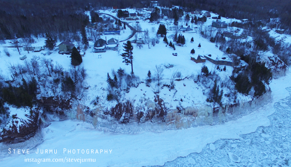 Photo: Freda, MI - Photo by Steve Jurmu - Instagram: SteveJurmu |
|||||
|---|---|---|---|---|---|
|
Today's High Snowfall in the UP - Agate Beach with 5 inches Most snow in the U.P.(season total) Painesdale with 215.9 inches | |||||
| KEY: T: trace - NR: No Report - ND: No Data | |||||
| Western/Northern Upper Peninsula Snowfall totals | Daily Amount | Season Total | On ground | Today in 2016 | YTD 2016/17 Season |
|
Houghton County FunintheUP.com station |
4.5 | 207.8 | 30 | 1.6 | 186.8 |
| Houghton County Snowfall Record: 354.1 inches - 1978/1979 | |||||
| 2nd most Snowfall 338.7 inches - 2013/14 | |||||
|
Marquette County (NWS Office)
measured by NOAA Marquette |
0.1 | 96.3 | 18 | 2.1 | 77.8 |
|
Keweenaw County - Updates on weekdays only - view daily measured by Keweenaw County Rd Commission |
1 | 172.5 | 20 | 3 | 160.5 |
| Keweenaw County Snowfall Record: 390.4 inches - 1978/1979 | |||||
|
Downtown Houghton FunintheUP.com station |
3 | 124.1 | 24 | 1.2 | 132.7 |
|
Houghton County Airport - updates on weekdays only view daily measured by KRRC This number reported in Daily Mining Gazette |
NR | 133 | 15 | 4 | 128.5 |
|
Michigan Tech University xc ski trails (FunintheUP.com station) |
3 | 155.5 | 25 | 1.3 | 150.2 |
|
Dollar Bay (FunintheUP.com station) |
3.2 | 149.6 | 27 | 1.4 | 144.5 |
|
Agate Beach (FunintheUP.com station) |
5 | 95 | 23 | 0.3 | 89 |
|
Allouez twnship (near Mohawk) measured by John Dee |
2.5 | 186 | 28 | 1 | 172.5 |
|
Twin Lakes measured by Cindy Hoover |
3.4 | 178.6 | NA | 0.9 | 143 |
|
Calumet (North) (FunintheUP.com station) |
2.7 | 190.6 | 27 | 1 | 177.6 |
|
Tamarack Location (Calumet) (FunintheUP.com station) |
4 | 210.5 | 38 | NR | NR |
|
Painsedale |
4.6 | 215.9 | 36 | 0.2 | 173.9 |
|
Hancock (Quincy Hill) |
2.5 | 163.9 | 26 | ||
|
Kearsarge |
2 | 126 | 26 | ||
| RedRidge | NR | 175 | 27 | ||
| Copper Harbor | NR | 65.2 | 22 | ||
| Jacobsville | 1.8 | 79.2 | 17 | ||
|
Pelkie - not updated since Dec 7th |
NR | 16.5 | NR | ||
| Keweenaw Bay | 1 | 86.75 | 14 | ||
|
Baraga - not updated since Dec 5th | NR | 57.2 | 15 | ||
| Herman | 3 | 116.5 | 24 | ||
|
Alberta(FordCntr) No report since Jan 18th |
NR | 96.3 | NR | ||
| Greenland | 4 | 145.4 | 26 | ||
| Ontonagon | 1.7 | 95.1 | 15 | ||
| Ironwood | 0 | 108.8 | 18 | ||
| Bergland | NR | 116.6 | 24 | ||
| Paulding | 1.4 | 82.5 | 17 | ||
| Watersmeet 1000 Isle | 0.7 | 55 | 18 | ||
| Stambaugh(IronRiver) | 0.5 | 36.7 | 9 | ||
| Amasa | NR | 35.2 | 13 | ||
| Central Upper Peninsula Snowfall totals | Daily Amount | Season Total | On Ground | ||
| Three Lakes | 0.7 | 60.2 | 15 | ||
| Clarksburg | 0.5 | 55.2 | 12 | ||
| Ishpeming (Deer Lake) | 1 | 97.5 | 21 | ||
| Hoist Basin | 0 | 109.5 | 26 | ||
| Big Bay 1NW | 1.7 | 88.7 | 21 | ||
| Harvey south | NR | 45.1 | 22 | ||
| Harvey CoRd480 | 0.9 | 66.4 | 15 | ||
| Green Garden | 1 | 56.1 | 5 | ||
| Marquette Lighthouse | 0.3 | 53 | 9 | ||
| Marquette downtown | 0.8 | 75.5 | NR | ||
| K.I. Sawyer | 0 | 40.5 | 12 | ||
| Munising | 1 | 127.8 | 23 | ||
| Chatham | 1.2 | 86.2 | 13 | ||
| Wetmore | 1.4 | 53.4 | 5 | ||
| Eastern Upper Peninsula Snowfall totals | Daily Amount | Season Total | On Ground | ||
| Grand Marais (Green Haven Loc) | 2 | 131.8 | 29 | ||
| Newberry City | 1 | 152.2 | 19 | ||
| Paradise | 1.2 | 96.1 | 17 | ||
|
Tahquamenon Falls St Park no update since Jan 1st |
NR | 65.1 | 16 | ||
| Sault Ste Marie | 0.2 | 72.2 | 14 | ||
| Sault Ste Marie Airport | 0.2 | 82.6 | 14 | ||
| Moran | 0 | 45 | 3 | ||
|
St. Ignace (Mackinac Bridge) measured by MDOT |
T | 50 | 2 | ||
|
Engadine measured by MDOT |
NR | 11.9 | 9 | ||
| Cedarville | 0.1 | 42.7 | NR | ||
| Detour | 0 | 27.2 | 3 | ||
| Southern Upper Peninsula Snowfall totals | Daily Amount | Season Total | On Ground | ||
| Arnold | 0 | 30 | 5 | ||
|
Iron Mountain | T | 29.8 | 6 | ||
| Norway | T | 27.9 | 9 | ||
| Menominee | 0 | 26.9 | T | ||
|
Bark River not updated since Dec 14 | 0 | 5.8 | 0 | ||
| Rapid River | T | 44.6 | 10 | ||
|
Escanaba station has more than shown | 0 | 19.7 | 8 | ||
| Gladstone | 0.3 | 34.5 | 10 | ||
| Garden Corners | 0 | 48.2 | 10 | ||
| Cooks | T | 46.4 | 9 | ||
| Parent Bay | T | 22.7 | 6 | ||
| Manistique WWTP | T | 36.5 | 9 | ||
|
Jan 26th, 2018 - Upper Peninsula Snowfall totals
Daily snow amount is measured snowfall from Jan 25th 10am to Jan 26th 10am. This page may be updated multiple times through the day. Notes for today: Very little snowfall to report for yesterday. The highest snowfall amount was 1 inch. Overall it was a real pleasant day yesterday, very nice out with a little sunshine which is always a nice thing. It appears that today will be a nice day. It looks like we won't be seeing much of any snowfall again today with the warmer temps and lack of cooler air moving across the area. The temps are beginning to rise this morning and look to be slightly above average again tomorrow. Get outside and enjoy things, go xc skiing, snowmobiling, snowshoeing, or take a walk along the shorelines of Lake Superior. Great Lakes Ice Percentage today - 26.95% - Yesterday - 27.85% - High 35.44% on 1.16.18 Lake Superior Ice Percentage today - 22.14% - Yesterday - 17.60% - High 23.77% on 1.16.18 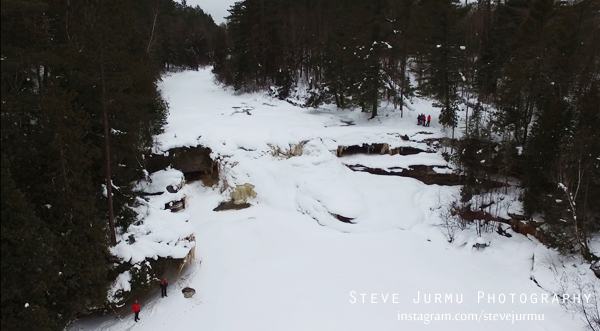 Photo: O-Kun-de-Kun Falls - Photo by Steve Jurmu - Instagram: SteveJurmu |
|||||
|---|---|---|---|---|---|
|
Today's High Snowfall in the UP - Newberry with 1 inch Most snow in the U.P.(season total) Painesdale with 211.3 inches | |||||
| KEY: T: trace - NR: No Report - ND: No Data | |||||
| Western/Northern Upper Peninsula Snowfall totals | Daily Amount | Season Total | On ground | Today in 2016 | YTD 2016/17 Season |
|
Houghton County FunintheUP.com station |
0 | 203.1 | 31 | 2.9 | 185.2 |
| Houghton County Snowfall Record: 354.1 inches - 1978/1979 | |||||
| 2nd most Snowfall 338.7 inches - 2013/14 | |||||
|
Marquette County (NWS Office)
measured by NOAA Marquette |
T | 96.2 | 20 | 2.9 | 75.7 |
|
Keweenaw County - Updates on weekdays only - view daily measured by Keweenaw County Rd Commission |
0 | 171.5 | 20 | 1 | 157.5 |
| Keweenaw County Snowfall Record: 390.4 inches - 1978/1979 | |||||
|
Downtown Houghton FunintheUP.com station |
0 | 121.1 | 25 | 2.3 | 131.5 |
|
Houghton County Airport - updates on weekdays only view daily measured by KRRC This number reported in Daily Mining Gazette |
0 | 133 | 15 | 2 | 124.5 |
|
Michigan Tech University xc ski trails (FunintheUP.com station) |
0.4 | 152.5 | 25 | 2.7 | 148.9 |
|
Dollar Bay (FunintheUP.com station) |
0 | 146.4 | 28 | 3 | 143.1 |
|
Agate Beach (FunintheUP.com station) |
0 | 90 | 22 | 0.2 | 88.7 |
|
Allouez twnship (near Mohawk) measured by John Dee |
0 | 183.5 | 27 | 1.5 | 171.5 |
|
Twin Lakes measured by Cindy Hoover |
0 | 175.2 | NA | 1.2 | 142.1 |
|
Calumet (North) (FunintheUP.com station) |
0 | 187.8 | 27 | 1 | 176.6 |
|
Tamarack Location (Calumet) (FunintheUP.com station) |
0 | 206.2 | 37 | NR | NR |
|
Painsedale |
0 | 211.2 | 33 | 1.9 | 173.7 |
|
Hancock (Quincy Hill) |
0 | 161.4 | 25 | ||
|
Kearsarge |
0 | 124 | 25 | ||
| RedRidge | T | 175 | 27 | ||
| Copper Harbor | NR | 65.2 | 22 | ||
| Jacobsville | 0.2 | 77.4 | 18 | ||
| Pelkie - not updated since Dec 7th | NR | 16.5 | NR | ||
| Keweenaw Bay | 0 | 85.75 | 16 | ||
| Baraga | NR | 57.2 | 15 | ||
| Herman | 0 | 113.5 | 22 | ||
|
Alberta(FordCntr) No report since Jan 18th |
NR | 96.3 | NR | ||
| Greenland | 0 | 141.4 | 26 | ||
| Ontonagon | NR | 93.4 | 15 | ||
| Ironwood | 0 | 108.8 | 18 | ||
| Bergland | NR | 116.6 | 24 | ||
| Paulding | 0 | 81.1 | 20 | ||
| Watersmeet 1000 Isle | 0 | 54.3 | 21 | ||
| Stambaugh(IronRiver) | 0 | 36.2 | 11 | ||
| Amasa | T | 35.2 | 13 | ||
| Central Upper Peninsula Snowfall totals | Daily Amount | Season Total | On Ground | ||
| Three Lakes | 0 | 59.5 | 16 | ||
| Clarksburg | 0 | 54.7 | 14 | ||
| Ishpeming (Deer Lake) | T | 96.5 | 21.5 | ||
| Hoist Basin | 0 | 109.3 | 30 | ||
| Big Bay 1NW | NR | 87 | 25 | ||
| Harvey south | 0 | 45.1 | 22 | ||
| Harvey CoRd480 | 0 | 65.5 | 18 | ||
| Green Garden | 0 | 55.1 | 7 | ||
| Marquette Lighthouse | 0.5 | 52.7 | 9 | ||
| Marquette downtown | 0 | 74.7 | NR | ||
| K.I. Sawyer | 0 | 40.5 | 15 | ||
| Munising | 0 | 126.8 | 25 | ||
| Chatham | 0 | 85 | 16 | ||
| Wetmore | 0 | 52 | NR | ||
| Eastern Upper Peninsula Snowfall totals | Daily Amount | Season Total | On Ground | ||
| Grand Marais (Green Haven Loc) | 0 | 129.8 | 31 | ||
| Newberry City | 1 | 151.2 | 21 | ||
| Paradise | 0 | 94.9 | 21 | ||
|
Tahquamenon Falls St Park no update since Jan 1st |
NR | 65.1 | 16 | ||
| Sault Ste Marie | 0 | 72 | 16 | ||
| Sault Ste Marie Airport | T | 82.4 | 14 | ||
| Moran | 0 | 45 | 7 | ||
|
St. Ignace (Mackinac Bridge) measured by MDOT |
T | 50 | 2 | ||
|
Engadine measured by MDOT |
0 | 11.9 | 9 | ||
| Cedarville | 0 | 42.6 | NR | ||
| Detour | 0 | 27.2 | 5 | ||
| Southern Upper Peninsula Snowfall totals | Daily Amount | Season Total | On Ground | ||
| Arnold | 0 | 30 | 12 | ||
|
Iron Mountain | 0 | 29.8 | 10 | ||
| Norway | 0 | 27.9 | 9 | ||
| Menominee | 0 | 26.9 | 1 | ||
|
Bark River not updated since Dec 14 | 0 | 5.8 | 0 | ||
| Rapid River | 0 | 44.6 | 12 | ||
|
Escanaba station has more than shown | 0 | 19.7 | 8 | ||
| Gladstone | 0 | 34.2 | 13 | ||
| Garden Corners | 0 | 48.2 | 13 | ||
| Cooks | 0 | 46.4 | 12 | ||
| Parent Bay | 0 | 22.7 | 6 | ||
| Manistique WWTP | T | 36.5 | 9 | ||
|
Jan 25th, 2018 - Upper Peninsula Snowfall totals
Daily snow amount is measured snowfall from Jan 25th 10am to Jan 26th 10am. This page may be updated multiple times through the day. Notes for today: Very little snowfall to report for yesterday. The highest snowfall amount was less than a half inch. Overall it was a real pleasant day yesterday, very nice out with a little sunshine which is always a nice thing. It appears that today will be a nice day. It looks like we won't be seeing much of any snowfall again today with the warmer temps and lack of cooler air moving across the area. The temps are beginning to rise this morning and look to be slightly above average again tomorrow. Get outside and enjoy things, go xc skiing, snowmobiling, snowshoeing, or take a walk along the shorelines of Lake Superior. Great Lakes Ice Percentage today - 27.85% - Yesterday - 24.59% - High 35.44% on 1.16.18 Lake Superior Ice Percentage today - 17.60% - Yesterday - 12.97% - High 23.77% on 1.16.18 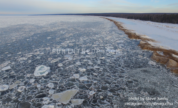
|
|||||
|---|---|---|---|---|---|
|
Today's High Snowfall in the UP - NWS Office/Ishpeming (DeerLake)/St. Ignace with a trace of snowfall. Most snow in the U.P.(season total) Painesdale with 211.2 inches | |||||
| KEY: T: trace - NR: No Report - ND: No Data | |||||
| Western/Northern Upper Peninsula Snowfall totals | Daily Amount | Season Total | On ground | Today in 2016 | YTD 2016/17 Season |
|
Houghton County FunintheUP.com station |
0 | 203.1 | 31 | T | 182.3 |
| Houghton County Snowfall Record: 354.1 inches - 1978/1979 | |||||
| 2nd most Snowfall 338.7 inches - 2013/14 | |||||
|
Marquette County (NWS Office)
measured by NOAA Marquette |
T | 96.2 | 20 | 0.2 | 72.8 |
|
Keweenaw County - Updates on weekdays only - view daily measured by Keweenaw County Rd Commission |
0 | 171.5 | 20 | 0 | 156.5 |
| Keweenaw County Snowfall Record: 390.4 inches - 1978/1979 | |||||
|
Downtown Houghton FunintheUP.com station |
0 | 121.1 | 25 | T | 129.2 |
|
Houghton County Airport - updates on weekdays only view daily measured by KRRC This number reported in Daily Mining Gazette |
0 | 132 | 15 | T | 122.5 |
|
Michigan Tech University xc ski trails (FunintheUP.com station) |
0.4 | 152.5 | 25 | T | 146.2 |
|
Dollar Bay (FunintheUP.com station) |
0 | 146.4 | 28 | 0 | 140.1 |
|
Agate Beach (FunintheUP.com station) |
0 | 90 | 22 | 0 | 88.5 |
|
Allouez twnship (near Mohawk) measured by John Dee |
0 | 183.5 | 27 | T | 170 |
|
Twin Lakes measured by Cindy Hoover |
0 | 175.2 | NA | 0.2 | 140.9 |
|
Calumet (North) (FunintheUP.com station) |
0 | 187.8 | 27 | T | 175.6 |
|
Tamarack Location (Calumet) (FunintheUP.com station) |
0 | 206.2 | 37 | NR | NR |
|
Painsedale |
0 | 211.2 | 33 | 0 | 171.8 |
|
Hancock (Quincy Hill) |
0 | 161.4 | 25 | ||
|
Kearsarge |
0 | 124 | 25 | ||
| RedRidge | T | 175 | 27 | ||
| Copper Harbor | NR | 65.2 | 22 | ||
| Jacobsville | 0.2 | 77.4 | 18 | ||
| Pelkie - not updated since Dec 7th | NR | 16.5 | NR | ||
| Keweenaw Bay | 0 | 85.75 | 16 | ||
| Baraga | NR | 57.2 | 15 | ||
| Herman | 0 | 113.5 | 22 | ||
|
Alberta(FordCntr) No report since Jan 18th |
NR | 96.3 | NR | ||
| Greenland | 0 | 141.4 | 26 | ||
| Ontonagon | NR | 93.4 | 15 | ||
| Ironwood | 0 | 108.8 | 18 | ||
| Bergland | NR | 116.6 | 24 | ||
| Paulding | 0 | 81.1 | 20 | ||
| Watersmeet 1000 Isle | 0 | 54.3 | 21 | ||
| Stambaugh(IronRiver) | 0 | 36.2 | 11 | ||
| Amasa | T | 35.2 | 13 | ||
| Central Upper Peninsula Snowfall totals | Daily Amount | Season Total | On Ground | ||
| Three Lakes | 0 | 59.5 | 16 | ||
| Clarksburg | 0 | 54.7 | 14 | ||
| Ishpeming (Deer Lake) | T | 96.5 | 21.5 | ||
| Hoist Basin | 0 | 109.3 | 30 | ||
| Big Bay 1NW | NR | 87 | 25 | ||
| Harvey south | 0 | 45.1 | 22 | ||
| Harvey CoRd480 | 0 | 65.5 | 18 | ||
| Green Garden | 0 | 55.1 | 7 | ||
| Marquette Lighthouse | 0 | 51.2 | 13 | ||
| Marquette downtown | 0 | 74.7 | NR | ||
| K.I. Sawyer | 0 | 40.5 | 15 | ||
| Munising | 0 | 126.8 | 25 | ||
| Chatham | 0 | 85 | 16 | ||
| Wetmore | 0 | 52 | NR | ||
| Eastern Upper Peninsula Snowfall totals | Daily Amount | Season Total | On Ground | ||
| Grand Marais (Green Haven Loc) | 0 | 129.8 | 31 | ||
| Newberry City | 0 | 150.2 | 21 | ||
| Paradise | 0 | 94.9 | 21 | ||
|
Tahquamenon Falls St Park no update since Jan 1st |
NR | 65.1 | 16 | ||
| Sault Ste Marie | 0 | 72 | 16 | ||
| Sault Ste Marie Airport | 0.2 | 82 | 16 | ||
| Moran | 0 | 45 | 7 | ||
|
St. Ignace (Mackinac Bridge) measured by MDOT |
T | 50 | 2 | ||
|
Engadine measured by MDOT |
0 | 11.9 | 9 | ||
| Cedarville | 0 | 42.6 | NR | ||
| Detour | 0.5 | 27.2 | 5 | ||
| Southern Upper Peninsula Snowfall totals | Daily Amount | Season Total | On Ground | ||
| Arnold | 0 | 30 | 12 | ||
|
Iron Mountain | 0 | 29.8 | 10 | ||
| Norway | 0 | 27.9 | 9 | ||
| Menominee | 0 | 26.9 | 1 | ||
|
Bark River not updated since Dec 14 | 0 | 5.8 | 0 | ||
| Rapid River | 0 | 44.6 | 12 | ||
|
Escanaba station has more than shown | 0 | 19.7 | 8 | ||
| Gladstone | 0 | 34.2 | 13 | ||
| Garden Corners | 0 | 48.2 | 13 | ||
| Cooks | 0 | 46.4 | 12 | ||
| Parent Bay | 0 | 22.7 | 6 | ||
| Manistique WWTP | 0 | 36.5 | 11 | ||
|
Jan 24th, 2018 - Upper Peninsula Snowfall totals
Daily snow amount is measured snowfall from Jan 24th 10am to Jan 25th 10am. This page may be updated multiple times through the day. Notes for today:Not much going on today, relatively mild through the day with sunshine which is always nice, did start getting a bit crisp into the evening with the wind picking up. Not much snow today to report, most places had no measurable snowfall today. A trace to 1 inch in places around the Copper Country and Keweenaw, and a trace up to 1" in the far eastern UP. Things look to get a bit warmer Friday and Saturday, then looks to cool down back into the mid teens through the week with more snowfall on its way. Great Lakes Ice Percentage today - 24.59% - Yesterday - 20.71% - High 35.44% on 1.16.18 Lake Superior Ice Percentage today - 12.97% - Yesterday - 8.65% - High 23.77% on 1.16.18 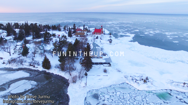
|
|||||
|---|---|---|---|---|---|
|
Today's High Snowfall in the UP - Allouez/Calumet(Tamarack Loc.)/Cedarville with 1 inch Most snow in the U.P.(season total) Painesdale with 211.2 inches | |||||
| KEY: T: trace - NR: No Report - ND: No Data | |||||
| Western/Northern Upper Peninsula Snowfall totals | Daily Amount | Season Total | On ground | Today in 2016 | YTD 2016/17 Season |
|
Houghton County FunintheUP.com station |
0.3 | 203.1 | 31 | 0 | 182 |
| Houghton County Snowfall Record: 354.1 inches - 1978/1979 | |||||
| 2nd most Snowfall 338.7 inches - 2013/14 | |||||
|
Marquette County (NWS Office)
measured by NOAA Marquette |
0.1 | 96.2 | 20 | 0 | 72.6 |
|
Keweenaw County - Updates on weekdays only - view daily measured by Keweenaw County Rd Commission |
0 | 171.5 | 20 | 0 | 156 |
| Keweenaw County Snowfall Record: 390.4 inches - 1978/1979 | |||||
|
Downtown Houghton FunintheUP.com station |
0.1 | 121.1 | 25 | 0 | 129.2 |
|
Houghton County Airport - updates on weekdays only view daily measured by KRRC This number reported in Daily Mining Gazette |
0 | 132 | 15 | 0 | 122.5 |
|
Michigan Tech University xc ski trails (FunintheUP.com station) |
0.4 | 152.5 | 25 | 0 | 145.9 |
|
Dollar Bay (FunintheUP.com station) |
0.4 | 146.4 | 28 | 0 | 140.1 |
|
Agate Beach (FunintheUP.com station) |
0 | 90 | 22 | 0 | 88.2 |
|
Allouez twnship (near Mohawk) measured by John Dee |
1 | 183.5 | 27 | 0 | 170 |
|
Twin Lakes measured by Cindy Hoover |
0 | 175.2 | NA | 0 | 140.7 |
|
Calumet (North) (FunintheUP.com station) |
0.7 | 187.8 | 27 | 0 | 175.3 |
|
Tamarack Location (Calumet) (FunintheUP.com station) |
1 | 206.2 | 37 | NR | NR |
|
Painsedale |
0.1 | 211.2 | 33 | 0 | 171.5 |
|
Hancock (Quincy Hill) |
0.5 | 161.4 | 25 | ||
|
Kearsarge |
T | 124 | 25 | ||
| RedRidge | T | 175 | 27 | ||
| Copper Harbor | NR | 65.2 | 22 | ||
| Jacobsville | 0.2 | 77.4 | 18 | ||
| Pelkie - not updated since Dec 7th | NR | 16.5 | NR | ||
| Keweenaw Bay | 0 | 85.75 | 16 | ||
| Baraga | NR | 57.2 | 15 | ||
| Herman | 0 | 113.5 | 24 | ||
|
Alberta(FordCntr) No report since Jan 18th |
NR | 96.3 | NR | ||
| Greenland | 0 | 141.4 | 26 | ||
| Ontonagon | NR | 93.4 | 15 | ||
| Ironwood | 0 | 108.8 | 21 | ||
| Bergland | NR | 116.6 | 24 | ||
| Paulding | 0 | 81.1 | 21 | ||
| Watersmeet 1000 Isle | 0 | 54.3 | 21 | ||
| Stambaugh(IronRiver) | 0 | 36.2 | 11 | ||
| Amasa | 0 | 35.2 | 16 | ||
| Central Upper Peninsula Snowfall totals | Daily Amount | Season Total | On Ground | ||
| Three Lakes | 0 | 59.5 | 16 | ||
| Clarksburg | 0 | 54.7 | 16 | ||
| Ishpeming (Deer Lake) | T | 96.5 | 21.5 | ||
| Hoist Basin | 0 | 109.3 | 30 | ||
| Big Bay 1NW | NR | 87 | 25 | ||
| Harvey south | 0 | 45.1 | 22 | ||
| Harvey CoRd480 | 0 | 65.5 | 18 | ||
| Green Garden | 0 | 55.1 | 7 | ||
| Marquette Lighthouse | 0 | 51.2 | 13 | ||
| Marquette downtown | 0 | 74.7 | NR | ||
| K.I. Sawyer | 0 | 40.5 | 15 | ||
| Munising | 0 | 126.8 | 25 | ||
| Chatham | 0 | 85 | 16 | ||
| Wetmore | 0 | 52 | NR | ||
| Eastern Upper Peninsula Snowfall totals | Daily Amount | Season Total | On Ground | ||
| Grand Marais (Green Haven Loc) | 0 | 129.8 | 31 | ||
| Newberry City | 0 | 150.2 | 21 | ||
| Paradise | 0 | 94.9 | 21 | ||
|
Tahquamenon Falls St Park no update since Jan 1st |
NR | 65.1 | 16 | ||
| Sault Ste Marie | 0.3 | 72 | 16 | ||
| Sault Ste Marie Airport | 0.4 | 81.8 | 16 | ||
| Moran | T | 45 | 7 | ||
|
St. Ignace (Mackinac Bridge) measured by MDOT |
0 | 50 | 2 | ||
|
Engadine measured by MDOT |
T | 11.9 | 9 | ||
| Cedarville | 1 | 42.6 | NR | ||
| Detour | 0.2 | 26.7 | 5 | ||
| Southern Upper Peninsula Snowfall totals | Daily Amount | Season Total | On Ground | ||
| Arnold | 0 | 30 | 12 | ||
|
Iron Mountain | 0 | 29.8 | 10 | ||
| Norway | 0 | 27.9 | 9 | ||
| Menominee | 0 | 26.9 | 1 | ||
|
Bark River not updated since Dec 14 | 0 | 5.8 | 0 | ||
| Rapid River | T | 44.6 | 12 | ||
|
Escanaba station has more than shown | 0 | 19.7 | 8 | ||
| Gladstone | 0 | 34.2 | 13 | ||
| Garden Corners | 0 | 48.2 | 13 | ||
| Cooks | 0 | 46.4 | 12 | ||
| Parent Bay | 0 | 22.7 | 6 | ||
| Manistique WWTP | 0 | 36.5 | 9 | ||
|
Jan 23rd, 2018 - Upper Peninsula Snowfall totals
Daily snow amount is measured snowfall from Jan 22th 10am to Jan 23rd 10am. This page may be updated multiple times through the day. Notes for today: Not much snowfall today. The higher numbers today were in the Huron Mountains and north of US41 in the central UP. Forecast appears to be warming again Friday and Saturday above freezing into the lower 40s, then starting Sunday temps look to dive slightly again brining more snowfall. Escanaba snowfall is greater than what is listed below. The snow observer at this location has been very inconsistent, we will no longer be using the data from this observer for Escanaba snowfall. We were contacted by an individual in Escanaba who has been taking measurements for the last few years there. This next season we will set up the observer with a snow station and train them so we will have a full running seasonal snowfall from them. The next couple days we will import the data from this season into the page from the observations taken thus far. Great Lakes Ice Percentage today - 20.71% - Yesterday - 20.67% - High 35.44% on 1.16.18 Lake Superior Ice Percentage today - 8.65% - Yesterday - 9% - High 23.77% on 1.16.18 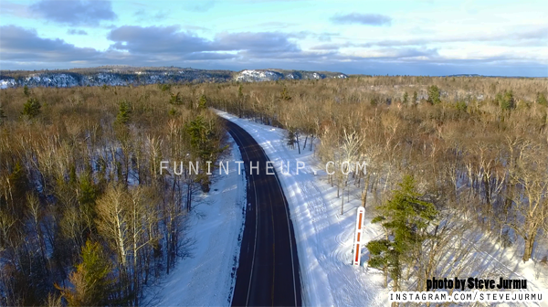
|
|||||
|---|---|---|---|---|---|
|
Today's High Snowfall in the UP - Clarksburg with 2.5 inches Most snow in the U.P.(season total) Painesdale with 211.1 inches | |||||
| KEY: T: trace - NR: No Report - ND: No Data | |||||
| Western/Northern Upper Peninsula Snowfall totals | Daily Amount | Season Total | On ground | Today in 2016 | YTD 2016/17 Season |
|
Houghton County FunintheUP.com station |
0.3 | 202.8 | 31 | 0 | 182 |
| Houghton County Snowfall Record: 354.1 inches - 1978/1979 | |||||
| 2nd most Snowfall 338.7 inches - 2013/14 | |||||
|
Marquette County (NWS Office)
measured by NOAA Marquette |
1.7 | 96.1 | 21 | 0 | 72.6 |
|
Keweenaw County - Updates on weekdays only - view daily measured by Keweenaw County Rd Commission |
0.5 | 171.5 | 20 | 0 | 156 |
| Keweenaw County Snowfall Record: 390.4 inches - 1978/1979 | |||||
|
Downtown Houghton FunintheUP.com station |
T | 121 | 25 | 0 | 129.2 |
|
Houghton County Airport - updates on weekdays only view daily measured by KRRC This number reported in Daily Mining Gazette |
0 | 132 | 15 | 0 | 122.5 |
|
Michigan Tech University xc ski trails (FunintheUP.com station) |
.2 | 152.1 | 25 | 0 | 145.9 |
|
Dollar Bay (FunintheUP.com station) |
0.2 | 146 | 27 | 0 | 140.1 |
|
Agate Beach (FunintheUP.com station) |
0 | 90 | 22 | 0 | 88.2 |
|
Allouez twnship (near Mohawk) measured by John Dee |
0.5 | 182.5 | 26 | 0 | 170 |
|
Twin Lakes measured by Cindy Hoover |
0.2 | 175.2 | NA | 0 | 140.7 |
|
Calumet (North) (FunintheUP.com station) |
0.4 | 186.9 | 28 | 0 | 175.3 |
|
Tamarack Location (Calumet) (FunintheUP.com station) |
0.6 | 205.2 | 37 | NR | NR |
|
Painsedale |
0.2 | 211.1 | 34 | 0 | 171.5 |
|
Hancock (Quincy Hill) |
0.7 | 160.9 | 25 | ||
|
Kearsarge |
T | 124 | 25 | ||
| RedRidge | T | 175 | 27 | ||
| Copper Harbor | NR | 65.2 | 22 | ||
| Jacobsville | 0.2 | 77.2 | 18 | ||
| Pelkie - not updated since Dec 7th | NR | 16.5 | NR | ||
| Keweenaw Bay | 0.5 | 85.75 | 16 | ||
| Baraga | NR | 57.2 | 15 | ||
| Herman | 2 | 113.5 | 25 | ||
|
Alberta(FordCntr) No report since Jan 18th |
NR | 96.3 | NR | ||
| Greenland | T | 141.4 | 26 | ||
| Ontonagon | NR | 93.4 | 15 | ||
| Ironwood | 0.5 | 108.8 | 21 | ||
| Bergland | NR | 116.6 | 24 | ||
| Paulding | 0.7 | 81.1 | 21 | ||
| Watersmeet 1000 Isle | T | 54.3 | 21 | ||
| Stambaugh(IronRiver) | T | 36.2 | 11 | ||
| Amasa | T | 35.2 | 16 | ||
| Central Upper Peninsula Snowfall totals | Daily Amount | Season Total | On Ground | ||
| Three Lakes | 0.8 | 59.5 | 16 | ||
| Clarksburg | 2.5 | 54.7 | 16 | ||
| Ishpeming (Deer Lake) | 1.5 | 96.5 | 23 | ||
| Hoist Basin | 0.5 | 109.3 | 30 | ||
| Big Bay 1NW | NR | 87 | 25 | ||
| Harvey south | 0.6 | 45.1 | 22 | ||
| Harvey CoRd480 | 1.2 | 65.5 | 18 | ||
| Green Garden | 0.3 | 55.1 | 7 | ||
| Marquette Lighthouse | 0 | 51.2 | 13 | ||
| Marquette downtown | 0.1 | 74.7 | NR | ||
| K.I. Sawyer | 0.1 | 40.5 | 15 | ||
| Munising | 0.5 | 126.8 | 25 | ||
| Chatham | T | 85 | 16 | ||
| Wetmore | 0 | 52 | NR | ||
| Eastern Upper Peninsula Snowfall totals | Daily Amount | Season Total | On Ground | ||
| Grand Marais (Green Haven Loc) | 0 | 129.8 | 31 | ||
| Newberry City | 0 | 150.2 | 21 | ||
| Paradise | 0.3 | 94.9 | 21 | ||
|
Tahquamenon Falls St Park no update since Jan 1st |
NR | 65.1 | 16 | ||
| Sault Ste Marie | 0.2 | 71.7 | 16 | ||
| Sault Ste Marie Airport | 0.3 | 81.8 | 16 | ||
| Moran | 0.5 | 45 | 7 | ||
|
St. Ignace (Mackinac Bridge) measured by MDOT |
T | 50 | 2 | ||
|
Engadine measured by MDOT |
T | 11.9 | 9 | ||
| Cedarville | 0 | 41.6 | NR | ||
| Detour | 0 | 26.5 | 5 | ||
| Southern Upper Peninsula Snowfall totals | Daily Amount | Season Total | On Ground | ||
| Arnold | 0 | 30 | 12 | ||
|
Iron Mountain | 0 | 29.8 | 10 | ||
| Norway | T | 27.9 | 9 | ||
| Menominee | T | 26.9 | 1 | ||
|
Bark River not updated since Dec 14 | 0 | 5.8 | 0 | ||
| Rapid River | 0.3 | 44.6 | 12 | ||
|
Escanaba station has more than shown | 0 | 19.7 | 8 | ||
| Gladstone | T | 34.2 | 13 | ||
| Garden Corners | 0 | 48.2 | 13 | ||
| Cooks | 0 | 46.4 | 12 | ||
| Parent Bay | 0 | 22.7 | 6 | ||
| Manistique WWTP | 0 | 36.5 | 10 | ||
|
Jan 22nd, 2018 - Upper Peninsula Snowfall totals
Daily snow amount is measured snowfall from Jan 22th 10am to Jan 23rd 10am. This page may be updated multiple times through the day. Notes for today: This snowfall impacted a slim section of the U.P. from Watersmeet up through Big Bay, to the east and west impact was less. Overall most areas saw some freezing rain, and a dense wet snowfall that made conditions slippery across the entire UP. Snowffall amounts varied greatly across the UP, but remained very consitent through the path of storm. Also note that last year we were under a warm up from Jan 15th-Jan25th were we saw a drop of 10+ inches of snow on the ground and rivers opening up and flowing like it was the middle of March. Escanaba snowfall is greater than what is listed below. The snow observer at this location has been very inconsistent, we will no longer be using the data from this observer for Escanaba snowfall. We were contacted by an individual in Escanaba who has been taking measurements for the last few years there. This next season we will set up the observer with a snow station and train them so we will have a full running seasonal snowfall from them. The next couple days we will import the data from this season into the page from the observations taken thus far. 
| |||||
|---|---|---|---|---|---|
|
Today's High Snowfall in the UP - Big Bay with 10.6 inches Most snow in the U.P.(season total) Painesdale with 210.9 inches | |||||
| KEY: T: trace - NR: No Report - ND: No Data | |||||
| Western/Northern Upper Peninsula Snowfall totals | Daily Amount | Season Total | On ground | Today in 2016 | YTD 2016/17 Season |
|
Houghton County FunintheUP.com station |
5.2 | 202.5 | 31 | 0 | 182 |
| Houghton County Snowfall Record: 354.1 inches - 1978/1979 | |||||
| 2nd most Snowfall 338.7 inches - 2013/14 | |||||
|
Marquette County (NWS Office)
measured by NOAA Marquette |
8.5 | 94.4 | 12 | 0 | 72.6 |
|
Keweenaw County - Updates on weekdays only - view daily measured by Keweenaw County Rd Commission |
3 | 171 | 20 | 0 | 156 |
| Keweenaw County Snowfall Record: 390.4 inches - 1978/1979 | |||||
|
Downtown Houghton FunintheUP.com station |
3.2 | 121 | 25 | 0 | 129.2 |
|
Houghton County Airport - updates on weekdays only view daily measured by KRRC This number reported in Daily Mining Gazette |
2.5 | 132 | 15 | 0 | 122.5 |
|
Michigan Tech University xc ski trails (FunintheUP.com station) |
3.5 | 151.9 | 25 | 0 | 145.9 |
|
Dollar Bay (FunintheUP.com station) |
3.8 | 145.8 | 27 | 0 | 140.1 |
|
Agate Beach (FunintheUP.com station) |
4 | 90 | 22 | 0 | 88.2 |
|
Allouez twnship (near Mohawk) measured by John Dee |
1.5 | 182 | 26 | 0 | 170 |
|
Twin Lakes measured by Cindy Hoover |
5.2 | 175 | NA | 0 | 140.7 |
|
Calumet (North) (FunintheUP.com station) |
2.9 | 186.5 | 28 | 0 | 175.3 |
|
Tamarack Location (Calumet) (FunintheUP.com station) |
4 | 204.6 | 37 | NR | NR |
|
Painsedale |
4.8 | 210.9 | 34 | 0 | 171.5 |
|
Hancock (Quincy Hill) |
2 | 160.2 | 25 | ||
|
Kearsarge |
1 | 124 | 25 | ||
| RedRidge | 5 | 175 | 28 | ||
| Copper Harbor | NR | 65.2 | 22 | ||
| Jacobsville | 3.9 | 77 | 18 | ||
| Pelkie - not updated since Dec 7th | NR | 16.5 | NR | ||
| Keweenaw Bay | 6 | 85.25 | 16 | ||
| Baraga | NR | 57.2 | 15 | ||
| Herman | 8 | 111.5 | 25 | ||
|
Alberta(FordCntr) No report since Jan 18th |
NR | 96.3 | NR | ||
| Greenland | 4.5 | 141.4 | 26 | ||
| Ontonagon | 2.2 | 93.4 | 15 | ||
| Ironwood | 4 | 108.3 | 21 | ||
| Bergland | 6.4 | 116.6 | 24 | ||
| Paulding | 10.3 | 80.4 | 22 | ||
| Watersmeet 1000 Isle | 10 | 54.3 | 21 | ||
| Stambaugh(IronRiver) | 5.5 | 36.2 | 11 | ||
| Amasa | 5.2 | 35.2 | 16 | ||
| Central Upper Peninsula Snowfall totals | Daily Amount | Season Total | On Ground | ||
| Three Lakes | 4.9 | 58.7 | 12 | ||
| Clarksburg | 6 | 52.2 | 15 | ||
| Ishpeming (Deer Lake) | 9.5 | 95.4 | 23 | ||
| Hoist Basin | 9.6 | 108.8 | 30 | ||
| Big Bay 1NW | 10.6 | 87 | 25 | ||
| Harvey south | 9.4 | 44.5 | 22 | ||
| Harvey CoRd480 | 5.5 | 64.3 | 18 | ||
| Green Garden | 4.7 | 54.8 | 9 | ||
| Marquette Lighthouse | 6 | 51.2 | 13 | ||
| Marquette downtown | 4.4 | 74.6 | NR | ||
| K.I. Sawyer | 5 | 40.4 | 15 | ||
| Munising | 4.5 | 126.3 | 25 | ||
| Chatham | 5.5 | 85 | 16 | ||
| Wetmore | 4.2 | 52 | NR | ||
| Eastern Upper Peninsula Snowfall totals | Daily Amount | Season Total | On Ground | ||
| Grand Marais (Green Haven Loc) | 4 | 129.8 | 31 | ||
| Newberry City | 4.9 | 150.2 | 21 | ||
| Paradise | 4.3 | 94.6 | 21 | ||
|
Tahquamenon Falls St Park no update since Jan 1st |
NR | 65.1 | 16 | ||
| Sault Ste Marie | 4.2 | 71.5 | 16 | ||
| Sault Ste Marie Airport | 4.1 | 81.5 | 16 | ||
| Moran | 5.4 | 44.5 | 7 | ||
|
St. Ignace (Mackinac Bridge) measured by MDOT |
4.5 | 50 | 4 | ||
|
Engadine measured by MDOT |
4 | 11.9 | 9 | ||
| Cedarville | 4.3 | 41.6 | NR | ||
| Detour | 5 | 26.5 | 5 | ||
| Southern Upper Peninsula Snowfall totals | Daily Amount | Season Total | On Ground | ||
| Arnold | 6 | 30 | 12 | ||
|
Iron Mountain | 4.5 | 29.8 | 10 | ||
| Norway | 3.1 | 27.9 | 9 | ||
| Menominee | 4 | 26.9 | 1 | ||
|
Bark River not updated since Dec 14 | 0 | 5.8 | 0 | ||
| Rapid River | 4.5 | 44.3 | 12 | ||
|
Escanaba See NOTES above regarding this station. | 5 | 19.7 | 8 | ||
| Gladstone | 5.7 | 34.2 | 13 | ||
| Garden Corners | 3.6 | 48.2 | 13 | ||
| Cooks | 4.4 | 46.4 | 12 | ||
| Parent Bay | 4 | 22.7.7 | 10 | ||
| Manistique WWTP | 6 | 36.5 | 12 | ||
Jan 17th - Jan 21st - No significant snowfall to report, we hit a mild spell, mid January thaw. On Jan 18th we saw a few stations in the Copper County and out in the Eastern UP with a trace of snowfall. Copper Harbor was the only station to report anything more than a trace this day with 0.5" of snowfall. On Jan 21st we saw a few stations in N. Houghton county and in Keweenaw county that saw a Trace to 0.2" of snowfall, other than that zip, nada, zero, snowfall.
Snowfall Season Totals Jan 18th
Copper Harbor saw 0.5" of snowfall, while other stations around the UP saw no snow and a few saw a trace. Things have warmed up slightly, and looks to remain that way for a couple more days before a cool off again.
Houghton county - 197.1
Keweenaw county - 168"
NWS Marquette - 85.9"
Houghton co. Airport -129.5"
Calumet (Cal Lake)-183.6"
Calumet (Tamarack Loc) - 200.4"
Painesdale - 206"
Ontonagon - 91"
Ironwood - 104.3"
Marquette downtown - 68.7"
Munising - 121.8"
Soo - 77.4"
St. Ignace - 45.5"
Escanaba - 14.7"
Iron Mountain - 24.5"
Snowfall Season Totals Jan 17th
NO Measurable snowfall anywhere in the UP, temps warmer and will stay warmer for a few more days.
Houghton county - 197.1"
Keweenaw county - 168"
NWS Marquette - 85.9"
Houghton co. Airport -129.5"
Calumet (Cal Lake)-183.6"
Calumet (Tamarack Loc) - 200.4"
Painesdale - 206"
Ontonagon - 91"
Ironwood - 104.3"
Marquette downtown - 68.7"
Munising - 121.8"
Soo - 77.4"
St. Ignace - 45.5"
Escanaba - 14.7"
Iron Mountain - 24.5"
Snowfall Season Totals Jan 16th
NWS office measured 6.9" of snowfall, the high for the UP today.
Houghton county - 197.1
Keweenaw county - 168"
NWS Marquette - 85.9"
Houghton co. Airport -129.5"
Calumet (Cal Lake)-183.6"
Calumet (Tamarack Loc) - 200.4" (2nd station to hit 200")
Painesdale - 206"
Ontonagon - 90.1"
Ironwood - 104.3"
Marquette downtown - 68.7"
Munising - 121.8"
Soo - 77.4"
St. Ignace - 45.5"
Escanaba - 14.7"
Iron Mountain - 24.5"
Snowfall Season Totals Jan 15th
Snowfall was Lake Effect snowfall from the NE, E, and SE winds today. This brought 10-13" to areas near Big Bay and north of Ishpeming. Areas in the Keweenaw saw 7-10 inches, and areas in Northern Houghton saw 5-9". Escanaba saw added 33% of their season snowfall today with 5" (14.7" for season), Rapid River added 6.3" to their total, now 31.6", also Gladstone added another 5" to their season total which is now 30.7".
Houghton county - 196.1
Keweenaw county - 168"
NWS Marquette - 79"
Houghton co. Airport - 129.5"
Calumet (Cal Lake)-182.6
Calumet (Tamarack Loc) - 198.6"
Painesdale - 204.7"
Ontonagon - 90.1"
Ironwood - 103.2" (finally hit 100 inches)
Marquette downtown - 68.7"
Munising - 117.8"
Soo - 77.4"
St. Ignace - 45.5"
Escanaba - 14.7"
Iron Mountain - 24.5"
Snowfall Season Totals Jan 14th
Houghton county - 188.8"
Keweenaw county -163"
NWS Marquette - 75.3
Houghton co. Airport - 124.25
Calumet (Cal Lake)-175.4
Calumet (Tamarack Loc) - 190.1"
Painesdale - 200.1" (first station to 200 inches)
Ontonagon - 90.1"
Ironwood - 98.9"
Marquette downtown - 64.6"
Munising - 115.8"
Soo - 77.4"
St. Ignace - 42.5"
Escanaba - 9.7"
Iron Mountain - 23"
|
Jan 13th, 2018 - Upper Peninsula Snowfall totals
Daily snow amount is measured snowfall from Jan 13th 10am to Jan 14th 10am. This page may be updated multiple times through the day. Notes for today: Cold again, but good news is that it appears to be warming up starting tomorrow on Monday. This will most likely bring more Lake Effect snowfall to the snow zones of the Upper Peninsula. You never know though as things can change quickly over the open waters of Lake Superior which is currently 19% ice covered. The snowfall amounts around the UP were minimal today. As many know that Painesdale is close to hitting 200 inches, if you look you will see the station is only 1 inch from 200, and Calumet (Tamarack Loc) is 11.4 inches from 200, and Houghton County location is 12.6 inches from 200 inches. | |||||
|---|---|---|---|---|---|
|
Today's High Snowfall in the UP - Grand Marais (Green Haven Loc) with 3 inches Most snow in the U.P.(season total) Painesdale with 199 inches | |||||
| KEY: T: trace - NR: No Report - ND: No Data | |||||
| Western/Northern Upper Peninsula Snowfall totals | Daily Amount | Season Total | On ground | Today in 2016 | YTD 2016/17 Season |
|
Houghton County FunintheUP.com station |
0.7 | 187.4 | 31 | 0.2 | 181.7 |
| Houghton County Snowfall Record: 354.1 inches - 1978/1979 | |||||
| 2nd most Snowfall 338.7 inches - 2013/14 | |||||
|
Marquette County (NWS Office)
measured by NOAA Marquette |
1.8 | 75.1 | 11 | T | 72.6 |
|
Keweenaw County - Updates on weekdays only - view daily measured by Keweenaw County Rd Commission |
NR | 158 | 24 | 2 | 156 |
| Keweenaw County Snowfall Record: 390.4 inches - 1978/1979 | |||||
|
Downtown Houghton FunintheUP.com station |
0.8 | 111.4 | 22 | T | 129.2 |
|
Houghton County Airport - updates on weekdays only view daily measured by KRRC This number reported in Daily Mining Gazette |
0 | 122.25 | 24 | T | 122.5 |
|
Michigan Tech University xc ski trails (FunintheUP.com station) |
0.5 | 141.2 | 26 | T | 145.9 |
|
Dollar Bay (FunintheUP.com station) |
0.4 | 134.6 | 26 | 0.2 | 140.1 |
|
Agate Beach (FunintheUP.com station) |
0 | 85 | 22 | 0 | 88.2 |
|
Allouez twnship (near Mohawk) measured by John Dee |
NR | 169 | 31 | 1 | 169.5 |
|
Twin Lakes measured by Cindy Hoover |
0.2 | 164.6 | NA | 0 | 140.7 |
|
Calumet (North) (FunintheUP.com station) |
2.7 | 173.1 | 32 | T | 175.3 |
|
Tamarack Location (Calumet) (FunintheUP.com station) |
1.8 | 188.6 | 39 | NR | NR |
|
Painsedale |
0.7 | 199 | 35 | 0.6 | 171.5 |
|
Hancock (Quincy Hill) |
0.9 | 151.8 | 28 | ||
|
Kearsarge |
1.5 | 123 | 31 | ||
| RedRidge | 1 | 164.5 | 32 | ||
| Copper Harbor | NR | 55.2 | 22 | ||
| Jacobsville | 0.1 | 69.1 | 16 | ||
| Pelkie - not updated since Dec 7th | NR | 16.5 | NR | ||
| Keweenaw Bay | 0 | 77.55 | 16 | ||
| Baraga | 0 | 57.2 | 15 | ||
| Herman | 0 | 94 | 20 | ||
|
Alberta(FordCntr) |
NR | 85.8 | NR | ||
| Greenland | 2.4 | 135 | 27 | ||
| Ontonagon | 0.5 | 89.5 | 16 | ||
| Ironwood | 0 | 97.8 | 18 | ||
| Bergland | NR | 96.2 | 16 | ||
| Paulding | 0 | 68.7 | 14 | ||
| Watersmeet 1000 Isle | 0 | 43.3 | 11 | ||
| Stambaugh(IronRiver) | 0 | 28.6 | 6 | ||
| Amasa | 0 | 27.5 | 10 | ||
| Central Upper Peninsula Snowfall totals | Daily Amount | Season Total | On Ground | ||
| Three Lakes | T | 49.8 | 12 | ||
| Clarksburg | 0 | 41 | 11 | ||
| Ishpeming (Deer Lake) | T | 69.9 | 12 | ||
| Hoist Basin | 0 | 77.1 | 12 | ||
| Big Bay 1NW | 0 | 67.8 | 17 | ||
| Harvey south | 0 | 33.6 | 12 | ||
| Harvey CoRd480 | T | 54.8 | 13 | ||
| Green Garden | 0.1 | 45.7 | 3 | ||
| Marquette Lighthouse | T | 40.7 | 7 | ||
| Marquette downtown | 0 | 63 | NR | ||
| K.I. Sawyer | 0 | 30.4 | 12 | ||
| Munising | 1 | 108.8 | 20 | ||
| Chatham | NR | 71.6 | 11 | ||
| Wetmore | NR | 39.1 | NR | ||
| Eastern Upper Peninsula Snowfall totals | Daily Amount | Season Total | On Ground | ||
| Grand Marais (Green Haven Loc) | 3 | 119.8 | 30 | ||
| Newberry City | 1 | 139.6 | 20 | ||
| Paradise | NR | 89 | 15 | ||
|
Tahquamenon Falls St Park no update since Jan 1st |
NR | 65.1 | 16 | ||
| Sault Ste Marie | 1.9 | 64.8 | 14 | ||
| Sault Ste Marie Airport | 1.9 | 76.4 | 13 | ||
| Moran | 0 | 36.9 | 1 | ||
|
St. Ignace (Mackinac Bridge) measured by MDOT |
0 | 42.5 | 2 | ||
|
Engadine measured by MDOT |
0 | 7.9 | 5 | ||
| Cedarville | 0 | 35.3 | NR | ||
| Detour | 0 | 21.5 | T | ||
| Southern Upper Peninsula Snowfall totals | Daily Amount | Season Total | On Ground | ||
| Arnold | 0 | 23.5 | 10 | ||
|
Iron Mountain | 0 | 21.5 | 5 | ||
| Norway | 0 | 21.7 | 5 | ||
| Menominee | 0 | 12 | 1 | ||
|
Bark River not updated since Dec 14 | 0 | 5.8 | 0 | ||
| Rapid River | 0 | 25.3 | 6 | ||
| Escanaba | 0 | 9.7 | 1 | ||
| Gladstone | 0 | 19.3 | 6 | ||
| Garden Corners | 0 | 29.1 | 5 | ||
| Cooks | 0 | 31.3 | 6 | ||
| Parent Bay | 0 | 14.7 | 6 | ||
| Manistique WWTP | 0 | 25.5 | 6 | ||
|
Jan 12th, 2018 - Upper Peninsula Snowfall totals
Daily snow amount is measured snowfall from Jan 12th 10am to Jan 13th 10am. This page may be updated multiple times through the day. Notes for today: Temps dropping back into the single digits and things are crisp once again. Lake Superior ice coverage keeps fluctuating up and down because of the winds, so far it hasn't been over 20%, it most likely won't get over 40% this season it looks like, so the lake effect snow will most likely continue through the end of the season. Temps look to get back up into the double digits later in the week, which would be nice. As the temps rise into the mid teens and lower 20s so does the snowfall we see as a result of Lake Effect. Painesdale snow station is very close to hitting 200 inches for the season, look for that to happen in the next few days, a few more stations are close to hitting 200 as well. | |||||
|---|---|---|---|---|---|
|
Today's High Snowfall in the UP - Hancock(Quincy Hill) with 4" Most snow in the U.P.(season total) Painesdale with 198.3 inches | |||||
| KEY: T: trace - NR: No Report - ND: No Data | |||||
| Western/Northern Upper Peninsula Snowfall totals | Daily Amount | Season Total | On ground | Today in 2016 | YTD 2016/17 Season |
|
Houghton County FunintheUP.com station |
2.8 | 186.7 | 32 | 2.5 | 181.5 |
| Houghton County Snowfall Record: 354.1 inches - 1978/1979 | |||||
| 2nd most Snowfall 338.7 inches - 2013/14 | |||||
|
Marquette County (NWS Office)
measured by NOAA Marquette |
1.8 | 75.1 | 11 | T | 72.6 |
|
Keweenaw County - Updates on weekdays only - view daily measured by Keweenaw County Rd Commission |
NR | 158 | 24 | 3 | 154 |
| Keweenaw County Snowfall Record: 390.4 inches - 1978/1979 | |||||
|
Downtown Houghton FunintheUP.com station |
1.5 | 110.6 | 22 | 1.9 | 129.2 |
|
Houghton County Airport - updates on weekdays only view daily measured by KRRC This number reported in Daily Mining Gazette |
2.5 | 122.25 | 24 | 2 | 122.5 |
|
Michigan Tech University xc ski trails (FunintheUP.com station) |
2.3 | 140.7 | 27 | 2.2 | 145.9 |
|
Dollar Bay (FunintheUP.com station) |
1.8 | 134.2 | 27 | 2 | 139.9 |
|
Agate Beach (FunintheUP.com station) |
1 | 85 | 22 | 2 | 88.2 |
|
Allouez twnship (near Mohawk) measured by John Dee |
3 | 169 | 31 | 2.5 | 168.5 |
|
Twin Lakes measured by Cindy Hoover |
2.6 | 164.6 | NA | 2.8 | 140.7 |
|
Calumet (North) (FunintheUP.com station) |
2.5 | 170.4 | 32 | 4 | 175.3 |
|
Tamarack Location (Calumet) (FunintheUP.com station) |
3 | 186.8 | 41 | NR | NR |
|
Painsedale |
2.6 | 198.3 | 36 | 2.1 | 170.9 |
|
Hancock (Quincy Hill) |
4 | 150.9 | 27 | ||
|
Kearsarge |
2 | 121.5 | 31 | ||
| RedRidge | 2 | 163.5 | 32 | ||
| Copper Harbor | 1.5 | 55.2 | 22 | ||
| Jacobsville | 1.1 | 69 | 17 | ||
| Pelkie - not updated since Dec 7th | NR | 16.5 | NR | ||
| Keweenaw Bay | 0.5 | 77.55 | 16 | ||
| Baraga | 0 | 57.2 | 15 | ||
| Herman | 0.5 | 94 | 20 | ||
|
Alberta(FordCntr) |
NR | 85.8 | NR | ||
| Greenland | 2.4 | 135 | 27 | ||
| Ontonagon | 0.8 | 89 | 16 | ||
| Ironwood | 2.2 | 97.8 | 18 | ||
| Bergland | NR | 96.2 | 16 | ||
| Paulding | 1.2 | 68.7 | 14 | ||
| Watersmeet 1000 Isle | T | 43.3 | 11 | ||
| Stambaugh(IronRiver) | T | 28.6 | 6 | ||
| Amasa | 0 | 27.5 | 10 | ||
| Central Upper Peninsula Snowfall totals | Daily Amount | Season Total | On Ground | ||
| Three Lakes | 0.6 | 49.8 | 12 | ||
| Clarksburg | 0.1 | 41 | 11 | ||
| Ishpeming (Deer Lake) | 0.6 | 69.9 | 12 | ||
| Hoist Basin | 0.7 | 77.1 | 12 | ||
| Big Bay 1NW | 0.9 | 67.8 | 17 | ||
| Harvey south | 0 | 33.6 | 12 | ||
| Harvey CoRd480 | 1.2 | 54.8 | 13 | ||
| Green Garden | 0.9 | 45.7 | 3 | ||
| Marquette Lighthouse | 0 | 40.7 | 7 | ||
| Marquette downtown | 1.6 | 63 | NR | ||
| K.I. Sawyer | 0.1 | 30.4 | 12 | ||
| Munising | 1.5 | 107.8 | 21 | ||
| Chatham | NR | 71.6 | 11 | ||
| Wetmore | NR | 39.1 | NR | ||
| Eastern Upper Peninsula Snowfall totals | Daily Amount | Season Total | On Ground | ||
| Grand Marais (Green Haven Loc) | 2.5 | 116.8 | 29 | ||
| Newberry City | 3.7 | 138.6 | 24 | ||
| Paradise | NR | 89 | 15 | ||
|
Tahquamenon Falls St Park no update since Jan 1st |
NR | 65.1 | 16 | ||
| Sault Ste Marie | 0 | 62.9 | 12 | ||
| Sault Ste Marie Airport | 1.5 | 74.5 | 12 | ||
| Moran | 0.2 | 36.9 | 1 | ||
|
St. Ignace (Mackinac Bridge) measured by MDOT |
1 | 42.5 | 2 | ||
|
Engadine measured by MDOT |
0 | 7.9 | 5 | ||
| Cedarville | 0 | 35.3 | NR | ||
| Detour | 0 | 21.5 | T | ||
| Southern Upper Peninsula Snowfall totals | Daily Amount | Season Total | On Ground | ||
| Arnold | 0 | 23.5 | 10 | ||
|
Iron Mountain | 0 | 21.5 | 5 | ||
| Norway | 0 | 21.7 | 5 | ||
| Menominee | 0 | 12 | 1 | ||
|
Bark River not updated since Dec 14 | 0 | 5.8 | 0 | ||
| Rapid River | 0.5 | 25.3 | 6 | ||
| Escanaba | 0 | 9.7 | 1 | ||
| Gladstone | 0 | 19.3 | 6 | ||
| Garden Corners | T | 29.1 | 5 | ||
| Cooks | 0.3 | 31.3 | 6 | ||
| Parent Bay | 0 | 14.7 | 6 | ||
| Manistique WWTP | T | 25.5 | 6 | ||
|
Jan 11th, 2018 - Upper Peninsula Snowfall totals
Daily snow amount is measured snowfall from Jan 11th 10am to Jan 12th 10am. This page may be updated multiple times through the day. Notes for today: Snow is back! After a brief 3 day warmup and temps from 25-45 degrees through much of the Upper Peninsula we once again have cold temps in the single digits and snowfall to measure. There was measureable snowfall across the entire UP this morning. Also Painesdale will be our first snow station in the Upper Peninsula to hit 200 inches by tomorrow or the next couple days, only 4.3 inches from 200 inches for the season. | |||||
|---|---|---|---|---|---|
|
Today's High Snowfall in the UP - Calumet (Tamarack Loc) with 10.6" Most snow in the U.P.(season total) Painesdale with 195.7 inches | |||||
| KEY: T: trace - NR: No Report - ND: No Data | |||||
| Western/Northern Upper Peninsula Snowfall totals | Daily Amount | Season Total | On ground | Today in 2016 | YTD 2016/17 Season |
|
Houghton County FunintheUP.com station |
7 | 183.9 | 30 | 3.3 | 179 |
| Houghton County Snowfall Record: 354.1 inches - 1978/1979 | |||||
| 2nd most Snowfall 338.7 inches - 2013/14 | |||||
|
Marquette County (NWS Office)
measured by NOAA Marquette |
2.2 | 73.3 | 9 | 6 | 72.6 |
|
Keweenaw County - Updates on weekdays only - view daily measured by Keweenaw County Rd Commission |
8 | 158 | 24 | 6 | 151 |
| Keweenaw County Snowfall Record: 390.4 inches - 1978/1979 | |||||
|
Downtown Houghton FunintheUP.com station |
5.2 | 109.1 | 20 | 2 | 127.3 |
|
Houghton County Airport - updates on weekdays only view daily measured by KRRC This number reported in Daily Mining Gazette |
6 | 119.75 | 24 | 2 | 120.5 |
|
Michigan Tech University xc ski trails (FunintheUP.com station) |
6.2 | 138.4 | 25 | 2.3 | 143.7 |
|
Dollar Bay (FunintheUP.com station) |
5.5 | 132.4 | 25 | 2.2 | 137.9 |
|
Agate Beach (FunintheUP.com station) |
6 | 83.5 | 20 | 2.5 | 86.2 |
|
Allouez twnship (near Mohawk) measured by John Dee |
9 | 166 | 31 | 5 | 166 |
|
Twin Lakes measured by Cindy Hoover |
5.8 | 162 | NA | 2.5 | 137.9 |
|
Calumet (North) (FunintheUP.com station) |
8.1 | 167.9 | 31 | 2 | 171.3 |
|
Tamarack Location (Calumet) (FunintheUP.com station) |
10.6 | 183.3 | 40 | NR | NR |
|
Kearsarge |
7 | 119.5 | 30 | 5 | 137 |
|
Painsedale |
7.1 | 195.7 | 35 | 3.6 | 168.8 |
|
Hancock (Quincy Hill) |
6.8 | 146.9 | 27 | 2.6 | 116.3 |
| RedRidge | 8 | 161.5 | 32 | ||
| Copper Harbor | 6.5 | 53.7 | 23 | ||
| Jacobsville | 2 | 67.9 | 16 | ||
| Pelkie - not updated since Dec 7th | NR | 16.5 | NR | ||
| Keweenaw Bay | 4.5 | 77.05 | 16 | ||
| Baraga | 0 | 57.2 | 15 | ||
| Herman | 8 | 93.5 | 20 | ||
|
Alberta(FordCntr) |
NR | 85.8 | NR | ||
| Greenland | 7 | 132.6 | 27 | ||
| Ontonagon | 5.5 | 88.2 | 16 | ||
| Ironwood | 8.2 | 95.6 | 20 | ||
| Bergland | NR | 96.2 | 16 | ||
| Paulding | 4.5 | 67.5 | 14 | ||
| Watersmeet 1000 Isle | 3.5 | 43.3 | 12 | ||
| Stambaugh(IronRiver) | 1 | 28.6 | 6 | ||
| Amasa | 2.5 | 27.5 | 10 | ||
| Central Upper Peninsula Snowfall totals | Daily Amount | Season Total | On Ground | ||
| Three Lakes | 3.2 | 49.2 | 12 | ||
| Clarksburg | 2.3 | 40.9 | 11 | ||
| Ishpeming (Deer Lake) | 2.8 | 68.3 | 13 | ||
|
Hoist Basin no update since Dec 26th |
NR | 71.1 | NR | ||
|
Big Bay 1NW not updated since Dec 21st | NR | 60.6 | NR | ||
| Harvey south | 0 | 30 | 12 | ||
| Harvey CoRd480 | NR | 37.2 | 9 | ||
| Green Garden | 3.6 | 44.8 | 3 | ||
| Marquette Lighthouse | 2 | 40.7 | 7 | ||
| Marquette downtown | 6.8 | 56.8 | NR | ||
| K.I. Sawyer | 2 | 28 | 11 | ||
| Munising | 4.5 | 106.3 | 20 | ||
| Chatham | 3.5 | 71.6 | 11 | ||
| Wetmore | NR | 39.1 | NR | ||
| Eastern Upper Peninsula Snowfall totals | Daily Amount | Season Total | On Ground | ||
| Grand Marais (Green Haven Loc) | 3 | 107.0 | 37 | ||
| Newberry City | NR | 130 | 23 | ||
| Paradise | 0.2 | 89 | 15 | ||
| Tahquamenon Falls St Park | NR | 65.1 | 16 | ||
| Sault Ste Marie | 0.3 | 62.9 | 12 | ||
| Sault Ste Marie Airport | 0.3 | 73.3 | 12 | ||
| Moran | 0.3 | 36.7 | 1 | ||
|
St. Ignace (Mackinac Bridge) measured by MDOT |
0.5 | 41.5 | 1 | ||
|
Engadine measured by MDOT |
T | 7.9 | 5 | ||
| Cedarville | NR | 34.9 | NR | ||
| Detour | NR | 21.5 | T | ||
| Southern Upper Peninsula Snowfall totals | Daily Amount | Season Total | On Ground | ||
| Arnold | 0 | 22 | 10 | ||
|
Iron Mountain | 0.7 | 21.5 | 5 | ||
| Norway | 0.7 | 21.7 | 5 | ||
| Menominee | 0.1 | 12 | 1 | ||
|
Bark River not updated since Dec 14 | 0 | 5.8 | 0 | ||
| Rapid River | 0.5 | 25.3 | 6 | ||
| Escanaba | 0 | 9.7 | 1 | ||
| Gladstone | 0.5 | 19.3 | 6 | ||
| Garden Corners | 0.4 | 29.1 | 5 | ||
| Cooks | 1.1 | 31 | 6 | ||
| Parent Bay | T | 14.7 | 7 | ||
| Manistique WWTP | 1 | 25.5 | 6 | ||
|
Jan 6th, 2018 - Upper Peninsula Snowfall totals
Daily snow amount is measured snowfall from Jan 6th 10am to Jan 7th 10am. This page may be updated multiple times through the day. Notes for today: We have had measureable snowfall the last 33 of last 34 days in the Copper Country and Keweenaw. | |||||
|---|---|---|---|---|---|
|
Today's High Snowfall in the UP - TIED Agate Beach & Halfway Lake with 2" Most snow in the U.P.(season total) Painesdale with 188.1 inches | |||||
| KEY: T: trace - NR: No Report - ND: No Data |
|
Jan 5th, 2018 - Upper Peninsula Snowfall totals
Daily snow amount is measured snowfall from Jan 5th 10am to Jan 6th 10am. This page may be updated multiple times through the day. Notes for today: We have had measureable snowfall the last 32 of last 33 days in the Copper Country and Keweenaw. Temps still in the single digits. It was nice to have some sunshine today, something we don't get much of 6 months of the year. Most of the UP saw snowfall last night except areas around Iron Mountain down to Menoninee. Look for temps to get into double digits for a few days. Lake Effect snow will likely continue for some time as Lake Superior has about 12% ice coverage now. | |||||
|---|---|---|---|---|---|
|
Today's High Snowfall in the UP - Wetmore with 5.1" Most snow in the U.P.(season total) Painesdale with 186.8 inches | |||||
| KEY: T: trace - NR: No Report - ND: No Data | |||||
| Western/Northern Upper Peninsula Snowfall totals | Daily Amount | Season Total | On ground | Today in 2016 | YTD 2016/17 Season |
|
Houghton County FunintheUP.com station |
2.3 | 174.7 | 31 | 6.4 | 144.4 |
| Houghton County Snowfall Record: 354.1 inches - 1978/1979 | |||||
| 2nd most Snowfall 338.7 inches - 2013/14 | |||||
|
Marquette County (NWS Office)
measured by NOAA Marquette |
2 | 69.8 | 11 | T | 58.6 |
|
Keweenaw County - Updates on weekdays only - view daily measured by Keweenaw County Rd Commission |
NR | 145 | 26 | 2 | 111 |
| Keweenaw County Snowfall Record: 390.4 inches - 1978/1979 | |||||
|
Downtown Houghton FunintheUP.com station |
1.5 | 102.3 | 21 | 5.4 | 100.1 |
|
Houghton County Airport - updates on weekdays only view daily measured by KRRC This number reported in Daily Mining Gazette |
2.25 | 110.75 | 27 | 5 | 95.25 |
|
Michigan Tech University xc ski trails (FunintheUP.com station) |
1.8 | 130.6 | 24 | 4.9 | 116.4 |
|
Dollar Bay (FunintheUP.com station) |
1.8 | 125.4 | 27 | 3.6 | 110.8 |
|
Agate Beach (FunintheUP.com station) |
NR | 75 | 20 | 5 | 67.4 |
|
Allouez twnship (near Mohawk) measured by John Dee |
NR | 149 | 30 | 3 | 131.5 |
|
Twin Lakes measured by Cindy Hoover |
1.5 | 154.4 | NA | 5.1 | 108.3 |
|
Calumet (North) (FunintheUP.com station) |
2.9 | 157.8 | 31 | 2.5 | 140.2 |
|
Tamarack Location (Calumet) (FunintheUP.com station) |
3.2 | 170.3 | 38 | NR | NR |
|
Kearsarge |
3 | 111.5 | 36 | 3 | 106.5 |
|
Painsedale |
2.2 | 186.8 | 37 | 7.4 | 132.9 |
|
Hancock (Quincy Hill) |
3.4 | 138.8 | 29 | 4.5 | 90.4 |
| RedRidge | NR | 144.5 | 38 | ||
| Copper Harbor | NR | 40.3 | 21 | ||
| Jacobsville | 1.1 | 65.1 | 17 | ||
| Pelkie - not updated since Dec 7th | NR | 16.5 | NR | ||
| Keweenaw Bay | 0.3 | 71.75 | 19 | ||
| Baraga | 0 | 57.2 | 15 | ||
| Herman | T | 84 | 16 | ||
|
Alberta(FordCntr) not updated since Dec 8th |
NR | 54 | NR | ||
| Greenland | 2.7 | 124.4 | 28 | ||
| Ontonagon | 2 | 81.6 | 20 | ||
| Ironwood | 3.7 | 86.3 | 20 | ||
| Bergland | NR | 89.2 | 18 | ||
| Paulding | 1 | 62.4 | 12 | ||
| Watersmeet 1000 Isle | 0 | 39.8 | 10 | ||
| Stambaugh(IronRiver) | 0 | 27.3 | 6 | ||
| Amasa | NR | 25 | 9 | ||
| Central Upper Peninsula Snowfall totals | Daily Amount | Season Total | On Ground | ||
| Three Lakes | 0.7 | 45.8 | 10 | ||
| Clarksburg | 0.6 | 38.1 | 10 | ||
| Ishpeming (Deer Lake) | NR | 61.8 | 11 | ||
|
Hoist Basin no update since Dec 26th |
NR | 61.2 | 12 | ||
|
Big Bay 1NW not updated since Dec 21st | NR | 37.6 | 8 | ||
| Harvey south | 0 | 30 | 12 | ||
| Harvey CoRd480 | NR | 37.2 | 9 | ||
| Green Garden | 4.2 | 40.9 | 5 | ||
| Marquette Lighthouse | NR | 28.2 | 6 | ||
| Marquette downtown | NR | 41 | NR | ||
| K.I. Sawyer | 0 | 26 | 11 | ||
| Munising | 4 | 98.4 | 24 | ||
| Chatham | NR | 62.5 | 11 | ||
| Wetmore | 5.1 | 30.3 | 17 | ||
| Eastern Upper Peninsula Snowfall totals | Daily Amount | Season Total | On Ground | ||
| Grand Marais (Green Haven Loc) | 4 | 107.0 | 37 | ||
| Newberry City | NR | 110.3 | 17 | ||
| Paradise | 1.8 | 81.2 | 18 | ||
| Tahquamenon Falls St Park | NR | 65.1 | 16 | ||
| Sault Ste Marie | 0 | 59.4 | 14 | ||
| Sault Ste Marie Airport | NR | 69.5 | 14 | ||
| Moran | 0.2 | 34.7 | 6 | ||
|
St. Ignace (Mackinac Bridge) measured by MDOT |
0 | 39 | 8 | ||
|
Engadine measured by MDOT |
0 | 7.9 | 6 | ||
| Cedarville | NR | 34.9 | NR | ||
| Detour | NR | 20.5 | 11 | ||
| Southern Upper Peninsula Snowfall totals | Daily Amount | Season Total | On Ground | ||
| Arnold | 0 | 22 | 10 | ||
|
Iron Mountain | 0 | 19.8 | 6 | ||
| Norway | 0 | 20.1 | 6 | ||
| Menominee | 0 | 11.3 | 4 | ||
|
Bark River not updated since Dec 14 | 0 | 5.8 | 0 | ||
| Rapid River | 0.5 | 22.4 | 8 | ||
| Escanaba | T | 8.7 | 3 | ||
| Gladstone | T | 16.9 | 7 | ||
| Garden Corners | 1.8 | 25.9 | 9 | ||
| Cooks | 1.6 | 28.3 | 9 | ||
| Parent Bay | 1 | 13.7 | 9 | ||
| Manistique WWTP | 1 | 23.5 | 10 | ||
|
Jan 4th, 2018 - Upper Peninsula Snowfall totals
Daily snow amount is measured snowfall from Jan 4th 10am to Jan 5th 10am. This page may be updated multiple times through the day. Notes for today: Snowfall the last 30 of the last 31 days. The UP and the rest of the midwest is continuing to see temps in the negative digits and single digits. Snowfall looks to continue and there looks to be a slight warmup coming. | |||||
|---|---|---|---|---|---|
|
Today's High Snowfall in the UP - Grand Marais with 4.5" Most snow in the U.P.(season total) Painesdale with 184.6 inches | |||||
| KEY: T: trace - NR: No Report - ND: No Data | |||||
| Western/Northern Upper Peninsula Snowfall totals | Daily Amount | Season Total | On ground | Today in 2016 | YTD 2016/17 Season |
|
Houghton County FunintheUP.com station |
2.6 | 172.4 | 31 | 5.6 | 138 |
| Houghton County Snowfall Record: 354.1 inches - 1978/1979 | |||||
| 2nd most Snowfall 338.7 inches - 2013/14 | |||||
|
Marquette County (NWS Office)
measured by NOAA Marquette |
1.8 | 67.8 | 10 | 1.2 | 58.6 |
|
Keweenaw County - Updates on weekdays only - view daily measured by Keweenaw County Rd Commission |
3 | 145 | 24 | 5 | 116 |
| Keweenaw County Snowfall Record: 390.4 inches - 1978/1979 | |||||
|
Downtown Houghton FunintheUP.com station |
2 | 100.8 | 22 | 3.5 | 94.7 |
|
Houghton County Airport - updates on weekdays onlyview daily measured by KRRC This number reported in Daily Mining Gazette |
3.75 | 108.5 | 27 | 5.5 | 90.25 |
|
Michigan Tech University xc ski trails (FunintheUP.com station) |
2 | 128.8 | 25 | 3.8 | 111.5 |
|
Dollar Bay (FunintheUP.com station) |
1.6 | 123.6 | 26 | 3.8 | 107.2 |
|
Agate Beach (FunintheUP.com station) |
3 | 75 | 20 | 4.5 | 62.4 |
|
Allouez twnship (near Mohawk) measured by John Dee |
3 | 149 | 30 | 4 | 128.5 |
|
Twin Lakes measured by Cindy Hoover |
0.9 | 152.9 | NA | 8.1 | 103.2 |
|
Calumet (North) (FunintheUP.com station) |
3.2 | 154.9 | 32 | 4 | 137.7 |
|
Tamarack Location (Calumet) (FunintheUP.com station) |
3.7 | 167.1 | 40 | NR | NR |
|
Kearsarge |
2 | 108.5 | 35 | 5 | 103.5 |
|
Painsedale |
2.9 | 184.6 | 38 | 6.4 | 125.5 |
|
Hancock (Quincy Hill) |
3 | 135.4 | 30 | 6 | 85.9 |
| RedRidge | 4 | 148.5 | 38 | ||
| Copper Harbor | 2 | 42.3 | 21 | ||
| Jacobsville | 0.5 | 64 | 17 | ||
| Pelkie - not updated since Dec 7th | NR | 16.5 | NR | ||
| Keweenaw Bay | 0 | 71.45 | 19 | ||
| Baraga | 0 | 57.2 | 15 | ||
| Herman | 1 | 84 | 16 | ||
|
Alberta(FordCntr) not updated since Dec 8th |
NR | 54 | NR | ||
| Greenland | 1.8 | 121.7 | 27 | ||
| Ontonagon | 1.1 | 79.6 | 19 | ||
| Ironwood | 2 | 82.6 | 18 | ||
| Bergland | NR | 89.2 | 18 | ||
| Paulding | 0.5 | 61.4 | 11 | ||
| Watersmeet 1000 Isle | T | 39.8 | 10 | ||
| Stambaugh(IronRiver) | T | 27.3 | 6 | ||
| Amasa | NR | 25 | 9 | ||
| Central Upper Peninsula Snowfall totals | Daily Amount | Season Total | On Ground | ||
| Three Lakes | 0.5 | 45.1 | 9 | ||
| Clarksburg | 0.3 | 37.5 | 10 | ||
| Ishpeming (Deer Lake) | 2 | 63.8 | 12 | ||
|
Hoist Basin no update since Jan 1st |
NR | 61.3 | 12 | ||
|
Big Bay 1NW not updated since Dec 21st | NR | 37.6 | 8 | ||
| Harvey south | NR | 30 | 12 | ||
| Harvey CoRd480 | 3.4 | 40.6 | 13 | ||
| Green Garden | 3.9 | 36.7 | 4 | ||
| Marquette Lighthouse | 2.8 | 33.7 | 9 | ||
| Marquette downtown | 0 | 41 | NR | ||
| K.I. Sawyer | 2.4 | 26 | 13 | ||
| Munising | 4 | 94.4 | 22 | ||
| Chatham | 3.5 | 62.5 | 13 | ||
|
Wetmore - no update since Dec 19th |
NR | 31.1 | NR | ||
| Eastern Upper Peninsula Snowfall totals | Daily Amount | Season Total | On Ground | ||
| Grand Marais (Green Haven Loc) | 4.5 | 103 | 37 | ||
| Newberry City | 1.5 | 111.8 | 17 | ||
| Paradise | 1.8 | 79.4 | 18 | ||
|
Tahquamenon Falls St Park no update since Jan 1st |
NR | 65.1 | 16 | ||
| Sault Ste Marie | 0 | 59.4 | 14 | ||
| Sault Ste Marie Airport | 0 | 69.5 | 14 | ||
| Moran | 0.2 | 34.5 | 6 | ||
|
St. Ignace (Mackinac Bridge) measured by MDOT |
0 | 39 | 8 | ||
|
Engadine measured by MDOT |
0 | 7.9 | 6 | ||
| Cedarville | 0 | 34.9 | NR | ||
| Detour | 0 | 20.5 | 11 | ||
| Southern Upper Peninsula Snowfall totals | Daily Amount | Season Total | On Ground | ||
| Arnold | 0 | 22 | 10 | ||
|
Iron Mountain | 0 | 19.8 | 6 | ||
| Norway | T | 20.1 | 6 | ||
| Menominee | 0 | 11.3 | 4 | ||
|
Bark River not updated since Dec 14 | 0 | 5.8 | 0 | ||
| Rapid River | 0.6 | 21.9 | 8 | ||
| Escanaba | T | 8.7 | 3 | ||
| Gladstone | 0.5 | 16.9 | 7 | ||
| Garden Corners | 0.9 | 24.1 | 8 | ||
| Cooks | 0.5 | 26.7 | 8 | ||
| Parent Bay | 0.1 | 12.7 | 8 | ||
| Manistique WWTP | T | 22.5 | 9 | ||
|
Jan 3rd, 2018 - Upper Peninsula Snowfall totals
Daily snow amount is measured snowfall from Jan 3rd 10am to Jan 4th 10am. This page may be updated multiple times through the day. Notes for today: In the Copper Country it has snowed 30 out of the last 31 days and it doesn't seem to be letting up anytime soon.To top it off temps have remained below freezing 27 out of 31 days. The cold looks to continue as an Artic Blast comes down from the middle of Canada. | |||||
|---|---|---|---|---|---|
|
Today's High Snowfall in the UP - Harvey with 5.2" Most snow in the U.P.(season total) Painesdale with 181.7 inches | |||||
| KEY: T: trace - NR: No Report - ND: No Data | |||||
| Western/Northern Upper Peninsula Snowfall totals | Daily Amount | Season Total | On ground | Today in 2016 | YTD 2016/17 Season |
|
Houghton County FunintheUP.com station |
2.3 | 169.8 | 31 | 5.4 | 132.4 |
| Houghton County Snowfall Record: 354.1 inches - 1978/1979 | |||||
| 2nd most Snowfall 338.7 inches - 2013/14 | |||||
|
Marquette County (NWS Office)
measured by NOAA Marquette |
2.7 | 66 | 8 | 1 | 57.4 |
|
Keweenaw County - Updates on weekdays only - view daily measured by Keweenaw County Rd Commission |
3 | 142 | 24 | 4 | 111 |
| Keweenaw County Snowfall Record: 390.4 inches - 1978/1979 | |||||
|
Downtown Houghton FunintheUP.com station |
2 | 98.8 | 21 | 4 | 91.2 |
|
Houghton County Airport - updates on weekdays onlyview daily measured by KRRC This number reported in Daily Mining Gazette |
2.5 | 104.75 | 24 | 3.25 | 84.75 |
|
Michigan Tech University xc ski trails (FunintheUP.com station) |
2.7 | 126.8 | 24 | 5.7 | 107.7 |
|
Dollar Bay (FunintheUP.com station) |
1.8 | 122 | 27 | 4.4 | 103.4 |
|
Agate Beach (FunintheUP.com station) |
NR | 64 | 18 | 4.5 | 57.9 |
|
Allouez twnship (near Mohawk) measured by John Dee |
4 | 146 | 29 | 4 | 124.5 |
|
Twin Lakes measured by Cindy Hoover |
1.5 | 52 | NA | 6.3 | 95.1 |
|
Calumet (North) (FunintheUP.com station) |
8.3 | 149.2 | 34 | 2.5 | 133.7 |
|
Tamarack Location (Calumet) (FunintheUP.com station) |
8.9 | 160.1 | 41 | NR | NR |
|
Kearsarge |
5 | 106.5 | 34 | 3 | 98.5 |
|
Painsedale |
2.4 | 181.7 | 39 | 6.7 | 119.1 |
|
Hancock (Quincy Hill) |
4.8 | 132.4 | 29 | 4.6 | 79.9 |
| RedRidge | 5 | 144.5 | 38 | ||
| Copper Harbor | 4 | 40.1 | 21 | ||
| Jacobsville | 0.8 | 63.5 | 17 | ||
| Pelkie - not updated since Dec 7th | NR | 16.5 | NR | ||
| Keweenaw Bay | 0.3 | 71.45 | 20 | ||
| Baraga | 0 | 57.2 | 15 | ||
| Herman | 1 | 83 | 16 | ||
|
Alberta(FordCntr) not updated since Dec 8th |
NR | 54 | NR | ||
| Greenland | 2.5 | 119.9 | 28 | ||
| Ontonagon | 1.7 | 78.5 | 20 | ||
| Ironwood | 3.5 | 80.6 | 17 | ||
| Bergland | T | 89.2 | 18 | ||
| Paulding | 1.6 | 60.9 | 11 | ||
| Watersmeet 1000 Isle | 0.4 | 39.8 | 10 | ||
| Stambaugh(IronRiver) | T | 27.3 | 6 | ||
| Amasa | NR | 25 | 9 | ||
| Central Upper Peninsula Snowfall totals | Daily Amount | Season Total | On Ground | ||
| Three Lakes | 0.4 | 44.6 | 9 | ||
| Clarksburg | 0.4 | 37.2 | 10 | ||
| Ishpeming (Deer Lake) | 1.9 | 61.8 | 11 | ||
|
Hoist Basin no update since Dec 26th |
NR | 61.2 | 12 | ||
|
Big Bay 1NW not updated since Dec 21st | NR | 37.6 | 8 | ||
| Harvey south | 5.2 | 30 | 12 | ||
| Harvey CoRd480 | T | 37.2 | 9 | ||
| Green Garden | 2.5 | 32.8 | 3 | ||
| Marquette Lighthouse | 0 | 28.2 | 6 | ||
| Marquette downtown | 0 | 41 | NR | ||
| K.I. Sawyer | 2.2 | 23.6 | 11 | ||
| Munising | 4.5 | 90.4 | 21 | ||
| Chatham | 3 | 59 | 11 | ||
|
Wetmore - no update since Dec 19th |
0 | 25.2 | NR | ||
| Eastern Upper Peninsula Snowfall totals | Daily Amount | Season Total | On Ground | ||
| Grand Marais (Green Haven Loc) | 5 | 98.5 | 36 | ||
| Newberry City | NR | 110.3 | 17 | ||
| Paradise | 3 | 77.6 | 19 | ||
| Tahquamenon Falls St Park | NR | 65.1 | 16 | ||
| Sault Ste Marie | 1 | 59 | 14 | ||
| Sault Ste Marie Airport | 1 | 69 | 14 | ||
| Moran | 0.2 | 34.3 | 6 | ||
|
St. Ignace (Mackinac Bridge) measured by MDOT |
T | 39 | 8 | ||
|
Engadine measured by MDOT |
0 | 7.9 | 6 | ||
| Cedarville | 0.3 | 34.9 | NR | ||
| Detour | 1.5 | 20.5 | 11 | ||
| Southern Upper Peninsula Snowfall totals | Daily Amount | Season Total | On Ground | ||
| Arnold | 0 | 22 | 10 | ||
|
Iron Mountain | 0 | 19.8 | 6 | ||
| Norway | T | 20.1 | 6 | ||
| Menominee | 0 | 11.3 | 4 | ||
|
Bark River not updated since Dec 14 | 0 | 5.8 | 0 | ||
| Rapid River | 1.4 | 21.3 | 8 | ||
| Escanaba | T | 8.7 | 3 | ||
| Gladstone | 0 | 16.4 | 7 | ||
| Garden Corners | 1.2 | 23.2 | 8 | ||
| Cooks | 1.7 | 26.2 | 8 | ||
| Parent Bay | 1 | 11.6 | 8 | ||
| Manistique WWTP | T | 22.5 | 9 | ||
|
Jan 2nd, 2018 - Upper Peninsula Snowfall totals
Daily snow amount is measured snowfall from Jan 2nd 10am to Jan 3rd 10am. This page may be updated multiple times through the day. Notes for today: LIght snow most of the day throughout the Copper Country and Keweenaw. Turned into heavier snowfall after midnight and into the morning. Areas around Ironwood and the Porkies saw around 4-5 inches of snow while areas around Ishpeming to Marquette saw around 1 inch. Munising and south of Grand Marais were around 4 inches. To the far east snowfalls were around a Trace to 2 inches of snowfall. | |||||
|---|---|---|---|---|---|
|
Today's High Snowfall in the UP - Calumet (Tamarack Location) with 8.9" Most snow in the U.P.(season total) Painesdale with 179.3 inches | |||||
| KEY: T: trace - NR: No Report - ND: No Data | |||||
| Western/Northern Upper Peninsula Snowfall totals | Daily Amount | Season Total | On ground | Today in 2016 | YTD 2016/17 Season |
|
Houghton County FunintheUP.com station |
6.3 | 167.5 | 31 | 0.4 | 127 |
| Houghton County Snowfall Record: 354.1 inches - 1978/1979 | |||||
| 2nd most Snowfall 338.7 inches - 2013/14 | |||||
|
Marquette County (NWS Office)
measured by NOAA Marquette |
0.3 | 63.3 | 9 | T | 56.4 |
|
Keweenaw County - Updates on weekdays only - view daily measured by Keweenaw County Rd Commission |
8 | 139 | 24 | 1 | 107 |
| Keweenaw County Snowfall Record: 390.4 inches - 1978/1979 | |||||
|
Downtown Houghton FunintheUP.com station |
5.2 | 96.8 | 21 | 0.3 | 87.2 |
|
Houghton County Airport - updates on weekdays onlyview daily measured by KRRC This number reported in Daily Mining Gazette |
8.5 | 102.25 | 24 | 0 | 81.5 |
|
Michigan Tech University xc ski trails (FunintheUP.com station) |
5.5 | 124.1 | 27 | 0.3 | 102 |
|
Dollar Bay (FunintheUP.com station) |
4 | 120.2 | 26 | 0.4 | 99 |
|
Agate Beach (FunintheUP.com station) |
NR | 64 | 18 | 0 | 53.4 |
|
Allouez twnship (near Mohawk) measured by John Dee |
8.5 | 142 | 25 | 1 | 120.5 |
|
Twin Lakes measured by Cindy Hoover |
7.5 | 150.5 | NA | 0.3 | 88.8 |
|
Calumet (North) (FunintheUP.com station) |
8.3 | 149.2 | 34 | 0.5 | 131.2 |
|
Tamarack Location (Calumet) (FunintheUP.com station) |
8.9 | 160.1 | 41 | NR | NR |
|
Kearsarge |
NR | 101.5 | 32 | 0 | 95.5 |
|
Painsedale |
6.8 | 179.3 | 40 | 0.6 | 112.4 |
|
Hancock (Quincy Hill) |
6.8 | 127.6 | 28 | 0.4 | 75.3 |
| RedRidge | 7 | 139.5 | 36 | ||
|
Copper Harbor - hasn't updated since Dec 22nd |
5 | 36.1 | 20 | ||
| Jacobsville | 1.4 | 62.7 | 18 | ||
| Pelkie - not updated since Dec 7th | NR | 16.5 | NR | ||
| Keweenaw Bay | 1 | 71.15 | 20 | ||
| Herman | 0 | 82 | 14 | ||
|
Alberta(FordCntr) not updated since Dec 8th |
NR | 54 | NR | ||
| Greenland | 7.5 | 117.4 | 29 | ||
| Ontonagon | 3.8 | 76.8 | 20 | ||
| Ironwood | 5 | 77.1 | 17 | ||
| Bergland | 0.5 | 89.2 | 19 | ||
| Paulding | 1.5 | 59.3 | 11 | ||
| Watersmeet 1000 Isle | 1 | 39.4 | 10 | ||
| Stambaugh(IronRiver) | T | 27.3 | 6 | ||
| Amasa | 1 | 25 | 9 | ||
| Central Upper Peninsula Snowfall totals | Daily Amount | Season Total | On Ground | ||
| Three Lakes | 1 | 44.2 | 9 | ||
| Clarksburg | 0.7 | 36.8 | 10 | ||
| Ishpeming (Deer Lake) | 0.9 | 59.9 | 10 | ||
|
Hoist Basin no update since Dec 26th |
NR | 61.2 | 12 | ||
|
Big Bay 1NW not updated since Dec 21st | NR | 37.6 | 8 | ||
| Harvey south | 0.4 | 24.8 | 10 | ||
| Harvey CoRd480 | 0.7 | 37.2 | 9 | ||
| Green Garden | 0.1 | 30.3 | 3 | ||
| Marquette Lighthouse | 1.2 | 28.2 | 6 | ||
| Marquette downtown | 0.1 | 41 | NR | ||
| K.I. Sawyer | 0.8 | 21.4 | 9 | ||
| Munising | 3 | 85.9 | 20 | ||
| Chatham | 2 | 56 | 10 | ||
|
Wetmore - no update since Dec 19th |
0 | 25.2 | NR | ||
| Eastern Upper Peninsula Snowfall totals | Daily Amount | Season Total | On Ground | ||
| Grand Marais (Green Haven Loc) | 4 | 93.5 | 34 | ||
| Newberry City | 3.5 | 110.3 | 17 | ||
| Paradise | 1 | 74.6 | 19 | ||
| Tahquamenon Falls St Park | NR | 65.1 | 16 | ||
| Sault Ste Marie | 1 | 58 | 14 | ||
| Sault Ste Marie Airport | 0.5 | 67.2 | 13 | ||
| Moran | 2.1 | 34.1 | 7 | ||
|
St. Ignace (Mackinac Bridge) measured by MDOT |
2 | 39 | 8 | ||
|
Engadine measured by MDOT |
T | 7.9 | 6 | ||
| Cedarville | 2.4 | 34.6 | NR | ||
| Detour | 4 | 19 | 9 | ||
| Southern Upper Peninsula Snowfall totals | Daily Amount | Season Total | On Ground | ||
| Arnold | 1 | 22 | 10 | ||
|
Iron Mountain | 0.2 | 19.8 | 6 | ||
| Norway | 1.1 | 20.1 | 6 | ||
| Menominee | 0.3 | 11.3 | 4 | ||
|
Bark River not updated since Dec 14 | 0 | 5.8 | 0 | ||
| Rapid River | 1.4 | 21.3 | 8 | ||
| Escanaba | 0.5 | 8.7 | 3 | ||
| Gladstone | 0.8 | 16.4 | 7 | ||
| Garden Corners | 1.4 | 22 | 7 | ||
| Cooks | 1.4 | 24.5 | 7 | ||
| Parent Bay | 1 | 11.6 | 8 | ||
| Manistique WWTP | 1 | 22.5 | 9 | ||
|
Jan 1st, 2018 - Upper Peninsula Snowfall totals
Daily snow amount is measured snowfall from Jan 1st 10am to Jan 2nd 10am. This page may be updated multiple times through the day. Notes for today: Well it is the second day of the new year 2018 and the snowfall still continues along with the cold. Lake Superior ice is only at 7.66% as of this morning. There was a little clearing in the sky today which was a nice to see for the brief time it was there. Things look to remain cold and snow looks to continue for this entire week. | |||||
|---|---|---|---|---|---|
|
Today's High Snowfall in the UP - Harvey with 3.4" Most snow in the U.P.(season total) Painesdale with 172.5 inches | |||||
| KEY: T: trace - NR: No Report - ND: No Data | |||||
| Western/Northern Upper Peninsula Snowfall totals | Daily Amount | Season Total | On ground | Today in 2016 | YTD 2016/17 Season |
|
Houghton County FunintheUP.com station |
1.1 | 161.2 | 27 | 0.8 | 126.6 |
| Houghton County Snowfall Record: 354.1 inches - 1978/1979 | |||||
| 2nd most Snowfall 338.7 inches - 2013/14 | |||||
|
Marquette County (NWS Office)
measured by NOAA Marquette |
0.2 | 63 | 10 | 0.2 | 56.4 |
|
Keweenaw County - Updates on weekdays only - view daily measured by Keweenaw County Rd Commission |
1 | 131 | 22 | 0 | 106 |
| Keweenaw County Snowfall Record: 390.4 inches - 1978/1979 | |||||
|
Downtown Houghton FunintheUP.com station |
0.8 | 91.6 | 21 | 0.3 | 86.9 |
|
Houghton County Airport - updates on weekdays onlyview daily measured by KRRC This number reported in Daily Mining Gazette |
0.5 | 93.75 | 21 | T | 81.5 |
|
Michigan Tech University xc ski trails (FunintheUP.com station) |
1 | 118.6 | 23 | 0.5 | 101.7 |
|
Dollar Bay (FunintheUP.com station) |
1.2 | 116.2 | 26 | 0.5 | 98.6 |
|
Agate Beach (FunintheUP.com station) |
T | 64 | 18 | 0.3 | 53.4 |
|
Allouez twnship (near Mohawk) measured by John Dee |
0.55 | 133.5 | 25 | 1 | 119.5 |
|
Twin Lakes measured by Cindy Hoover |
0.1 | 143 | NA | 0.3 | 88.5 |
|
Calumet (North) (FunintheUP.com station) |
1 | 140.9 | 29 | T | 130.7 |
|
Tamarack Location (Calumet) (FunintheUP.com station) |
1.4 | 151.2 | 35 | NR | NR |
|
Kearsarge |
NR | 101.5 | 30 | 0 | 95.5 |
|
Painsedale |
1.9 | 172.5 | 35 | 0.6 | 111.8 |
|
Hancock (Quincy Hill) |
1.3 | 120.8 | 23 | 0.1 | 74.9 |
| RedRidge | 0.5 | 132.5 | 32 | ||
|
Copper Harbor - hasn't updated since Dec 22nd |
0.5 | 31.1 | 16 | ||
| Jacobsville | 0.2 | 61.3 | 16 | ||
| Pelkie - not updated since Dec 7th | NR | 16.5 | NR | ||
| Keweenaw Bay | 0 | 70.15 | 20 | ||
| Herman | 0 | 82 | 7 | ||
|
Alberta(FordCntr) not updated since Dec 8th |
NR | 54 | NR | ||
| Greenland | 0.1 | 109.9 | 27 | ||
| Ontonagon | NR | 73 | 20 | ||
| Ironwood | 0 | 72.1 | 14 | ||
| Bergland | T | 88.7 | 18 | ||
| Paulding | 0 | 57.8 | 10 | ||
| Watersmeet 1000 Isle | 0 | 38.4 | 9 | ||
| Stambaugh(IronRiver) | 0 | 27.3 | 6 | ||
| Amasa | 0 | 24 | 8 | ||
| Central Upper Peninsula Snowfall totals | Daily Amount | Season Total | On Ground | ||
| Three Lakes | T | 43.2 | 8 | ||
| Clarksburg | 0 | 36.1 | 10 | ||
| Ishpeming (Deer Lake) | 0 | 59 | 11 | ||
|
Hoist Basin no update since Dec 26th |
0 | 48.9 | 8 | ||
|
Big Bay 1NW not updated since Dec 21st | NR | 37.6 | 8 | ||
| Harvey south | 3.4 | 24.4 | 10 | ||
| Harvey CoRd480 | 0 | 36.5 | 9 | ||
| Green Garden | 0 | 30.2 | 3 | ||
| Marquette Lighthouse | 0 | 27 | 7 | ||
| Marquette downtown | 0 | 40.9 | NR | ||
| K.I. Sawyer | 0 | 20.6 | 9 | ||
| Munising | 1 | 82.9 | 18 | ||
| Chatham | NR | 49.5 | 7 | ||
|
Wetmore - no update since Dec 19th |
0 | 25.2 | NR | ||
| Eastern Upper Peninsula Snowfall totals | Daily Amount | Season Total | On Ground | ||
| Grand Marais (Green Haven Loc) | 2 | 89.5 | 34 | ||
| Newberry City | 2.7 | 106.8 | 16 | ||
| Paradise | 2.6 | 73.6 | 18 | ||
| Tahquamenon Falls St Park | NR | 65.1 | 16 | ||
| Sault Ste Marie | 0.6 | 57 | 14 | ||
| Sault Ste Marie Airport | 0.7 | 66.7 | 13 | ||
| Moran | 0.2 | 32 | 5 | ||
|
St. Ignace (Mackinac Bridge) measured by MDOT |
T | 37 | 7 | ||
|
Engadine measured by MDOT |
0 | 7.9 | 5 | ||
| Cedarville | 0.2 | 32.2 | NR | ||
| Detour | T | 15 | 6 | ||
| Southern Upper Peninsula Snowfall totals | Daily Amount | Season Total | On Ground | ||
| Arnold | 0 | 21 | 10 | ||
|
Iron Mountain | 0 | 19.6 | 6 | ||
| Norway | 0 | 19 | 6 | ||
| Menominee | 0 | 11 | 5 | ||
|
Bark River not updated since Dec 14 | 0 | 5.8 | 0 | ||
| Rapid River | 0 | 19.9 | 7 | ||
| Escanaba | 0 | 8.2 | 3 | ||
| Gladstone | 0 | 15.6 | 6 | ||
| Garden Corners | 0 | 20.6 | 6 | ||
| Cooks | 0 | 23.1 | 6 | ||
| Parent Bay | 0 | 10.6 | 7 | ||
| Manistique WWTP | 0 | 21.5 | 9 | ||
Help funintheUP.com