Winter in the Upper Peninsula

Upper Peninsula Snowfall Totals

Winter 2018/19

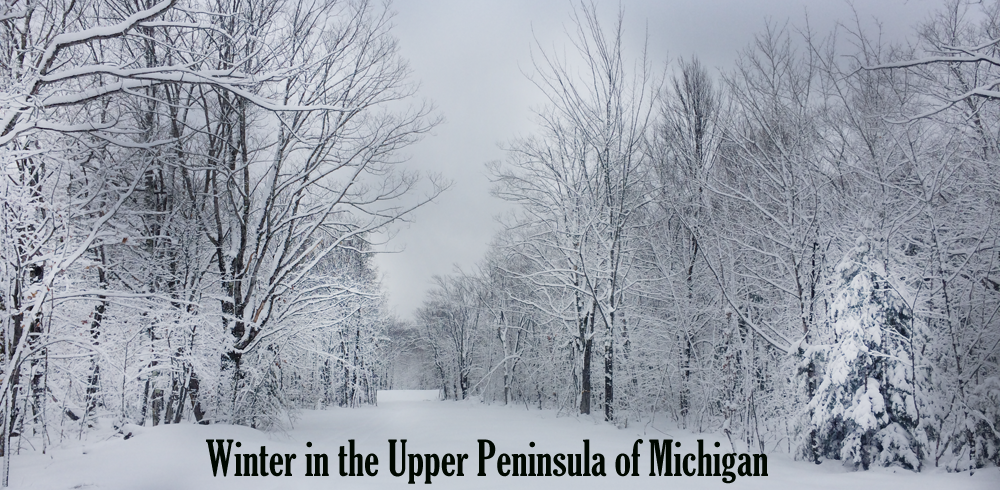
Snowfall in the Upper Peninsula of Michigan

A WINTER WONDERLAND

Hello all, welcome back to another winter season. This is the 7th year of snowfall reports on FunintheUP.com, thanks for following the snowfall page! FunintheUP has quickly become the #1 place for snowfall totals for those interested. Over 1.6 million people viewed our snowfall videos last year from LIVE snowfall reports, to our snowfall videos through our facebook page.
This year will be another fun year of snow, are you ready? Last year the highest snowfall was at the Calumet (Tamarack Loc.) with 331 inches of snowfall for the season. There was a total of 5 snow stations that hit 300 inches last season, they were Calumet (Tamarack Loc) with 331", Painesdale with 314.8", Houghton county with 311.9", Keweenaw County with 304", and Allouez township with 300". This season looks to be no different that last year cold and snow. The snowbelts usually always get their snowfall, but this season we should see an increase in non snowbelt areas with more snow than the last few years have brought to them. One thing is for sure and that is FunintheUP will have your snow updates all winter long, thanks for following.
If you enjoy the videos and the snowfall updates please consider making a donation or become a sponsor to help support this page so I can continue to promote the Upper Peninsula.

--Thank you so much for your support for over the years, Yooper Steve.

Nature is full of genius, full of the divinity; so that not a snowflake escapes its fashioning hand."
-- Henry David Thoreau

Top 10 Snowfall as of 11.26

Beautiful Snow Covered Trees

Upper Peninsula Tours

Upper Peninsula Snowfall Totals - by FunintheUP.com

Tune in Each Monday for Facebook LIVE at 5pm Top 10 Snowiest Locations in the Upper Peninsula.
Snowfall Reports Sponsored by Upper Peninsula Tours

Top 10 Snowiest places in the Upper Peninsula

Each week on Monday we update the Top 10, watch the LIVE report on facebook on Mondays at 5pm.


Snowfall from Jan Feb 28th 10am to Mar 1st 10am. This page may be updated multiple times through the day.
Check out the 11th Annual Glide-N-Gorge Fundraiser - Join friends for xc skiing, delicious eats, and social time at the Maasto Hiihto XC Ski Trails in Hancock, MI. Get your tickets today and save $5, all proceeds go towards maintaining the cross country ski trails.

Snowfall Reports by Steve Jurmu :: Feb 28th, 2019 :: Comments ::

No snowfall to report. Good to have a break today. Shouldn't see much snow this week a few flurries here and there. Temps appear to be on colder side the next few days though. Ice on Lake Superior has reached over 80% now, lake effect snowfall should be minimal until it starts to warm up a bit and the ice starts breaking up again. We may see ice reach 9295% this season yet.

Today's High Snowfall: no locations with snowfall
Most snowfall, season to date: Calumet (Tamarack Loc.) with 307.4 inches

FAQ's about Snowfall in the Upper Peninsula
Top 10 Snowiest Places in the U.P.
Current locations to hit 300 inches for the season.
Current locations to hit 200 inches for the season.
Current locations to hit 100 inches for the season.
Upper Peninsula Tours - Guided Tours - kayaking, waterfalls, hiking, off-road, scenic views. Web - Facebook - Instagram
UP VIP Card - Discounts all year long at businesses in the Upper Peninsula. Web - Facebook
Add your link to this page. Contact steve @ funintheup .com for more details.
Mar 1 - Great Lakes Ice Coverage // Graphic of ice coverage
NOAA updates ice data later in evening
Lake Superior Ice Percentage Today - 84.00% - Yesterday 86.05% - High 86.05% on 2.28.19
Great Lakes Ice Percentage Today - 74.19% - Yesterday 71.29% - High 71.29% on 2.28.19

Top 10 Snowiest Places in the Upper Peninsula Feb 25th


KEY: T: trace - NR: No Report - ND: No Data
Western/Northern Upper Peninsula Snowfall totals Daily AmountSeason TotalOn ground Today in 2017YTD
2017/18 Season
Houghton County (Superior Loc.)
FunintheUP.com station - measured by Steve Jurmu
0240.9540256.2
Houghton County Snowfall Record: 354.1 inches - 1978/1979
2nd most Snowfall 338.7 inches - 2013/14
Keweenaw County (Delaware)
Updates on weekdays only - view daily
measured by Keweenaw County Rd Commission
0266472245
Keweenaw County Snowfall Record: 390.4 inches - 1978/1979
Downtown Houghton
FunintheUP.com station - measured by Steve Jurmu
0157.1320158
Michigan Tech University xc ski trails
(FunintheUP.com station - measured by Steve Jurmu
0186.2460193.4
Dollar Bay (FunintheUP.com station - measured by Steve Jurmu)
0209.4560189
Agate Beach FunintheUP.com station - measured by John H.
0165550119.4
Calumet
(FunintheUP.com station - measured by Steve Jurmu)
0257.9580238
Calumet (Tamarack Loc.)
(FunintheUP.com station - measured by Steve Jurmu)

0307.4640271
Houghton County Airport
updates on weekdays only view daily
measured by KRRC
0159.25420176.75
Painsedale
0244.9650258.8
Allouez twnship
(near Mohawk) measured by John Dee
0252541.5245
Twin Lakes no snow observer this year NRNA
Kearsarge
snowfall not updated regularly
0107.952
Hancock (Quincy Hill) 0177.440
RedRidge (started updating Dec 1st) 098.543
Copper Harbor NR
Jacobsville 0100.638
Pelkie NR88.934
Keweenaw Bay 0163.357
Baraga (rarely updates) 075
L'Anse (new station this year) NR102.3ND
Herman 0200.451
Covington (new station this yr) 0128.244
Alberta (FordCntr) (rarely updates) NR41.84
Greenland 0185.845
Ontonagon 0113.133
Ironwood 016032
Ironwood #2 0164.930
Bergland 0162.742
Paulding 011338
Watersmeet 1000 Isle 088.438
Stambaugh (Iron River) 070.838
Watton 0124.540
Amasa 077.229
Central Upper Peninsula Snowfall totals Daily AmountSeason TotalOn Ground Today in 2017YTD
2017/18 Season
Marquette County (NWS Office)
measured by NOAA Marquette
0204.9500116
Marquette County NWS Record: 319.8 inches - 2001/2002
Three Lakes (Beaufort Lake)(MICHIGAMME 3WNW) 0122.841
Clarksburg 0138.855
West Ishpeming 0127.940
Ishpeming (Deer Lake Dead River Basin area) 0200.754
Hoist Basin (no update since 10.22) NR5.7
Big Bay 1NW 0148.447
Marquette downtown 0102.5ND
Marquette Lighthouse 097.627
K.I. Sawyer NR60.336
Harvey (Co.Rd.480) 0118.133
Harvey south 058.938
Green Garden 0116.827
Chatham 0153.230
Munising 0189.549
Wetmore (barely ever updates) NR11.5
Eastern Upper Peninsula Snowfall totals Daily AmountSeason TotalOn Ground
Grand Marais (Green Haven Loc)
started measuring Dec 1st
0168.853
Newberry 0203.740
Paradise 0154.241
Tahquamenon Falls St Park
updates end of each month - not updated yet for Jan
0147.742
Sault Ste Marie 09332
Sault Ste Marie Airport 0139.140
Rudyard NR61.427
Moran 092.231
St. Ignace (Mackinac Bridge)
measured by MDOT
010225
Engadine
measured by MDOT
NR28.818
Cedarville 079.8ND
Drummond Island 076.833.5
Detour 0102.526
Southern Upper Peninsula Snowfall totals Daily AmountSeason TotalOn Ground
Arnold NR2011
Iron Mountain
072.927
Norway 070.726
Menominee 050.6ND
Rapid River NR6026
Escanaba
059.326
Gladstone 071.234
Garden Corners 077.732
Cooks (no reports this year)NR
Parent Bay(no reports this year) NR0
Manistique WWTP 09038
Back to Top


Snowfall from Jan Feb 27th 10am to Feb 28th 10am. This page may be updated multiple times through the day.
Check out the 11th Annual Glide-N-Gorge Fundraiser - Join friends for xc skiing, delicious eats, and social time at the Maasto Hiihto XC Ski Trails in Hancock, MI. Get your tickets today and save $5, all proceeds go towards maintaining the cross country ski trails.

Snowfall Reports by Steve Jurmu :: Feb 27th, 2019 :: Comments ::

Light snow is the story, good change from a few days prior. Snow is great but sometimes it isn't fun, mostly when it drifts like it did and when the temps are in the negative temps, it isnt a fun time to be outside, but otherwise being outside in the snow enjoying winter activities is a blast.

Today's High Snowfall: Newberry with 3.3"
Most snowfall, season to date: Calumet (Tamarack Loc.) with 307.4 inches

FAQ's about Snowfall in the Upper Peninsula
Top 10 Snowiest Places in the U.P.
Current locations to hit 300 inches for the season.
Current locations to hit 200 inches for the season.
Current locations to hit 100 inches for the season.
Upper Peninsula Tours - Guided Tours - kayaking, waterfalls, hiking, off-road, scenic views. Web - Facebook - Instagram
UP VIP Card - Discounts all year long at businesses in the Upper Peninsula. Web - Facebook
Add your link to this page. Contact steve @ funintheup .com for more details.
Feb 28 - Great Lakes Ice Coverage // Graphic of ice coverage
NOAA updates ice data later in evening
Lake Superior Ice Percentage Today - 86.05% - Yesterday 85.32% - High 86.05% on 2.28.19
Great Lakes Ice Percentage Today - 71.29% - Yesterday 69.41% - High 71.29% on 2.28.19

Top 10 Snowiest Places in the Upper Peninsula Feb 25th


KEY: T: trace - NR: No Report - ND: No Data
Western/Northern Upper Peninsula Snowfall totals Daily AmountSeason TotalOn ground Today in 2017YTD
2017/18 Season
Houghton County (Superior Loc.)
FunintheUP.com station - measured by Steve Jurmu
T240.9540256.2
Houghton County Snowfall Record: 354.1 inches - 1978/1979
2nd most Snowfall 338.7 inches - 2013/14
Keweenaw County (Delaware)
Updates on weekdays only - view daily
measured by Keweenaw County Rd Commission
1266472245
Keweenaw County Snowfall Record: 390.4 inches - 1978/1979
Downtown Houghton
FunintheUP.com station - measured by Steve Jurmu
0157.1320158
Michigan Tech University xc ski trails
(FunintheUP.com station - measured by Steve Jurmu
T186.2460193.4
Dollar Bay (FunintheUP.com station - measured by Steve Jurmu)
T209.4560189
Agate Beach FunintheUP.com station - measured by John H.
0.5165550119.4
Calumet
(FunintheUP.com station - measured by Steve Jurmu)
0.6257.9580238
Calumet (Tamarack Loc.)
(FunintheUP.com station - measured by Steve Jurmu)

T307.4640271
Houghton County Airport
updates on weekdays only view daily
measured by KRRC
NR159.25420176.75
Painsedale
0244.9650258.8
Allouez twnship
(near Mohawk) measured by John Dee
T252541.5245
Twin Lakes no snow observer this year NRNA
Kearsarge
snowfall not updated regularly
0107.952
Hancock (Quincy Hill) 0177.440
RedRidge (started updating Dec 1st) T98.543
Copper Harbor NR
Jacobsville 0.4100.638
Pelkie NR88.934
Keweenaw Bay 1.3163.357
Baraga (rarely updates) NR75
L'Anse (new station this year) NR102.3ND
Herman T200.451
Covington (new station this yr) 0.6128.244
Alberta (FordCntr) (rarely updates) NR41.84
Greenland 0185.845
Ontonagon 0113.133
Ironwood 016032
Ironwood #2 T164.930
Bergland T162.744
Paulding 011338
Watersmeet 1000 Isle 088.438
Stambaugh (Iron River) 0.370.838
Watton 0.3124.540
Amasa T77.231
Central Upper Peninsula Snowfall totals Daily AmountSeason TotalOn Ground Today in 2017YTD
2017/18 Season
Marquette County (NWS Office)
measured by NOAA Marquette
2.6204.9500114
Marquette County NWS Record: 319.8 inches - 2001/2002
Three Lakes (Beaufort Lake)(MICHIGAMME 3WNW) 0122.841
Clarksburg 0.5138.855
West Ishpeming 0.5127.940
Ishpeming (Deer Lake Dead River Basin area) 1.4200.754
Hoist Basin (no update since 10.22) NR5.7
Big Bay 1NW 0.2148.448
Marquette downtown 0.6102.5ND
Marquette Lighthouse 0.597.627
K.I. Sawyer NR60.336
Harvey (Co.Rd.480) 0.7118.133
Harvey south 0.658.938
Green Garden 1116.827
Chatham 1153.230
Munising 0.5189.549
Wetmore (barely ever updates) NR11.5
Eastern Upper Peninsula Snowfall totals Daily AmountSeason TotalOn Ground
Grand Marais (Green Haven Loc)
started measuring Dec 1st
1.5168.853
Newberry 3.3203.740
Paradise 1.7154.241
Tahquamenon Falls St Park
updates end of each month - not updated yet for Jan
1.4147.742
Sault Ste Marie 1.49332
Sault Ste Marie Airport 0139.140
Rudyard NR61.427
Moran 0.892.231
St. Ignace (Mackinac Bridge)
measured by MDOT
1.510225
Engadine
measured by MDOT
NR28.818
Cedarville 0.679.8ND
Drummond Island 0.376.834
Detour 1102.526
Southern Upper Peninsula Snowfall totals Daily AmountSeason TotalOn Ground
Arnold NR2011
Iron Mountain
0.572.927
Norway 0.570.726
Menominee 0.550.6ND
Rapid River NR6026
Escanaba
259.326
Gladstone 1.471.234
Garden Corners 2.377.732
Cooks (no reports this year)NR
Parent Bay(no reports this year) NR0
Manistique WWTP 29038
Back to Top


Snowfall from Jan Feb 26th 10am to Feb 27th 10am. This page may be updated multiple times through the day.
Check out the 11th Annual Glide-N-Gorge Fundraiser - Join friends for xc skiing, delicious eats, and social time at the Maasto Hiihto XC Ski Trails in Hancock, MI. Get your tickets today and save $5, all proceeds go towards maintaining the cross country ski trails.

Snowfall Reports by Steve Jurmu :: Feb 26th, 2019 :: Comments ::

Herman and Newberry both joined the 200 Inch Club today. Also Jacobsville joined the 100 Inch Club today.

A quiet day with some sunshine across the Upper Peninsula. Light snowfall across the UP with 3 inches being the highest today. There was still a lot of people out clearing driveways and road commissions were still out clearing and widening roadways. Another storm system looks to be making its way into the Upper Peninsula sometime on Friday night into Saturday. Snowfall amounts and the impact of the system is yet to be determined. I will be keeping an eye out and watching the weather models closely and update the forecast above when such details become available. Lake Superior has the highest percentage of ice coverage so far this season, see the numbers below.

Today's High Snowfall: Herman and Menominee both with 3"
Most snowfall, season to date: Calumet (Tamarack Loc.) with 307.4 inches

FAQ's about Snowfall in the Upper Peninsula
Top 10 Snowiest Places in the U.P.
Current locations to hit 300 inches for the season.
Current locations to hit 200 inches for the season.
Current locations to hit 100 inches for the season.
Upper Peninsula Tours - Guided Tours - kayaking, waterfalls, hiking, off-road, scenic views. Web - Facebook - Instagram
UP VIP Card - Discounts all year long at businesses in the Upper Peninsula. Web - Facebook
Add your link to this page. Contact steve @ funintheup .com for more details.
Feb 27 - Great Lakes Ice Coverage // Graphic of ice coverage
NOAA updates ice data later in evening
Lake Superior Ice Percentage Today - 85.32% - Yesterday 76.57% - High 85.32% on 2.27.19
Great Lakes Ice Percentage Today - 69.41% - Yesterday 61.81% - High 69.41% on 2.27.19

Top 10 Snowiest Places in the Upper Peninsula Feb 25th


KEY: T: trace - NR: No Report - ND: No Data
Western/Northern Upper Peninsula Snowfall totals Daily AmountSeason TotalOn ground Today in 2017YTD
2017/18 Season
Houghton County (Superior Loc.)
FunintheUP.com station - measured by Steve Jurmu
1.4240.9550256.2
Houghton County Snowfall Record: 354.1 inches - 1978/1979
2nd most Snowfall 338.7 inches - 2013/14
Keweenaw County (Delaware)
Updates on weekdays only - view daily
measured by Keweenaw County Rd Commission
1265472245
Keweenaw County Snowfall Record: 390.4 inches - 1978/1979
Downtown Houghton
FunintheUP.com station - measured by Steve Jurmu
0.8157.1330158
Michigan Tech University xc ski trails
(FunintheUP.com station - measured by Steve Jurmu
0.9186.2490193.4
Dollar Bay (FunintheUP.com station - measured by Steve Jurmu)
1.8209.4580189
Agate Beach FunintheUP.com station - measured by John H.
1164580119.4
Calumet
(FunintheUP.com station - measured by Steve Jurmu)
1.5257.3580238
Calumet (Tamarack Loc.)
(FunintheUP.com station - measured by Steve Jurmu)

1.7307.4650271
Houghton County Airport
updates on weekdays only view daily
measured by KRRC
NR159.25420176.75
Painsedale
0.9244.9650258.8
Allouez twnship
(near Mohawk) measured by John Dee
1252541.5245
Twin Lakes no snow observer this year NRNA
Kearsarge
snowfall not updated regularly
T107.952
Hancock (Quincy Hill) 0.8177.440
RedRidge (started updating Dec 1st) 1.598.544
Copper Harbor NR
Jacobsville 0.5100.238
Pelkie NR88.934
Keweenaw Bay
Today's number is a 2 day total.
016238
Baraga (rarely updates) NR75
L'Anse (new station this year) NR102.3ND
Herman 3200.452
Covington (new station this yr) NR127.648
Alberta (FordCntr) (rarely updates) NR41.84
Greenland 1.7185.845
Ontonagon 1.3113.135
Ironwood 1.816032
Ironwood #2 2164.935
Bergland 1.2162.746
Paulding 1.811338
Watersmeet 1000 Isle 1.888.440
Stambaugh (Iron River) 1.670.538
Watton 1.5124.241
Amasa 1.577.231
Central Upper Peninsula Snowfall totals Daily AmountSeason TotalOn Ground Today in 2017YTD
2017/18 Season
Marquette County (NWS Office)
measured by NOAA Marquette
0202.349T114
Marquette County NWS Record: 319.8 inches - 2001/2002
Three Lakes (Beaufort Lake)(MICHIGAMME 3WNW) 1.3122.839
Clarksburg 1138.355
West Ishpeming 1127.441
Ishpeming (Deer Lake Dead River Basin area) 0.7199.355
Hoist Basin (no update since 10.22) NR5.7
Big Bay 1NW 0.8148.249
Marquette downtown 0.8101.9ND
Marquette Lighthouse 0.797.127
K.I. Sawyer NR60.336
Harvey (Co.Rd.480) 0.7118.133
Harvey south 0.758.337
Green Garden 0.5115.827
Chatham 1152.232
Munising 0.518949
Wetmore (barely ever updates) NR11.5
Eastern Upper Peninsula Snowfall totals Daily AmountSeason TotalOn Ground
Grand Marais (Green Haven Loc)
started measuring Dec 1st
0.5167.353
Newberry 1.4200.438
Paradise 0.6152.539
Tahquamenon Falls St Park
updates end of each month - not updated yet for Jan
NR98.324
Sault Ste Marie T91.633
Sault Ste Marie Airport 0.1139.140
Rudyard NR61.427
Moran 1.291.431
St. Ignace (Mackinac Bridge)
measured by MDOT
0.5100.524
Engadine
measured by MDOT
NR28.818
Cedarville 0.879.2ND
Drummond Island 0.876.534
Detour 0.2101.526
Southern Upper Peninsula Snowfall totals Daily AmountSeason TotalOn Ground
Arnold NR2011
Iron Mountain
1.872.427
Norway 270.227
Menominee 350.1ND
Rapid River NR6026
Escanaba
1.757.325
Gladstone 1.269.833
Garden Corners 2.475.430
Cooks (no reports this year)NR
Parent Bay(no reports this year) NR0
Manistique WWTP 18836
Back to Top


Snowfall from Jan Feb 25th 10am to Feb 26th 10am. This page may be updated multiple times through the day.
Check out the 11th Annual Glide-N-Gorge Fundraiser - Join friends for xc skiing, delicious eats, and social time at the Maasto Hiihto XC Ski Trails in Hancock, MI. Get your tickets today and save $5, all proceeds go towards maintaining the cross country ski trails.

by Steve Jurmu :: Feb 25th, 2019 :: Comments ::

A few concentrated snow bands dropped some snowfall in the far central UP and the northern eastern UP, enough for a few inches to be measured. Most places had a break in the snowfall with a bit of sunshine through the day. People spent the day shoveling, plowing, and snowblowing their driveways after the storm. Many of the roadways are open but there are a lot that are still closed due to the drifting. There was some storm damage that happened. See information below. Looking forward to a few days of little snowfall and a chance of sunshine until the weekend. There is another system that might make its way into the UP this weekend, we are still watching the development, it shouldn't be like what we had on the 23rd and 24th though.

Here is a small sample of the happenings across the UP during the storm.
--Michigan Tech University CLOSED
--Snowmobiler in Calumet Township rear ends MI State Police car
--Heavy snow and drifting causes Copper Dog 150 re-routes
--M26 from Eagle River to Copper Harbor CLOSED.
--Negaunee school bus garage collapses
--M-28 between Harvey and Munising closed around 1pm, it reopened around 8pm on Feb 25th.
--Mackinac Bridge closed to high winds
--US-2 between Worth Rd. and I-75 was CLOSED Sunday and reopened Tuesday according to MDOT
--Shunk Furniture roof collapses
--Old Ish Auto building roof collapsed
--Marquette County Central Dispatch/Emergency Management issues ALERT, STAY HOME ( seriously� if you do not have to go out don�t . If you must give yourself lots of time. The road commission cannot keep up with the wind and snow)
--Report of multiple vehicles stuck in the intersection of US 41 and Teal Lake Ave in Negaunee City. Please avoid this area if possible.
Croix street running along Teal Lake is closed. There are signs placed at the US 41 intersection.
--Kelly Johnson Airport Access Road is closed so that the road commission can plow the road. There are signs posted.
--M-117 CLOSED between US-2 and M-28 in Luce and Mackinac Counties


Today's High Snowfall: Munising with 5.4"
Most snowfall, season to date: Calumet (Tamarack Loc.) with 305.7 inches

FAQ's about Snowfall in the Upper Peninsula
Top 10 Snowiest Places in the U.P.
Current locations to hit 300 inches for the season.
Current locations to hit 200 inches for the season.
Current locations to hit 100 inches for the season.
Upper Peninsula Tours - Guided Tours - kayaking, waterfalls, hiking, off-road, scenic views. Web - Facebook - Instagram
UP VIP Card - Discounts all year long at businesses in the Upper Peninsula. Web - Facebook
Add your link to this page. Contact steve @ funintheup .com for more details.
Feb 26 - Great Lakes Ice Coverage // Graphic of ice coverage
NOAA updates ice data later in evening
Lake Superior Ice Percentage Today - 76.57% - Yesterday 75.78% - High 83.13% on 2.21.19
Great Lakes Ice Percentage Today - 61.81% - Yesterday 56.44% - High 66.87% on 2.20.19

Top 10 Snowiest Places in the Upper Peninsula Feb 25th
2 Day Snow Storm Totals

Only showing the snowfall amounts for stations with 18 inches or more for the 2 days of Feb 23rd and 24th.

29.7" - Calumet (Tamarack loc.)
28.5" - Three Lakes
26.5" - Keweenaw Bay
25.4" - Calumet
25.3" - Hancock (Quincy Hill)
24.0" - Dollar Bay
24.0" - Clarksburg
22.6" - Ishpeming(Deer Lake area)
21.2" - Downtown Houghton
20.6" - Houghton county (Superior loc.)
20.0" - Kearsarge
20.0" - Keweenaw County (Delaware loc.)
19.7" - NWS Marquette office US41
19.5" - Mohawk
18.3" - Painesdale


KEY: T: trace - NR: No Report - ND: No Data
Western/Northern Upper Peninsula Snowfall totals Daily AmountSeason TotalOn ground Today in 2017YTD
2017/18 Season
Houghton County (Superior Loc.)
FunintheUP.com station - measured by Steve Jurmu
0.3239.5560256.2
Houghton County Snowfall Record: 354.1 inches - 1978/1979
2nd most Snowfall 338.7 inches - 2013/14
Keweenaw County (Delaware)
Updates on weekdays only - view daily
measured by Keweenaw County Rd Commission
2264462245
Keweenaw County Snowfall Record: 390.4 inches - 1978/1979
Downtown Houghton
FunintheUP.com station - measured by Steve Jurmu
T156.3340158
Michigan Tech University xc ski trails
(FunintheUP.com station - measured by Steve Jurmu
0.2185.3500193.4
Dollar Bay (FunintheUP.com station - measured by Steve Jurmu)
0.2207.6580189
Agate Beach FunintheUP.com station - measured by John H.
0163.5590119.4
Calumet
(FunintheUP.com station - measured by Steve Jurmu)
0.5255.8580.9238
Calumet (Tamarack Loc.)
(FunintheUP.com station - measured by Steve Jurmu)

0.7305.7701.9271
Houghton County Airport
updates on weekdays only view daily
measured by KRRC
0159.25420176.75
Painsedale
0.1244650258.8
Allouez twnship
(near Mohawk) measured by John Dee
0.5251541.5245
Twin Lakes no snow observer this year NRNA
Kearsarge
snowfall not updated regularly
T107.952
Hancock (Quincy Hill) 1.8176.640
RedRidge (started updating Dec 1st) NR9740
Copper Harbor NR
Jacobsville 0.399.738
Pelkie NR88.934
Keweenaw Bay
Today's number is a 2 day total.
316238
Baraga (rarely updates) NR75
L'Anse (new station this year) NR102.3ND
Herman T197.452
Covington (new station this yr) NR127.648
Alberta (FordCntr) (rarely updates) NR41.84
Greenland 0.4184.148
Ontonagon 0.3105.834
Ironwood 0158.230
Ironwood #2 NR15235
Bergland 0161.548
Paulding 0111.241
Watersmeet 1000 Isle 086.639
Stambaugh (Iron River) T68.937
Watton 0122.741
Amasa 075.731
Central Upper Peninsula Snowfall totals Daily AmountSeason TotalOn Ground Today in 2017YTD
2017/18 Season
Marquette County (NWS Office)
measured by NOAA Marquette
0.1202.3513.9114
Marquette County NWS Record: 319.8 inches - 2001/2002
Three Lakes (Beaufort Lake)(MICHIGAMME 3WNW) 0121.541
Clarksburg 0137.355
West Ishpeming NR126.448
Ishpeming (Deer Lake Dead River Basin area) 0198.659
Hoist Basin (no update since 10.22) NR5.7
Big Bay 1NW NR137.348
Marquette downtown NR101.1ND
Marquette Lighthouse 096.426
K.I. Sawyer NR60.336
Harvey (Co.Rd.480) 0103.930
Harvey south NR57.635
Green Garden 0115.328
Chatham 0151.232
Munising 5.4188.549
Wetmore (barely ever updates) NR11.5
Eastern Upper Peninsula Snowfall totals Daily AmountSeason TotalOn Ground
Grand Marais (Green Haven Loc)
started measuring Dec 1st
3166.855
Newberry 1.519939
Paradise 3.9151.939
Tahquamenon Falls St Park
updates end of each month - not updated yet for Jan
NR98.324
Sault Ste Marie 1.691.633
Sault Ste Marie Airport 5.313941
Rudyard NR61.427
Moran 090.231
St. Ignace (Mackinac Bridge)
measured by MDOT
010024
Engadine
measured by MDOT
NR28.818
Cedarville NR78.4ND
Drummond Island 075.732
Detour 0101.330
Southern Upper Peninsula Snowfall totals Daily AmountSeason TotalOn Ground
Arnold NR2011
Iron Mountain
070.625
Norway 068.226
Menominee 046.8ND
Rapid River NR6026
Escanaba
055.125
Gladstone 068.432
Garden Corners 07329
Cooks (no reports this year)NR
Parent Bay(no reports this year) NR0
Manistique WWTP T8735
Back to Top


Snowfall from Jan Feb 24th 10am to Feb 25th 10am. This page may be updated multiple times through the day.
Check out the 11th Annual Glide-N-Gorge Fundraiser - Join friends for xc skiing, delicious eats, and social time at the Maasto Hiihto XC Ski Trails in Hancock, MI. Get your tickets today and save $5, all proceeds go towards maintaining the cross country ski trails.

by Steve Jurmu :: Feb 24th, 2019 :: Comments ::

Calumet (Tamarack Loc.) is the first to join the 300 INCH CLUB with 305 inches today.

Dollar Bay and NWS office joined the 200 INCH CLUB today. Dollar Bay with 207.4 inches and the NWS office with 202.2 inches.

Kearsarge, St. Ignace, and DeTour joined the 100 INCH CLUB today. Kearsarge with with 107.9 inches, St. Ignace with 100 inches, and Detour Village with 101.3 inches.

Our first 300 inches was recorded today at Calumet (Tamarack Loc.) with a total of 17.2 inches brought the station to 305 inches for the season. Some serious weather in the Upper Peninsula for 2 days. Wind gusts reached up to 50-79mph in the UP, combined with heavy snowfall made for a couple days that you were happy to be inside. There were many calls for wrecker service and many who just had to fend for themselves. There were many who had to leave their vehicles until the morning because they got stuck. Even throught the day it was a chore getting out with drifts as high as 8 and 9 feet across roadways and up against homes. This snowstorm will be one to remember for sure, the storm of Feb 23rd and 24th. The southern UP and eastern UP didn't see the snowfall amounts the central, western, and northern UP saw, but everywhere across the UP saw high winds. There were around 15 snowfall locations with a 2 day snowfall total from 18 inches up to 29.7 inches. MTU cancelled classes again. There is a lot to write about with this storm, but it surely will be a storm for the record books in many ways. Ice amounts of Lake Superior didn't change as much as I had expected, they only dropped 5 percent from 2 days prior even after all that wind we had.

Today's High Snowfall: Hancock (Quincy hill) with 19.2"
Most snowfall, season to date: Calumet (Tamarack Loc.) with 305 inches

FAQ's about Snowfall in the Upper Peninsula
Top 10 Snowiest Places in the U.P.
Current locations to hit 300 inches for the season.
Current locations to hit 200 inches for the season.
Current locations to hit 100 inches for the season.
Upper Peninsula Tours - Guided Tours - kayaking, waterfalls, hiking, off-road, scenic views. Web - Facebook - Instagram
UP VIP Card - Discounts all year long at businesses in the Upper Peninsula. Web - Facebook
Add your link to this page. Contact steve @ funintheup .com for more details.
Feb 25 - Great Lakes Ice Coverage // Graphic of ice coverage
NOAA updates ice data later in evening
Lake Superior Ice Percentage Today - 75.78% - Yesterday 77.66% - High 83.13% on 2.21.19
Great Lakes Ice Percentage Today - 56.44% - Yesterday 55.96% - High 66.87% on 2.20.19

Top 10 Snowiest Places in the Upper Peninsula Feb 25th


KEY: T: trace - NR: No Report - ND: No Data
Western/Northern Upper Peninsula Snowfall totals Daily AmountSeason TotalOn ground Today in 2017YTD
2017/18 Season
Houghton County (Superior Loc.)
FunintheUP.com station - measured by Steve Jurmu
8.1239.2585.3256.2
Houghton County Snowfall Record: 354.1 inches - 1978/1979
2nd most Snowfall 338.7 inches - 2013/14
Keweenaw County (Delaware)
Updates on weekdays only - view daily
measured by Keweenaw County Rd Commission
18262417243
Keweenaw County Snowfall Record: 390.4 inches - 1978/1979
Downtown Houghton
FunintheUP.com station - measured by Steve Jurmu
11.7156.3353.5158
Michigan Tech University xc ski trails
(FunintheUP.com station - measured by Steve Jurmu
12.5185.1524.5193.4
Dollar Bay (FunintheUP.com station - measured by Steve Jurmu)
12.5207.4595189
Agate Beach FunintheUP.com station - measured by John H.
13.5163.5605119.4
Calumet
(FunintheUP.com station - measured by Steve Jurmu)
13.6255.3604.3237.1
Calumet (Tamarack Loc.)
(FunintheUP.com station - measured by Steve Jurmu)

17.2305725.5269.1
Houghton County Airport
updates on weekdays only view daily
measured by KRRC
12159.25425176.75
Painsedale
7.8243.9654.4258.8
Allouez twnship
(near Mohawk) measured by John Dee
10.5250.5525.5243.5
Twin Lakes no snow observer this year NRNA
Kearsarge
snowfall not updated regularly
12107.954
Hancock (Quincy Hill) 19.2174.840
RedRidge (started updating Dec 1st) NR9740
Copper Harbor NR
Jacobsville 6.199.438
Pelkie NR88.934
Keweenaw Bay
Today's number is a 2 day total.
2215963
Baraga (rarely updates) NR75
L'Anse (new station this year) NR102.3ND
Herman NR197.447
Covington (new station this yr) 14127.648
Alberta (FordCntr) (rarely updates) NR41.84
Greenland 13183.748
Ontonagon 6105.535
Ironwood 4158.230
Ironwood #2 NR15235
Bergland NR161.538
Paulding NR111.238
Watersmeet 1000 Isle 2.586.640
Stambaugh (Iron River) 268.935
Watton 4.6122.741
Amasa 11.575.732
Central Upper Peninsula Snowfall totals Daily AmountSeason TotalOn Ground Today in 2017YTD
2017/18 Season
Marquette County (NWS Office)
measured by NOAA Marquette
16202.250T110.1
Marquette County NWS Record: 319.8 inches - 2001/2002
Three Lakes (Beaufort Lake)(MICHIGAMME 3WNW) 4121.541
Clarksburg 12137.360
West Ishpeming NR126.448
Ishpeming (Deer Lake Dead River Basin area) 10.7198.659
Hoist Basin (no update since 10.22) NR5.7
Big Bay 1NW NR137.348
Marquette downtown NR101.1ND
Marquette Lighthouse 2.296.426
K.I. Sawyer NR60.336
Harvey (Co.Rd.480) 9.8103.930
Harvey south NR57.635
Green Garden 4115.328
Chatham 5151.232
Munising 7.5183.147
Wetmore (barely ever updates) NR11.5
Eastern Upper Peninsula Snowfall totals Daily AmountSeason TotalOn Ground
Grand Marais (Green Haven Loc)
started measuring Dec 1st
10163.856
Newberry 9.1197.540
Paradise 4.214839
Tahquamenon Falls St Park
updates end of each month - not updated yet for Jan
NR98.324
Sault Ste Marie 1.49032
Sault Ste Marie Airport 7.4133.741
Rudyard NR61.427
Moran 0.590.231
St. Ignace (Mackinac Bridge)
measured by MDOT
210024
Engadine
measured by MDOT
NR28.818
Cedarville NR78.4ND
Drummond Island NR75.732
Detour 12101.330
Southern Upper Peninsula Snowfall totals Daily AmountSeason TotalOn Ground
Arnold NR2011
Iron Mountain
0.370.625
Norway 0.268.226
Menominee 0.546.8ND
Rapid River NR6026
Escanaba
0.555.125
Gladstone 0.368.432
Garden Corners 1.47329
Cooks (no reports this year)NR
Parent Bay(no reports this year) NR0
Manistique WWTP 18735
Back to Top


Snowfall from Jan Feb 23rd 10am to Feb 24th 10am. This page may be updated multiple times through the day.
Check out the 11th Annual Glide-N-Gorge Fundraiser - Join friends for xc skiing, delicious eats, and social time at the Maasto Hiihto XC Ski Trails in Hancock, MI. Get your tickets today and save $5, all proceeds go towards maintaining the cross country ski trails.

by Steve Jurmu :: Feb 23rd, 2019 :: Comments ::

Ontonagon joined the 100 INCH CLUB today with 105.5 inches.
Tomorrow we might have a few more stations to hit 100 Inches and another 2 or 3 stations to hit the 200 Inch mark.

Wow a day today across the UP, wake up to high winds and knee deep snowfall. Not like it's unusual but knowing what is in store for the entire day is kinda depressing even as someone as myself who absolutely loves snow and winter. Even days as this can put one into a dream of 70 degrees in Miami or a golf trip to Hawaii. I still love snow though, days like today make it a challenge for even the heartiest Yoopers like myself, the fact is I've been in dozens of snowstorms like this one and will be in many more probably. Anyway around 2pm winds really picked up across the UP, in the Copper Country, Blizzard status was achieved at 5pm with 3 continuous ours of 35mph winds with gusts as high at 66mph. Peak gusts today elsewhere in the UP were 41mph at Rapid River, 50mph at Iron Mtn, 58mph in Ontonagon, 67mph in Copper Harbor, and a whopping 74mph at Stannard Rock lighthouse on Lake Superior. Winds look to continue through the Am and snow looks to settle down slightly through the early morning hours. Snowfall remains heavy in the Copper Country and there still is a band of snowfall just east of Ishpeming making an impact around Melstrand and north of Shingleton. There is also a band north of Newberry around Tahquamenon Falls state park just west of Paradise still making an impact. Drifts are monsterous and snow pack is deep, hitting over 60 inches of depth in some locations in the Upper Peninsula as of this morning.

Today's High Snowfall: Big Bay with 16.3"
Most snowfall, season to date: Calumet (Tamarack Loc.) with 287.8 inches

Top 10 Snowiest Places in the U.P.
Current locations to hit 100 inches for the season.
Current locations to hit 200 inches for the season.
FAQ's about Snowfall in the Upper Peninsula
Upper Peninsula Tours - Guided Tours - kayaking, waterfalls, hiking, off-road, scenic views. Web - Facebook - Instagram
UP VIP Card - Discounts all year long at businesses in the Upper Peninsula. Web - Facebook
Add your link to this page. Contact steve @ funintheup .com for more details.
Feb 24 - Great Lakes Ice Coverage // Graphic of ice coverage
NOAA updates ice data later in evening
Lake Superior Ice Percentage Today - 77.66% - Yesterday 76.76% - High 83.13% on 2.21.19
Great Lakes Ice Percentage Today - 55.96% - Yesterday 57.17% - High 66.87% on 2.20.19

200+ Inches at 6 Locations


KEY: T: trace - NR: No Report - ND: No Data
Western/Northern Upper Peninsula Snowfall totals Daily AmountSeason TotalOn ground Today in 2017YTD
2017/18 Season
Houghton County (Superior Loc.)
FunintheUP.com station - measured by Steve Jurmu
12.5231.1510250.9
Houghton County Snowfall Record: 354.1 inches - 1978/1979
2nd most Snowfall 338.7 inches - 2013/14
Keweenaw County (Delaware)
Updates on weekdays only - view daily
measured by Keweenaw County Rd Commission
NR242426234
Keweenaw County Snowfall Record: 390.4 inches - 1978/1979
Downtown Houghton
FunintheUP.com station - measured by Steve Jurmu
9.5144.6300154.5
Michigan Tech University xc ski trails
(FunintheUP.com station - measured by Steve Jurmu
10.3172.6450188.9
Dollar Bay (FunintheUP.com station - measured by Steve Jurmu)
11.5194.9510184
Agate Beach FunintheUP.com station - measured by John H.
10150500114.4
Calumet
(FunintheUP.com station - measured by Steve Jurmu)
11.8241.7500232.3
Calumet (Tamarack Loc.)
(FunintheUP.com station - measured by Steve Jurmu)

12.5287.8600262.6
Houghton County Airport
updates on weekdays only view daily
measured by KRRC
NR146.25340171.75
Painsedale
10.5236.1600253.4
Allouez twnship
(near Mohawk) measured by John Dee
9240492238
Twin Lakes no snow observer this year NRNA
Kearsarge
snowfall not updated regularly
895.946
Hancock (Quincy Hill) 6.1155.640
RedRidge (started updating Dec 1st) NR9740
Copper Harbor NR
Jacobsville 693.331
Pelkie NR88.934
Keweenaw Bay 4.513744
Baraga (rarely updates) NR75
L'Anse (new station this year) NR102.3ND
Herman 10197.438
Covington (new station this yr) 11113.638
Alberta (FordCntr) (rarely updates) NR41.84
Greenland 10170.745
Ontonagon 7.3105.532
Ironwood 9.3154.232
Ironwood #2 6.915235
Bergland NR161.538
Paulding 8.5111.238
Watersmeet 1000 Isle 8.584.137
Stambaugh (Iron River) 7.566.935
Watton 10.2118.138
Amasa NR63.227
Central Upper Peninsula Snowfall totals Daily AmountSeason TotalOn Ground Today in 2017YTD
2017/18 Season
Marquette County (NWS Office)
measured by NOAA Marquette
3.7186.2453.5110.1
Marquette County NWS Record: 319.8 inches - 2001/2002
Three Lakes (Beaufort Lake)(MICHIGAMME 3WNW) 10.7117.539
Clarksburg 12125.360
West Ishpeming 12.6126.448
Ishpeming (Deer Lake Dead River Basin area) 11.9187.955
Hoist Basin (no update since 10.22) NR5.7
Big Bay 1NW 16.3137.348
Marquette downtown 10.2101.1ND
Marquette Lighthouse 10.594.230
K.I. Sawyer NR60.336
Harvey (Co.Rd.480) 9.8103.930
Harvey south NR57.635
Green Garden 9.8111.333
Chatham 5.8146.232
Munising 6175.642
Wetmore (barely ever updates) NR11.5
Eastern Upper Peninsula Snowfall totals Daily AmountSeason TotalOn Ground
Grand Marais (Green Haven Loc)
started measuring Dec 1st
5153.851
Newberry 3.5188.434
Paradise 3.5143.838
Tahquamenon Falls St Park
updates end of each month - not updated yet for Jan
NR98.324
Sault Ste Marie 2.488.632
Sault Ste Marie Airport 5.3126.336
Rudyard NR61.427
Moran 1.289.731
St. Ignace (Mackinac Bridge)
measured by MDOT
T9824
Engadine
measured by MDOT
028.818
Cedarville NR78.4ND
Drummond Island NR75.732
Detour NR85.322
Southern Upper Peninsula Snowfall totals Daily AmountSeason TotalOn Ground
Arnold NR2011
Iron Mountain
670.329
Norway 4.76825
Menominee 146.3ND
Rapid River 76026
Escanaba
455.125
Gladstone 3.668.133
Garden Corners 2.871.629
Cooks (no reports this year)NR
Parent Bay(no reports this year) NR0
Manistique WWTP 48636
Back to Top


Snowfall from Jan Feb 22nd 10am to Feb 23rd 10am. This page may be updated multiple times through the day.
Check out the 11th Annual Glide-N-Gorge Fundraiser - Join friends for xc skiing, delicious eats, and social time at the Maasto Hiihto XC Ski Trails in Hancock, MI. Get your tickets today and save $5, all proceeds go towards maintaining the cross country ski trails.

by Steve Jurmu :: Feb 23rd, 2019 :: Comments ::

Not much snow across the UP to report for today. The UP tonight will begin to be covered in more white with the snow storm moving in later tonight. During the day today we will see flurries with an inch or two of snowfall before late evening when the real beast starts to impact the Upper Peninsula. You can read the forecast above to get more details. Snowfall amounts are almost impossible to predict as there is so much that goes into forecasting it. A weathermans forecasted amounts are often scrutinized by their predicted amount and the snowfall that has fallen after a snow event. So when you see snowfall amounts, you just never know as there are many factors in play. Back to this storm system on Sunday. This could be a hard hitting storm, and by hard hitting it isn't because of the snowfall it is the winds and freezing rain we might see in combination with the wet snow. Getting 10+ inches of snowfall isn't a big deal really it is just the added freezing rain and gale force winds that add to it. The Western UP and Copper Country into the Keweenaw should see greater than 10 inches with 15-20 inches possible in some areas around Toivola, Painesdale, Calumet, Mohawk, and in the Keweenaw, the central UP 6-10 inches, southern UP around 4-6 inches likely, and the eastern UP anywhere from 4-10 inches. The winds will be wicked and the snowfall will be heavy snow which will lead to power outages, so prepare for that now if you aren't already. Roads may be a challenge to traverse starting around midnight, which most people will be off the roads by then. Tomorrow early going may be difficult as road crews work to clear the roads.

Today's High Snowfall: Watersmeet with 2"
Most snowfall, season to date: Calumet (Tamarack Loc.) with 275.3 inches

Top 10 Snowiest Places in the U.P.
Current locations to hit 100 inches for the season.
Current locations to hit 200 inches for the season.
FAQ's about Snowfall in the Upper Peninsula
Upper Peninsula Tours - Guided Tours - kayaking, waterfalls, hiking, off-road, scenic views. Web - Facebook - Instagram
UP VIP Card - Discounts all year long at businesses in the Upper Peninsula. Web - Facebook
Add your link to this page. Contact steve @ funintheup .com for more details.
Feb 23 - Great Lakes Ice Coverage // Graphic of ice coverage
NOAA updates ice data later in evening
Lake Superior Ice Percentage Today - 76.76% - Yesterday 80.18% - High 83.13% on 2.21.19
Great Lakes Ice Percentage Today - 57.17% - Yesterday 59.92% - High 66.87% on 2.20.19

200+ Inches at 6 Locations


KEY: T: trace - NR: No Report - ND: No Data
Western/Northern Upper Peninsula Snowfall totals Daily AmountSeason TotalOn ground Today in 2017YTD
2017/18 Season
Houghton County (Superior Loc.)
FunintheUP.com station - measured by Steve Jurmu
0.5218.6428.3250.9
Houghton County Snowfall Record: 354.1 inches - 1978/1979
2nd most Snowfall 338.7 inches - 2013/14
Keweenaw County (Delaware)
Updates on weekdays only - view daily
measured by Keweenaw County Rd Commission
NR242426234
Keweenaw County Snowfall Record: 390.4 inches - 1978/1979
Downtown Houghton
FunintheUP.com station - measured by Steve Jurmu
0.2135.1226.8154.5
Michigan Tech University xc ski trails
(FunintheUP.com station - measured by Steve Jurmu
0.2162.3367.2188.9
Dollar Bay (FunintheUP.com station - measured by Steve Jurmu)
0.5183.4409.2184
Agate Beach FunintheUP.com station - measured by John H.
0.8140390114.4
Calumet
(FunintheUP.com station - measured by Steve Jurmu)
0.5229.9398.5232.3
Calumet (Tamarack Loc.)
(FunintheUP.com station - measured by Steve Jurmu)

0.6275.3499262.6
Houghton County Airport
updates on weekdays only view daily
measured by KRRC
NR146.25347171.75
Painsedale
0.1225.6527.4253.4
Allouez twnship
(near Mohawk) measured by John Dee
NR231478236
Twin Lakes no snow observer this year NRNA
Kearsarge
snowfall not updated regularly
087.943
Hancock (Quincy Hill) 0149.537
RedRidge (started updating Dec 1st) 09740
Copper Harbor NR
Jacobsville T87.326
Pelkie T88.934
Keweenaw Bay 1.5132.542
Baraga (rarely updates) NR75
L'Anse (new station this year) NR102.3ND
Herman T187.438
Covington (new station this yr) 0102.628
Alberta (FordCntr) (rarely updates) NR41.84
Greenland 0160.742
Ontonagon T98.229
Ironwood 0.4144.928
Ironwood #2 0.5145.130
Bergland 0161.538
Paulding 0.4102.730
Watersmeet 1000 Isle 275.631
Stambaugh (Iron River) 1.559.427
Watton 0.5107.929
Amasa 063.227
Central Upper Peninsula Snowfall totals Daily AmountSeason TotalOn Ground Today in 2017YTD
2017/18 Season
Marquette County (NWS Office)
measured by NOAA Marquette
0182.5460106.6
Marquette County NWS Record: 319.8 inches - 2001/2002
Three Lakes (Beaufort Lake)(MICHIGAMME 3WNW) T106.830
Clarksburg 0113.350
West Ishpeming 0113.840
Ishpeming (Deer Lake Dead River Basin area) 017646
Hoist Basin (no update since 10.22) NR5.7
Big Bay 1NW 012133
Marquette downtown 090.9ND
Marquette Lighthouse 083.723
K.I. Sawyer 060.336
Harvey (Co.Rd.480) 0103.930
Harvey south 057.635
Green Garden 0.6101.524
Chatham 0140.430
Munising 0169.642
Wetmore (barely ever updates) NR11.5
Eastern Upper Peninsula Snowfall totals Daily AmountSeason TotalOn Ground
Grand Marais (Green Haven Loc)
started measuring Dec 1st
0148.848
Newberry 0184.934
Paradise 0140.338
Tahquamenon Falls St Park
updates end of each month - not updated yet for Jan
NR98.324
Sault Ste Marie 086.232
Sault Ste Marie Airport T12135
Rudyard NR61.427
Moran 088.530
St. Ignace (Mackinac Bridge)
measured by MDOT
09824
Engadine
measured by MDOT
028.818
Cedarville 078.4ND
Drummond Island NR75.732
Detour NR85.322
Southern Upper Peninsula Snowfall totals Daily AmountSeason TotalOn Ground
Arnold NR2011
Iron Mountain
1.364.324
Norway 0.863.323
Menominee 0.345.3ND
Rapid River NR46.417
Escanaba
051.122
Gladstone 064.531
Garden Corners T68.828
Cooks (no reports this year)NR
Parent Bay(no reports this year) NR0
Manistique WWTP T8239
Back to Top


Snowfall from Jan Feb 21st 10am to Feb 22nd 10am. This page may be updated multiple times through the day.
Check out the 11th Annual Glide-N-Gorge Fundraiser - Join friends for xc skiing, delicious eats, and social time at the Maasto Hiihto XC Ski Trails in Hancock, MI. Get your tickets today and save $5, all proceeds go towards maintaining the cross country ski trails.

by Steve Jurmu :: Feb 22nd, 2019 :: Comments ::

After a snowy and windy day on Feb 20th, it was a nice day overall, mostly clear skies with some sunshine and slightly warmer temps. Now for what is in store for the weekend, it has everyone talking, the next storm. To me and many others who live in the UP, it is just another winter storm. Living in the UP during the winter we are always dealing with snowfall and taking it day by day, if you hate snow then you probably shouldn't be living in the Upper Peninsula. There are many areas in the US that get more snow than we do, but not many at our our elevations and that aren't in mountains or at ski resorts. Going through all the data, computer models, and talking with and listening to meterologists the last couple days, this storm looks to be a large one. Winds do look to be pretty intense with gale force winds possible, combined with the wet snow, rain, sleet it could get nasty for driving and there will probably be some power outages, so prepare for that right now. The entire UP looks to be impacted as this system continues to move to the NE up through the heart of America into the Midwest. With Lake Superior to our north and Lake Michigan to our south, the UP will probably see heavy snow for a few hours. Details are still developing and it is hard to have any idea of snowfall totals with a system like this. There could be 5 inches or could be 24 inches. We shall see in the next 12 to 24 hrs what is developing and have a better understanding of the impacts we could see through the Upper Peninsula. It is winter afterall and snowfall is what we see in the Upper Peninsula on an almost daily basis. Be safe out there and enjoy the winter by skiing, snowshoeing, snowmobiling, sledding, ice climbing, and just walking your dog. Do something and just don't complain about each winter storm we get. There are only two (2) seasons here in the UP, Winter and Summer, summer starting July 4th and lasting till Sept 30th.

Today's High Snowfall: Herman with 1"
Most snowfall, season to date: Calumet (Tamarack Loc.) with 274.7 inches

Top 10 Snowiest Places in the U.P.
Current locations to hit 100 inches for the season.
Current locations to hit 200 inches for the season.
FAQ's about Snowfall in the Upper Peninsula
Upper Peninsula Tours - Guided Tours - kayaking, waterfalls, hiking, off-road, scenic views. Web - Facebook - Instagram
UP VIP Card - Discounts all year long at businesses in the Upper Peninsula. Web - Facebook
Add your link to this page. Contact steve @ funintheup .com for more details.
Feb 22nd - Great Lakes Ice Coverage // Graphic of ice coverage
NOAA updates ice data later in evening
Lake Superior Ice Percentage Today - 80.18% - Yesterday 83.13% - High 83.13% on 2.21.19
Great Lakes Ice Percentage Today - 59.92% - Yesterday 63.10% - High 66.87% on 2.20.19

200+ Inches at 6 Locations


KEY: T: trace - NR: No Report - ND: No Data
Western/Northern Upper Peninsula Snowfall totals Daily AmountSeason TotalOn ground Today in 2017YTD
2017/18 Season
Houghton County (Superior Loc.)
FunintheUP.com station - measured by Steve Jurmu
0.2218.1430242.6
Houghton County Snowfall Record: 354.1 inches - 1978/1979
2nd most Snowfall 338.7 inches - 2013/14
Keweenaw County (Delaware)
Updates on weekdays only - view daily
measured by Keweenaw County Rd Commission
0242423228
Keweenaw County Snowfall Record: 390.4 inches - 1978/1979
Downtown Houghton
FunintheUP.com station - measured by Steve Jurmu
T134.9230147.7
Michigan Tech University xc ski trails
(FunintheUP.com station - measured by Steve Jurmu
0.2162.1370181.7
Dollar Bay (FunintheUP.com station - measured by Steve Jurmu)
T182.9410174.8
Agate Beach FunintheUP.com station - measured by John H.
0139.2400114.4
Calumet
(FunintheUP.com station - measured by Steve Jurmu)
0.4229.4400.5223.8
Calumet (Tamarack Loc.)
(FunintheUP.com station - measured by Steve Jurmu)

0.7274.7510.8253.6
Houghton County Airport
updates on weekdays only view daily
measured by KRRC
0146.25340164.75
Painsedale
0.6225.5540246
Allouez twnship
(near Mohawk) measured by John Dee
0.5231471.5228
Twin Lakes no snow observer this year NRNA
Kearsarge
snowfall not updated regularly
087.943
Hancock (Quincy Hill) 0.3149.537
RedRidge (started updating Dec 1st) 09740
Copper Harbor NR
Jacobsville T87.327
Pelkie NR80.434
Keweenaw Bay 013138
Baraga 075
L'Anse (new station this year) NR102.3ND
Herman 1187.439
Covington (new station this yr) NR102.631
Alberta (FordCntr) (rarely updates) NR41.84
Greenland 0.4160.743
Ontonagon NR9829
Ironwood 0.5144.529
Ironwood #2 NR144.635
Bergland 0161.538
Paulding 0.1102.331
Watersmeet 1000 Isle T73.630
Stambaugh (Iron River) T57.925
Watton 0.2107.425
Amasa T63.227
Central Upper Peninsula Snowfall totals Daily AmountSeason TotalOn Ground Today in 2017YTD
2017/18 Season
Marquette County (NWS Office)
measured by NOAA Marquette
T182.5440.2106.6
Marquette County NWS Record: 319.8 inches - 2001/2002
Three Lakes (Beaufort Lake)(MICHIGAMME 3WNW) 0.2106.831
Clarksburg 0.2113.352
West Ishpeming 0.3113.840
Ishpeming (Deer Lake Dead River Basin area) NR17650
Hoist Basin (no update since 10.22) NR5.7
Big Bay 1NW 012135
Marquette downtown T90.9ND
Marquette Lighthouse NR83.723
K.I. Sawyer NR60.336
Harvey (Co.Rd.480) 0103.930
Harvey south 057.635
Green Garden 0100.923
Chatham T140.430
Munising 0169.643
Wetmore (barely ever updates) NR11.5
Eastern Upper Peninsula Snowfall totals Daily AmountSeason TotalOn Ground
Grand Marais (Green Haven Loc)
started measuring Dec 1st
0.5148.848
Newberry 0.3184.935
Paradise 0140.338
Tahquamenon Falls St Park
updates end of each month - not updated yet for Jan
NR98.324
Sault Ste Marie T86.232
Sault Ste Marie Airport 0.112135
Rudyard NR61.427
Moran 088.531
St. Ignace (Mackinac Bridge)
measured by MDOT
09825
Engadine
measured by MDOT
028.818
Cedarville 078.4ND
Drummond Island NR75.732
Detour NR85.322
Southern Upper Peninsula Snowfall totals Daily AmountSeason TotalOn Ground
Arnold NR2011
Iron Mountain
06325
Norway T62.524
Menominee 045.3ND
Rapid River NR46.417
Escanaba
051.122
Gladstone 064.531
Garden Corners 068.828
Cooks (no reports this year)NR
Parent Bay(no reports this year) NR0
Manistique WWTP T8241
Back to Top


Snowfall from Jan Feb 20th 10am to Feb 21st 10am. This page may be updated multiple times through the day.
Check out the 11th Annual Glide-N-Gorge Fundraiser - Join friends for xc skiing, delicious eats, and social time at the Maasto Hiihto XC Ski Trails in Hancock, MI. Get your tickets today and save $5, all proceeds go towards maintaining the cross country ski trails.

4 Stations joined the 100 INCH CLUB today, they are the following. L'Anse hit 102.3 inches, Paulding hit 102.2 inches, Harvey(CoRd480) hit 103.9 inches, Green Garden hit 100.9 inches for season.

A small storm system moved in across the UP early afternoon yesterday. The entire UP saw some snowfall as a result of this system. The system moved up from the SW and then circled around with winds changing from the SE. This resulted in much of the UP seeing 4-12 inches of snowfall. What we are watching right now is the storm system that is lingering down along the California, New Mexico, and Arizona. This system has the potential to drop 12-18 inches of snowfall very quickly kind of like what the Feb 12th storm did here in the Upper Peninsula. Right now the NWS is forecasting about 10 overall being the highest anticipated total which is no big thing, but we need to watch this system because it is looking pretty powerful. The system should be making it's way into the UP sometime Saturday into Sunday morning.

Today's High Snowfall: Keweenaw Cnty (Delaware loc) & Red Ridge both with 12"
Most snowfall, season to date: Calumet (Tamarack Loc.) with 274 inches

Top 10 Snowiest Places in the U.P.
Current locations to hit 100 inches for the season.
Current locations to hit 200 inches for the season.
FAQ's about Snowfall in the Upper Peninsula
Upper Peninsula Tours - Guided Tours - kayaking, waterfalls, hiking, off-road, scenic views. Web - Facebook - Instagram
UP VIP Card - Discounts all year long at businesses in the Upper Peninsula. Web - Facebook
Add your link to this page. Contact steve @ funintheup .com for more details.
Feb 21st - Great Lakes Ice Coverage // Graphic of ice coverage
NOAA updates ice data later in evening
Lake Superior Ice Percentage Today - 83.13% - Yesterday 81.52% - High 83.13% on 2.21.19
Great Lakes Ice Percentage Today - 63.10% - Yesterday 66.87% - High 66.87% on 2.20.19

200+ Inches at 6 Locations


KEY: T: trace - NR: No Report - ND: No Data
Share Snowfall Totals on Facebook:
Western/Northern Upper Peninsula Snowfall totals Daily AmountSeason TotalOn ground Today in 2017YTD
2017/18 Season
Houghton County (Superior Loc.)
FunintheUP.com station - measured by Steve Jurmu
11.8217.9451.8242.6
Houghton County Snowfall Record: 354.1 inches - 1978/1979
2nd most Snowfall 338.7 inches - 2013/14
Keweenaw County (Delaware)
Updates on weekdays only - view daily
measured by Keweenaw County Rd Commission
12242422225
Keweenaw County Snowfall Record: 390.4 inches - 1978/1979
Downtown Houghton
FunintheUP.com station - measured by Steve Jurmu
7.2134.9241.5147.7
Michigan Tech University xc ski trails
(FunintheUP.com station - measured by Steve Jurmu
8.5161.9381.5181.7
Dollar Bay (FunintheUP.com station - measured by Steve Jurmu)
10.5182.9431.5174.8
Agate Beach FunintheUP.com station - measured by John H.
9139.2420.3114.4
Calumet
(FunintheUP.com station - measured by Steve Jurmu)
8.1229421.5223.3
Calumet (Tamarack Loc.)
(FunintheUP.com station - measured by Steve Jurmu)

9.5274531.8252.8
Houghton County Airport
updates on weekdays only view daily
measured by KRRC
7146.25342.5164.75
Painsedale
10.8224.9561.6246
Allouez twnship
(near Mohawk) measured by John Dee
9230.5489225.5
Twin Lakes no snow observer this year NRNA
Kearsarge
snowfall not updated regularly
587.943
Hancock (Quincy Hill) 6.5149.237
RedRidge (started updating Dec 1st) 129740
Copper Harbor NR
Jacobsville 5.287.330
Pelkie NR80.434
Keweenaw Bay 6.513138
Baraga 575
L'Anse (new station this year) 6.5102.3ND
Herman 4186.440
Covington (new station this yr) 5102.631
Alberta (FordCntr) (rarely updates) NR41.84
Greenland 5.3160.344
Ontonagon NR9829
Ironwood 6.814429
Ironwood #2 7.1144.635
Bergland 6.9161.538
Paulding 4.7102.232
Watersmeet 1000 Isle 6.573.632
Stambaugh (Iron River) 4.657.926
Watton 5107.225
Amasa 463.227
Central Upper Peninsula Snowfall totals Daily AmountSeason TotalOn Ground Today in 2017YTD
2017/18 Season
Marquette County (NWS Office)
measured by NOAA Marquette
6.2182.5440.1106.4
Marquette County NWS Record: 319.8 inches - 2001/2002
Three Lakes (Beaufort Lake)(MICHIGAMME 3WNW) 4.7106.634
Clarksburg 4.2113.152
West Ishpeming 5.3113.540
Ishpeming (Deer Lake Dead River Basin area) 6.417650
Hoist Basin (no update since 10.22) NR5.7
Big Bay 1NW 6.912138
Marquette downtown 5.890.9ND
Marquette Lighthouse 5.383.723
K.I. Sawyer NR60.336
Harvey (Co.Rd.480) 4.9103.930
Harvey south 5.257.636
Green Garden 5100.925
Chatham 5140.430
Munising 8.5169.644
Wetmore (barely ever updates) NR11.5
Eastern Upper Peninsula Snowfall totals Daily AmountSeason TotalOn Ground
Grand Marais (Green Haven Loc)
started measuring Dec 1st
6148.349
Newberry 5184.636
Paradise 5.5140.338
Tahquamenon Falls St Park
updates end of each month - not updated yet for Jan
NR98.324
Sault Ste Marie 4.586.232
Sault Ste Marie Airport 4.3120.926
Rudyard NR61.427
Moran 3.688.532
St. Ignace (Mackinac Bridge)
measured by MDOT
39826
Engadine
measured by MDOT
128.818
Cedarville 3.978.4ND
Drummond Island NR75.732
Detour NR85.325
Southern Upper Peninsula Snowfall totals Daily AmountSeason TotalOn Ground
Arnold NR2011
Iron Mountain
4.16325
Norway 4.462.524
Menominee 4.545.3ND
Rapid River NR46.417
Escanaba
3.951.122
Gladstone 5.764.531
Garden Corners 6.568.830
Cooks (no reports this year)NR
Parent Bay(no reports this year) NR0
Manistique WWTP 88241
Back to Top


Snowfall from Jan Feb 19th 10am to Feb 20th 10am. This page may be updated multiple times through the day.
Check out the 11th Annual Glide-N-Gorge Fundraiser - Join friends for xc skiing, delicious eats, and social time at the Maasto Hiihto XC Ski Trails in Hancock, MI. Get your tickets today and save $5, all proceeds go towards maintaining the cross country ski trails.

Little to no snowfall yesterday. A trace of snow near the Soo and a few flurries down in Rapid River which measured 1 inch of snow. Another nice day across the Upper Peninsula of Michigan. Things were a little bit colder yesterday but overall a pleasant day.There is a winter system moving across northern Wisconsin and central Minnesota right now that will be starting to make its way into the UP around 1-2pm today. Most of the Upper Peninsula is under a Winter Storm Advisory and Winter Storm Warning. You can now read our Snow Report Forecast above. The winter weather in the UP is often snowy and windy it shouldn't take anyone by surprise. However there are storms that things can get hairy and travel is extremely dangerous, Feb 12th was one of those days in the Marquette area. Always use caution on the roads. There have been more accidents, more people pulling out in front of you being impatient, passing you in blinding snow conditions, and going to fast for conditions. We all need to do our parts to ensure we all get home safe.

Today's High Snowfall: Rapid River with 1"
Most snowfall, season to date: Calumet (Tamarack Loc.) with 264.5 inches

Top 10 Snowiest Places in the U.P.
Current locations to hit 100 inches for the season.
Current locations to hit 200 inches for the season.
FAQ's about Snowfall in the Upper Peninsula
Upper Peninsula Tours - Guided Tours - kayaking, waterfalls, hiking, off-road, scenic views. Web - Facebook - Instagram
UP VIP Card - Discounts all year long at businesses in the Upper Peninsula. Web - Facebook
Add your link to this page. Contact steve @ funintheup .com for more details.
Feb 20th - Great Lakes Ice Coverage // Graphic of ice coverage
NOAA updates ice data later in evening
Lake Superior Ice Percentage Today - 81.52% - Yesterday 80.66% - High 81.52% on 2.20.19
Great Lakes Ice Percentage Today - 66.87% - Yesterday 66.12% - High 66.87% on 2.20.19

200+ Inches at 6 Locations


KEY: T: trace - NR: No Report - ND: No Data
Share Snowfall Totals on Facebook:

Western/Northern Upper Peninsula Snowfall totals Daily AmountSeason TotalOn ground Today in 2017YTD
2017/18 Season
Houghton County (Superior Loc.)
FunintheUP.com station - measured by Steve Jurmu
0206.1375.9240.8
Houghton County Snowfall Record: 354.1 inches - 1978/1979
2nd most Snowfall 338.7 inches - 2013/14
Keweenaw County (Delaware)
Updates on weekdays only - view daily
measured by Keweenaw County Rd Commission
0230387223
Keweenaw County Snowfall Record: 390.4 inches - 1978/1979
Downtown Houghton
FunintheUP.com station - measured by Steve Jurmu
0127.7203.5146.2
Michigan Tech University xc ski trails
(FunintheUP.com station - measured by Steve Jurmu
0153.4324.5180.2
Dollar Bay (FunintheUP.com station - measured by Steve Jurmu)
0172384.5173.3
Agate Beach FunintheUP.com station - measured by John H.
0130.2365114.1
Calumet
(FunintheUP.com station - measured by Steve Jurmu)
0220.9385.5221.8
Calumet (Tamarack Loc.)
(FunintheUP.com station - measured by Steve Jurmu)

0264.5477.6251
Houghton County Airport
updates on weekdays only view daily
measured by KRRC
0139.25330162.25
Painsedale
0214.1514.8244.4
Allouez twnship
(near Mohawk) measured by John Dee
0221.5459225.5
Twin Lakes no snow observer this year NRNA
Kearsarge
snowfall not updated regularly
082.940
Hancock (Quincy Hill) 0142.732
RedRidge (started updating Dec 1st) 08539
Copper Harbor NR
Jacobsville 082.125
Pelkie NR80.434
Keweenaw Bay 0124.535
Baraga NR13.55
L'Anse (new station this year) NR93.8ND
Herman 0182.440
Covington (new station this yr) 097.628
Alberta (FordCntr) (rarely updates) NR41.84
Greenland 015544
Ontonagon 09829
Ironwood 0137.226
Ironwood #2 0137.530
Bergland 0154.634
Paulding 097.530
Watersmeet 1000 Isle 067.128
Stambaugh (Iron River) 053.323
Watton 0102.229
Amasa 059.227
Central Upper Peninsula Snowfall totals Daily AmountSeason TotalOn Ground Today in 2017YTD
2017/18 Season
Marquette County (NWS Office)
measured by NOAA Marquette
0176.3481.8106.3
Marquette County NWS Record: 319.8 inches - 2001/2002
Three Lakes (Beaufort Lake)(MICHIGAMME 3WNW) 0101.932
Clarksburg 0108.950
West Ishpeming 0108.239
Ishpeming (Deer Lake Dead River Basin area) 0169.649
Hoist Basin (no update since 10.22) NR5.7
Big Bay 1NW 0114.133
Marquette downtown 085.1ND
Marquette Lighthouse 078.421
K.I. Sawyer 060.336
Harvey (Co.Rd.480) 098.632
Harvey south NR52.432
Green Garden 095.923
Chatham 0135.428
Munising 0161.143
Wetmore (barely ever updates) NR11.5
Eastern Upper Peninsula Snowfall totals Daily AmountSeason TotalOn Ground
Grand Marais (Green Haven Loc)
started measuring Dec 1st
0142.346
Newberry 0179.635
Paradise 0134.836
Tahquamenon Falls St Park
updates end of each month - not updated yet for Jan
NR98.324
Sault Ste Marie NR81.725
Sault Ste Marie Airport 0116.635
Rudyard NR61.427
Moran 084.932
St. Ignace (Mackinac Bridge)
measured by MDOT
09525
Engadine
measured by MDOT
NR27.817
Cedarville 074.5ND
Drummond Island 075.732
Detour 085.325
Southern Upper Peninsula Snowfall totals Daily AmountSeason TotalOn Ground
Arnold NR2011
Iron Mountain
058.925
Norway 058.122
Menominee NR40.8ND
Rapid River NR46.417
Escanaba
047.222
Gladstone 0.258.829
Garden Corners 062.326
Cooks (no reports this year)NR
Parent Bay(no reports this year) NR0
Manistique WWTP 07432
Back to Top


Snowfall from Jan Feb 18th 10am to Feb 19th 10am. This page may be updated multiple times through the day.
Check out the 11th Annual Glide-N-Gorge Fundraiser - Join friends for xc skiing, delicious eats, and social time at the Maasto Hiihto XC Ski Trails in Hancock, MI. Get your tickets today and save $5, all proceeds go towards maintaining the cross country ski trails.

It was nice to see some sunshine the last few days, it made for good skiing and snowmobiling weather along with all the fresh snowfall we have had, conditions were excellent. Things will change starting tomorrow, back into the winter snowfall mode. Wednesday we should see snowfall across most of the Upper Peninsula. The NWS Marquette has issued a Winter Weather Advisory for much of the UP. See the Snow Forecast above to see what is expected. Little to now snowfall across the UP today. Lake Superior ice coverage is the highest it has been all season, now at 80% ice. It may break up some with winds during this weeks stormy weather coming.

Today's High Snowfall: NWS office with 3.2"
Most snowfall, season to date: Calumet (Tamarack Loc.) with 264.5 inches

Top 10 Snowiest Places in the U.P.
Current locations to hit 100 inches for the season.
Current locations to hit 200 inches for the season.
FAQ's about Snowfall in the Upper Peninsula
Upper Peninsula Tours - Guided Tours - kayaking, waterfalls, hiking, off-road, scenic views. Web - Facebook - Instagram
UP VIP Card - Discounts all year long at businesses in the Upper Peninsula. Web - Facebook
Add your link to this page. Contact steve @ funintheup .com for more details.
Feb 19th - Great Lakes Ice Coverage // Graphic of ice coverage
NOAA updates ice data later in evening
Lake Superior Ice Percentage Today - 80.66% - Yesterday 76.86% - High 80.66% on 2.19.19
Great Lakes Ice Percentage Today - 66.12% - Yesterday 62.24% - High 66.12% on 2.19.19

200+ Inches at 6 Locations


KEY: T: trace - NR: No Report - ND: No Data
Share Snowfall Totals on Facebook:

Western/Northern Upper Peninsula Snowfall totals Daily AmountSeason TotalOn ground Today in 2017YTD
2017/18 Season
Houghton County (Superior Loc.)
FunintheUP.com station - measured by Steve Jurmu
0206.1374.5234.9
Houghton County Snowfall Record: 354.1 inches - 1978/1979
2nd most Snowfall 338.7 inches - 2013/14
Keweenaw County (Delaware)
Updates on weekdays only - view daily
measured by Keweenaw County Rd Commission
0230385216
Keweenaw County Snowfall Record: 390.4 inches - 1978/1979
Downtown Houghton
FunintheUP.com station - measured by Steve Jurmu
0127.7203.3142.7
Michigan Tech University xc ski trails
(FunintheUP.com station - measured by Steve Jurmu
0153.4323.7175.7
Dollar Bay (FunintheUP.com station - measured by Steve Jurmu)
0172382.7168.8
Agate Beach FunintheUP.com station - measured by John H.
0130.2361109.1
Calumet
(FunintheUP.com station - measured by Steve Jurmu)
0220.9383.8216.3
Calumet (Tamarack Loc.)
(FunintheUP.com station - measured by Steve Jurmu)

0264.5475.2243.4
Houghton County Airport
updates on weekdays only view daily
measured by KRRC
0139.25332.5162.25
Painsedale
0214.1512.7239.6
Allouez twnship
(near Mohawk) measured by John Dee
0221.5453216.5
Twin Lakes no snow observer this year NRNA
Kearsarge
snowfall not updated regularly
082.940
Hancock (Quincy Hill) 0142.732
RedRidge (started updating Dec 1st) 08539
Copper Harbor NR
Jacobsville 082.125
Pelkie NR80.434
Keweenaw Bay 0124.535
Baraga NR13.55
L'Anse (new station this year) NR93.8ND
Herman 0182.440
Covington (new station this yr) 097.628
Alberta (FordCntr) (rarely updates) NR41.84
Greenland 015544
Ontonagon 09829
Ironwood 0137.226
Ironwood #2 0137.530
Bergland 0154.634
Paulding 097.530
Watersmeet 1000 Isle 067.128
Stambaugh (Iron River) 053.323
Watton 0102.229
Amasa 059.227
Central Upper Peninsula Snowfall totals Daily AmountSeason TotalOn Ground Today in 2017YTD
2017/18 Season
Marquette County (NWS Office)
measured by NOAA Marquette
3.2176.3480.3104.5
Marquette County NWS Record: 319.8 inches - 2001/2002
Three Lakes (Beaufort Lake)(MICHIGAMME 3WNW) 0101.932
Clarksburg T108.950
West Ishpeming 0.2108.239
Ishpeming (Deer Lake Dead River Basin area) 0169.649
Hoist Basin (no update since 10.22) NR5.7
Big Bay 1NW 0114.133
Marquette downtown T85.1ND
Marquette Lighthouse 078.421
K.I. Sawyer 060.336
Harvey (Co.Rd.480) 098.632
Harvey south NR52.432
Green Garden 0.495.923
Chatham 0.5135.428
Munising 0161.143
Wetmore (barely ever updates) NR11.5
Eastern Upper Peninsula Snowfall totals Daily AmountSeason TotalOn Ground
Grand Marais (Green Haven Loc)
started measuring Dec 1st
T142.346
Newberry 0.2179.635
Paradise 0.4134.834
Tahquamenon Falls St Park
updates end of each month - not updated yet for Jan
NR98.324
Sault Ste Marie NR81.725
Sault Ste Marie Airport 0116.635
Rudyard NR61.427
Moran 084.932
St. Ignace (Mackinac Bridge)
measured by MDOT
09525
Engadine
measured by MDOT
NR27.817
Cedarville 074.5ND
Drummond Island 075.732
Detour 085.325
Southern Upper Peninsula Snowfall totals Daily AmountSeason TotalOn Ground
Arnold NR2011
Iron Mountain
058.925
Norway 058.122
Menominee NR40.8ND
Rapid River NR46.417
Escanaba
T47.222
Gladstone 0.258.829
Garden Corners T62.326
Cooks (no reports this year)NR
Parent Bay(no reports this year) NR0
Manistique WWTP 07432
Back to Top


Snowfall from Jan Feb 17th 10am to Feb 18th 10am. This page may be updated multiple times through the day.
NOTE: You can send us your snow photos, snow videos, and snowfall reports to snow @ funintheup.com, please make sure to tell us where it is and the date.
Check out the 11th Annual Glide-N-Gorge Fundraiser - Join friends for xc skiing, delicious eats, and social time at the Maasto Hiihto XC Ski Trails in Hancock, MI. Get your tickets today and save $5, all proceeds go towards maintaining the cross country ski trails.

Ice on Lake Superior has increased to 76.86%, the highest percentage this season. A little Lake Effect snow was seen off Lake Superior at Herman, Clarksburg, south of Harvey, and the most around the NWS office, and north of US41 near the Dead River Basin. Other areas of the UP saw a trace of snow to an inch. Snow will be light if any tonight into Tuesday and possibly Wednesday. Wednesday and into the weekend there may be a system moving in that could affect the UP again, we shall wait and see how it develops.
There have been many snowmobile accidents resulting in deaths and also many vehicle wrecks resulting in deaths this winter. Please slow down and use caution when out and about. Winter is sometimes pretty brutal here in the UP but it is also a wonderful time of the year as well, be safe out there. Ohh and please clean your vehicles off so you can see when you pull out from intersections, if you're not willing to do that then please stay home. Also there has been an increase of people pulling out from intersections right in front of people causing harzardous situations and wrecks. Be patient out there on the roads.

Today's High Snowfall: Ishpeming (Deer Lake area) with 8.9"
Most snowfall, season to date: Calumet (Tamarack Loc.) with 264.5 inches

Top 10 Snowiest Places in the U.P.
Current locations to hit 100 inches for the season.
Current locations to hit 200 inches for the season.
FAQ's about Snowfall in the Upper Peninsula
Upper Peninsula Tours - Guided Tours - kayaking, waterfalls, hiking, off-road, scenic views. Web - Facebook - Instagram
UP VIP Card - Discounts all year long at businesses in the Upper Peninsula. Web - Facebook
Add your link to this page. Contact steve @ funintheup .com for more details.

Feb 18th - Great Lakes Ice Coverage // Graphic of ice coverage
NOAA site updates ice data for the day later in evening
Lake Superior Ice Percentage Today - 76.86% - Yesterday 75.11% - High 76.86% on 2.18.19
Great Lakes Ice Percentage Today - 62.24% - Yesterday 58.13% - High 62.24% on 2.18.19

200+ Inches at 6 Locations


KEY: T: trace - NR: No Report - ND: No Data
Share Snowfall Totals on Facebook:

Western/Northern Upper Peninsula Snowfall totals Daily AmountSeason TotalOn ground Today in 2017YTD
2017/18 Season
Houghton County (Superior Loc.)
FunintheUP.com station - measured by Steve Jurmu
T206.1370230.4
Houghton County Snowfall Record: 354.1 inches - 1978/1979
2nd most Snowfall 338.7 inches - 2013/14
Keweenaw County (Delaware)
Updates on weekdays only - view daily
measured by Keweenaw County Rd Commission
0230380211
Keweenaw County Snowfall Record: 390.4 inches - 1978/1979
Downtown Houghton
FunintheUP.com station - measured by Steve Jurmu
0127.7200139.4
Michigan Tech University xc ski trails
(FunintheUP.com station - measured by Steve Jurmu
0153.4320172
Dollar Bay (FunintheUP.com station - measured by Steve Jurmu)
0172380166.1
Agate Beach FunintheUP.com station - measured by John H.
0130.2360108.1
Calumet
(FunintheUP.com station - measured by Steve Jurmu)
0220.9380212.5
Calumet (Tamarack Loc.)
(FunintheUP.com station - measured by Steve Jurmu)

0264.5470238.2
Houghton County Airport
updates on weekdays only view daily
measured by KRRC
0139.25330.5159.75
Painsedale
0.1214.1510236.9
Allouez twnship
(near Mohawk) measured by John Dee
0221.545T213.5
Twin Lakes no snow observer this year NRNA
Kearsarge
snowfall not updated regularly
082.940
Hancock (Quincy Hill) 0.3142.732
RedRidge (started updating Dec 1st) 08540
Copper Harbor NR
Jacobsville T82.125
Pelkie NR80.434
Keweenaw Bay 0124.535
Baraga NR13.55
L'Anse (new station this year) NR93.8ND
Herman 2182.443
Covington (new station this yr) 1.597.628
Alberta (FordCntr) (rarely updates) NR41.84
Greenland T15544
Ontonagon 09829
Ironwood 0.5137.226
Ironwood #2 1137.530
Bergland 1154.636
Paulding T97.530
Watersmeet 1000 Isle 0.567.128
Stambaugh (Iron River) T53.323
Watton T102.229
Amasa T59.227
Central Upper Peninsula Snowfall totals Daily AmountSeason TotalOn Ground Today in 2017YTD
2017/18 Season
Marquette County (NWS Office)
measured by NOAA Marquette
5.1173.1450104.2
Marquette County NWS Record: 319.8 inches - 2001/2002
Three Lakes (Beaufort Lake)(MICHIGAMME 3WNW) 1101.932
Clarksburg 4.5108.951
West Ishpeming 4.510841
Ishpeming (Deer Lake Dead River Basin area) 8.9169.654
Hoist Basin (no update since 10.22) NR5.7
Big Bay 1NW 2.7114.133
Marquette downtown 1.985.1ND
Marquette Lighthouse 0.878.421
K.I. Sawyer 060.336
Harvey (Co.Rd.480) 4.498.632
Harvey south NR52.432
Green Garden 2.695.524
Chatham 0.5134.928
Munising 0.3161.143
Wetmore (barely ever updates) NR11.5
Eastern Upper Peninsula Snowfall totals Daily AmountSeason TotalOn Ground
Grand Marais (Green Haven Loc)
started measuring Dec 1st
0.5142.347
Newberry 0179.438
Paradise 0134.437
Tahquamenon Falls St Park
updates end of each month - not updated yet for Jan
NR98.324
Sault Ste Marie NR81.725
Sault Ste Marie Airport T116.635
Rudyard NR61.427
Moran T84.932
St. Ignace (Mackinac Bridge)
measured by MDOT
09525
Engadine
measured by MDOT
NR27.821
Cedarville 074.5ND
Drummond Island 075.736
Detour 085.325
Southern Upper Peninsula Snowfall totals Daily AmountSeason TotalOn Ground
Arnold NR2011
Iron Mountain
T58.925
Norway 0.558.123
Menominee NR40.8ND
Rapid River NR46.417
Escanaba
047.222
Gladstone 058.629
Garden Corners T62.327
Cooks (no reports this year)NR
Parent Bay(no reports this year) NR0
Manistique WWTP 07435
Back to Top


Snowfall from Jan Feb 16th 10am to Feb 17th 10am. This page may be updated multiple times through the day.
NOTE: You can send us your snow photos, snow videos, and snowfall reports to snow @ funintheup.com, please make sure to tell us where it is and the date.
11th Annual Glide-N-Gorge - Join friends for xc skiing, delicious eats, and social time at the Maasto Hiihto XC Ski Trails

Very little snowfall today. Sunshine during the day which was a nice change of pace, a break from the snowfall is good, even though I love snow and many up here do. It was a nice day to get out and just enjoy the sun on your face and relax a bit. The next couple days across the Copper Country and Keweenaw we shouldn't see to much snow, a trace to an inch possible tonight, on Monday, and Tuesday. There may be more snowfall moving in to the Marquette area with a possible 2-6 inches late Sunday night into Monday morning. The western and northern UP a few inches possible. Eastern UP should see minimal snow in the early part of the week.

Today's High Snowfall: Newberry west 1.7"
Most snowfall, season to date: Calumet (Tamarack Loc.) with 264.9 inches

Top 10 Snowiest Places in the U.P.
Current locations to hit 100 inches for the season.
Current locations to hit 200 inches for the season.
FAQ's about Snowfall in the Upper Peninsula
Upper Peninsula Tours - Guided Tours - kayaking, waterfalls, hiking, off-road, scenic views. Web - Facebook - Instagram
UP VIP Card - Discounts all year long at businesses in the Upper Peninsula. Web - Facebook
Add your link to this page. Contact steve @ funintheup .com for more details.

Feb 17th - Great Lakes Ice Coverage // Graphic of ice coverage
NOAA site updates ice data for the day later in evening
Lake Superior Ice Percentage Today - 75.11% - Yesterday 63.94% - High 75.11% on 2.17.19
Great Lakes Ice Percentage Today - 58.13% - Yesterday 51.62% - High 58.13% on 2.17.19

200+ Inches at 6 Locations


KEY: T: trace - NR: No Report - ND: No Data
Share Snowfall Totals on Facebook:

Western/Northern Upper Peninsula Snowfall totals Daily AmountSeason TotalOn ground Today in 2017YTD
2017/18 Season
Houghton County (Superior Loc.)
FunintheUP.com station - measured by Steve Jurmu
T206.1370230.4
Houghton County Snowfall Record: 354.1 inches - 1978/1979
2nd most Snowfall 338.7 inches - 2013/14
Keweenaw County (Delaware)
Updates on weekdays only - view daily
measured by Keweenaw County Rd Commission
0230380211
Keweenaw County Snowfall Record: 390.4 inches - 1978/1979
Downtown Houghton
FunintheUP.com station - measured by Steve Jurmu
0127.7200139.4
Michigan Tech University xc ski trails
(FunintheUP.com station - measured by Steve Jurmu
T153.432T172
Dollar Bay (FunintheUP.com station - measured by Steve Jurmu)
0.5172380166.1
Agate Beach FunintheUP.com station - measured by John H.
0130.2360108.1
Calumet
(FunintheUP.com station - measured by Steve Jurmu)
0.4220.9380212.5
Calumet (Tamarack Loc.)
(FunintheUP.com station - measured by Steve Jurmu)

0.7264.5470238.2
Houghton County Airport
updates on weekdays only view daily
measured by KRRC
NR139.25330159.75
Painsedale
0214520.8236.9
Allouez twnship
(near Mohawk)
measured by John Dee
T221.5461213.5
Twin Lakes no snow observer this year NRNA
Kearsarge
snowfall not updated regularly
082.940
Hancock (Quincy Hill) 0142.432
RedRidge (started updating Dec 1st) 08543
Copper Harbor NR
Jacobsville 082.126
Pelkie NR80.434
Keweenaw Bay 0.2124.535
Baraga NR13.55
L'Anse (new station this year) NR93.8ND
Herman T180.444
Covington (new station this yr) 096.128
Alberta (FordCntr) (rarely updates) NR41.84
Greenland 015544
Ontonagon 09829
Ironwood 0136.728
Ironwood #2 0136.532
Bergland T153.638
Paulding 097.530
Watersmeet 1000 Isle 066.631
Stambaugh (Iron River) 053.324
Watton 0102.229
Amasa NR59.227
Central Upper Peninsula Snowfall totals Daily AmountSeason TotalOn Ground Today in 2017YTD
2017/18 Season
Marquette County (NWS Office)
measured by NOAA Marquette
0.3168450.9104.2
Three Lakes (Beaufort Lake)(MICHIGAMME 3WNW) T100.934
Clarksburg T104.448
West Ishpeming 0103.544
Ishpeming (Deer Lake Dead River Basin area) 0160.752
Hoist Basin (no update since 10.22) NR5.7
Big Bay 1NW 0.8111.433
Marquette downtown 0.583.2ND
Marquette Lighthouse 0.677.621
K.I. Sawyer 060.336
Harvey (Co.Rd.480) 94.232
Harvey south NR52.432
Green Garden 192.922
Chatham T134.429
Munising 0.2160.844
Wetmore (barely ever updates) NR11.5
Eastern Upper Peninsula Snowfall totals Daily AmountSeason TotalOn Ground
Grand Marais (Green Haven Loc)
started measuring Dec 1st
0141.850
Newberry 1.7179.438
Paradise 0134.437
Tahquamenon Falls St Park
updates end of each month
not updated yet for Jan
NR98.324
Sault Ste Marie NR81.725
Sault Ste Marie Airport T116.634
Rudyard NR61.427
Moran 084.932
St. Ignace (Mackinac Bridge)
measured by MDOT
T9526
Engadine
measured by MDOT
NR27.821
Cedarville 074.5ND
Drummond Island 075.736
Detour 085.325
Southern Upper Peninsula Snowfall totals Daily AmountSeason TotalOn Ground
Arnold NR2011
Iron Mountain
NR58.925
Norway 057.625
Menominee NR40.8ND
Rapid River NR46.417
Escanaba
047.222
Gladstone 058.630
Garden Corners 062.327
Cooks (no reports this year)NR
Parent Bay(no reports this year) NR0
Manistique WWTP 07436
Back to Top


Snowfall from Jan Feb 15th 10am to Feb 16th 10am. This page may be updated multiple times through the day.
NOTE: You can send us your snow photos, snow videos, and snowfall reports to snow @ funintheup.com, please make sure to tell us where it is and the date.
Three more snowfall locations have hit 100 inches. Clarksburg, Three Lakes, West Ishpeming joined the 100 Inch Club today.

11th Annual Glide-N-Gorge - Join friends for xc skiing, delicious eats, and social time at the Maasto Hiihto XC Ski Trails

Well the last 2 weeks have been snow filled here in the Upper Peninsula. Many snow stations have seen 40-50 inches of snow already during the month of February. We have 6 snow stations already with 200 inches with about 5 more about to hit 200 inches and a few stations that will probably hit 300 inches this season. Things look to remain quiet on the snowfall front for a couple days with temps hovering around the teens. About mid next week we might see another snow system move into the UP, doesn't look like to much of a system right now, forecast for a couple inches across UP the next 3 days. We are supposed to be moving into our coldest time of the year the last couple weeks of February but things look to remain sort of mild. This shouldn't affect the ice coverage on Lake Superior much as temps aren't supposed to get much above the mid 20s. Ice moved back in on the western shore of Lake Superior after being blown out earlier this week from the east and south winds. Flying the drone out off of Agate Beach I was able to get out to 3500 feet off shore before I found open water today. Always remember if you are exploring the Lake Superior shoreline to treat the ice as if it isn't safe. No picture or video is worth your life or someones life.

Today's High Snowfall: Three Lakes west 10.4"
Most snowfall, season to date: Calumet (Tamarack Loc.) with 263.8 inches

Top 10 Snowiest Places in the U.P.
Current locations to hit 100 inches for the season.
Current locations to hit 200 inches for the season.
FAQ's about Snowfall in the Upper Peninsula
Upper Peninsula Tours - Guided Tours - kayaking, waterfalls, hiking, off-road, scenic views. Web - Facebook - Instagram
UP VIP Card - Discounts all year long at businesses in the Upper Peninsula. Web - Facebook
Add your link to this page. Contact steve @ funintheup .com for more details.

Feb 16th - Great Lakes Ice Coverage // Graphic of ice coverage
NOAA site updates ice data for the day later in evening
Lake Superior Ice Percentage Today - 63.94% - Yesterday 65.57% - High 71.89% on 2.10.19
Great Lakes Ice Percentage Today - 51.62% - Yesterday 49.29% - High 56.59% on 2.11.19

200+ Inches at 6 Locations


KEY: T: trace - NR: No Report - ND: No Data Share Snowfall Totals on Facebook:

Western/Northern Upper Peninsula Snowfall totals Daily AmountSeason TotalOn ground Today in 2017YTD
2017/18 Season
Houghton County (Superior Loc.)
FunintheUP.com station - measured by Steve Jurmu
0.5206.1381.1230.4
Houghton County Snowfall Record: 354.1 inches - 1978/1979
2nd most Snowfall 338.7 inches - 2013/14
Keweenaw County (Delaware)
Updates on weekdays only - view daily
measured by Keweenaw County Rd Commission
2230382211
Keweenaw County Snowfall Record: 390.4 inches - 1978/1979
Downtown Houghton
FunintheUP.com station - measured by Steve Jurmu
0.1127.7200.5139.4
Michigan Tech University xc ski trails
(FunintheUP.com station - measured by Steve Jurmu
0.2153.4320.8172
Dollar Bay (FunintheUP.com station - measured by Steve Jurmu)
0.5172381.5166.1
Agate Beach FunintheUP.com station - measured by John H.
0.3130.2360108.1
Calumet
(FunintheUP.com station - measured by Steve Jurmu)
1220.5401.2212.5
Calumet (Tamarack Loc.)
(FunintheUP.com station - measured by Steve Jurmu)

1.3263.8481.8238.2
Houghton County Airport
updates on weekdays only view daily
measured by KRRC
NR139.25332159.25
Painsedale
4.8214560.8236.9
Allouez twnship
(near Mohawk)
measured by John Dee
3221.5481213.5
Twin Lakes no snow observer this year NRNA
Kearsarge
snowfall not updated regularly
182.940
Hancock (Quincy Hill) 1142.432
RedRidge (started updating Dec 1st) 18543
Copper Harbor NR
Jacobsville 1.182.127
Pelkie NR80.434
Keweenaw Bay 1124.335
Baraga NR13.55
L'Anse (new station this year) NR93.8ND
Herman 4180.447
Covington (new station this yr) 2.596.132
Alberta (FordCntr) (rarely updates) NR41.84
Greenland 4.515544
Ontonagon 1.49829
Ironwood 0.6136.732
Ironwood #2 0.6136.532
Bergland 5.5153.640
Paulding 0.897.531
Watersmeet 1000 Isle T66.631
Stambaugh (Iron River) 0.253.324
Watton 1.6102.230
Amasa NR59.227
Central Upper Peninsula Snowfall totals Daily AmountSeason TotalOn Ground Today in 2017YTD
2017/18 Season
Marquette County (NWS Office)
measured by NOAA Marquette
8167.744T103.3
Three Lakes (Beaufort Lake)(MICHIGAMME 3WNW) 4.2100.936
Clarksburg 6104.449
West Ishpeming 3.7103.544
Ishpeming (Deer Lake Dead River Basin area) 8.5160.752
Hoist Basin (no update since 10.22) NR5.7
Big Bay 1NW 1.6110.634
Marquette downtown 082.7ND
Marquette Lighthouse 2.77722
K.I. Sawyer 0.760.336
Harvey (Co.Rd.480) 694.232
Harvey south NR52.432
Green Garden 3.791.923
Chatham 6.5134.430
Munising 4.2160.645
Wetmore (barely ever updates) NR11.5
Eastern Upper Peninsula Snowfall totals Daily AmountSeason TotalOn Ground
Grand Marais (Green Haven Loc)
started measuring Dec 1st
5141.850
Newberry 5.5177.740
Paradise 2.4134.438
Tahquamenon Falls St Park
updates end of each month
not updated yet for Jan
NR98.324
Sault Ste Marie NR81.725
Sault Ste Marie Airport 1116.635
Rudyard NR61.427
Moran 0.884.932
St. Ignace (Mackinac Bridge)
measured by MDOT
19527
Engadine
measured by MDOT
NR27.821
Cedarville 0.774.5ND
Drummond Island 172.536
Detour T85.325
Southern Upper Peninsula Snowfall totals Daily AmountSeason TotalOn Ground
Arnold NR2011
Iron Mountain
NR58.925
Norway T57.625
Menominee NR40.8ND
Rapid River NR46.417
Escanaba
T47.222
Gladstone T58.631
Garden Corners 0.162.328
Cooks (no reports this year)NR
Parent Bay(no reports this year) NR0
Manistique WWTP 37436
Back to Top


Snowfall from Jan Feb 14th 10am to Feb 15th 10am. This page may be updated multiple times through the day.
NOTE: You can send us your snow photos, snow videos, and snowfall reports to snow @ funintheup.com, please make sure to tell us where it is and the date.
Watton joined the 100 Inch Club today.

Big snowfall in a zone from Greenland, Twin Lakes, down to Alston along M38, and over Baraga, L'Anse and to the lil town of Herman. Some of you may have heard through the rumor line that there was 30 inches and up to 40 inches of snowfall in those areas. Highly unlikely that there was anything more than 25 inches anywhere in those areas. Is it possible that there was, anything in life is possible really, but when the largest snowfall numbers from snowfall reporters was 17.5 inches out of Pelkie, then over to Greenland there was 14 inches, and Twin Lakes there was 14", it is unlikely there was anything more than low 20s in actual snowfall accumulation. All the photos and videos I have seen online are from drifts, off sides of houses, on porches with overhanging eves, etc. One guy had a photo of a truck covered in snow that has been sitting there all winter and he said that snowfall was from last night. Snowfall is a big thing to talk about in the winter, it is fun to laugh at your friends and family whinning about a couple inches they got when you see 10-40x that amount in 5 months here in the UP. One thing is for certain since Jan 7th, we have seen many days of snowfall and we aren't in short supply, if anyone wants some come and get it, but come with a dump truck.

Today's High Snowfall: Pelkie 17.5"
Most snowfall, season to date: Calumet (Tamarack Loc.) with 262.5 inches

Current locations to hit 100 inches for the season.
Current locations to hit 200 inches for the season.
Upper Peninsula Tours - Guided Tours - kayaking, waterfalls, hiking, off-road, scenic views. Web - Facebook - Instagram
UP VIP Card - Discounts all year long at businesses in the Upper Peninsula. Web - Facebook
Add your link to this page. Contact steve @ funintheup .com for more details.
Feb 15th - Great Lakes Ice Coverage // Graphic of ice coverage
NOAA site updates ice data for the day later in evening
Lake Superior Ice Percentage Today - 65.57% - Yesterday 69.26% - High 71.89% on 2.10.19
Great Lakes Ice Percentage Today - 49.29% - Yesterday 53.16% - High 56.59% on 2.11.19


FAQ's about Snowfall in the Upper Peninsula
KEY: T: trace - NR: No Report - ND: No Data Share Snowfall Totals on Facebook:

Western/Northern Upper Peninsula Snowfall totals Daily AmountSeason TotalOn ground Today in 2017YTD
2017/18 Season
Houghton County (Superior Loc.)
FunintheUP.com station - measured by Steve Jurmu
5.2205.6380.8229.3
Houghton County Snowfall Record: 354.1 inches - 1978/1979
2nd most Snowfall 338.7 inches - 2013/14
Keweenaw County (Delaware)
Updates on weekdays only - view daily
measured by Keweenaw County Rd Commission
4228391209
Keweenaw County Snowfall Record: 390.4 inches - 1978/1979
Downtown Houghton
FunintheUP.com station - measured by Steve Jurmu
3127.6200.4138.9
Michigan Tech University xc ski trails
(FunintheUP.com station - measured by Steve Jurmu
4.4153.2340.5171.2
Dollar Bay (FunintheUP.com station - measured by Steve Jurmu)
6171.5400.5164.6
Agate Beach FunintheUP.com station - measured by John H.
6129.9390.3108.1
Calumet
(FunintheUP.com station - measured by Steve Jurmu)
5.2219.5441211.3
Calumet (Tamarack Loc.)
(FunintheUP.com station - measured by Steve Jurmu)

6.1262.5511.4236.4
Houghton County Airport
updates on weekdays only view daily
measured by KRRC
2.5139.25331157.25
Painsedale
5.8209.2550.4236.1
Allouez twnship
(near Mohawk)
measured by John Dee
7218.548T212.5
Twin Lakes no snow observer this year NRNA
Kearsarge
snowfall not updated regularly
681.941
Hancock (Quincy Hill) 1141.433
RedRidge (started updating Dec 1st) 48444
Copper Harbor NR
Jacobsville 4.28124
Pelkie 17.680.434
Keweenaw Bay 11.5123.335
Baraga NR13.55
L'Anse (new station this year) NR93.8ND
Herman 12176.448
Covington (new station this yr) 293.630
Alberta (FordCntr) (rarely updates) NR41.84
Greenland 14150.540
Ontonagon 6.496.629
Ironwood 6136.133
Ironwood #2 3.4135.934
Bergland 3.5148.138
Paulding 1.896.733
Watersmeet 1000 Isle 1.666.631
Stambaugh (Iron River) 0.653.124
Watton 2.5100.630
Amasa 159.227
Central Upper Peninsula Snowfall totals Daily AmountSeason TotalOn Ground Today in 2017YTD
2017/18 Season
Marquette County (NWS Office)
measured by NOAA Marquette
2.3159.7430103.3
Three Lakes (Beaufort Lake)(MICHIGAMME 3WNW) 4.696.735
Clarksburg 3.598.443
West Ishpeming 3.599.839
Ishpeming (Deer Lake Dead River Basin area) 2.5152.249
Hoist Basin (no update since 10.22) NR5.7
Big Bay 1NW 3.110936
Marquette downtown 082.7ND
Marquette Lighthouse 4.774.321
K.I. Sawyer NR59.637
Harvey (Co.Rd.480) 287.429
Harvey south 252.432
Green Garden 3.388.222
Chatham 7.5127.930
Munising 7156.445
Wetmore (barely ever updates) NR11.5
Eastern Upper Peninsula Snowfall totals Daily AmountSeason TotalOn Ground
Grand Marais (Green Haven Loc)
started measuring Dec 1st
5136.848
Newberry 7.2171.137
Paradise 6.213237
Tahquamenon Falls St Park
updates end of each month
not updated yet for Jan
NR98.324
Sault Ste Marie NR81.725
Sault Ste Marie Airport 3.6115.635
Rudyard NR61.427
Moran 7.784.132
St. Ignace (Mackinac Bridge)
measured by MDOT
89426
Engadine
measured by MDOT
427.821
Cedarville 8.773.8ND
Drummond Island 771.536.5
Detour 985.325
Southern Upper Peninsula Snowfall totals Daily AmountSeason TotalOn Ground
Arnold NR2011
Iron Mountain
2.558.925
Norway 3.557.625
Menominee 140.8ND
Rapid River NR46.417
Escanaba
047.222
Gladstone 3.758.631
Garden Corners 1.162.229
Cooks (no reports this year)NR
Parent Bay(no reports this year) NR0
Manistique WWTP 57134
Back to Top


Snowfall from Jan Feb 13th 10am to Feb 14th 10am. This page may be updated multiple times through the day.
NOTE: You can send us your snow photos, snow videos, and snowfall reports to snow @ funintheup.com, please make sure to tell us where it is and the date.
Houghton County (Superior loc) joined the 200 Inch Club today.

We saw some sunshine and clear skies after a snow filled day and evening with heavy snow that piled up to be the biggest winter storm of the season. It was nice to see the sun, something we see seldom during the winter season here in the Upper Peninsula. Snowfall was minimal in most areas. There was some early morning snowfall still that piled up around the Ishpeming area and near Chatham, those areas being our higher totals today. Lake Superior ice is hovering around 60-70% the last couple days after the storm winds brought it back down into the 50s briefly. We are going to see more snow across the Copper Country and Western UP as well as areas around Munising to east of Newberry through the weekend.

Today's High Snowfall: NWS office with 9.1"
Most snowfall, season to date: Calumet (Tamarack Loc.) with 256.4 inches

Current locations to hit 100 inches for the season.
Current locations to hit 200 inches for the season.
Upper Peninsula Tours - Guided Tours - kayaking, waterfalls, hiking, off-road, scenic views. Web - Facebook - Instagram
UP VIP Card - Discounts all year long at businesses in the Upper Peninsula. Web - Facebook
Add your link to this page. Contact steve @ funintheup .com for more details.
Feb 14th - Great Lakes Ice Coverage // Graphic of ice coverage
NOAA site updates ice data for the day later in evening
Lake Superior Ice Percentage Today - 69.26% - Yesterday 64.81% - High 71.89% on 2.10.19
Great Lakes Ice Percentage Today - 53.16% - Yesterday 52.08% - High 56.59% on 2.11.19


FAQ's about Snowfall in the Upper Peninsula
KEY: T: trace - NR: No Report - ND: No Data Share Snowfall Totals on Facebook:

Western/Northern Upper Peninsula Snowfall totals Daily AmountSeason TotalOn ground Today in 2017YTD
2017/18 Season
Houghton County (Superior Loc.)
FunintheUP.com station - measured by Steve Jurmu
0.9200.4380228.5
Houghton County Snowfall Record: 354.1 inches - 1978/1979
2nd most Snowfall 338.7 inches - 2013/14
Keweenaw County (Delaware)
Updates on weekdays only - view daily
measured by Keweenaw County Rd Commission
1224380208
Keweenaw County Snowfall Record: 390.4 inches - 1978/1979
Downtown Houghton
FunintheUP.com station - measured by Steve Jurmu
0.5124.6210138.5
Michigan Tech University xc ski trails
(FunintheUP.com station - measured by Steve Jurmu
0.7148.8340170.7
Dollar Bay (FunintheUP.com station - measured by Steve Jurmu)
1165.5380164.1
Agate Beach FunintheUP.com station - measured by John H.
0.5123.9360107.8
Calumet
(FunintheUP.com station - measured by Steve Jurmu)
1214.3420210.3
Calumet (Tamarack Loc.)
(FunintheUP.com station - measured by Steve Jurmu)

1256.4480235
Houghton County Airport
updates on weekdays only view daily
measured by KRRC
0136.75330156.25
Painsedale
0.5203.4520235.7
Allouez twnship
(near Mohawk)
measured by John Dee
0.5211.5460212.5
Twin Lakesno snow observer this year NRNA
Kearsarge
NR75.941
Hancock (Quincy Hill) 0.5140.433
RedRidge (started updating Dec 1st) 18042
Copper Harbor NR
Jacobsville 0.776.824
Pelkie 0.562.820
Keweenaw Bay 0111.829
Baraga NR13.55
L'Anse (new station this year) 093.8ND
Herman 1164.438
Covington (new station this yr) NR91.430
Alberta (FordCntr) (rarely updates) NR41.84
Greenland 0.5136.535
Ontonagon 090.226
Ironwood 0.2130.128
Ironwood #2 T13230
Bergland 014439
Paulding T94.934
Watersmeet 1000 Isle T6532
Stambaugh (Iron River) 052.526
Watton 0.598.129
Amasa T58.227
Central Upper Peninsula Snowfall totals Daily AmountSeason TotalOn Ground Today in 2017YTD
2017/18 Season
Marquette County (NWS Office)
measured by NOAA Marquette
9.1157.446T103.3
Three Lakes (Beaufort Lake)(MICHIGAMME 3WNW) 0.792.130
Clarksburg 1.594.940
West Ishpeming 0.896.338
Ishpeming (Deer Lake Dead River Basin area) 2.5149.749
Hoist Basin (no update since 10.22) NR5.7
Big Bay 1NW 1.5105.934
Marquette downtown 0.282.7ND
Marquette Lighthouse 0.969.620
K.I. Sawyer NR59.637
Harvey (Co.Rd.480) 0.185.430
Harvey south T50.432
Green Garden 0.584.924
Chatham 7120.428
Munising 4.3149.442
Wetmore (barely ever updates) NR11.5
Eastern Upper Peninsula Snowfall totals Daily AmountSeason TotalOn Ground
Grand Marais (Green Haven Loc)
started measuring Dec 1st
3131.846
Newberry 1.6163.932
Paradise NR125.836
Tahquamenon Falls St Park
updates end of each month
not updated yet for Jan
NR98.324
Sault Ste Marie NR81.725
Sault Ste Marie Airport T11231
Rudyard NR61.427
Moran 0.576.426
St. Ignace (Mackinac Bridge)
measured by MDOT
18621
Engadine
measured by MDOT
023.818
Cedarville 0.265.1ND
Drummond Island T64.531
Detour T76.318
Southern Upper Peninsula Snowfall totals Daily AmountSeason TotalOn Ground
Arnold NR2011
Iron Mountain
056.427
Norway 054.124
Menominee 039.8ND
Rapid River NR46.417
Escanaba
044.223
Gladstone 054.931
Garden Corners T61.129
Cooks (no reports this year)NR
Parent Bay(no reports this year) NR0
Manistique WWTP T6629
Back to Top


Snowfall from Jan Feb 12th 10am to Feb 13th 10am. This page may be updated multiple times through the day.
NOTE: You can send us your snow photos, snow videos, and snowfall reports to snow @ funintheup.com, please make sure to tell us where it is and the date.
Big Bay joined the 100 Inch Club today.
Painesdale and Mohawk joined the 200 Inch Club today.

Biggest Winter Storm of the season so far. When I say the biggest, I mean the largest impact, as it impacted the entire UP. We had many snow stations with over 8 inches of snowfall and over 25 snowfall location with 10 inches or more, the highest being 24.3 inches. We saw a storm system pulling moisture up from the South to SE and later winds moving in from the East. This system brought moisture up into the cooler air of the Upper Peninsula also pulling moisture up off Lake Michigan dropping snowfall to the central and eastern UP. Combined with North and NW winds lake effect snow increased snowfall amounts from the western UP and into the Keweenaw as well as the higher impacted areas around Ishpeming to Marquette. We saw these fronts meet each other over the central Upper Peninsula giving Marquette, Ishpeming, Clarksburg, and Negaunee areas a significant amount of snow in a short period of time. Over the next few days across the Upper Peninsula there will be an inch or two of snowfall. Snowfall increasing into Friday and the weekend.

Today's High Snowfall: Ishpeming Deer Lake with 24.3"
Most snowfall, season to date: Calumet (Tamarack Loc.) with 255.4 inches

Current locations to hit 100 inches for the season.
Current locations to hit 200 inches for the season.
Upper Peninsula Tours - Guided Tours - kayaking, waterfalls, hiking, off-road, scenic views. Web - Facebook - Instagram
UP VIP Card - Discounts all year long at businesses in the Upper Peninsula. Web - Facebook
Add your link to this page. Contact steve @ funintheup .com for more details.
Feb 13th - Great Lakes Ice Coverage // Graphic of ice coverage
NOAA site updates ice data for the day later in evening
Lake Superior Ice Percentage Today - 64.81% - Yesterday 66.47% - High 71.89% on 2.10.19
Great Lakes Ice Percentage Today - 52.08% - Yesterday 54.64% - High 56.59% on 2.11.19

Snow Report Feb 12th Snowstorm from downtown Negaunee


FAQ's about Snowfall in the Upper Peninsula
KEY: T: trace - NR: No Report - ND: No Data Share Snowfall Totals on Facebook:

Western/Northern Upper Peninsula Snowfall totals Daily AmountSeason TotalOn ground Today in 2017YTD
2017/18 Season
Houghton County (Superior Loc.)
FunintheUP.com station - measured by Steve Jurmu
10.8199.5400.2228.5
Houghton County Snowfall Record: 354.1 inches - 1978/1979
2nd most Snowfall 338.7 inches - 2013/14
Keweenaw County (Delaware)
Updates on weekdays only - view daily
measured by Keweenaw County Rd Commission
10223401208
Keweenaw County Snowfall Record: 390.4 inches - 1978/1979
Downtown Houghton
FunintheUP.com station - measured by Steve Jurmu
5.2124.1230138.5
Michigan Tech University xc ski trails
(FunintheUP.com station - measured by Steve Jurmu
5.7148.136T170.7
Dollar Bay (FunintheUP.com station - measured by Steve Jurmu)
7.4164.5400.2164.1
Agate Beach FunintheUP.com station - measured by John H.
9123.4400107.8
Calumet
(FunintheUP.com station - measured by Steve Jurmu)
10.6213.3450.1210.3
Calumet (Tamarack Loc.)
(FunintheUP.com station - measured by Steve Jurmu)

10.8255.4510.5235
Houghton County Airport
updates on weekdays only view daily
measured by KRRC
5.5136.75330156.25
Painsedale
11.5202.9530.3235.7
Allouez twnship
(near Mohawk)
measured by John Dee
12.521148T212.5
Twin Lakesno snow observer this year NRNA
Kearsarge
NR75.941
Hancock (Quincy Hill) 4.6139.935
RedRidge (started updating Dec 1st) 97944
Copper Harbor NR
Jacobsville 1.976.125
Pelkie NR
Keweenaw Bay 6.5111.829
Baraga NR13.55
L'Anse (new station this year) 6.593.8ND
Herman 11163.439
Covington (new station this yr) 891.431
Alberta (FordCntr) (rarely updates) NR41.84
Greenland 7.813636
Ontonagon 4.590.224
Ironwood 13.2129.930
Ironwood #2 913232
Bergland 12.414439
Paulding 9.894.934
Watersmeet 1000 Isle 96532
Stambaugh (Iron River) 852.526
Watton 897.630
Amasa 958.229
Central Upper Peninsula Snowfall totals Daily AmountSeason TotalOn Ground Today in 2017YTD
2017/18 Season
Marquette County (NWS Office)
measured by NOAA Marquette
16.5148.331T103.3
Three Lakes (Beaufort Lake)(MICHIGAMME 3WNW) 991.430
Clarksburg 16.593.441
West Ishpeming 1995.540
Ishpeming (Deer Lake Dead River Basin area) 24.3147.252
Hoist Basin (no update since 10.22) NR5.7
Big Bay 1NW 11.5104.435
Marquette downtown 11.482.5ND
Marquette Lighthouse 14.268.721
K.I. Sawyer 1059.637
Harvey (Co.Rd.480) 13.185.330
Harvey south 11.250.432
Green Garden 11.784.426
Chatham 12113.428
Munising 11.5145.141
Wetmore (barely ever updates) NR11.5
Eastern Upper Peninsula Snowfall totals Daily AmountSeason TotalOn Ground
Grand Marais (Green Haven Loc)
started measuring Dec 1st
8128.846
Newberry 5.3162.332
Paradise 8.2125.836
Tahquamenon Falls St Park
updates end of each month
not updated yet for Jan
NR98.324
Sault Ste Marie NR81.725
Sault Ste Marie Airport 6.611231
Rudyard NR61.427
Moran 775.927
St. Ignace (Mackinac Bridge)
measured by MDOT
6.58522
Engadine
measured by MDOT
423.818
Cedarville 8.364.9ND
Drummond Island 7.564.532
Detour 876.318
Southern Upper Peninsula Snowfall totals Daily AmountSeason TotalOn Ground
Arnold NR2011
Iron Mountain
10.456.427
Norway 8.254.125
Menominee 8.539.8ND
Rapid River NR46.417
Escanaba
1244.223
Gladstone 11.154.931
Garden Corners 1061.129
Cooks (no reports this year)NR
Parent Bay(no reports this year) NR0
Manistique WWTP 66629
Back to Top


Snowfall from Jan Feb 11th 10am to Feb 12th 10am. This page may be updated multiple times through the day.
NOTE: You can send us your snow photos, snow videos, and snowfall reports to snow @ funintheup.com, please make sure to tell us where it is and the date.
Just a little snowfall today across the UP. A Winter Storm Advisory has been issued for most of the UP for early morning Tuesday through early morning Wednesday. It appears most areas in the UP will at least see a couple inches and up to a foot of snowfall in the higher elevations around Negaunee and Ishpeming area and Huron Mountains.

Today's High Snowfall: Menominee with 3.5"
Most snowfall, season to date: Calumet (Tamarack Loc.) with 243.9 inches

Current locations to hit 100 inches for the season.
Current locations to hit 200 inches for the season.
Upper Peninsula Tours - Guided Tours - kayaking, waterfalls, hiking, off-road, scenic views. Web - Facebook - Instagram
UP VIP Card - Discounts all year long at businesses in the Upper Peninsula. Web - Facebook
Add your link to this page. Contact steve @ funintheup .com for more details.
Feb 12th - Great Lakes Ice Coverage // Graphic of ice coverage
NOAA site updates ice data for the day later in evening
Lake Superior Ice Percentage Today - 66.28% - Yesterday 70.75% - High 71.89% on 2.10.19
Great Lakes Ice Percentage Today - 54.64% - Yesterday 56.59% - High 56.59% on 2.11.19


FAQ's about Snowfall in the Upper Peninsula
KEY: T: trace - NR: No Report - ND: No Data Share Snowfall Totals on Facebook:

Western/Northern Upper Peninsula Snowfall totals Daily AmountSeason TotalOn ground Today in 2017YTD
2017/18 Season
Houghton County (Superior Loc.)
FunintheUP.com station - measured by Steve Jurmu
0.3188.736T228.3
Houghton County Snowfall Record: 354.1 inches - 1978/1979
2nd most Snowfall 338.7 inches - 2013/14
Keweenaw County (Delaware)
Updates on weekdays only - view daily
measured by Keweenaw County Rd Commission
1213360207
Keweenaw County Snowfall Record: 390.4 inches - 1978/1979
Downtown Houghton
FunintheUP.com station - measured by Steve Jurmu
T118.9200138.5
Michigan Tech University xc ski trails
(FunintheUP.com station - measured by Steve Jurmu
0.2142.4340170.7
Dollar Bay (FunintheUP.com station - measured by Steve Jurmu)
0.7156.3360163.9
Agate Beach FunintheUP.com station - measured by John H.
NR114.4350107.8
Calumet
(FunintheUP.com station - measured by Steve Jurmu)
0.5202.7380.4210.2
Calumet (Tamarack Loc.)
(FunintheUP.com station - measured by Steve Jurmu)

0.7244.6480.5234.5
Houghton County Airport -
updates on weekdays only view daily
measured by KRRC
0131.25300.5156.25
Painsedale
0191.4450.3235.4
Allouez twnship (near Mohawk)
measured by John Dee
1198.5430.5212.5
Twin Lakes
no snow observer this year
NRNA
Kearsarge
NR75.941
Hancock (Quincy Hill)
0.1135.333
RedRidge (started updating Dec 1st) T7040
Copper Harbor NR
Jacobsville T74.223
Pelkie NR
Keweenaw Bay 0103.826
Baraga NR13.55
L'Anse 087.3ND
Herman T152.431
Covington (new station this yr) 0.283.423
Alberta(FordCntr) (rarely updates) NR41.84
Greenland T128.230
Ontonagon 0.285.724
Ironwood 1.2116.722
Ironwood #2 112325
Bergland 0.513231
Paulding 0.785.126
Watersmeet 1000 Isle 1.75624
Stambaugh(Iron River) 1.244.519
Watton 0.289.624
Amasa 149.221
Central Upper Peninsula Snowfall totals Daily AmountSeason TotalOn Ground Today in 2017YTD
2017/18 Season
Marquette County (NWS Office)
measured by NOAA Marquette
0.5131.8310.1103.3
Three Lakes (Beaufort Lake)(MICHIGAMME 3WNW) 0.282.420
Clarksburg 0.276.925
West Ishpeming 0.176.525
Ishpeming (Deer Lake) 0122.933
Hoist Basin (no update since 10.22) NR5.7
Big Bay 1NW 092.928
Marquette downtown 071.1ND
Marquette Lighthouse 054.513
K.I. Sawyer 0.149.627
Harvey (Co.Rd.480) 072.218
Harvey south T39.225
Green Garden 0.272.716
Chatham 0101.420
Munising 0133.631
Wetmore (barely ever updates) NR11.5
Eastern Upper Peninsula Snowfall totals Daily AmountSeason TotalOn Ground
Grand Marais (Green Haven Loc)
started measuring Dec 1st
0120.839
Newberry 015728
Paradise 0117.631
Tahquamenon Falls St Park
updates end of each month
not updated yet for Jan
NR98.324
Sault Ste Marie 081.725
Sault Ste Marie Airport 0105.427
Rudyard NR61.427
Moran 068.922
St. Ignace
(Mackinac Bridge)measured by MDOT
078.519
Engadine
measured by MDOT
019.814
Cedarville 056.6ND
Drummond Island 05725
Detour 068.310
Southern Upper Peninsula Snowfall totals Daily AmountSeason TotalOn Ground
Arnold NR2011
Iron Mountain
14625
Norway 1.44619
Menominee 031.3ND
Rapid River 046.417
Escanaba
T32.213
Gladstone T43.823
Garden Corners 051.121
Cooks (no reports this year)NR
Parent Bay(no reports this year) NR0
Manistique WWTP T6022
Back to Top


Snowfall from Jan Feb 10th 10am to Feb 11th 10am. This page may be updated multiple times through the day.
NOTE: You can send us your snow photos, snow videos, and snowfall reports to snow @ funintheup.com, please make sure to tell us where it is and the date.
Just a little snowfall today across the UP. A Winter Storm Advisory has been issued for most of the UP for early morning Tuesday through early morning Wednesday. It appears most areas in the UP will at least see a couple inches and up to a foot of snowfall in the higher elevations around Negaunee and Ishpeming area and Huron Mountains.

Today's High Snowfall: Menominee with 3.5"
Most snowfall, season to date: Calumet (Tamarack Loc.) with 243.9 inches

Current locations to hit 100 inches for the season.
Current locations to hit 200 inches for the season.
Upper Peninsula Tours - Guided Tours - kayaking, waterfalls, hiking, off-road, scenic views. Web - Facebook - Instagram
UP VIP Card - Discounts all year long at businesses in the Upper Peninsula. Web - Facebook
Add your link to this page. Contact steve @ funintheup .com for more details.
Feb 11th - Great Lakes Ice Coverage // Graphic of ice coverage
NOAA site updates ice data for the day later in evening
Lake Superior Ice Percentage Today - 70.75% - Yesterday 71.89% - High 71.89% on 2.10.19
Great Lakes Ice Percentage Today - 56.59% - Yesterday 55.75% - High 56.59% on 2.11.19


FAQ's about Snowfall in the Upper Peninsula
KEY: T: trace - NR: No Report - ND: No Data Share Snowfall Totals on Facebook:

Western/Northern Upper Peninsula Snowfall totals Daily AmountSeason TotalOn ground Today in 2017YTD
2017/18 Season
Houghton County (Superior Loc.)
FunintheUP.com station - measured by Steve Jurmu
1.5188.4360228.3
Houghton County Snowfall Record: 354.1 inches - 1978/1979
2nd most Snowfall 338.7 inches - 2013/14
Keweenaw County (Delaware)
Updates on weekdays only - view daily
measured by Keweenaw County Rd Commission
0.5212360207
Keweenaw County Snowfall Record: 390.4 inches - 1978/1979
Downtown Houghton
FunintheUP.com station - measured by Steve Jurmu
0.5118.9200138.5
Michigan Tech University xc ski trails
(FunintheUP.com station - measured by Steve Jurmu
1142.2340170.7
Dollar Bay (FunintheUP.com station - measured by Steve Jurmu)
0.7156.3360163.9
Agate Beach FunintheUP.com station - measured by John H.
0.8114.4350107.8
Calumet
(FunintheUP.com station - measured by Steve Jurmu)
1.3202.2380209.8
Calumet (Tamarack Loc.)
(FunintheUP.com station - measured by Steve Jurmu)

1.5243.9480234
Houghton County Airport -
updates on weekdays only view daily
measured by KRRC
1131.25300155.75
Painsedale
1.4191.4460235.1
Allouez twnship (near Mohawk)
measured by John Dee
T197.5430212
Twin Lakes
no snow observer this year
NRNA
Kearsarge
NR75.941
Hancock (Quincy Hill)
0.7135.233
RedRidge (started updating Dec 1st) NR7040
Copper Harbor NR
Jacobsville 1.574.224
Pelkie NR
Keweenaw Bay 0103.826
Baraga NR13.55
L'Anse 085.8ND
Herman 1152.432
Covington (new station this yr) 1.583.225
Alberta(FordCntr) (rarely updates) NR41.84
Greenland 1.4128.230
Ontonagon 0.985.523
Ironwood 2.3115.523
Ironwood #2 2.112226
Bergland 1131.531
Paulding 2.184.426
Watersmeet 1000 Isle 354.323
Stambaugh(Iron River) 2.843.319
Watton 1.689.424
Amasa 1.548.221
Central Upper Peninsula Snowfall totals Daily AmountSeason TotalOn Ground Today in 2017YTD
2017/18 Season
Marquette County (NWS Office)
measured by NOAA Marquette
1131.3300103.2
Three Lakes (Beaufort Lake)(MICHIGAMME 3WNW) 1.482.220
Clarksburg 1.576.725
West Ishpeming 1.376.426
Ishpeming (Deer Lake) 1.5122.933
Hoist Basin (no update since 10.22) NR5.7
Big Bay 1NW 4.492.929
Marquette downtown 1.471.1ND
Marquette Lighthouse 154.517
K.I. Sawyer 1.249.527
Harvey (Co.Rd.480) 1.472.218
Harvey south 039.225
Green Garden 1.172.517
Chatham 1101.420
Munising 1.3133.632
Wetmore (barely ever updates) NR11.5
Eastern Upper Peninsula Snowfall totals Daily AmountSeason TotalOn Ground
Grand Marais (Green Haven Loc)
started measuring Dec 1st
1.5120.840
Newberry 1.515728
Paradise 0.7117.631
Tahquamenon Falls St Park
updates end of each month
not updated yet for Jan
NR98.324
Sault Ste Marie 0.481.725
Sault Ste Marie Airport 0.4105.427
Rudyard NR61.427
Moran 1.168.922
St. Ignace
(Mackinac Bridge)measured by MDOT
1.578.519
Engadine
measured by MDOT
019.814
Cedarville 0.956.6ND
Drummond Island 0.75725
Detour 0.568.310
Southern Upper Peninsula Snowfall totals Daily AmountSeason TotalOn Ground
Arnold NR2011
Iron Mountain
2.64519
Norway 1.544.519
Menominee 3.531.3ND
Rapid River 046.417
Escanaba
032.213
Gladstone 143.823
Garden Corners 151.121
Cooks (no reports this year)NR
Parent Bay(no reports this year) NR0
Manistique WWTP 06022
Back to Top


Snowfall from Jan Feb 9th 10am to Feb 10th 10am. This page may be updated multiple times through the day.
NOTE: You can send us your snow photos, snow videos, and snowfall reports to snow @ funintheup.com, please make sure to tell us where it is and the date.
After a big 4 days of snowfall we saw a light dusting of snowfall. Temps remained in the single digits and look to rise slightly ino the teens and low 20s through the week. Tuesday looks to bring more snowfall, some areas look to possibly even have freezing drizzle. We are on the verge of having 5 or 6 snow stations to hit 200 inches for the season in the next few days. Currently Calumet (Tamarack loc) with 242.4" and Keweenaw County (Delaware loc) with 208.5", and Calumet with 200.9" are the three stations at 200 so far.

Today's High Snowfall: Grand Marais (Green Haven loc) with 0.5"
Most snowfall, season to date: Calumet (Tamarack Loc.) with 242.4 inches

Current locations to hit 100 inches for the season.
Current locations to hit 200 inches for the season.
Upper Peninsula Tours - Guided Tours - kayaking, waterfalls, hiking, off-road, scenic views. Web - Facebook - Instagram
UP VIP Card - Discounts all year long at businesses in the Upper Peninsula. Web - Facebook
Add your link to this page. Contact steve @ funintheup .com for more details.
Feb 10th - Great Lakes Ice Coverage // Graphic of ice coverage
NOAA site updates ice data for the day later in evening
Lake Superior Ice Percentage Today - 71.89% - Yesterday 64.34% - High 71.89% on 2.10.19
Great Lakes Ice Percentage Today - 55.75% - Yesterday 50.22% - High 56.05% on 2.1.19
FAQ's about Snowfall in the Upper Peninsula
KEY: T: trace - NR: No Report - ND: No Data Share Snowfall Totals on Facebook:

Western/Northern Upper Peninsula Snowfall totals Daily AmountSeason TotalOn ground Today in 2017YTD
2017/18 Season
Houghton County (Superior Loc.)
FunintheUP.com station - measured by Steve Jurmu
T186.937T228.3
Houghton County Snowfall Record: 354.1 inches - 1978/1979
2nd most Snowfall 338.7 inches - 2013/14
Keweenaw County (Delaware)
Updates on weekdays only - view daily
measured by Keweenaw County Rd Commission
NR208.5322207
Keweenaw County Snowfall Record: 390.4 inches - 1978/1979
Downtown Houghton
FunintheUP.com station - measured by Steve Jurmu
T118.4210138.5
Michigan Tech University xc ski trails
(FunintheUP.com station - measured by Steve Jurmu
T141.2350170.7
Dollar Bay (FunintheUP.com station - measured by Steve Jurmu)
T155.6370163.9
Agate Beach FunintheUP.com station - measured by John H.
0113.6350107.8
Calumet
(FunintheUP.com station - measured by Steve Jurmu)
0.1200.9390209.8
Calumet (Tamarack Loc.)
(FunintheUP.com station - measured by Steve Jurmu)

0.2242.4480234
Houghton County Airport -
updates on weekdays only view daily
measured by KRRC
0.5129.75300155.75
Painsedale
0190480.1235.1
Allouez twnship (near Mohawk)
measured by John Dee
T197.5440212
Twin Lakes
no snow observer this year
NRNA
Kearsarge
NR75.942
Hancock (Quincy Hill)
0.3134.534
RedRidge (started updating Dec 1st) NR7040
Copper Harbor NR
Jacobsville 072.724
Pelkie NR
Keweenaw Bay 0103.826
Baraga NR13.55
L'Anse NR85.8ND
Herman 0151.433
Covington (new station this yr) 081.724
Alberta(FordCntr) (rarely updates) NR41.84
Greenland T126.829
Ontonagon NR82.924
Ironwood 0113.223
Ironwood #2 0119.925
Bergland T130.530
Paulding 082.325
Watersmeet 1000 Isle 051.321
Stambaugh(Iron River) T40.517
Watton T87.824
Amasa NR46.721
Central Upper Peninsula Snowfall totals Daily AmountSeason TotalOn Ground Today in 2017YTD
2017/18 Season
Marquette County (NWS Office)
measured by NOAA Marquette
T130.3310.2103.2
Three Lakes (Beaufort Lake)(MICHIGAMME 3WNW) T80.820
Clarksburg 075.223
West Ishpeming NR75.127
Ishpeming (Deer Lake) NR121.434
Hoist Basin (no update since 10.22) NR5.7
Big Bay 1NW 088.525
Marquette downtown NR69.7ND
Marquette Lighthouse 053.516
K.I. Sawyer 048.328
Harvey (Co.Rd.480) 070.819
Harvey south 039.225
Green Garden 071.416
Chatham NR100.420
Munising 0132.334
Wetmore (barely ever updates) NR11.5
Eastern Upper Peninsula Snowfall totals Daily AmountSeason TotalOn Ground
Grand Marais (Green Haven Loc)
started measuring Dec 1st
0.5118.843
Newberry T155.529
Paradise 0.3116.931
Tahquamenon Falls St Park
updates end of each month
not updated yet for Jan
NR98.324
Sault Ste Marie T81.325
Sault Ste Marie Airport 0.210527
Rudyard
no updates since 1.30
NR5522
Moran 067.821
St. Ignace
(Mackinac Bridge)measured by MDOT
07718
Engadine
measured by MDOT
019.814
Cedarville 054.8ND
Drummond Island 056.323
Detour 067.810
Southern Upper Peninsula Snowfall totals Daily AmountSeason TotalOn Ground
Arnold NR2011
Iron Mountain
042.419
Norway 04319
Menominee 027.8ND
Rapid River 046.417
Escanaba
032.213
Gladstone 042.824
Garden Corners 050.121
Cooks (no reports this year)NR
Parent Bay(no reports this year) NR0
Manistique WWTP 06022
Back to Top


Snowfall from Jan Feb 8th 10am to Feb 9th 10am. This page may be updated multiple times through the day.
NOTE: You can send us your snow photos, snow videos, and snowfall reports to snow @ funintheup.com, please make sure to tell us where it is and the date.
Calumet joined the 200 Inch Snowfall Club today with 1.2" of snow, for season total of 200.8 inches.
High snowfall numbers today came out of the eastern UP just south of Grand Marais. A few inches seen around Munising and Newberry. The western and northern UP only saw about an inch or two of snowfall. Cold temps again with high winds most of the day across the UP. Temps should stay cold through the weekend and into next week. Early next week through it appears another winter system will be moving in across the region possibly bringing another foot or more of snow. The temps should rise into the mid 20s by Tuesday which is when the winter storm might be making its way into the UP. We shall see how the system develops over the next day or two. Ice coverage on Lake Superior has reached 64%, but many regions are but an inch to 3 inches thick. It may grow slightly over the next couple day to 70%. If we start getting into the 80% range that is when the Lake Effect really starts leveling off, but a good day of windy weather can break up the ice quickly. Always treat ice as unsafe ice, use extreme caution always on ice.

Today's High Snowfall: Grand Marais with 8 inches
Most snowfall, season to date: Calumet (Tamarack Loc.) with 242.2 inches

Current locations to hit 100 inches for the season.
Current locations to hit 200 inches for the season.
Upper Peninsula Tours - Guided Tours - kayaking, waterfalls, hiking, off-road, scenic views. Web - Facebook - Instagram
UP VIP Card - Discounts all year long at businesses in the Upper Peninsula. Web - Facebook
Add your link to this page. Contact steve @ funintheup .com for more details.
Feb 9th - Great Lakes Ice Coverage // Graphic of ice coverage
NOAA site updates ice data for the day later in evening
Lake Superior Ice Percentage Today - 64.34% - Yesterday 67.37% - High 67.37% on 2.8.19
Great Lakes Ice Percentage Today - 50.22% - Yesterday 51.28% - High 56.05% on 2.1.19
FAQ's about Snowfall in the Upper Peninsula
KEY: T: trace - NR: No Report - ND: No Data Share Snowfall Totals on Facebook:

Western/Northern Upper Peninsula Snowfall totals Daily AmountSeason TotalOn ground Today in 2017YTD
2017/18 Season
Houghton County (Superior Loc.)
FunintheUP.com station - measured by Steve Jurmu
1.4186.9380.6228.3
Houghton County Snowfall Record: 354.1 inches - 1978/1979
2nd most Snowfall 338.7 inches - 2013/14
Keweenaw County (Delaware)
Updates on weekdays only - view daily
measured by Keweenaw County Rd Commission
NR208.5322207
Keweenaw County Snowfall Record: 390.4 inches - 1978/1979
Downtown Houghton
FunintheUP.com station - measured by Steve Jurmu
0.5118.4220.2138.5
Michigan Tech University xc ski trails
(FunintheUP.com station - measured by Steve Jurmu
0.8141.2360.4170.7
Dollar Bay (FunintheUP.com station - measured by Steve Jurmu)
2.5155.6380.5163.9
Agate Beach FunintheUP.com station - measured by John H.
0.3113.6350107.8
Calumet
(FunintheUP.com station - measured by Steve Jurmu)
1.2200.8401.8209.8
Calumet (Tamarack Loc.)
(FunintheUP.com station - measured by Steve Jurmu)

1242.2492234
Houghton County Airport -
updates on weekdays only view daily
measured by KRRC
0129.75300155.75
Painsedale
3.2190480.7235
Allouez twnship (near Mohawk)
measured by John Dee
1.5197.5462212
Twin Lakes
no snow observer this year
NRNA
Kearsarge
NR75.940
Hancock (Quincy Hill)
0.7134.234
RedRidge (started updating Dec 1st) NR7040
Copper Harbor NR
Jacobsville 0.572.724
Pelkie NR
Keweenaw Bay 0.3103.826
Baraga NR13.55
L'Anse NR85.8ND
Herman 1151.433
Covington (new station this yr) 081.724
Alberta(FordCntr) (rarely updates) NR41.84
Greenland 1.1126.830
Ontonagon NR82.924
Ironwood 0113.223
Ironwood #2 0119.925
Bergland T130.531
Paulding 082.326
Watersmeet 1000 Isle 051.321
Stambaugh(Iron River) T40.517
Watton 0.487.824
Amasa NR46.721
Central Upper Peninsula Snowfall totals Daily AmountSeason TotalOn Ground Today in 2017YTD
2017/18 Season
Marquette County (NWS Office)
measured by NOAA Marquette
T130.3310103.2
Three Lakes (Beaufort Lake)(MICHIGAMME 3WNW) 0.380.820
Clarksburg 0.475.224
West Ishpeming NR75.127
Ishpeming (Deer Lake) NR121.434
Hoist Basin (no update since 10.22) NR5.7
Big Bay 1NW 0.288.525
Marquette downtown NR69.7ND
Marquette Lighthouse T53.516
K.I. Sawyer 048.328
Harvey (Co.Rd.480) 070.819
Harvey south 039.225
Green Garden 071.416
Chatham NR100.320
Munising 3132.334
Wetmore (barely ever updates) NR11.5
Eastern Upper Peninsula Snowfall totals Daily AmountSeason TotalOn Ground
Grand Marais (Green Haven Loc)
started measuring Dec 1st
8118.843
Newberry 5.1155.530
Paradise 3.6116.931
Tahquamenon Falls St Park
updates end of each month
not updated yet for Jan
NR98.324
Sault Ste Marie 2.281.326
Sault Ste Marie Airport 3.2104.827
Rudyard
no updates since 1.30
NR5522
Moran 067.821
St. Ignace
(Mackinac Bridge)measured by MDOT
T7718
Engadine
measured by MDOT
019.814
Cedarville 054.8ND
Drummond Island 0.256.323
Detour 067.810
Southern Upper Peninsula Snowfall totals Daily AmountSeason TotalOn Ground
Arnold NR2011
Iron Mountain
042.419
Norway 04319
Menominee 027.8ND
Rapid River 046.417
Escanaba
032.213
Gladstone 042.824
Garden Corners 050.121
Cooks (no reports this year)NR
Parent Bay(no reports this year) NR0
Manistique WWTP T6022
Back to Top


Snowfall from Jan Feb 7th 10am to Feb 8th 10am. This page may be updated multiple times through the day.
Keweenaw County joined the 200 Inch Snowfall Club today with 14" of snow, for season total of 208.5 inches.
Chatham joined the 100 Inch Snowfall Club today with 6" for a season total of 100.3 inches.
The Soo Airport joined the 100 Inch Snowfall Club today with 2.5" for a season total of 101.6 inches.

Well the storm that was forecast arrived. It wasn't all that bad, really until later in the evening as it got dark and the wind started picking up. Snow did add up quickly dropping most of the snowfall from 2-8pm, there were a few more inches seen after. Highest snow totals of 10-16 inches came from Greenland, the Copper Country, and into the Keweenaw. Areas around Ishpeming and Negaunee saw snowfall from 5-8 inches. The Southern UP saw around 2-5 inches of snowfall. The eastern UP saw around an inch.

Today's High Snowfall: Mohawk with 16 inches
Most snowfall, season to date: Calumet (Tamarack Loc.) with 241.2 inches

Current locations to hit 100 inches for the season.
Current locations to hit 200 inches for the season.
Upper Peninsula Tours - Guided Tours - kayaking, waterfalls, hiking, off-road, scenic views. Web - Facebook - Instagram
UP VIP Card - Discounts all year long at businesses in the Upper Peninsula. Web - Facebook
Add your link to this page. Contact steve @ funintheup .com for more details.
Feb 8th - Great Lakes Ice Coverage // Graphic of ice coverage
NOAA site updates ice data for the day later in evening
Lake Superior Ice Percentage Today - 67.37% - Yesterday 50.73% - High 67.37% on 2.8.19
Great Lakes Ice Percentage Today - 51.28% - Yesterday 42.03% - High 56.05% on 2.1.19

Shoveling 15.5 inches of snow today.
FAQ's about Snowfall in the Upper Peninsula
KEY: T: trace - NR: No Report - ND: No Data Share Snowfall Totals on Facebook:

Western/Northern Upper Peninsula Snowfall totals Daily AmountSeason TotalOn ground Today in 2017YTD
2017/18 Season
Houghton County (Superior Loc.)
FunintheUP.com station - measured by Steve Jurmu
12.5185.5400.5227.7
Houghton County Snowfall Record: 354.1 inches - 1978/1979
2nd most Snowfall 338.7 inches - 2013/14
Keweenaw County (Delaware)
Updates on weekdays only - view daily
measured by Keweenaw County Rd Commission
14208.5322205
Keweenaw County Snowfall Record: 390.4 inches - 1978/1979
Downtown Houghton
FunintheUP.com station - measured by Steve Jurmu
8.1117.9220.9138
Michigan Tech University xc ski trails
(FunintheUP.com station - measured by Steve Jurmu
10.5140.4380.3170.3
Dollar Bay (FunintheUP.com station - measured by Steve Jurmu)
12153.1400.5163.4
Agate Beach FunintheUP.com station - measured by John H.
11113.3350.3107.8
Calumet
(FunintheUP.com station - measured by Steve Jurmu)
14.2199.6440.5208
Calumet (Tamarack Loc.)
(FunintheUP.com station - measured by Steve Jurmu)

15.5241.2530.6232
Houghton County Airport -
updates on weekdays only view daily
measured by KRRC
8.25129.75301155.75
Painsedale
14.5186.8560.4234.3
Allouez twnship (near Mohawk)
measured by John Dee
1619649T210
Twin Lakes
no snow observer this year
NRNA
Kearsarge
NR75.940
Hancock (Quincy Hill)
9.2133.535
RedRidge (started updating Dec 1st) NR7040
Copper Harbor NR
Jacobsville 5.972.225
Pelkie NR
Keweenaw Bay 2.8103.527
Baraga NR13.55
L'Anse 8.385.8ND
Herman 9150.434
Covington (new station this yr) 581.724
Alberta(FordCntr) (rarely updates) NR41.84
Greenland 10125.732
Ontonagon 7.382.924
Ironwood 9.2113.224
Ironwood #2 10119.930
Bergland 8.4130.532
Paulding 7.182.326
Watersmeet 1000 Isle 451.322
Stambaugh(Iron River) 3.540.519
Watton 6.287.426
Amasa 546.721
Central Upper Peninsula Snowfall totals Daily AmountSeason TotalOn Ground Today in 2017YTD
2017/18 Season
Marquette County (NWS Office)
measured by NOAA Marquette
8.4130.3260103.2
Three Lakes (Beaufort Lake)(MICHIGAMME 3WNW) 580.520
Clarksburg 5.574.825
West Ishpeming 5.675.127
Ishpeming (Deer Lake) 8121.434
Hoist Basin (no update since 10.22) NR5.7
Big Bay 1NW 8.488.527
Marquette downtown 6.669.7ND
Marquette Lighthouse 753.517
K.I. Sawyer 5.448.328
Harvey (Co.Rd.480) 6.970.819
Harvey south 7.439.225
Green Garden 6.571.416
Chatham 6100.420
Munising 8.2129.334
Wetmore (barely ever updates) NR11.5
Eastern Upper Peninsula Snowfall totals Daily AmountSeason TotalOn Ground
Grand Marais (Green Haven Loc)
started measuring Dec 1st
5110.838
Newberry 2.6150.426
Paradise 3.911330
Tahquamenon Falls St Park
updates end of each month
not updated yet for Jan
NR98.324
Sault Ste Marie 1.679.124
Sault Ste Marie Airport 2.5101.626
Rudyard
no updates since 1.30
NR5522
Moran 1.267.821
St. Ignace
(Mackinac Bridge)measured by MDOT
17718
Engadine
measured by MDOT
019.814
Cedarville 054.8ND
Drummond Island 056.123
Detour 167.810
Southern Upper Peninsula Snowfall totals Daily AmountSeason TotalOn Ground
Arnold NR2011
Iron Mountain
5.442.419
Norway 5.44319
Menominee 3.427.8ND
Rapid River 3.146.417
Escanaba
432.213
Gladstone 3.442.824
Garden Corners 1.650.121
Cooks (no reports this year)NR
Parent Bay(no reports this year) NR0
Manistique WWTP 26022
Back to Top


Snowfall from Jan Feb 6th 10am to Feb 7th 10am. This page may be updated multiple times through the day.
Keweenaw Bay joined the 100 Inch Snowfall Club today with 5.5" bringing season total to 100.7"
Well a couple inches here and there across the UP. Temps remain in the mid teens to low 20s across the UP. The Winter Storm Warning for much of the UP is still in effect with 5-8 inches through most of the eastern and southern UP. The rest of the UP may see up to 12 inches and the higher snowbelt areas in the UP may see up to 16 inches of snow through Friday morning. It is Michigan Tech Winter Carnival Week and I will be out doing some video and photography work, keep an eye out I might do a LIVE Video on our facebook page.

Today's High Snowfall: Keweenaw Bay with 5.5 inches
Most snowfall, season to date: Calumet (Tamarack Loc.) with 224.1 inches (yet to be updated)

Current locations to hit 100 inches for the season.
Current locations to hit 200 inches for the season.
Upper Peninsula Tours - Guided Tours - kayaking, waterfalls, hiking, off-road, scenic views. Web - Facebook - Instagram
UP VIP Card - Discounts all year long at businesses in the Upper Peninsula. Web - Facebook
Add your link to this page. Contact steve @ funintheup .com for more details.
Feb 6th - Great Lakes Ice Coverage // Graphic of ice coverage
NOAA site updates ice data for the day later in evening
Lake Superior Ice Percentage Today - 50.73% - Yesterday 46.48% - High 58.17% on 2.1.19
Great Lakes Ice Percentage Today - 42.03% - Yesterday 39.86% - High 56.05% on 2.1.19
FAQ's about Snowfall in the Upper Peninsula
KEY: T: trace - NR: No Report - ND: No Data Share Snowfall Totals on Facebook:

Western/Northern Upper Peninsula Snowfall totals Daily AmountSeason TotalOn ground Today in 2017YTD
2017/18 Season
Houghton County (Superior Loc.)
FunintheUP.com station - measured by Steve Jurmu
1.5173310.5227.2
Houghton County Snowfall Record: 354.1 inches - 1978/1979
2nd most Snowfall 338.7 inches - 2013/14
Keweenaw County (Delaware)
Updates on weekdays only - view daily
measured by Keweenaw County Rd Commission
2194.5281.5203
Keweenaw County Snowfall Record: 390.4 inches - 1978/1979
Downtown Houghton
FunintheUP.com station - measured by Steve Jurmu
1.2109.8200.9138
Michigan Tech University xc ski trails
(FunintheUP.com station - measured by Steve Jurmu
1.5129.9280.4170
Dollar Bay (FunintheUP.com station - measured by Steve Jurmu)
1.7141.1330.5162.9
Agate Beach FunintheUP.com station - measured by John H.
2102.3260107.5
Calumet
(FunintheUP.com station - measured by Steve Jurmu)
1.5185.4381207.5
Calumet (Tamarack Loc.)
(FunintheUP.com station - measured by Steve Jurmu)

1.6224.1441.2231.4
Houghton County Airport -
updates on weekdays only view daily
measured by KRRC
1.5121.5281154.75
Painsedale
1.6166.4410.5233.9
Allouez twnship (near Mohawk)
measured by John Dee
2.5180391210
Twin Lakes
no snow observer this year
NRNA
Kearsarge
NR75.940
Hancock (Quincy Hill)
1.6124.332
RedRidge (started updating Dec 1st) 27040
Copper Harbor NR
Jacobsville 1.166.320
Pelkie NR
Keweenaw Bay 5.5100.725
Baraga NR13.55
L'Anse NR77.5ND
Herman 0141.427
Covington (new station this yr) 0.576.719
Alberta(FordCntr) (rarely updates) NR41.84
Greenland 1115.726
Ontonagon 2.175.623
Ironwood 1.210419
Ironwood #2 1109.922
Bergland 1122.127
Paulding 1.475.219
Watersmeet 1000 Isle 0.547.318
Stambaugh(Iron River) 13714
Watton 0.881.220
Amasa 0.541.717
Central Upper Peninsula Snowfall totals Daily AmountSeason TotalOn Ground Today in 2017YTD
2017/18 Season
Marquette County (NWS Office)
measured by NOAA Marquette
1.9121.926T103.2
Three Lakes (Beaufort Lake)(MICHIGAMME 3WNW) 0.775.516
Clarksburg 169.320
West Ishpeming 0.469.522
Ishpeming (Deer Lake) 0.6113.428
Hoist Basin (no update since 10.22) NR5.7
Big Bay 1NW 1.479.922
Marquette downtown 0.663.1ND
Marquette Lighthouse 146.510
K.I. Sawyer 142.924
Harvey (Co.Rd.480) 0.763.915
Harvey south 0.731.820
Green Garden 0.864.911
Chatham NR93.818
Munising 0.2121.129
Wetmore (barely ever updates) NR11.5
Eastern Upper Peninsula Snowfall totals Daily AmountSeason TotalOn Ground
Grand Marais (Green Haven Loc)
started measuring Dec 1st
0.5105.836
Newberry 0.7147.825
Paradise 0.2109.127
Tahquamenon Falls St Park
updates end of each month
not updated yet for Jan
NR98.324
Sault Ste Marie 0.377.524
Sault Ste Marie Airport 399.124
Rudyard
no updates since 1.30
NR5522
Moran NR66.421
St. Ignace
(Mackinac Bridge)measured by MDOT
17618
Engadine
measured by MDOT
019.814
Cedarville 0.154.8ND
Drummond Island 056.123
Detour 266.812
Southern Upper Peninsula Snowfall totals Daily AmountSeason TotalOn Ground
Arnold NR2011
Iron Mountain
0.83715
Norway 0.737.615
Menominee NR24.2ND
Rapid River 0.843.316
Escanaba
0.528.212
Gladstone 0.639.422
Garden Corners 0.148.520
Cooks (no reports this year)NR
Parent Bay(no reports this year) NR0
Manistique WWTP T5820
Back to Top


Snowfall from Jan Feb 5th 10am to Feb 6th 10am. This page may be updated multiple times through the day.
Agate Beach joined the 100 Inch Club today after getting 1.5" of snow giving that stations a season total of 100.3 inches.
Well I guess the big news of the day is the large winter system moving into the UP on Thursday. This looks to impact most of the UP and especially the snowbelt regions of the Upper Peninsula. Yesterday there was a system that dropped 2-8 inches of snowfall in the southern UP. Elsewhere most other locations in the Upper Peninsula received some snowfall from 1 inch to 5 inches of snowfall measured today. The winds along with the snowfall on Thursday will start picking up around 11am and will continue through the afternoon into the evening. Make sure you give yourself extra time to get to your destination and take your time pulling out from side streets and also give yourself extra room between you and the vehicle ahead of you. Stay warm and stay safe, make it home.

Today's High Snowfall: Spalding with 8.2 inches
Most snowfall, season to date: Calumet (Tamarack Loc.) with 224.1 inches

Current locations to hit 100 inches for the season.
Current locations to hit 200 inches for the season.
Upper Peninsula Tours - Guided Tours - kayaking, waterfalls, hiking, off-road, scenic views. Web - Facebook - Instagram
UP VIP Card - Discounts all year long at businesses in the Upper Peninsula. Web - Facebook
Add your link to this page. Contact steve @ funintheup .com for more details.
Feb 6th - Great Lakes Ice Coverage // Graphic of ice coverage
NOAA site updates ice data for the day later in evening
Lake Superior Ice Percentage Today - 46.48% - Yesterday 40.90% - High 58.17% on 2.1.19
Great Lakes Ice Percentage Today - 39.86% - Yesterday 36.85% - High 56.05% on 2.1.19

Snowfall Report from Calumet.
FAQ's about Snowfall in the Upper Peninsula
KEY: T: trace - NR: No Report - ND: No Data Share Snowfall Totals on Facebook:

Western/Northern Upper Peninsula Snowfall totals Daily AmountSeason TotalOn ground Today in 2017YTD
2017/18 Season
Houghton County (Superior Loc.)
FunintheUP.com station - measured by Steve Jurmu
2171.5311.2226.7
Houghton County Snowfall Record: 354.1 inches - 1978/1979
2nd most Snowfall 338.7 inches - 2013/14
Keweenaw County (Delaware)
Updates on weekdays only - view daily
measured by Keweenaw County Rd Commission
3192.5286201.5
Keweenaw County Snowfall Record: 390.4 inches - 1978/1979
Downtown Houghton
FunintheUP.com station - measured by Steve Jurmu
2108.6211.3137.1
Michigan Tech University xc ski trails
(FunintheUP.com station - measured by Steve Jurmu
2128.4251169.6
Dollar Bay (FunintheUP.com station - measured by Steve Jurmu)
2139.4331162.4
Agate Beach FunintheUP.com station - measured by John H.
1.5100.3242.5107.5
Calumet
(FunintheUP.com station - measured by Steve Jurmu)
2.5183.9380.9206.5
Calumet (Tamarack Loc.)
(FunintheUP.com station - measured by Steve Jurmu)

2.9224.1441.1230.2
Houghton County Airport -
updates on weekdays only view daily
measured by KRRC
2.5120281.5153.75
Painsedale
2164.8402.1233.4
Allouez twnship (near Mohawk)
measured by John Dee
3.5177.5395209
Twin Lakes
no snow observer this year
NRNA
Kearsarge
NR75.940
Hancock (Quincy Hill)
2122.731
RedRidge (started updating Dec 1st) 36840
Copper Harbor NR
Jacobsville 1.665.219
Pelkie NR
Keweenaw Bay 295.220
Baraga NR13.55
L'Anse NR77.5ND
Herman 2141.427
Covington (new station this yr) 276.219
Alberta(FordCntr) (rarely updates) NR41.84
Greenland 1114.724
Ontonagon 173.518
Ironwood 1102.819
Ironwood #2 1.3108.921
Bergland 1.4121.127
Paulding 2.673.819
Watersmeet 1000 Isle NR45.813
Stambaugh(Iron River) 4.53614
Watton 280.420
Amasa 441.217
Central Upper Peninsula Snowfall totals Daily AmountSeason TotalOn Ground Today in 2017YTD
2017/18 Season
Marquette County (NWS Office)
measured by NOAA Marquette
2.812022T103.2
Three Lakes (Beaufort Lake)(MICHIGAMME 3WNW) 272.816
Clarksburg 2.168.320
West Ishpeming 2.669.122
Ishpeming (Deer Lake) 3.5112.828
Hoist Basin (no update since 10.22) NR5.7
Big Bay 1NW 2.178.522
Marquette downtown 2.762.5ND
Marquette Lighthouse 345.59
K.I. Sawyer 3.541.923
Harvey (Co.Rd.480) 3.163.215
Harvey south 3.231.119
Green Garden 3.264.111
Chatham 393.818
Munising 4.5120.930
Wetmore (barely ever updates) NR11.5
Eastern Upper Peninsula Snowfall totals Daily AmountSeason TotalOn Ground
Grand Marais (Green Haven Loc)
started measuring Dec 1st
3105.337
Newberry 4147.126
Paradise 1.7108.927
Tahquamenon Falls St Park
updates end of each month
not updated yet for Jan
NR98.324
Sault Ste Marie 1.677.224
Sault Ste Marie Airport 1.396.124
Rudyard
no updates since 1.30
NR5522
Moran 4.266.421
St. Ignace
(Mackinac Bridge)measured by MDOT
57518
Engadine
measured by MDOT
419.814
Cedarville 354.7ND
Drummond Island 1.556.123
Detour 264.812
Southern Upper Peninsula Snowfall totals Daily AmountSeason TotalOn Ground
Arnold NR2011
Iron Mountain
5.136.216
Norway 7.736.915
Menominee 3.524.2ND
Rapid River 6.742.516
Escanaba
727.712
Gladstone 7.638.822
Garden Corners 6.248.420
Cooks (no reports this year)NR
Parent Bay(no reports this year) NR0
Manistique WWTP 65820
Back to Top


Snowfall from Jan Feb 4th 10am to Feb 5th 10am. This page may be updated multiple times through the day.
Ironwood has joined the 100 Inch Club with 3 inches today bringing the season total to 101.8 inches
Still some power outages in the Marquette area. Things a bit colder today and it looks to stay that way. A winter storm warning for southern UP today. The Keweenaw had the most snowfall today, areas from Calumet up to Delaware saw 5-11 inches of snow. The next couple days there should be light flurries with an inch or two each day. It isn't until Thursday that another winter storm system looks to be making its way into the UP, forecasting 5-12 inches of snow early Thursday morning into Friday afternoon, heaviest snowfall will be from Ironwood up to the Keweenaw and areas in the Huron Mtns and near Big Bay.

Today's High Snowfall: Keweenaw County with 11 inches
Most snowfall, season to date: Calumet (Tamarack Loc.) with 221.2 inches

Current locations to hit 100 inches for the season.
Current locations to hit 200 inches for the season.
Upper Peninsula Tours - Guided Tours - kayaking, waterfalls, hiking, off-road, scenic views. Web - Facebook - Instagram
UP VIP Card - Discounts all year long at businesses in the Upper Peninsula. Web - Facebook
Add your link to this page. Contact steve @ funintheup .com for more details.
Feb 5th - Great Lakes Ice Coverage // Graphic of ice coverage
NOAA site updates ice data for the day later in evening
Lake Superior Ice Percentage Today - 40.90% - Yesterday 40.41% - High 58.17% on 2.1.19
Great Lakes Ice Percentage Today - 36.85% - Yesterday 40.36% - High 56.05% on 2.1.19
FAQ's about Snowfall in the Upper Peninsula
KEY: T: trace - NR: No Report - ND: No Data Share Snowfall Totals on Facebook:

Western/Northern Upper Peninsula Snowfall totals Daily AmountSeason TotalOn ground Today in 2017YTD
2017/18 Season
Houghton County (Superior Loc.)
FunintheUP.com station - measured by Steve Jurmu
4.8169.5311.3225.5
Houghton County Snowfall Record: 354.1 inches - 1978/1979
2nd most Snowfall 338.7 inches - 2013/14
Keweenaw County (Delaware)
Updates on weekdays only - view daily
measured by Keweenaw County Rd Commission
11189.5282195.5
Keweenaw County Snowfall Record: 390.4 inches - 1978/1979
Downtown Houghton
FunintheUP.com station - measured by Steve Jurmu
3.8106.6201.4135.8
Michigan Tech University xc ski trails
(FunintheUP.com station - measured by Steve Jurmu
3.7126.4251.2168.6
Dollar Bay (FunintheUP.com station - measured by Steve Jurmu)
5.6137.4321.3161.4
Agate Beach FunintheUP.com station - measured by John H.
398.8240.8105
Calumet
(FunintheUP.com station - measured by Steve Jurmu)
5.2181.4341.8205.6
Calumet (Tamarack Loc.)
(FunintheUP.com station - measured by Steve Jurmu)

6.8221.2432.5229.1
Houghton County Airport -
updates on weekdays only view daily
measured by KRRC
3117.5282.5152.25
Painsedale
4162.8391.5231.3
Allouez twnship (near Mohawk)
measured by John Dee
8174382204
Twin Lakes
no snow observer this year
NRNA
Kearsarge
NR75.939
Hancock (Quincy Hill)
3.8120.729
RedRidge (started updating Dec 1st) 66539
Copper Harbor NR
Jacobsville 2.163.618
Pelkie NR
Keweenaw Bay 2.593.220
Baraga NR13.55
L'Anse (not updated since 1.30) 2.577.5ND
Herman 2139.425
Covington (new station this yr) 1.274.216
Alberta(FordCntr) (rarely updates) NR41.84
Greenland 2113.726
Ontonagon 272.517
Ironwood 3101.819
Ironwood #2 3107.620
Bergland (no update since 1.30) 1.2119.726
Paulding 0.769.616
Watersmeet 1000 Isle 146.814
Stambaugh(Iron River) NR31.511
Watton 1.578.419
Amasa 0.537.214
Central Upper Peninsula Snowfall totals Daily AmountSeason TotalOn Ground Today in 2017YTD
2017/18 Season
Marquette County (NWS Office)
measured by NOAA Marquette
1.6117.221T103.2
Three Lakes (Beaufort Lake)(MICHIGAMME 3WNW) 0.772.815
Clarksburg 0.966.218
West Ishpeming (no update since 1.28) 066.420
Ishpeming (Deer Lake) (no update since 1.30) 1.7109.325
Hoist Basin (no update since 10.22) NR5.7
Big Bay 1NW 476.419
Marquette downtown 0.959.8ND
Marquette Lighthouse 0.942.57
K.I. Sawyer 0.338.419
Harvey (Co.Rd.480) 1.560.112
Harvey south 1.627.917
Green Garden 1.260.98
Chatham 290.816
Munising 1.7116.427
Wetmore (barely ever updates) NR11.5
Eastern Upper Peninsula Snowfall totals Daily AmountSeason TotalOn Ground
Grand Marais (Green Haven Loc)
started measuring Dec 1st
2102.334
Newberry 2.1143.124
Paradise 1.1107.226
Tahquamenon Falls St Park
updates end of each month
NR98.311
Sault Ste Marie 075.622
Sault Ste Marie Airport 0.194.824
Rudyard
no updates since 1.30
NR5522
Moran 0.262.217
St. Ignace (Mackinac Bridge)
measured by MDOT
T7013
Engadine
measured by MDOT
015.814
Cedarville NR51.7ND
Drummond Island 05423
Detour 062.812
Southern Upper Peninsula Snowfall totals Daily AmountSeason TotalOn Ground
Arnold NR2011
Iron Mountain
0.131.113
Norway 029.210
Menominee NR20.7ND
Rapid River 035.812
Escanaba
020.79
Gladstone T31.216
Garden Corners 042.217
Cooks (no reports this year)NR
Parent Bay(no reports this year) NR0
Manistique WWTP 05217
Back to Top


Snowfall from Jan Feb 3rd 10am to Feb 4th 10am. This page may be updated multiple times through the day.
There was freezing rain that impacted much of the UP and particularly around Ishpeming to Marquette area. Power lines were down and there were also power outages throughout the morning into the evening. Little snow anywhere in the UP. A little snowfall around Three Lakes, Michigamme, Paulding, Ironwood, Greenland, Herman, the Copper Country, and into the Keweenaw. We should see snowfall increase as the evening goes on, a few inches is possible through the western, northern, and central UP.

Today's High Snowfall: Herman with 2 inch
Most snowfall, season to date: Calumet (Tamarack Loc.) with 214.4 inches

Current locations to hit 100 inches for the season.
Current locations to hit 200 inches for the season.
Upper Peninsula Tours - Guided Tours - kayaking, waterfalls, hiking, off-road, scenic views. Web - Facebook - Instagram
UP VIP Card - Discounts all year long at businesses in the Upper Peninsula. Web - Facebook
Add your link to this page. Contact steve @ funintheup .com for more details.
Feb 4th - Great Lakes Ice Coverage // Graphic of ice coverage
NOAA site updates ice data for the day later in evening
Lake Superior Ice Percentage Today - 40.41% - Yesterday 38.64% - High 58.17% on 2.1.19
Great Lakes Ice Percentage Today - 40.36% - Yesterday 40.94% - High 56.05% on 2.1.19
KEY: T: trace - NR: No Report - ND: No Data - FAQ's about Snowfall in the Upper Peninsula
Share Snowfall Totals on Facebook:

Western/Northern Upper Peninsula Snowfall totals Daily AmountSeason TotalOn ground Today in 2017YTD
2017/18 Season
Houghton County (Superior Loc.)
FunintheUP.com station - measured by Steve Jurmu
0.5164.7301.6224.2
Houghton County Snowfall Record: 354.1 inches - 1978/1979
2nd most Snowfall 338.7 inches - 2013/14
Keweenaw County (Delaware)
Updates on weekdays only - view daily
measured by Keweenaw County Rd Commission
0178.5254193.5
Keweenaw County Snowfall Record: 390.4 inches - 1978/1979
Downtown Houghton
FunintheUP.com station - measured by Steve Jurmu
0.3102.8161.4134.4
Michigan Tech University xc ski trails
(FunintheUP.com station - measured by Steve Jurmu
0.3122.7245.3166.4
Dollar Bay (FunintheUP.com station - measured by Steve Jurmu)
0.5131.8300.9160.1
Agate Beach FunintheUP.com station - measured by John H.
195.8225.5103.2
Calumet
(FunintheUP.com station - measured by Steve Jurmu)
0.7176.2302.1203.8
Calumet (Tamarack Loc.)
(FunintheUP.com station - measured by Steve Jurmu)

1.2214.4403226.6
Houghton County Airport -
updates on weekdays only view daily
measured by KRRC
1.5114.5281149.75
Painsedale
0.3158.8371.3229.8
Allouez twnship (near Mohawk)
measured by John Dee
1166342202
Twin Lakes
no snow observer this year
NRNA
Kearsarge
NR75.939
Hancock (Quincy Hill)
0.8116.928
RedRidge (started updating Dec 1st) 15936
Copper Harbor NR
Jacobsville 0.261.516
Pelkie NR
Keweenaw Bay 1.890.719
Baraga NR13.55
L'Anse (not updated since 1.30) NR75ND
Herman 2137.424
Covington (new station this yr) 0.57315
Alberta(FordCntr) (rarely updates) NR41.84
Greenland 0.6111.724
Ontonagon 0.670.517
Ironwood 0.598.816
Ironwood #2 T104.618
Bergland 1.5118.525
Paulding 0.769.616
Watersmeet 1000 Isle 045.814
Stambaugh(Iron River) NR31.511
Watton 0.576.917
Amasa 036.713
Central Upper Peninsula Snowfall totals Daily AmountSeason TotalOn Ground Today in 2017YTD
2017/18 Season
Marquette County (NWS Office)
measured by NOAA Marquette
0115.6211.9103.2
Three Lakes (Beaufort Lake)(MICHIGAMME 3WNW) 0.472.115
Clarksburg 065.317
West Ishpeming (no update since 1.28) 066.5ND
Ishpeming (Deer Lake) (no update since 1.30) 0107.626
Hoist Basin (no update since 10.22) NR5.7
Big Bay 1NW 0.572.416
Marquette downtown 058.9ND
Marquette Lighthouse 041.65
K.I. Sawyer 03816
Harvey (Co.Rd.480) 058.611
Harvey south 026.316
Green Garden 059.77
Chatham 088.814
Munising 0114.727
Wetmore (barely ever updates) NR11.5
Eastern Upper Peninsula Snowfall totals Daily AmountSeason TotalOn Ground
Grand Marais (Green Haven Loc)
started measuring Dec 1st
0100.335
Newberry 014123
Paradise 0106.126
Tahquamenon Falls St Park
updates end of each month
098.324
Sault Ste Marie 075.622
Sault Ste Marie Airport 094.724
Rudyard
no updates since 1.30
NR52.522
Moran 06217
St. Ignace (Mackinac Bridge)
measured by MDOT
T7016
Engadine
measured by MDOT
015.810
Cedarville 051.7ND
Drummond Island 05423
Detour 062.812
Southern Upper Peninsula Snowfall totals Daily AmountSeason TotalOn Ground
Arnold NR2011
Iron Mountain
03111
Norway 029.211
Menominee NR20.7ND
Rapid River 035.812
Escanaba
020.76
Gladstone T31.215
Garden Corners 042.214
Cooks (no reports this year)NR
Parent Bay(no reports this year) NR0
Manistique WWTP 05214
Back to Top


Snowfall from Jan Feb 2nd 10am to Feb 3rd 10am. This page may be updated multiple times through the day.
Things were pretty calm overall today. Temps were a bit more mild in the mid teens to low 20s across the UP. Snowfall was minimal with a trace of snowfall in a few locations. Supposed to be a little snowfall coming on Sunday night into Monday as the temps start dropping again towards the single digits. Lake Superior ice coverage will keep increasing steadily over the next week, but there are a lot of thin areas and with a good windy day or two things the ice can break up quickly. From Jan 18th to Feb 1st ice coverage went from 6% to 58%, it has fallen back down about 15%. Last year highest ice coverage on Lake Superior was around 75%.

Today's High Snowfall: Soo with 0.1 inch
Most snowfall, season to date: Calumet (Tamarack Loc.) with 213.2 inches

Current locations to hit 100 inches for the season.
Current locations to hit 200 inches for the season.
Upper Peninsula Tours - Guided Tours - kayaking, waterfalls, hiking, off-road, scenic views. Web - Facebook - Instagram
UP VIP Card - Discounts all year long at businesses in the Upper Peninsula. Web - Facebook
Add your link to this page. Contact steve @ funintheup .com for more details.
Feb 3rd - Great Lakes Ice Coverage // Graphic of ice coverage
NOAA site updates ice data for the day later in evening
Lake Superior Ice Percentage Today - 38.64% - Yesterday 47.06% - High 58.17% on 2.1.19
Great Lakes Ice Percentage Today - 40.94% - Yesterday 45.08% - High 56.05% on 2.1.19
KEY: T: trace - NR: No Report - ND: No Data - FAQ's about Snowfall in the Upper Peninsula
Share Snowfall Totals on Facebook:

Western/Northern Upper Peninsula Snowfall totals Daily AmountSeason TotalOn ground Today in 2017YTD
2017/18 Season
Houghton County (Superior Loc.)
FunintheUP.com station - measured by Steve Jurmu
0164.2316.2222.6
Houghton County Snowfall Record: 354.1 inches - 1978/1979
2nd most Snowfall 338.7 inches - 2013/14
Keweenaw County (Delaware)
Updates on weekdays only - view daily
measured by Keweenaw County Rd Commission
NR178.5266189.5
Keweenaw County Snowfall Record: 390.4 inches - 1978/1979
Downtown Houghton
FunintheUP.com station - measured by Steve Jurmu
0102.5175.7133
Michigan Tech University xc ski trails
(FunintheUP.com station - measured by Steve Jurmu
0122.4265.3166.4
Dollar Bay (FunintheUP.com station - measured by Steve Jurmu)
0131.3314.7159.2
Agate Beach FunintheUP.com station - measured by John H.
NR94.8285.5103.2
Calumet
(FunintheUP.com station - measured by Steve Jurmu)
0.7175.5324.5201.7
Calumet (Tamarack Loc.)
(FunintheUP.com station - measured by Steve Jurmu)

0.9213.2424223.6
Houghton County Airport -
updates on weekdays only view daily
measured by KRRC
NR113286.5148.75
Painsedale
0.1158.5396.6228.5
Allouez twnship (near Mohawk)
measured by John Dee
NR165364200
Twin Lakes
no snow observer this year
NRNA
Kearsarge
NR75.939
Hancock (Quincy Hill)
0116.129
RedRidge (started updating Dec 1st) NR54.522
Copper Harbor NR
Jacobsville T61.316
Pelkie NR
Keweenaw Bay 088.918
Baraga NR13.55
L'Anse 075ND
Herman 0135.424
Covington (new station this yr) 072.515
Alberta(FordCntr) NR41.84
Greenland 0111.129
Ontonagon NR59.915
Ironwood 098.318
Ironwood #2 0104.618
Bergland 011724
Paulding 068.918
Watersmeet 1000 Isle 045.816
Stambaugh(Iron River) 031.511
Watton 076.417
Amasa 036.714
Central Upper Peninsula Snowfall totals Daily AmountSeason TotalOn Ground Today in 2017YTD
2017/18 Season
Marquette County (NWS Office)
measured by NOAA Marquette
T115.6220.1101.3
Three Lakes (Beaufort Lake)(MICHIGAMME 3WNW) 071.715
Clarksburg 065.318
West Ishpeming NR66.420
Ishpeming (Deer Lake) 0107.625
Hoist Basin (no update since 10.22) NR5.7
Big Bay 1NW NR65.316
Marquette downtown 058.9ND
Marquette Lighthouse 041.66
K.I. Sawyer 037.919
Harvey (Co.Rd.480) 058.610
Harvey south 026.316
Green Garden T59.77
Chatham NR88.817
Munising 0114.730
Wetmore (barely ever updates) NR11.5
Eastern Upper Peninsula Snowfall totals Daily AmountSeason TotalOn Ground
Grand Marais (Green Haven Loc)
started measuring Dec 1st
0100.338
Newberry 014126
Paradise 0102.931
Tahquamenon Falls St Park
updates end of each month
NR98.311
Sault Ste Marie 0.175.523
Sault Ste Marie Airport 094.624
Rudyard
no updates since Nov 30th
NR52.522
Moran 06217
St. Ignace (Mackinac Bridge)
measured by MDOT
07018
Engadine
measured by MDOT
015.814
Cedarville NR51.7ND
Drummond Island 05423
Detour 062.812
Southern Upper Peninsula Snowfall totals Daily AmountSeason TotalOn Ground
Arnold NR2011
Iron Mountain
NR3110
Norway 029.210
Menominee NR20.7ND
Rapid River 035.812
Escanaba
020.79
Gladstone 031.216
Garden Corners 042.217
Cooks (no reports this year)NR
Parent Bay(no reports this year) NR0
Manistique WWTP 05218
Back to Top


Snowfall from Jan Feb 1st 10am to Feb 2nd 10am. This page may be updated multiple times through the day.
A little warmer yesterday and today. Very little snowfall across the UP, most areas that had snow to report came in less than an inch of snowfall except Paradise snowfall location. Temps should stay on the mild side compared to the last week. We should see temps in the mid 20s through Monday then temps will dip again into the single digits to low teens for another week with more snowfall likely steadily.

Today's High Snowfall: Munising with 1 inch
Most snowfall, season to date: Calumet (Tamarack Loc.) with 213.2 inches

Current locations to hit 100 inches for the season.
Current locations to hit 200 inches for the season.
Upper Peninsula Tours - Guided Tours - kayaking, waterfalls, hiking, off-road, scenic views. Web - Facebook - Instagram
UP VIP Card - Discounts all year long at businesses in the Upper Peninsula. Web - Facebook
Add your link to this page. Contact steve @ funintheup .com for more details.
Feb 2nd - Great Lakes Ice Coverage // Graphic of ice coverage
NOAA site updates ice data for the day later in evening
Lake Superior Ice Percentage Today - 47.06% - Yesterday 58.17% - High 58.17% on 2.1.19
Great Lakes Ice Percentage Today - 45.08% - Yesterday 56.05% - High 56.05% on 2.1.19
KEY: T: trace - NR: No Report - ND: No Data - FAQ's about Snowfall in the Upper Peninsula
Share Snowfall Totals on Facebook:

Western/Northern Upper Peninsula Snowfall totals Daily AmountSeason TotalOn ground Today in 2017YTD
2017/18 Season
Houghton County (Superior Loc.)
FunintheUP.com station - measured by Steve Jurmu
0.4164.2323.2216.4
Houghton County Snowfall Record: 354.1 inches - 1978/1979
2nd most Snowfall 338.7 inches - 2013/14
Keweenaw County (Delaware)
Updates on weekdays only - view daily
measured by Keweenaw County Rd Commission
0.5178.5261183.5
Keweenaw County Snowfall Record: 390.4 inches - 1978/1979
Downtown Houghton
FunintheUP.com station - measured by Steve Jurmu
0.1102.5181.4127.3
Michigan Tech University xc ski trails
(FunintheUP.com station - measured by Steve Jurmu
0.2122.4262.5161.1
Dollar Bay (FunintheUP.com station - measured by Steve Jurmu)
0.4131.3321.5154.5
Agate Beach FunintheUP.com station - measured by John H.
NR94.8280.397.7
Calumet
(FunintheUP.com station - measured by Steve Jurmu)
0.7175.5322.1197.2
Calumet (Tamarack Loc.)
(FunintheUP.com station - measured by Steve Jurmu)

0.9213.2422.4219.6
Houghton County Airport -
updates on weekdays only view daily
measured by KRRC
NR113282.5142.25
Painsedale
0.1158.5391.7221.9
Allouez twnship (near Mohawk)
measured by John Dee
NR165361196
Twin Lakes
no snow observer this year
NRNA
Kearsarge
NR75.939
Hancock (Quincy Hill)
0.4116.129
RedRidge (started updating Dec 1st) NR54.522
Copper Harbor NR
Jacobsville T61.317
Pelkie NR
Keweenaw Bay 088.918
Baraga NR13.55
L'Anse 075ND
Herman 0135.424
Covington (new station this yr) 072.515
Alberta(FordCntr) NR41.84
Greenland 0111.129
Ontonagon NR59.915
Ironwood 098.318
Ironwood #2 0104.618
Bergland 011726
Paulding 068.918
Watersmeet 1000 Isle 045.816
Stambaugh(Iron River) 031.511
Watton 0.176.417
Amasa 036.714
Central Upper Peninsula Snowfall totals Daily AmountSeason TotalOn Ground Today in 2017YTD
2017/18 Season
Marquette County (NWS Office)
measured by NOAA Marquette
0.6115.6221.4101.2
Three Lakes (Beaufort Lake)(MICHIGAMME 3WNW) T71.715
Clarksburg T65.318
West Ishpeming NR66.420
Ishpeming (Deer Lake) 0107.625
Hoist Basin (no update since 10.22) NR5.7
Big Bay 1NW NR65.316
Marquette downtown 058.9ND
Marquette Lighthouse 041.66
K.I. Sawyer 037.919
Harvey (Co.Rd.480) 058.610
Harvey south 026.316
Green Garden T59.77
Chatham NR88.817
Munising 1114.730
Wetmore (barely ever updates) NR11.5
Eastern Upper Peninsula Snowfall totals Daily AmountSeason TotalOn Ground
Grand Marais (Green Haven Loc)
started measuring Dec 1st
0.3100.338
Newberry 0.714126
Paradise 0.3102.931
Tahquamenon Falls St Park
updates end of each month
0.398.311
Sault Ste Marie 0.675.524
Sault Ste Marie Airport 0.594.624
Rudyard
no updates since Nov 30th
NR52.522
Moran 0.861.819
St. Ignace (Mackinac Bridge)
measured by MDOT
T7019
Engadine
measured by MDOT
015.814
Cedarville NR51.7ND
Drummond Island T5423
Detour 062.812
Southern Upper Peninsula Snowfall totals Daily AmountSeason TotalOn Ground
Arnold NR2011
Iron Mountain
NR3110
Norway 029.210
Menominee NR20.7ND
Rapid River 035.812
Escanaba
020.79
Gladstone 031.216
Garden Corners T42.217
Cooks (no reports this year)NR
Parent Bay(no reports this year) NR0
Manistique WWTP 05218
Back to Top


Top 10 Snowfall as of 11.26


Beautiful Snow Covered Trees

Past Seasons Snowfall

Top 5 Snowfall totals 2017-18
331.0" - Calumet (Tamarack Loc)
314.8" - Painesdale
311.9" - Houghton county
304.0" - Keweenaw county
300.0" - Allouez township

Snowfall totals 2016-17
Houghton county - 286.6 inches
Keweenaw county - 276.0 inches
Marquette county - 154.0 inches

Snowfall totals 2015-16
Houghton county - 290.1 inches
Keweenaw county - 222.0 inches
Marquette county - 160.9 inches

Snowfall totals 2014-15
Houghton county - 246.4 inches
Keweenaw county - 271.5 inches
Marquette county - 172.9 inches

Snowfall totals 2013-14
Houghton county - 338.7 inches
Keweenaw county - 340.5 inches
Marquette county - 198.9 inches

Snowfall totals 2012-13
Houghton county - 288 inches
Keweenaw county - 314 inches
Marquette county - 214.6 inches

Snowfall totals 2011-12
Houghton county - 178.5 inches
Keweenaw county - 195 inches
Marquette county - 152.8 inches


People often search for:

snowfall in michigan 2018
snowfall in michigan 2017
current snow totals michigan
michigan snowfall totals by year
michigan average snowfall map
latest snowfall in michigan
michigan snowfall records
upper peninsula snowfall
snow in michigan yesterday
upper peninsula snow report
michigan snowfall totals by year
houghton snowfall total 2018
first snowfall in michigan 2018